


Springdale, Pennsylvania
Springdale is a borough of 3,319 people in Allegheny County, Pennsylvania, founded in 1820.
Why visit Springdale
Townapedia lists 9 museums and landmarks, 8 parks and trails, 3 places to eat and 5 attractions in and around town.
Highlights include Bessemer & Lake Erie Railroad Bridge, C. L. Schmitt Bridge, Rachel Carson Homestead and Allegheny River Lock and Dam No. 3.
July is the warmest month, with average highs of 83°F; January lows average 19°F.
Weather in Springdale
Forecast from the National Weather Service. Full forecast
About Springdale
Springdale is a borough in northeastern Allegheny County, Pennsylvania, United States, 18 miles (29 km) northeast of Pittsburgh along the Allegheny River. The population was 3,400 at the 2020 census. The borough became official in 1906, after breaking away from the township.
From the Wikipedia article Springdale, Pennsylvania (this version), under CC BY-SA 4.0.
Things to do5

Bessemer & Lake Erie Railroad Bridge
Bridge · 2.1 mi
Bridge over the Allegheny River in Pennsylvania

C. L. Schmitt Bridge
Bridge · 1.7 mi
Bridge in Pennsylvania, United States


Museums and landmarks9

Rachel Carson Homestead
Monument and historic site · National Register of Historic Places · 0.4 mi
Birthplace of Rachel Carson
Allegheny River Lock and Dam No. 3
Monument and historic site · National Register of Historic Places · 1.8 mi
Place in Pennsylvania listed on National Register of Historic Places
Logans Ferry Powder Works Historic District
Monument and historic site · National Register of Historic Places · 0.8 mi
Historic district in Pennsylvania, United States

New Kensington Downtown Historic District
Monument and historic site · National Register of Historic Places · 1.9 mi
Historic district in New Kensington, Pennsylvania
New Kensington Production Works Historic District
Monument and historic site · National Register of Historic Places · 1.8 mi
Historic district in Pennsylvania, United States
Oakmont Country Club
Monument and historic site · National Register of Historic Places · 2.6 mi
Country club in the eastern United States
Parks, trails and playgrounds8


Restaurants and cafes3





History
Springdale Borough was incorporated in 1906, when it separated from Springdale Township. It was named after local natural springs and the surrounding small valley, or dale. The area was originally inhabited by Native American tribes, but soon colonized by European settlers. The town became a bustling railroad town and a hub for the coal industry in the late 1800s and the early 1900s. Springdale originally got its name in the year 1820 by either Hannah Keene or her daughter, Frances Keene. Before this, the town is believed to have been known as "Deertown." Today, Springdale is a quiet residential community with a small downtown area and many small businesses.
The first European settlers arrived in the area in the early 1800s. Among these settlers were familiar surnames such as Mellon, Henderson, Remaley, Shoop, Brackenridge, Denny, Pillow, Keene, Hanna, Coe, and Moyer. Several streets in Springdale today are named after these families.
From the History section of Springdale, Pennsylvania on Wikipedia, under CC BY-SA 4.0.
Churches and places of worship6
Mount St. Peter Church
Church · National Register of Historic Places · 1.8 mi
The Savation Army New Kensington Corps
Place of worship · 1.3 mi
255 3rd Street, New Kensington
Gas and EV charging4
Schools, colleges and libraries29
Healthcare1
Map of Springdale
65 places. The map loads OpenStreetMap tiles when you open it.
Climate by month
Monthly table
| Month | High | Low | Rain |
|---|---|---|---|
| Jan | 36°F | 19°F | 3.4 in |
| Feb | 40°F | 21°F | 2.9 in |
| Mar | 49°F | 28°F | 3.7 in |
| Apr | 62°F | 38°F | 3.7 in |
| May | 72°F | 48°F | 3.9 in |
| Jun | 79°F | 58°F | 4.5 in |
| Jul | 83°F | 62°F | 4.5 in |
| Aug | 82°F | 60°F | 3.6 in |
| Sep | 76°F | 54°F | 4.2 in |
| Oct | 64°F | 43°F | 3.3 in |
| Nov | 51°F | 32°F | 3.3 in |
| Dec | 42°F | 26°F | 3.7 in |
U.S. Climate Normals 1991-2020 for Acmetonia Lock 3 (2 mi away), NOAA NCEI.
People and cost of living
American Community Survey 5-year estimates, 2020-2024, U.S. Census Bureau. Estimates have margins of error, larger for small towns.
Disaster history
Allegheny County has had 8 federal disaster declarations since 2000, most often for hurricanes.
- 2020-03-30: Covid-19 Pandemic (Biological)
- 2020-03-13: Covid-19 (Biological)
- 2013-10-01: Severe Storms, Tornadoes, And Flooding (Severe Storm)
- 2012-10-29: Hurricane Sandy (Hurricane)
- 2010-04-16: Severe Winter Storms And Snowstorms (Snowstorm)
- 2005-09-10: Hurricane Katrina (Hurricane)
OpenFEMA disaster declarations summaries.
Getting there and nearby towns
Allegheny County Airport (AGC) is the nearest airport with scheduled flights listed in OpenStreetMap, 15 miles away.
- Cheswick 1 mi west, about 2 min by car
- New Kensington 3 mi northeast, about 4 min by car
- Arnold 3 mi north, about 4 min by car
- Plum 3 mi southeast, about 5 min by car
- Oakmont 3 mi southwest, about 5 min by car
- Lower Burrell 4 mi northeast, about 7 min by car
- Brackenridge 5 mi northeast, about 8 min by car
- Blawnox 5 mi southwest, about 8 min by car
- Fox Chapel 6 mi west, about 9 min by car
- Russellton 6 mi northwest, about 9 min by car
Drive times are estimates from straight-line distance, not routes.
Local news
Headlines from INDB, the NEMICO news database.
Reviews, tips and questions
Loading what members have shared...
Sources and licences
- NCES EDGE (Public domain): public schools
- NOAA NCEI U.S. Climate Normals 1991-2020 (Public domain): climate by month
- OpenFEMA (Public domain): disaster declarations
- OpenStreetMap contributors (ODbL 1.0): places, airports, map data
- U.S. Census Bureau (Public domain): population, income, housing, education, commute
- Wikidata (CC0 1.0): elevation, founding date, time zone, website, landmarks and historic places
- Wikimedia Commons (see each image): photos
- Wikipedia (CC BY-SA 4.0): overview and history text
Photo credits
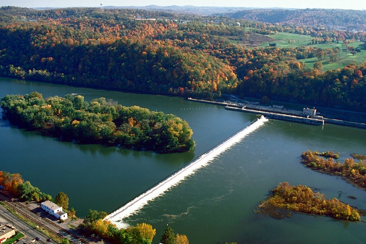
- Allegheny Islands State Park, C.W. Bill Young Lock and Dam, U.S. Army Corps of Engineers, Public domain
- Mount Saint Peter Church, Rudy4rachel ( talk ), Public domain
- Liberty Theater, New Kensington, Fred S. Danner, Public domain
- B&lerr, Jet Lowe, National Park Service, Public domain
- Cheswick, Pennsylvania - Airborne Batimore to Minneapolis (3358227606), brewbooks from near Seattle, USA, CC BY-SA 2.0
- Space Boats (51552450381), thederek412 from United States, CC BY 2.0
- WEST PENN POWER PLANT, NORTH OF PITTSBURGH. IT IS A VERY OLD COAL-FIRED FACILITY ALONG THE ALLEGHENY RIVER, AND HAS BEEN CITED FOR VIOLATIONS OF THE CLEAN AIR ACT PASSED BY CONGRESS AND ADMINISTRATED..., John L. Alexandrowicz, Public domain
- WEST PENN POWER PLANT NORTH OF PITTSBURGH. IT IS A VERY OLD COAL-FIRED FACILITY ALONG THE ALLEGHENY RIVER, AND HAS BEEN CITED FOR VIOLATIONS OF THE CLEAN AIR ACT PASSED BY CONGRESS AND ADMINISTERED..., John L. Alexandrowicz, Public domain
- Cruising the Allegheny River (49918139422), thederek412 from United States, CC BY 2.0
- Puccinia mariae-wilsoniae 65544697, Mason Heberling, CC BY 4.0
- WEST PENN POWER PLANT, NORTH OF PITTSBURGH. IT IS A VERY OLD COAL-FIRED FACILITY ALONG THE ALLEGHENY RIVER, AND HAS BEEN CITED FOR VIOLATIONS OF THE CLEAN AIR ACT PASSED BY CONGRESS AND ADMINISTERED..., John L. Alexandrowicz, Public domain
- Spruce from Coolidge in Cheswick, Nyttend, Public domain


Page built October 30, 2026. Spotted a mistake? Tell us or suggest a place.