


Summerfield, Maryland
Summerfield is a community of 15,065 people in Prince George's County, Maryland.
Why visit Summerfield
Townapedia lists 8 museums and landmarks, 15 parks and trails, 50 places to eat, 12 places to stay and 1 attraction in and around town.
Highlights include AMC, Beall's Pleasure, Concord and Northwest Stadium.
July is the warmest month, with average highs of 90°F; January lows average 28°F.
Weather in Summerfield
Forecast from the National Weather Service. Full forecast
About Summerfield
Summerfield is a census-designated place in Prince George's County, Maryland. As of the 2020 census, the population was 14,758. A suburb of Washington, D.C., the area is home to Northwest Stadium and the Prince George's County Sports and Learning Complex. It first became a census-designated place after the 2010 census.
From the Wikipedia article Summerfield, Maryland (this version), under CC BY-SA 4.0.
Things to do1

Museums and landmarks8

Beall's Pleasure
Monument and historic site · National Register of Historic Places · 2.1 mi
Historic house in Landover, Maryland, United States
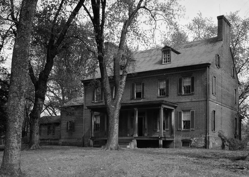
Concord
Monument and historic site · National Register of Historic Places · 1.9 mi
Historic house in District Heights, Maryland, United States

Fairmount Heights Historic District
Monument and historic site · National Register of Historic Places · 2.6 mi
Historic district in Maryland, USA

Mount Hope
Monument and historic site · National Register of Historic Places · 2.7 mi
Human settlement in Maryland, United States of America

Mount Lubentia
Monument and historic site · National Register of Historic Places · 3.2 mi
Human settlement in Maryland, United States of America

Nannie Helen Burroughs School
Monument and historic site · National Register of Historic Places · 3.4 mi
Historic school formerly named Trades Hall of National Training School for Women and Girls

Ridgeley School
Monument and historic site · National Register of Historic Places · 1.2 mi
Historic school in Capitol Heights, Maryland, United States


Strand Theater
Monument and historic site · National Register of Historic Places · 3.1 mi
Former movie theater in Washington D.C.
Parks, trails and playgrounds15


3 more on the map.
Restaurants and cafes50

China Dragon Restaurant
Restaurant · Chinese · 1.8 mi
7527 Landover Road, Hyattsville
Tu-Sa 11:00-21:00; Su 12:00-20:30
Hook & Reel
Restaurant · Seafood, Cajun · 1.6 mi
9201 Woodmore Centre Drive, Lanham
12:00-22:00; Fr,Sa 12:00-24:00
Outback Steakhouse
Restaurant · American, Steak · 1.6 mi
9660 Lottsford Court, Upper Marlboro
Mo-Th 11:00-22:00; Fr,Sa 11:00-23:00; Su 11:00-21:00
Silver Diner
Restaurant · American, Diner · 1.7 mi
9151 Ruby Lockhart Boulevard, Lanham
Su-Th 07:00-23:00, Fr-Sa 07:00-00:00
Nando's
Restaurant · Chicken, Portuguese · 1.7 mi
2700 Campus Way North, Lanham
Su-Th 10:30-22:00; Fr,Sa 10:30-23:00



38 more on the map.
Where to stay12
Holiday Inn Express & Suites
Motel and hotel · 1.2 mi
9101 Basil Court, Upper Marlboro
Churches and places of worship26
First Baptist Church of Deanwood
Church · National Register of Historic Places · 3.7 mi
Ridgley Methodist Episcopal Church
Church · National Register of Historic Places · 1.3 mi
St. Matthew's Church
Church · National Register of Historic Places · 2.2 mi
Corinth Baptist Church
Church · Baptist · 2.0 mi
903 Cypresstree Drive, Capitol Heights
Shopping5
Gas and EV charging10
Schools, colleges and libraries66
Cesar Chavez Public Charter Schools For Public Policy
School · 4.3 mi
3701 Hayes Street Ne, Washington
Healthcare3
Capital Region Medical Center
Hospital · 1.3 mi
901 North Harry S Truman Drive, Largo
Advanced Urgent Care - Kaiser Permanente Largo Medical Center
Clinic and pharmacy · 1.8 mi
1221 Mercantile Lane, Largo
Map of Summerfield
196 places. The map loads OpenStreetMap tiles when you open it.
Climate by month
Monthly table
| Month | High | Low | Rain | Snow |
|---|---|---|---|---|
| Jan | 45°F | 28°F | 3.0 in | 4.7 in |
| Feb | 48°F | 30°F | 2.8 in | 2.3 in |
| Mar | 56°F | 36°F | 4.0 in | 1.4 in |
| Apr | 68°F | 46°F | 3.4 in | 0.0 in |
| May | 77°F | 57°F | 4.3 in | 0.0 in |
| Jun | 85°F | 66°F | 4.6 in | 0.0 in |
| Jul | 90°F | 71°F | 4.6 in | 0.0 in |
| Aug | 88°F | 69°F | 3.7 in | 0.0 in |
| Sep | 82°F | 62°F | 4.1 in | 0.0 in |
| Oct | 70°F | 49°F | 4.2 in | 0.0 in |
| Nov | 58°F | 39°F | 3.2 in | 0.0 in |
| Dec | 49°F | 32°F | 3.7 in | 1.3 in |
U.S. Climate Normals 1991-2020 for Natl Arboretum Dc (6 mi away), NOAA NCEI.
People and cost of living
American Community Survey 5-year estimates, 2020-2024, U.S. Census Bureau. Estimates have margins of error, larger for small towns.
Disaster history
Prince George's County has had 13 federal disaster declarations since 2000, most often for hurricanes.
- 2026-01-24: Severe Winter Storm (Winter Storm)
- 2020-03-26: Covid-19 Pandemic (Biological)
- 2020-03-13: Covid-19 (Biological)
- 2016-03-04: Severe Winter Storm And Snowstorm (Snowstorm)
- 2012-11-20: Hurricane Sandy (Hurricane)
- 2012-10-28: Hurricane Sandy (Hurricane)
OpenFEMA disaster declarations summaries.
Getting there and nearby towns
College Park Airport (CGS) is the nearest airport with scheduled flights listed in OpenStreetMap, 6 miles away.
- Landover 2 mi northwest, about 3 min by car
- Lake Arbor 2 mi east, about 3 min by car
- Largo 3 mi southeast, about 4 min by car
- Forestville 4 mi south, about 6 min by car
- Mitchellville 4 mi northeast, about 6 min by car
- New Carrollton 4 mi north, about 7 min by car
- Kettering 4 mi east, about 7 min by car
- Lanham 4 mi north, about 7 min by car
- East Riverdale 4 mi northwest, about 7 min by car
- Seabrook 5 mi north, about 9 min by car
Drive times are estimates from straight-line distance, not routes.
Local news
Headlines from INDB, the NEMICO news database.
Reviews, tips and questions
Loading what members have shared...
Sources and licences
- NCES EDGE (Public domain): public schools
- NOAA NCEI U.S. Climate Normals 1991-2020 (Public domain): climate by month
- OpenFEMA (Public domain): disaster declarations
- OpenStreetMap contributors (ODbL 1.0): places, airports, map data
- U.S. Census Bureau (Public domain): population, income, housing, education, commute
- Wikidata (CC0 1.0): elevation, founding date, time zone, website, landmarks and historic places
- Wikimedia Commons (see each image): photos
- Wikipedia (CC BY-SA 4.0): overview and history text
Photo credits
- 2016-09-13 11 23 21 View east along Maryland State Route 214 (Central Avenue) at Hampton Park Boulevard in Summerfield, Prince Georges County, Maryland, Famartin, CC BY-SA 4.0
- Deanwood Old Church, Smallbones, CC0
- Mt Lubentia Jan 09, Pubdog at en.wikipedia, Public domain
- Strand Teater DC, Smallbones, CC0
- St Matthews Church Sept 09, Pubdog ( talk ), Public domain
- Ridgley Methodist Episcopal Church Dec 08, Pubdog ( talk ), Public domain
- Bealls Pleasure 1936 HABS, John O. Brostrup, Public domain
- Trades Hall of National Training School for Women and Girls, Farragutful, CC BY-SA 4.0
- Concord 1936, Historic American Buildings Survey / Historic American Engineering Record, Public domain
- Grace United Methodist Church - Fairmount Heights, Maryland, Farragutful, CC BY-SA 4.0
- Mount Hope Cheverly Dec 08, Pubdog ( talk ), Public domain
- Ridgeley Rosenwald School, exterior (21636807881), Preservation Maryland, CC BY-SA 2.0
- St Ambrose, Cheverly, MD, Roberto221, CC BY-SA 4.0
- Metropolitan Baptist Church, SlipperyDude, CC BY-SA 3.0


Page built October 30, 2026. Spotted a mistake? Tell us or suggest a place.