


Ban Ao Nang, Thailand
ตำบลอ่าวนาง
Ban Ao Nang is a town of 8,000 people in Krabi, Thailand.
Why visit Ban Ao Nang
Townapedia lists 4 museums and landmarks, 5 parks and trails, 130 places to eat, 119 places to stay and 5 attractions in and around town.
Highlights include Railay Beach, Khao Khlong Haeng, Ao Nang Beach and Noppharat Thara Beach.
Weather in Ban Ao Nang
Forecast from MET Norway (CC BY 4.0). Full forecast
About Ban Ao Nang
Ao Nang (Thai: อ่าวนาง, pronounced [ʔàːw nāːŋ]) is a resort town and one of the ten subdistricts (tambon) of Mueang Krabi District, Krabi, Thailand.
From the Wikipedia article Ao Nang (this version), under CC BY-SA 4.0.
Travel tips from other travellers: Ban Ao Nang on Wikivoyage (CC BY-SA 4.0).
Photos of Ban Ao Nang


Things to do5



Museums and landmarks4

Parks, trails and playgrounds5




Restaurants and cafes130
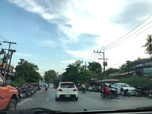
Thai Me Up Pang
Restaurant · Thai, Seafood, Western, Brunch, Breakfast, Pizza, Mexican · 2.1 km
206 moo2
Mo-Su 08:30-22:00
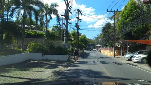
Umberto’s Cuisine
Restaurant · Italian, Italian Pizza, Mediterranean, Seafood, Pizza · 1.3 km
125, Moo 3, Ao nong
Mo-Su 11:30-22:30
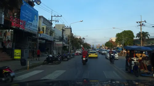
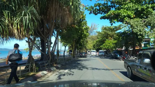
Aning Restaurant
Restaurant · Thai, Seafood, International · 1.8 km
142 Moo 2 Ao Nang Beach Road
Mo-Su 10:00-00:00
Govinda's Restaurant
Restaurant · 1.3 km
115 Moo 3
Mo-Fr 12:00-15:30, 18:00-21:00

Kiss Bar Ao Nang
Bar and pub · 2.2 km
At the front of Soi RCA on the main Ao Nang road, Kiss Bar Too is Ao Nang’s newest nightlife destination. Join Crazy DJ Daniel and the...
246/8 Soi RCA
Mo-Su 18:00-03:00


118 more on the map.
More about Ban Ao Nang
Geography
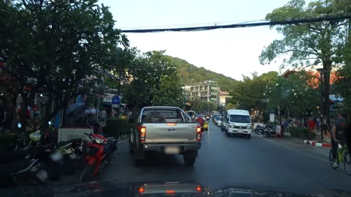
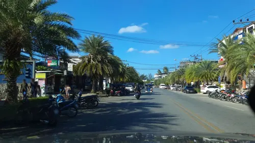
Ao Nang is a central point of the coastal province of Krabi, Thailand. The town consists chiefly of a main street, which is dominated by restaurants, pubs, shops and other commerce aimed at tourists. The main beach is used by sunbathers to a certain extent, but there are a large number of long-tail boats which offer access to other beaches on the mainland and on nearby islands.
From the Wikipedia article Ao Nang, under CC BY-SA 4.0.
Where to stay119
Aonang Goodwill Hotel
Motel and hotel · 2.5 km
420/22 ตำบล อ่าวนาง Tambon Ao Nang, Aonang Chang Wat Krabi 81000, Thailand
Churches and places of worship3
Shopping4
Schools, colleges and libraries2
Healthcare5
Map of Ban Ao Nang
250 places. The map loads OpenStreetMap tiles when you open it.
Getting there and nearby towns
Krabi International Airport (KBV) is the nearest airport with scheduled flights listed in OpenStreetMap, 20 km away.
- Krabi 11 km east, about 11 min by car
- Nuea Khlong 21 km east, about 21 min by car
- Ban Phru Nai 26 km southwest, about 26 min by car
- Phuket 49 km west, about 49 min by car
- Wichit 50 km west, about 50 min by car
- Kathu 54 km west, about 54 min by car
- Phang Nga 55 km northwest, about 55 min by car
- Saladan 54 km southeast, about 54 min by car
- Patong 59 km west, about 59 min by car
- Ban Khao Lak 89 km northwest, about 1 h 30 min by car
Drive times are estimates from straight-line distance, not routes.
Towns near Ban Ao Nang


Keep exploring
Local news
Headlines from INDB.
Reviews, tips and questions
Loading what members have shared...
Sources and licences
- GeoNames (CC BY 4.0): population, coordinates, regions and time zone
- Mapillary (see each image): photos
- OpenStreetMap contributors (ODbL 1.0): places, airports, map data
- Wikidata (CC0 1.0): elevation, founding date, time zone, website, landmarks and historic places
- Wikimedia Commons (see each image): photos
- Wikipedia (CC BY-SA 4.0): overview and history text
Photo credits
- Ao Nang beach panorama 1, kallerna, CC BY-SA 3.0
- Railay, Wendy Harman, CC BY 2.0
- Ao Nang - Nopparat Thara Beach - 0012, Stefan Fussan, CC BY-SA 3.0
- AlAman Mosque Ahoerstemeier 1, Ahoerstemeier, CC BY 4.0
- Geopelia striata in Ao Nang, Krabi, Alexey Komarov, CC BY-SA 4.0
- Muay Thai Ao Nang 5, kallerna, CC BY-SA 3.0
- Muay Thai Ao Nang 4, kallerna, CC BY-SA 3.0
- Muay Thai Ao Nang 2, kallerna, CC BY-SA 3.0
- Muay Thai Ao Nang 1, kallerna, CC BY-SA 3.0
- Muay Thai Ao Nang 11, kallerna, CC BY-SA 3.0
- Muay Thai Ao Nang 7, kallerna, CC BY-SA 3.0
- Muay Thai Ao Nang 10, kallerna, CC BY-SA 3.0
- Muay Thai Ao Nang 6, kallerna, CC BY-SA 3.0
- Muay Thai Ao Nang 8, kallerna, CC BY-SA 3.0
- Muay Thai Ao Nang 3, kallerna, CC BY-SA 3.0
- Muay Thai Ao Nang 9, kallerna, CC BY-SA 3.0
- Ao Nang, Mueang Krabi District, Krabi 81180, Thailand - panoramio, Dirk Enthoven, CC BY 3.0
- Citizen of Krabi, Alexey Komarov, CC BY-SA 4.0
- Ao Nang, Mueang Krabi District, Krabi, Thailand - panoramio (41), Jacek Lesniowski, CC BY-SA 3.0
- Ao Nang, Mueang Krabi District, Krabi, Thailand - panoramio (13), Dirk Enthoven, CC BY 3.0
- Ao nang -krabi - panoramio, Dirk Enthoven, CC BY 3.0
- Ao nang - krabi thailand - panoramio (2), Dirk Enthoven, CC BY 3.0
- Ao Nang - panoramio (6), Scorewith German, CC BY 3.0
- Krabi police - panoramio, Dirk Enthoven, CC BY 3.0
- Ao Nang, Mueang Krabi District, Krabi, Thailand - panoramio (74), ::::=UT=::::, CC BY-SA 3.0
- Ao Nang - panoramio (9), Scorewith German, CC BY 3.0
- Uitzicht sabai hotel ao nang - panoramio, Dirk Enthoven, CC BY 3.0
- Uitzicht sabai hotel - panoramio, Dirk Enthoven, CC BY 3.0
- Ao Nang - panoramio (4), Scorewith German, CC BY 3.0
- Hat Noppharat Thara beach 7, kallerna, CC BY-SA 3.0
- Sunset in Krabi, 13 April 2018, Alexey Komarov, CC BY-SA 4.0
- Krabi 2015 april - panoramio (17), Roma Neus, CC BY 3.0
- Krabi- Nopparatthara beach - panoramio, Thajsko, CC BY 3.0
- AlAman Mosque Ahoerstemeier 2, Ahoerstemeier, CC BY 4.0
- AlAman Mosque Ahoerstemeier 3, Ahoerstemeier, CC BY 4.0
- Ao Nang - panoramio (3), Scorewith German, CC BY 3.0
- Ao Nang, Mueang Krabi District, Krabi, Thailand - panoramio (7), Dirk Enthoven, CC BY 3.0
- Ao Nang, Mueang Krabi District, Krabi, Thailand - panoramio (12), Dirk Enthoven, CC BY 3.0
- ศาลาทะเลรีสอร์ทแอนด์สปา - panoramio, ::::=UT=::::, CC BY-SA 3.0
- Ao Nang, Mueang Krabi District, Krabi 81180, Thailand - panoramio (2), Dirk Enthoven, CC BY 3.0
- Ao Nang beach 2, kallerna, CC BY-SA 3.0
- Street-level photo, jrcarlsen, CC BY-SA 4.0
- Street-level photo, promthak, CC BY-SA 4.0
- Street-level photo, jrcarlsen, CC BY-SA 4.0
- Street-level photo, jrcarlsen, CC BY-SA 4.0
- Street-level photo, jrcarlsen, CC BY-SA 4.0
- Street-level photo, jrcarlsen, CC BY-SA 4.0
- Street-level photo, jrcarlsen, CC BY-SA 4.0
- Street-level photo, jrcarlsen, CC BY-SA 4.0
- Street-level photo, jrcarlsen, CC BY-SA 4.0
- Street-level photo, jrcarlsen, CC BY-SA 4.0
- Street-level photo, jrcarlsen, CC BY-SA 4.0
- Street-level photo, promthak, CC BY-SA 4.0
- Street-level photo, traveler25, CC BY-SA 4.0
- Street-level photo, jrcarlsen, CC BY-SA 4.0
- Street-level photo, jrcarlsen, CC BY-SA 4.0
- Street-level photo, promthak, CC BY-SA 4.0
- Street-level photo, jrcarlsen, CC BY-SA 4.0
- Street-level photo, jrcarlsen, CC BY-SA 4.0
- Street-level photo, jrcarlsen, CC BY-SA 4.0
- Street-level photo, jrcarlsen, CC BY-SA 4.0
- Street-level photo, jrcarlsen, CC BY-SA 4.0
- Street-level photo, jrcarlsen, CC BY-SA 4.0
- Street-level photo, jrcarlsen, CC BY-SA 4.0
- Street-level photo, jrcarlsen, CC BY-SA 4.0
- Street-level photo, traveler25, CC BY-SA 4.0
- Street-level photo, freddouhelk, CC BY-SA 4.0


Page built November 10, 2026. Spotted a mistake? Tell us or suggest a place.