


Ban Phai, Thailand
อำเภอบ้านไผ่
Ban Phai is a town of 35,583 people in Khon Kaen, Thailand.
Why visit Ban Phai
Townapedia lists 4 museums and landmarks, 1 park or trail, 14 places to eat and 1 place to stay in and around town.
Weather in Ban Phai
Forecast from MET Norway (CC BY 4.0). Full forecast
About Ban Phai
Ban Phai (Thai: บ้านไผ่, pronounced [bâːn pʰàj]; Northeastern Thai: บ้านไผ่, pronounced [bâːn pʰāj]) is a district (amphoe) of Khon Kaen province, northeastern Thailand.
From the Wikipedia article Ban Phai district (this version), under CC BY-SA 4.0.
Photos of Ban Phai


Museums and landmarks4


Parks, trails and playgrounds1

Restaurants and cafes14
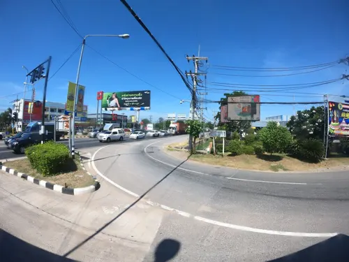
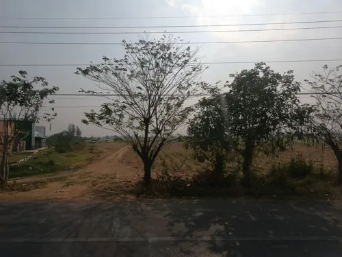




2 more on the map.
Where to stay1

History
Originally named Ban Keng (บ้านเกิ้ง), the area was at first a subdistrict (tambon) of Chonnabot district. In 1928 the minor district (king amphoe) Ban Phai was established consisting of three subdistricts split off from Chonnabot. It was upgraded to a full district on 1 February 1940. In 1946 Chonnabot was downgraded to be a part of Ban Phai District, until it was reestablished in 1966.
From the History section of Ban Phai district on Wikipedia, under CC BY-SA 4.0.
More about Ban Phai
Geography
Neighboring districts are (from the south clockwise): Pueai Noi, Nong Song Hong, Non Sila, Chonnabot, Mancha Khiri, and Ban Haet of Khon Kaen Province; Kosum Phisai and Kut Rang of Maha Sarakham province.
Economy
As of 2019, Thai sugar giant, the Mitr Phol Group, plans to construct a sugarcane mill and biomass power plant in the district. The initiative will occupy 4,000 rai (640 ha; 1,600 acres) of three of the province's neighbouring districts: Ban Phai, Chonnabot, and Non Sila. The operation will form part of the Ban Phai Bio-Hub Industrial Estate and is linked to the Eastern Economic Corridor (EEC) project. Mitr Phol's plans have been met with some opposition from local residents. Mitr Phol has pledged that the factory will have no adverse environmental effects.
From the Wikipedia article Ban Phai district, under CC BY-SA 4.0.
Notable people from Ban Phai
- Sailom AdiOlympic boxer of Thailand
- Padejsuk PitsanurachanThai kickboxer
Born in Ban Phai, according to Wikidata (CC0). Each name links to its Wikipedia article.
Churches and places of worship28
มูลนิธิบ้านไผ่การกุศลสงเคราะห์
Place of worship
ถนน สุขาภิบาล 2, Banphai Khon Kaen
วัดจันทร์ประสิทธิ์
Place of worship · 0.8 km
ถนน จันทร์ประสิทธิ์, Banphai Khon Kaen
Shopping4
Gas and EV charging19
Schools, colleges and libraries56
Healthcare22
Ban Sang Paen Subdistrict Health Promoting Hospital
Clinic and pharmacy · 8.2 km
Ban Wang Yao Subdistrict Health Promoting Hospital
Clinic and pharmacy · 11.3 km
Map of Ban Phai
149 places. The map loads OpenStreetMap tiles when you open it.
Getting there and nearby towns
Khon Kaen Airport (KKC) is the nearest airport with scheduled flights listed in OpenStreetMap, 46 km away.
- Pueai Noi 28 km southeast, about 28 min by car
- Phon 31 km southwest, about 31 min by car
- Kosum Phisai 42 km northeast, about 42 min by car
- Khon Kaen 44 km north, about 44 min by car
- Kaeng Khro 51 km west, about 51 min by car
- Maha Sarakham 62 km east, about 1 h by car
- Bua Yai 62 km southwest, about 1 h by car
- Wapi Pathum 73 km east, about 1 h 15 min by car
- Phu Khiao 73 km northwest, about 1 h 15 min by car
- Chaiyaphum 80 km west, about 1 h 15 min by car
Drive times are estimates from straight-line distance, not routes.
Towns near Ban Phai


Keep exploring
Local news
Headlines from INDB.
Reviews, tips and questions
Loading what members have shared...
Sources and licences
- GeoNames (CC BY 4.0): population, coordinates, regions and time zone
- Mapillary (see each image): photos
- OpenStreetMap contributors (ODbL 1.0): places, airports, map data
- Wikidata (CC0 1.0): elevation, founding date, time zone, website
- Wikimedia Commons (see each image): photos
- Wikipedia (CC BY-SA 4.0): overview and history text
Photo credits
- DFC 3039 A quiet night street scene as a food vendor tends a small cart with a child sitting on the curb and passersby browsing illuminated stalls in the background, PattayaPatrol, CC BY-SA 4.0
- DFC 3030 A lively nighttime street scene a small sidewalk food stall and storefront glow under awnings while parked scooters line the curb and traffic moves along the busy road, PattayaPatrol, CC BY-SA 4.0
- DFC 3032 A busy street scene at night outside a brightly lit corner shop with parked motorbikes and vendors attending to customers on the sidewalk, PattayaPatrol, CC BY-SA 4.0
- DFC 3033 A street food vendor prepares an order under warm lights as customers wait beside motorbikes and plastic chairs on a busy evening, PattayaPatrol, CC BY-SA 4.0
- DFC 3035 Bustling night market alive with vendors glowing stalls and people weaving through the lively street, PattayaPatrol, CC BY-SA 4.0
- A woman sitting on a chair next to a food cart 2025, Pattaya Patrol, CC BY-SA 4.0
- DFC 3026 A brightly lit modern monument decorated with purple and white lights stands in the center of a quiet city roundabout at night surrounded by low-rise shops and streetlights, PattayaPatrol, CC BY-SA 4.0
- DFC 3005 A peaceful shaded courtyard with a central tree lush ferns hanging lanterns and colorful wind chimes decorating the open-air seating area, PattayaPatrol, CC BY-SA 4.0
- DFC 3024 A peaceful tree-lined courtyard softly lit at night beside a modern building, PattayaPatrol, CC BY-SA 4.0
- DFC 3002 A peaceful courtyard garden between buildings with lush trees a small wooden pavilion and a shaded lawn path, PattayaPatrol, CC BY-SA 4.0
- DFC 2998 A quiet village with rusted tin roofs and lush green trees stretching toward the horizon, PattayaPatrol, CC BY-SA 4.0
- DFC 3003 A quiet suburban scene with low-rise buildings leafy trees and a clear sky punctuated by a tall communication tower, PattayaPatrol, CC BY-SA 4.0
- DFC 3004 Delicate purple blossoms gently floating in a rustic clay bowl of water creating a serene natural centerpiece, PattayaPatrol, CC BY-SA 4.0
- DFC 3009 A cozy lived-in home office and kitchen area with a cluttered desk display shelves of dishes and ornaments a refrigerator and stools scattered across a concrete floor, PattayaPatrol, CC BY-SA 4.0
- DFC 3008 A busy open-air kitchen with large pots and cooking equipment lined up on stainless-steel tables as staff in blue caps and aprons prepare meals, PattayaPatrol, CC BY-SA 4.0
- DFC 3019 Ornate Chinese temple gate richly decorated with dragons colorful roof carvings and traditional lanterns, PattayaPatrol, CC BY-SA 4.0
- DFC 3020 A close-up of a patterned tortoise resting beside a shallow dish of greens on a patch of soil and leaves, PattayaPatrol, CC BY-SA 4.0
- DFC 3018 A quiet street-side eatery with metal tables and chairs set out on the sidewalk red lanterns hanging above and a lone patron seated inside, PattayaPatrol, CC BY-SA 4.0
- DFC 3014 Cozy eclectic café interior with wooden tables lounge chairs and a bar lined with vintage signs and decorations, PattayaPatrol, CC BY-SA 4.0
- Burger and fries on a wooden plate, Pattaya Patrol, CC BY-SA 4.0
- Street view - panoramio (5), Adriaan Castermans, CC BY-SA 3.0
- Temple - panoramio (15), Adriaan Castermans, CC BY-SA 3.0
- Railwaypassing - panoramio, Adriaan Castermans, CC BY-SA 3.0
- Temple 2 - panoramio (1), Adriaan Castermans, CC BY-SA 3.0
- Temple 1 - panoramio (2), Adriaan Castermans, CC BY-SA 3.0
- Temple 3 - panoramio (1), Adriaan Castermans, CC BY-SA 3.0
- 2017-Th-06 1 2017-03-22 04.43.57, Dr Helena Shaverdo, Vienna, CC BY-SA 4.0
- ISS031-E-10784 - View of Earth, Earth Science and Remote Sensing Unit , Lyndon B. Johnson Space Center, Public domain
- Panorama of Wichian 's home - panoramio, ลูกอีสาน บ้านไผ่, CC BY 3.0
- ถนนหน้าบ้านวิเชียร - panoramio, ลูกอีสาน บ้านไผ่, CC BY-SA 3.0
- บ้านแม่บัวโฮง เตชะนอก - panoramio, ลูกอีสาน บ้านไผ่, CC BY-SA 3.0
- ทุ่งนา - panoramio, ลูกอีสาน บ้านไผ่, CC BY-SA 3.0
- ISS031-E-10785 - View of Earth, Earth Science and Remote Sensing Unit , Lyndon B. Johnson Space Center, Public domain
- ISS031-E-10786 - View of Earth, Earth Science and Remote Sensing Unit , Lyndon B. Johnson Space Center, Public domain
- Citroen DS - panoramio, Adriaan Castermans, CC BY-SA 3.0
- ISS046-E-741 - View of Earth, Earth Science and Remote Sensing Unit , Lyndon B. Johnson Space Center, Public domain
- Street-level photo, ThailandCambodia, CC BY-SA 4.0
- Street-level photo, ozflor, CC BY-SA 4.0
- Street-level photo, ozflor, CC BY-SA 4.0
- Street-level photo, ozflor, CC BY-SA 4.0
- Street-level photo, ozflor, CC BY-SA 4.0
- Street-level photo, ozflor, CC BY-SA 4.0
- Street-level photo, ozflor, CC BY-SA 4.0
- Street-level photo, ThailandCambodia, CC BY-SA 4.0
- Street-level photo, ozflor, CC BY-SA 4.0
- Street-level photo, ozflor, CC BY-SA 4.0


Page built November 10, 2026. Spotted a mistake? Tell us or suggest a place.