

Ban Phe, Thailand
เทศบาลตำบลบ้านเพ
Ban Phe is a town of 17,414 people in Rayong, Thailand, founded in March 12, 1974.
Why visit Ban Phe
Townapedia lists 1 museum or landmark, 7 parks and trails, 47 places to eat, 5 places to stay and 1 attraction in and around town.
Highlights include Rayong Aquarium and Khao Laem Ya – Mu Ko Samet National Park.
Weather in Ban Phe
Forecast from MET Norway (CC BY 4.0). Full forecast
Things to do1

Rayong Aquarium
Zoo and aquarium · 2.4 km
Public aquarium in Rayong, Thailand
We-Fr 10:00-16:00; Sa-Su 10:00-17:00
Museums and landmarks1
Parks, trails and playgrounds7
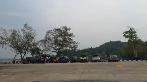

Khao Laem Ya – Mu Ko Samet National Park
Park · 4.7 km
National park of Thailand


Restaurants and cafes47
The Beatles Bar Resto
Bar and pub · 0.7 km
DE 8 HEURES A PAS D'HEURES



35 more on the map.
Where to stay5
Shopping7
Gas and EV charging3
Map of Ban Phe
71 places. The map loads OpenStreetMap tiles when you open it.
Getting there and nearby towns
U-Tapao - Pattaya International airport (UTP) is the nearest airport with scheduled flights listed in OpenStreetMap, 47 km away.
- Rayong 20 km west, about 20 min by car
- Klaeng 28 km northeast, about 28 min by car
- Ban Chang 43 km west, about 43 min by car
- Sattahip 58 km west, about 58 min by car
- Tha Mai 62 km east, about 1 h by car
- Ban Talat Bueng 68 km northwest, about 1 h 15 min by car
- Pattaya 69 km northwest, about 1 h 15 min by car
- Chanthaburi 72 km east, about 1 h 15 min by car
- Bang Lamung 72 km northwest, about 1 h 15 min by car
- Si Racha 82 km northwest, about 1 h 15 min by car
Drive times are estimates from straight-line distance, not routes.
Towns near Ban Phe


Keep exploring
Local news
Headlines from INDB.
Reviews, tips and questions
Loading what members have shared...
Sources and licences
- GeoNames (CC BY 4.0): population, coordinates, regions and time zone
- Mapillary (see each image): photos
- OpenStreetMap contributors (ODbL 1.0): places, airports, map data
- Wikidata (CC0 1.0): elevation, founding date, time zone, website, landmarks and historic places
- Wikimedia Commons (see each image): photos
Photo credits
- Ban phe 2005, No machine-readable author provided. Kereish~commonswiki assumed (based on copyright claims)., Public domain
- Street-level photo, jrcarlsen, CC BY-SA 4.0
- Street-level photo, jrcarlsen, CC BY-SA 4.0
- Street-level photo, jrcarlsen, CC BY-SA 4.0
- Street-level photo, jrcarlsen, CC BY-SA 4.0
- Street-level photo, jrcarlsen, CC BY-SA 4.0
- Street-level photo, jrcarlsen, CC BY-SA 4.0
- Street-level photo, jrcarlsen, CC BY-SA 4.0
- Street-level photo, jrcarlsen, CC BY-SA 4.0
- Street-level photo, jrcarlsen, CC BY-SA 4.0
- Street-level photo, roadroid, CC BY-SA 4.0
- Street-level photo, jrcarlsen, CC BY-SA 4.0
- Street-level photo, roadroid, CC BY-SA 4.0
- Street-level photo, jrcarlsen, CC BY-SA 4.0
- Street-level photo, balthus_mc, CC BY-SA 4.0
- Street-level photo, km2bp, CC BY-SA 4.0
- Street-level photo, jrcarlsen, CC BY-SA 4.0
- Street-level photo, km2bp, CC BY-SA 4.0
- Street-level photo, jrcarlsen, CC BY-SA 4.0
- Street-level photo, roadroid, CC BY-SA 4.0
- Street-level photo, roadroid, CC BY-SA 4.0
- Street-level photo, jrcarlsen, CC BY-SA 4.0
- Street-level photo, jrcarlsen, CC BY-SA 4.0
- Street-level photo, jrcarlsen, CC BY-SA 4.0
- Street-level photo, jrcarlsen, CC BY-SA 4.0
Page built November 10, 2026. Spotted a mistake? Tell us or suggest a place.