


Bang Kruai, Thailand
เทศบาลเมืองบางกรวย
Bang Kruai is a town of 78,305 people in Nonthaburi, Thailand, founded in November 16, 1971.
Why visit Bang Kruai
Townapedia lists 13 museums and landmarks, 6 parks and trails, 59 places to eat, 5 places to stay and 17 attractions in and around town.
Highlights include Kiakkai Bridge, Krung Thon Bridge, 14 October 1973 Memorial and Bangkok National Museum.
Weather in Bang Kruai
Forecast from MET Norway (CC BY 4.0). Full forecast
Photos of Bang Kruai


Things to do17


National Theatre
Cinema and theater · 5.5 km
Theatre in Bangkok, Thailand


Phan Phiphop Lila Bridge
Bridge · 5.9 km
Bridge across Khlong Khu Mueang Doem in Thailand



Chaloem Wan Chat bridge
Bridge · 6.0 km
Bridge and road intersection in Bangkok, Thailand
5 more on the map.
Museums and landmarks13

14 October 1973 Memorial
Monument and historic site · 6.1 km
Memorial in Thailand


National Art Gallery
Museum · 5.6 km
Art gallery in Bangkok, Thailand

Phra Ratchawang Bowon Sathan Mongkhon
Monument and historic site · 5.6 km
Former palace in Bangkok, Thailand

Royal Elephant National Museum
Museum · 5.7 km
Museum in Bangkok, Thailand

Siriraj Medical Museum
Museum · 5.4 km
Medical museum in Bangkok, Thailand



Thai Parliament Museum
Museum · 5.5 km
Political history museum in Bangkok, Thailand

1 more on the map.
Parks, trails and playgrounds6



Restaurants and cafes59
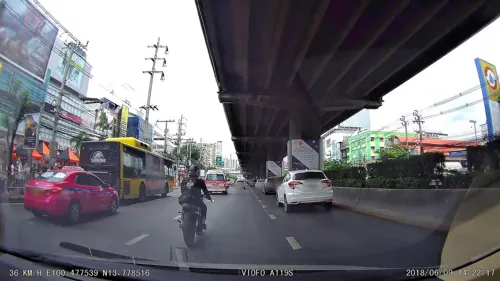
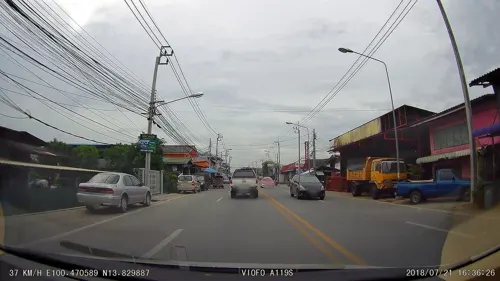

500 Cafe
Cafe · Coffee Shop, Cafe, ิbakery, Cocktail · 3.0 km
500 Cafe by FORFUN Bangkok, Thailand
500 ซอยแซมมี่
Fr-Sa 13:00-00:00

ก๋วยเตี๋ยวเรือ ยายเพลิน
Restaurant · Thai, ก๋๋วยเตี๋ยวเรือ, ส้มตำ, ยำแซ่บ, ข้าวผัด ปู กุ้ง, ก๋วยเตี๋ยวเนื้อ, ก๋๋วยเตี๋ยวหมู, กะเพราถาด หมู กุ้ง เนื้อ · 3.0 km
72 9 ถนนนครอินทร์
Mo-Su 10:30-20:00

๋Jeab's kitchen
Restaurant · Italian, Burger, Sandwich, Fish And Chips · 2.3 km
1456 จรัญสนิทวงศ์ 75 แยก 30, บางพลัด
Mo-Su 10:00-20:00
Onni's Coffee
Cafe · 2.3 km
1836 Sirindhorn Rd, Bang Bumru, Bang Phlat, Bangkok 10700
Mo-Su 09:00-18:00
47 more on the map.
Where to stay5
Churches and places of worship37
Wat Chaiyaprueksamala Ratchaworawihan
Place of worship · Thai Mahanikaya · 1.3 km
Wat Kho Non Bang Si Thong
Place of worship · Thai Mahanikaya · 1.4 km
Shopping17
Gas and EV charging2
Schools, colleges and libraries16
King Mongkut's University of Technology North Bangkok
School · 4.9 km
Healthcare7
Map of Bang Kruai
179 places. The map loads OpenStreetMap tiles when you open it.
Getting there and nearby towns
Don Mueang International Airport (DMK) is the nearest airport with scheduled flights listed in OpenStreetMap, 19 km away.
- Taling Chan 4 km southwest, about 4 min by car
- Bangkok Noi 5 km south, about 5 min by car
- Bangkok 6 km southeast, about 6 min by car
- Dusit 6 km southeast, about 6 min by car
- Bang Sue 6 km east, about 6 min by car
- Pom Prap Sattru Phai 7 km southeast, about 7 min by car
- Mueang Nonthaburi 8 km northeast, about 8 min by car
- Samphanthawong 9 km southeast, about 9 min by car
- Thon Buri 9 km south, about 9 min by car
- Chatuchak 10 km east, about 10 min by car
Drive times are estimates from straight-line distance, not routes.
Towns near Bang Kruai


Keep exploring
Local news
Headlines from INDB.
Reviews, tips and questions
Loading what members have shared...
Sources and licences
- GeoNames (CC BY 4.0): population, coordinates, regions and time zone
- Mapillary (see each image): photos
- OpenStreetMap contributors (ODbL 1.0): places, airports, map data
- Wikidata (CC0 1.0): elevation, founding date, time zone, website, landmarks and historic places
- Wikimedia Commons (see each image): photos
Photo credits
- Wat Chalo, Bang Kruai District, Nonthaburi 11130, Thailand - panoramio, Андрей Бобровский, CC BY 3.0
- Bang Kruai - panoramio, Anil Kaushik, CC BY-SA 3.0
- Krung Thong Bridge 05499, dsin_travel, CC BY 2.0
- Bridge at Nonthaburi 1 Road, Paul_012, CC BY-SA 4.0
- โรงละครแห่งชาติ April2021 Thailand National Theatre Bangkok 01, Chainwit., CC BY-SA 4.0
- สะพานนรรัตน์สถาน, Dharmadana, CC BY 4.0
- สะพานผ่านพิภพลีลา199, CKasa, CC BY-SA 3.0
- Pinklao bridge, Ahoerstemeier, CC BY-SA 3.0
- Panoramic Rama V Bridge, Supanut Arunoprayote, CC BY 4.0
- Rama 6 bridge, Erzengel, CC BY-SA 4.0
- Rama VII Bridge (downstream, west bank of Chao Phraya River), Xiengyod, CC BY-SA 3.0
- Rama VIII Bridge at night, Stygiangloom on Flickr, CC BY 2.0
- อนุสรณ์สถาน 14 ตุลา ถ่ายเมื่อกันยายน 2563 14 October 1973 Memorial 02, Chainwit., CC BY-SA 4.0
- Bangkok National Museum, This Photo was taken by Supanut Arunoprayote . Feel free to use any of my images, but please mention me as the author and may send me a message. (สามารถใช้ภาพได้อิสระ..., CC BY 4.0
- พิพิธภัณท์เหรียญ, Bntofficial, CC BY-SA 4.0
- Bangkok NationalGallery1, Mr.Sayompoo Setabhrahmana, CC BY-SA 4.0
- (2020) พระราชวังบวรวสถานมงคล เขตพระนคร กรุงเทพมหานคร (1), กสิณธร ราชโอรส, CC BY-SA 4.0
- The Forensic Science Museum in Bangkok, Bobby from London, L'Angleterre, CC BY 2.0
- Vimanmek Mansion, Gisling, CC BY-SA 3.0
- Dusit Zoo bear statue, Ahoerstemeier, CC BY-SA 3.0
- Pata Zoo - panoramio, mohigan, CC BY-SA 3.0
- สวนหลวงพระราม 8 ๘, Phoebus 28, CC BY-SA 4.0
- Bangkokphrasumenfort03, Fotograf / Photographer: Heinrich Damm ( User:Hdamm , Hdamm at de.wikipedia.org ), CC BY 2.0
- Conception Church, Bangkok, Supanut Arunoprayote, CC BY-SA 4.0
- Bkkwangthaphra0603e, Hdamm, CC BY-SA 3.0
- Bangkok Chalor temple 003, Mattana, Public domain
- วัดชัยพฤกษมาลาราชวรวิหาร เขตตลิ่งชัน กรุงเทพมหานคร (10), กสิณธร ราชโอรส, CC BY-SA 4.0
- วัดไก่เตี้ย (กรุงเทพมหานคร), Dharmadana, CC BY-SA 4.0
- วัดนครป่าหมาก, Dharmadana, CC BY-SA 4.0
- Chotikaram-(2), Archy36, CC BY-SA 3.0
- วัดจันทร์ (จังหวัดนนทบุรี)01, Dharmadana, CC BY-SA 4.0
- Thai spirit house at a hotel in bangkok ศาลพระภูมิ ศาลเจ้าที่, Chainwit., CC BY-SA 4.0
- โรงช้าง, Immwwi, CC BY-SA 3.0
- Kiakkai Bridge - 2026 08 21 - 01, Anna Frodesiak, CC0
- Bodindecha (Sing Singhaseni) Nonthaburi School Emblem, Cocoman1456, CC0
- อุโบสถ วัดชลอ จ.นนทบุรี (3), กสิณธร ราชโอรส, CC BY-SA 4.0
- Bangkanoon, Archy36, CC BY-SA 3.0
- อุโบสถ วัดชลอ จ.นนทบุรี (2), กสิณธร ราชโอรส, CC BY-SA 4.0
- วัดชลอ อ.บางกรวย จ.นนทบุรี (7), กสิณธร ราชโอรส, CC BY-SA 4.0
- อุโบสถ วัดชลอ จ.นนทบุรี (4), กสิณธร ราชโอรส, CC BY-SA 4.0
- Street-level photo, ThailandCambodia, CC BY-SA 4.0
- Street-level photo, poramet, CC BY-SA 4.0
- Street-level photo, km2bp, CC BY-SA 4.0
- Street-level photo, poramet, CC BY-SA 4.0
- Street-level photo, mishari, CC BY-SA 4.0


Page built November 10, 2026. Spotted a mistake? Tell us or suggest a place.