


Bang Sue, Thailand
เขตบางซื่อ
Bang Sue is a city of 125,440 people in Bangkok, Thailand, founded in November 9, 1989.
Why visit Bang Sue
Townapedia lists 36 museums and landmarks, 37 parks and trails, 207 places to eat, 27 places to stay and 18 attractions in and around town.
Highlights include Bangkok Aquarium, Chamai Maru Chet Bridge, Chatuchak Market and Bank of Thailand Museum.
Weather in Bang Sue
Forecast from MET Norway (CC BY 4.0). Full forecast
About Bang Sue
Bang Sue (Thai: บางซื่อ, pronounced [bāːŋ sɯ̂ː]) is one of the 50 districts (khet) of Bangkok, Thailand. It borders Chatuchak to the east, Phaya Thai to the southeast, Dusit to the south, Bang Phlat and Bang Kruai across the Chao Phraya to the west and Mueang Nonthaburi to the north.
From the Wikipedia article Bang Sue district (this version), under CC BY-SA 4.0.
Photos of Bang Sue


Things to do18

Bangkok Aquarium
Monument and historic site · 6.0 km
Public aquarium in Bangkok, Thailand


Dan Neramit
Monument and historic site · 3.8 km
Amusement park in Thailand



Chaloem Wan Chat bridge
Bridge · 6.5 km
Bridge and road intersection in Bangkok, Thailand
Chaturaphak Rangsarit Bridge
Bridge · 6.2 km
Bridge in Bangkok, Thailand
6 more on the map.
Museums and landmarks36

Chatuchak Market
Monument and historic site · 2.4 km
Sa-Su 09:00-18:00; We-Th 07:00-18:00; Fr 18:00-00:00


Museum of Contemporary Art
Museum · 5.7 km
Contemporary Art, museum in Chatuchak, Bangkok

Royal Elephant National Museum
Museum · 4.5 km
Museum in Bangkok, Thailand



Children's Discovery Museum
Museum · 2.4 km
Museum in Bangkok, Thailand
Thai Parliament Museum
Museum · 4.5 km
Political history museum in Bangkok, Thailand
24 more on the map.
Parks, trails and playgrounds37

Chatuchak Park
Park · 2.7 km
Public park just north of Chatuchak Weekend Market
ถนนกำแพงเพชร 3
Mo-Su 04:30-22:00



Chak Phupha Su Maha Nathee Park
Park · 2.4 km
Park in Bangkok, Thailand

Prachanukun Health Garden สวนสุขภาพ ประชานุกูล
Park · 2.3 km
Prachanukun Health Garden สวนสุขภาพ ประชานุกูล
25 more on the map.
Restaurants and cafes207
Fat Bird
Restaurant · International · 3.4 km
36/9 Phaholyothin Soi 7, Phayathai
18:00 - 23:00
Narita Izakaya Charan 78
Restaurant · Japanese, Izakaya · 3.3 km
140 ถนนจรัญสนิทวงศ์
Mo-Su 17:00-24:00
Suan Son
Restaurant · Chicken, Noodles, Chinese · 1.4 km
103-105 ถนนประชาราษฎร์สาย 1
Mo-Su 08:00-12:00, 13:00-16:00
ร้านครัวตามใจ
Restaurant · Thai, Fried Food, Bubble Tea, Noodle, Seafood · 2.2 km
537 Charan Sanit Wong 95/1, แขวงบางอ้อ
Mo-Su 09:00-21:00
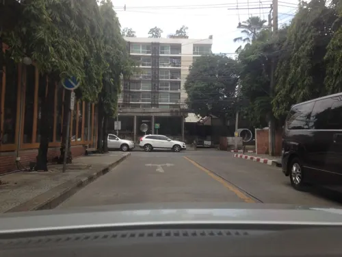
103 Factory
Restaurant · Coffee Shop · 3.4 km
24/4 Ari Soi 4, Phayathai
11:00 - 11:00
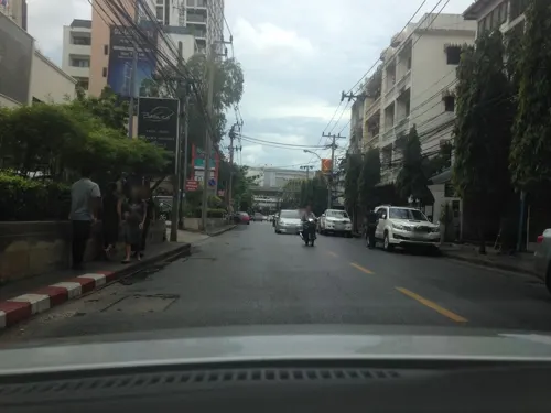
Ari Ba Bar
Restaurant · 3.5 km
36/3 Phaholyothin Soi 9
17:00 - 00:00

ChaaChaa Malatang - เซ็นทรัลลาดพร้าว
Restaurant · Chinese · 3.2 km
LP-R06 ถนนพหลโยธิน
Mo-Su 11:00-21:30
195 more on the map.
History
Bang Sue was one of eight outer Bangkok amphoes (districts) established during King Chulalongkorn's reign.
In an administrative reform in 1938, Bang Sue was reduced from an amphoe to a tambon (sub-district), becoming part of Dusit district. In 1972, as part of the creation of a special administrative area of Bangkok where tambons in Bangkok were renamed khwaengs and amphoes in Bangkok were renamed khets, Bang Sue became Khwaeng Bang Sue under Khet Dusit. Bang Sue became a khet in 1989.
"Bang Sue" means "community of the faithful". The name appears in Journey to Phrabat, a poem by Sunthorn Phu written in 1807.
According to regional folklore, the name originates from the "Story of Lord Uthong". When someone asked about the hidden treasure of Lord Uthong (a mythical king, not the King Uthong of Ayutthaya), the locals responded with honesty.
Bang Pho is the historic area along the Chao Phraya River. In the 18th century, corresponding to the early Rattanakosin era, used to be a settlement for Annamese (presently known Vietnamese) immigrants.
From the History section of Bang Sue district on Wikipedia, under CC BY-SA 4.0.
Where to stay27
Churches and places of worship34
Wat Khema Phirataram Ratchaworawihan
Place of worship · Thai Thammayut · 3.2 km
Wat Chat Kaeo Chongkonlani
Place of worship · Thai Mahanikaya · 2.0 km
Shopping34
Gas and EV charging20
Schools, colleges and libraries48
King Mongkut's University of Technology North Bangkok
School · 2.0 km
Healthcare18
Map of Bang Sue
250 places. The map loads OpenStreetMap tiles when you open it.
Getting there and nearby towns
Don Mueang International Airport (DMK) is the nearest airport with scheduled flights listed in OpenStreetMap, 14 km away.
- Dusit 4 km south, about 4 min by car
- Din Daeng 5 km southeast, about 5 min by car
- Mueang Nonthaburi 6 km north, about 6 min by car
- Bangkok 7 km southwest, about 7 min by car
- Bangkok Noi 8 km southwest, about 8 min by car
- Taling Chan 9 km southwest, about 9 min by car
- Thon Buri 11 km southwest, about 11 min by car
- Pak Kret 12 km north, about 12 min by car
- Bang Kapi 14 km east, about 14 min by car
- Phasi Charoen 15 km southwest, about 15 min by car
Drive times are estimates from straight-line distance, not routes.
Towns near Bang Sue


Keep exploring
Local news
Headlines from INDB.
Reviews, tips and questions
Loading what members have shared...
Sources and licences
- GeoNames (CC BY 4.0): population, coordinates, regions and time zone
- Mapillary (see each image): photos
- OpenStreetMap contributors (ODbL 1.0): places, airports, map data
- Wikidata (CC0 1.0): elevation, founding date, time zone, website, landmarks and historic places
- Wikimedia Commons (see each image): photos
- Wikipedia (CC BY-SA 4.0): overview and history text
Photo credits
- Wat bang pho, Bang sue, bangkok, Thailand - panoramio, trungydang, CC BY 3.0
- Bang Sue MRT Station, NC-MyLifeArm, CC BY-SA 4.0
- Walkway from MRT to Bang Sue Railway Station, NC-MyLifeArm, CC BY-SA 4.0
- Old Bang Sue entrance, Griff88, CC BY-SA 4.0
- Bang Sue MRT Station - Concourse level, NC-MyLifeArm, CC BY-SA 4.0
- Bang Sue Junction railway station 05, Boonlert, CC0
- Bang Sue Junction railway station 06, Boonlert, CC0
- Entrance to Bang Sue MRT Station, NC-MyLifeArm, CC BY-SA 4.0
- Bang Sue Junction railway station 04, Boonlert, CC0
- Bang Sue Grand Station 20221027, OraMAAG, CC BY-SA 4.0
- Bang Sue Junction railway station 03, Boonlert, CC0
- Bang Sue I Junc. Station before demolishing, NC-MyLifeArm, CC BY-SA 4.0
- Express train no.76 at Bang Sue Junction Station, Thanapas.som, CC BY-SA 4.0
- Bang Sue Junction Railway Station platform, NC-MyLifeArm, CC BY-SA 4.0
- Bang Sue Junction railway station 02, Boonlert, CC0
- Bang Sue Grand Station Bangkok, Amin, CC BY-SA 4.0
- Bang Sue Junction railway station 01, Boonlert, CC0
- สถานแสดงพันธุ์สัตว์น้ำกรุงเทพ, ยุทธนาสาระขันธ์, CC BY-SA 4.0
- BKK Saphan Chamai Maruchet, Hdamm, CC BY-SA 3.0
- Krung Thong Bridge 05499, dsin_travel, CC BY 2.0
- สะพานนรรัตน์สถาน, Dharmadana, CC BY 4.0
- Panoramic Rama V Bridge, Supanut Arunoprayote, CC BY 4.0
- Rama 6 bridge, Erzengel, CC BY-SA 4.0
- Rama VII Bridge (downstream, west bank of Chao Phraya River), Xiengyod, CC BY-SA 3.0
- Rama VIII Bridge at night, Stygiangloom on Flickr, CC BY 2.0
- พิพิธภัณท์เหรียญ, Bntofficial, CC BY-SA 4.0
- Museum of Contemporary Art (MOCA), Bangkok, Thailand - 20161201-05, Smuconlaw, CC BY-SA 4.0
- Bkkwangsuanpakkardlp03, Heinrich Damm ( User:Hdamm , Hdamm at de.wikipedia.org ), CC BY 2.0
- Exterior of Thai Bank Museum (2026) 01, Medelam, CC BY-SA 4.0
- Postal scale, Lerdsuwa, CC BY-SA 3.0
- Chatuchak park, Lerdsuwa, CC BY-SA 3.0
- สวนวชิรเบญจทัศ (สวนรถไฟ) IMG 7315, PEAK99, CC BY-SA 4.0
- Dusit Zoo bear statue, Ahoerstemeier, CC BY-SA 3.0
- A gate of King Rama IX Memorial Park 20221016 165652, Xiengyod~commonswiki, CC BY-SA 4.0
- สวนหลวงพระราม 8 ๘, Phoebus 28, CC BY-SA 4.0
- Bangkokphrasumenfort03, Fotograf / Photographer: Heinrich Damm ( User:Hdamm , Hdamm at de.wikipedia.org ), CC BY 2.0
- Santiphap Park 2, Mx. Granger, CC0
- Conception Church, Bangkok, Supanut Arunoprayote, CC BY-SA 4.0
- Kasetsart University Auditorium, David Supervid, CC BY-SA 4.0
- UTCC 2, Mx. Granger, CC0
- Chatuchak Market (8270018927), Ian Gratton from Sutton-n-Craven, North Yorkshire, England, CC BY 2.0
- วัดเขมาภิตาราม, Warin~commonswiki, CC BY-SA 4.0
- Place ParkQueenSirikit, Thanyakij, Public domain
- Refurbished CentralPlaza Ladprao, Khemkhaeng, CC BY-SA 3.0
- Union Mall,Bangkok (44), กสิณธร ราชโอรส, CC BY-SA 4.0
- โรงพยาบาลยันฮี 01, Dharmadana, CC BY-SA 4.0
- Building 8 Samsenwittayalai, JasperVanHelpe, CC BY-SA 4.0
- CATC2024, ยุทธนาสาระขันธ์, CC BY 4.0
- วัดมัชฌันติการาม เขตบางซื่อ กรุงเทพมหานคร (10), กสิณธร ราชโอรส, CC BY-SA 4.0
- Amazing Thailand - panoramio, likeacat, CC BY-SA 3.0
- วัดจันทรสโมสร เขตดุสิต กรุงเทพมหานคร (9), กสิณธร ราชโอรส, CC BY-SA 4.0
- วัดเลียบราษฎร์บำรุง เขตบางซื่อ กรุงเทพมหานคร (9), กสิณธร ราชโอรส, CC BY-SA 4.0
- วัดฉัตรแก้วจงกลณี 02, Dharmadana, CC BY-SA 4.0
- วัดน้อยนพคุณ เขตดุสิต กรุงเทพมหานคร (5), กสิณธร ราชโอรส, CC BY-SA 4.0
- วัดแก้วฟ้าจุฬามณี เขตดุสิต กรุงเทพมหานคร (7), กสิณธร ราชโอรส, CC BY-SA 4.0
- วัดไผ่ตัน เขตพญาไท กรุงเทพมหานคร (24), กสิณธร ราชโอรส, CC BY-SA 4.0
- Pak-Nam, Archy36, CC BY-SA 3.0
- โรงพยาบาลบางโพ, Dharmadana, CC BY-SA 4.0
- โรงช้าง, Immwwi, CC BY-SA 3.0
- Horwang School2023, ยุทธนาสาระขันธ์, CC BY-SA 4.0
- Dan Neramit castle in 2005, ong from Seattle, USA, CC BY 2.0
- Kiakkai Bridge - 2026 08 21 - 01, Anna Frodesiak, CC0
- วัดใหม่ทองเสน 1, Wachararwish, CC BY-SA 3.0
- Street-level photo, ratirat, CC BY-SA 4.0
- Street-level photo, ratirat, CC BY-SA 4.0
- Street-level photo, ratirat, CC BY-SA 4.0
- Street-level photo, ratirat, CC BY-SA 4.0
- Street-level photo, ThailandCambodia, CC BY-SA 4.0
- Street-level photo, kasetitkml_pipitchai, CC BY-SA 4.0
- Street-level photo, ThailandCambodia, CC BY-SA 4.0
- Street-level photo, ratirat, CC BY-SA 4.0
- Street-level photo, vandecasteele, CC BY-SA 4.0
- Street-level photo, mishari, CC BY-SA 4.0
- Street-level photo, ThailandCambodia, CC BY-SA 4.0
- Street-level photo, mapfool, CC BY-SA 4.0
- Street-level photo, ThailandCambodia, CC BY-SA 4.0
- Street-level photo, ratirat, CC BY-SA 4.0
- Street-level photo, ratirat, CC BY-SA 4.0


Page built November 10, 2026. Spotted a mistake? Tell us or suggest a place.