


Bueng Kum, Thailand
เขตบึงกุ่ม
Bueng Kum is a city of 145,830 people in Bangkok, Thailand, founded in September 4, 1989.
Why visit Bueng Kum
Townapedia lists 12 museums and landmarks, 22 parks and trails, 159 places to eat, 20 places to stay and 4 attractions in and around town.
Highlights include Happyland, Siam Park City, Museum of Buddhist Art and Prasart Museum.
Weather in Bueng Kum
Forecast from MET Norway (CC BY 4.0). Full forecast
About Bueng Kum
Bueng Kum (Thai: บึงกุ่ม, pronounced [bɯ̄ŋ kùm]) is one of the 50 districts (Khet) of Bangkok, Thailand. From north clockwise, it is bounded by Bang Khen, Khan Na Yao, Saphan Sung, Bang Kapi, and Lat Phrao.
From the Wikipedia article Bueng Kum district (this version), under CC BY-SA 4.0.
Photos of Bueng Kum


Things to do4

Happyland
Monument and historic site · 3.2 km
Former amusement park in Bangkok, Thailand
Siam Park City
Monument and historic site · 3.7 km
Amusement and water park in the Khan Na Yao District of Bangkok, Thailand


Museums and landmarks12
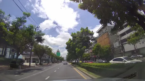

Kwan-Riam Floating Market
Monument and historic site · 4.6 km
ฃอย187 soi 187 ถนนรามคำแหง
Sa-Su 06:00-20:00

Parks, trails and playgrounds22


Chocolate Ville
Sports field and stadium · 3.0 km
Mo-Th 15:00-23:00; Fr-Su, PH 14:00-24:00


Park Nantawan krungtep kreetha
Park · 3.8 km
NANTAWAN พระราม9 กรุงเทพกรีฑาตัดใหม่ Saphan Sung


10 more on the map.
Restaurants and cafes159
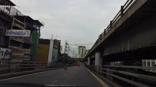
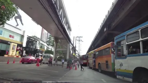


ชอบแกง ข้าวที่ชอบแกงที่ใช่
Restaurant · ข้าวราดแกง, Thai · 4.1 km
18/1 ปตท.ศรีนครินทร์ - ร่มเกล้า ศรีนครินทร์ - ร่มเกล้า, แขวงทับช้าง
07:00-21:00
ตัวมัมชาบูหม่าล่าสายพาน & บุฟเฟต์หมูกะทะ
Restaurant · Asian, ขาบูหม่าล่า, หมูกะทะ · 2.5 km
1521 ซอยนวมินทร์ 14, แขวงคลองจั่น
10.00- 00.00
เจ๊ปทุม ก๋วยเตี๋ยวหมู ต้มยำ เย็นตาโฟ
Restaurant · Thai · 2.8 km
ถนนนวมินทร์, แขวงคลองจั่น
Mo-Su 07:00-16:00
Beluga Coff & Juice
Cafe · Coffee Shop · 2.5 km
685/2 นวมินทร์ 14, แขวงคลองจั่น
Mo-Su 07:00-18:00
Horm Cha @ Ramkhamhaeng 52
Cafe · Coffee Shop, Tea · 4.2 km
110 74/5 ซอยรามคำแหง 52/2
Mo-Su 07:15-20:00
147 more on the map.
History
Bueng Kum was separated from Bang Kapi on 4 September 1989. It consisted of three sub-districts: Khlong Kum, Khan Na Yao, and Saphan Sung. On 14 October 1997, Khan Na Yao and Saphan Sung were elevated to districts, leaving Bueng Kum with a sole sub-district, Khlong Kum.
Bueng Kum was named so because of a lake ("bueng" means 'lake') used as water reservoir for flood prevention. There are also plants called "kum" (Crataeva sp.) around the lake. The lake is part of Seri Thai Park.
From the History section of Bueng Kum district on Wikipedia, under CC BY-SA 4.0.
Where to stay20
Livotel Express Hotel Ramkhamhaeng 50 Bangkok
Motel and hotel · 4.1 km
26 ซอย รามคำแหง 50
M. D. Rose Apartments
Motel and hotel · 4.2 km
50 40 Soi Ramkhamhaeng, Bang Kapi, 40 ซอยรามคำแหง, บางกะปิ
Baron Zotel Bangkok
Motel and hotel · 3.4 km
77 Soi Lardprao117, Klongchan , Bangkapi
Apple Holiday Inn
Motel and hotel · 4.3 km
713 ซ.ลาดพร้าว 101 (แยก 21) ถ.ลาดพร้าว
Churches and places of worship16
Shopping47
Gas and EV charging23
Schools, colleges and libraries31
Healthcare17
La Purita CLINIC (ลา พูริต้า คลินิก) สาขารัชดาภิเษก
Clinic and pharmacy · 4.5 km
444 olympia thai plaza, แขวงสามเสนนอก
The Demis House – Aesthetic Clinic
Clinic and pharmacy · 1.4 km
233 ซอยรามคำแหง 110
Map of Bueng Kum
250 places. The map loads OpenStreetMap tiles when you open it.
Getting there and nearby towns
Suvarnabhumi Airport (BKK) is the nearest airport with scheduled flights listed in OpenStreetMap, 15 km away.
- Bang Kapi 3 km southwest, about 3 min by car
- Din Daeng 11 km west, about 11 min by car
- Bang Sue 15 km west, about 15 min by car
- Dusit 16 km west, about 16 min by car
- Bangkok 18 km west, about 18 min by car
- Mueang Nonthaburi 19 km northwest, about 19 min by car
- Bangkok Noi 21 km west, about 21 min by car
- Thon Buri 21 km west, about 21 min by car
- Samut Prakan 22 km south, about 22 min by car
- Nong Chok 22 km east, about 22 min by car
Drive times are estimates from straight-line distance, not routes.
Towns near Bueng Kum


Keep exploring
Local news
Headlines from INDB.
Reviews, tips and questions
Loading what members have shared...
Sources and licences
- GeoNames (CC BY 4.0): population, coordinates, regions and time zone
- Mapillary (see each image): photos
- OpenStreetMap contributors (ODbL 1.0): places, airports, map data
- Wikidata (CC0 1.0): elevation, founding date, time zone, website, landmarks and historic places
- Wikimedia Commons (see each image): photos
- Wikipedia (CC BY-SA 4.0): overview and history text
Photo credits
- ถนนนวมินทร์, Phoebus 28, CC BY-SA 4.0
- Prasart Museum palms, Flickr user: scott.zona Miami https://www.flickr.com/people/scottzona/, CC BY 2.0
- Campus entrance (Stamford International University, Hua Hin campus, Thailand - January 23 2009), MiCRoSCoPiC^eaRthLinG ( talk ) ( Uploads ), CC BY-SA 3.0
- ฟู้ดแลนด์ สาขาจรัญสนิทวงศ์, Dharmadana, CC BY-SA 4.0
- วัดศรีบุญเรือง (กรุงเทพมหานคร), Dharmadana, CC BY-SA 4.0
- สะพานเสรีไทย3, Phoebus 28, CC BY-SA 4.0
- Phra Kiao Triamnom Colored, โรงเรียนเตรียมอุดมศึกษาน้อมเกล้าและโรงเรียนในเครือ, CC0
- Saphan Sung, Bangkok 10240, Thailand - panoramio, Dextor DD., CC BY 3.0
- Little Walk Ramkhamhaeng20251005, ยุทธนาสาระขันธ์, CC BY-SA 4.0
- Park & Ride at Khlong Ban Ma Station20250209, ยุทธนาสาระขันธ์, CC BY-SA 4.0
- Ram Inthra, Khan Na Yao, Bangkok 10230, Thailand - panoramio, Dextor DD., CC BY 3.0
- Siwatt-gown, Bebe Boon, CC BY-SA 4.0
- Mi krop, Bangkok, 2018-04-12 (2), Bitterschoko, CC0
- Buddha Image Bathing 2018-04-12 (4), Index Librorum Permissorum, CC0
- Mi krop, Bangkok, 2018-04-12 (1), Bitterschoko, CC0
- Buddha Image Bathing 2018-04-12 (3), Index Librorum Permissorum, CC0
- Buddha Image Bathing 2018-04-12 (5), Index Librorum Permissorum, CC0
- Buddha Image Bathing 2018-04-12 (1), Index Librorum Permissorum, CC0
- Buddha Image Bathing 2018-04-12 (2), Index Librorum Permissorum, CC0
- MG EP 02 Thailand 2022-03-09, Navigator84, CC BY-SA 4.0
- MG EP 01 Thailand 2022-03-09, Navigator84, CC BY-SA 4.0
- ชลอ ธรรมศิริ, Cunningdodo, Public domain
- HOME TOWN General store ^ Gas Station - panoramio, Thaweesak Churasri, CC BY 3.0
- Orient-Thai B747-300 (13076538245), Alec Wilson from Hampton-in-Arden, UK, CC BY-SA 2.0
- Orient-Thai MD8 -1 (13076660553), Alec Wilson from Hampton-in-Arden, UK, CC BY-SA 2.0
- Orient-Thai MD8 -2 (13076850104), Alec Wilson from Hampton-in-Arden, UK, CC BY-SA 2.0
- Macaroni goreng, Vee Satayamas, CC BY 2.0
- Panorama view - panoramio (1), Thaweesak Churasri, CC BY 3.0
- Serithai Cycling Club - panoramio, Thaweesak Churasri, CC BY 3.0
- Serithai Cycling Club - panoramio (1), Thaweesak Churasri, CC BY 3.0
- Motorway 9 Klong kum Interchange 2019, LoveTripSpotting, CC BY-SA 4.0
- Monk-blessed amulet, Myanmar Wik, CC BY-SA 4.0
- Amulets associated with religious beliefs, especially Buddhism, Myanmar Wik, CC BY-SA 4.0
- Thai Buddha amulet, Myanmar Wik, CC BY-SA 4.0
- A famous amulet market in Bangkok, Myanmar Wik, CC BY-SA 4.0
- အဆောင်လက်ဖွဲ့အမျိုးမျိုးပုံ, Myanmar Wik, CC BY-SA 4.0
- Tampak Luar Gereja Mother of Perpetual Help Khlong Chan (2026) 02, Medelam, CC BY-SA 4.0
- Ikon Bunda Maria Penolong Abadi di Gereja Mother of Perpetual Help Khlong Chan (2026), Medelam, CC BY-SA 4.0
- Menara dan Papan Nama Gereja Mother of Perpetual Help Khlong Chan (2026), Medelam, CC BY-SA 4.0
- Altar Gereja Mother of Perpetual Help Khlong Chan (2026) 02, Medelam, CC BY-SA 4.0
- Chocolate Ville European style restaurant - panoramio, Thaweesak Churasri, CC BY 3.0
- Street-level photo, toffy, CC BY-SA 4.0
- Street-level photo, lvl5, CC BY-SA 4.0
- Street-level photo, toffy, CC BY-SA 4.0
- Street-level photo, ozflor, CC BY-SA 4.0
- Street-level photo, toffy, CC BY-SA 4.0
- Street-level photo, ThailandCambodia, CC BY-SA 4.0
- Street-level photo, ozflor, CC BY-SA 4.0
- Street-level photo, ThailandCambodia, CC BY-SA 4.0
- Street-level photo, ozflor, CC BY-SA 4.0


Page built November 10, 2026. Spotted a mistake? Tell us or suggest a place.