


Nong Chok, Thailand
เขตหนองจอก
Nong Chok is a city of 157,138 people in Bangkok, Thailand.
Why visit Nong Chok
Townapedia lists 1 museum or landmark, 7 parks and trails, 19 places to eat and 5 places to stay in and around town.
Highlights include Nong Chok Park and Bangkok Arena.
Weather in Nong Chok
Forecast from MET Norway (CC BY 4.0). Full forecast
About Nong Chok
Nong Chok (Thai: หนองจอก, pronounced [nɔ̌ːŋ t͡ɕɔ̀ːk]) is one of the 50 districts (khet) of Bangkok, Thailand. It is bounded by other districts (from north clockwise): Amphoe Lam Luk Ka of Pathum Thani province, Amphoe Bang Nam Priao and Amphoe Mueang Chachoengsao of Chachoengsao province, Lat Krabang, Min Buri and Khlong Sam Wa of Bangkok. It is the biggest, easternmost and the most sparsely populated district of Bangkok.
From the Wikipedia article Nong Chok district (this version), under CC BY-SA 4.0.
Photos of Nong Chok


Museums and landmarks1

Parks, trails and playgrounds7


Restaurants and cafes19
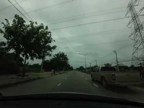
ฌามเช้า
Restaurant · Breakfast, อาหารฮาลาล, เครื่องดื่ม, Coffee Shop, ร้านอาหาร · 7.8 km
21/1 ถนนราษฎร์อุทิศ
เสาร์-อาทิตย์ 7:00-11:30น.
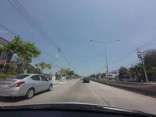
The Bung Steak Halal Food
Restaurant · Japanese, Burger, Thai, Steak House · 3.6 km


7 more on the map.
Where to stay5

หนองจอก 20 แมนชั่น
Motel and hotel · 4.5 km
1/51 หมู่ 7 เชื่อมสัมพันธ์ 20

History
The district was established as an amphoe in 1897 during the reign of King Chulalongkorn. The original settlers were Muslims relocated from southern Thailand. In 1902, it became an amphoe of the newly established Min Buri province. Due to economic hardship during 1930–31, Min Buri Province was disbanded in 1931 and Nong Chok was transferred to Chachoengsao province.
District administration was later moved again to Bangkok in 1932 due to inconvenience of travel between Nong Chok and Chachoengsao. As of 2006, about 75% of the population were Muslims while 22% were Buddhists. The name Nong Chok means water lettuce (Pistia stratiotes) swamp.
From the History section of Nong Chok district on Wikipedia, under CC BY-SA 4.0.
More about Nong Chok
Economy
Agriculture was and remains the most important part of Nong Chok economy. Rice, vegetables, fruits, and livestocks are the main products. It is famous for its gamecocks and birdcages. Many canals were dug for irrigation and transportation.
From the Wikipedia article Nong Chok district, under CC BY-SA 4.0.
Churches and places of worship35
Wat Prayong-Kitti Wanaram
Place of worship · Thai Mahanikaya · 4.7 km
Wat Sap Samoson Nikon Kasem
Place of worship · Thai Mahanikaya · 6.4 km
Shopping7
Gas and EV charging10
Schools, colleges and libraries19
Mahanakorn University of Technology
School · 1.4 km
140 ถนนเชื่อมสัมพันธ์
Healthcare3
Map of Nong Chok
106 places. The map loads OpenStreetMap tiles when you open it.
Getting there and nearby towns
Suvarnabhumi Airport (BKK) is the nearest airport with scheduled flights listed in OpenStreetMap, 23 km away.
- Mueang Nonthaburi 38 km west, about 38 min by car
- Bangkok 41 km west, about 41 min by car
- Samut Prakan 41 km southwest, about 41 min by car
- Pak Kret 40 km west, about 40 min by car
- Thon Buri 43 km west, about 43 min by car
- Taling Chan 45 km west, about 45 min by car
- Phasi Charoen 49 km west, about 49 min by car
- Nong Khaem 58 km west, about 58 min by car
- Si Racha 76 km south, about 1 h 15 min by car
- Nakhon Pathom 88 km west, about 1 h 30 min by car
Drive times are estimates from straight-line distance, not routes.
Towns near Nong Chok


Keep exploring
Local news
Headlines from INDB.
Reviews, tips and questions
Loading what members have shared...
Sources and licences
- GeoNames (CC BY 4.0): population, coordinates, regions and time zone
- Mapillary (see each image): photos
- OpenStreetMap contributors (ODbL 1.0): places, airports, map data
- Wikidata (CC0 1.0): elevation, founding date, time zone, website, landmarks and historic places
- Wikimedia Commons (see each image): photos
- Wikipedia (CC BY-SA 4.0): overview and history text
Photo credits
- อาคาร ๓ บ.ด.๔, SuphachaiFang, CC BY-SA 4.0
- Wat Prayong, Wat Prayong, CC BY-SA 4.0
- วัดทรัพย์สโมสรนิกรเกษม Wat Sub samo sorn nikon kasem - panoramio, Thaweesak Churasri, CC BY 3.0
- มหาวิทยาลัยเทคโนโลยีมหานคร "Mahanakorn University of Technology" (MUT) - panoramio, Thaweesak Churasri, CC BY 3.0
- วัดหนองจอก - panoramio, Thaweesak Churasri, CC BY 3.0
- แยกหนองจอก - panoramio, Thaweesak Churasri, CC BY 3.0
- สวนสาธารณะหนองจอก Nongchock Park - panoramio (16), Thaweesak Churasri, CC BY 3.0
- สวนสาธารณะหนองจอก Nongchock Park - panoramio, Thaweesak Churasri, CC BY 3.0
- สวนสาธารณะหนองจอก Nongchock Park - panoramio (3), Thaweesak Churasri, CC BY 3.0
- สวนสาธารณะหนองจอก Nongchock Park - panoramio (2), Thaweesak Churasri, CC BY 3.0
- โรงพยาบาลหนองจอก Nongchock Hospital - panoramio, Thaweesak Churasri, CC BY 3.0
- สวนสาธารณะหนองจอก Nongchock Park - panoramio (1), Thaweesak Churasri, CC BY 3.0
- สวนสาธารณะหนองจอก Nongchock Park - panoramio (18), Thaweesak Churasri, CC BY 3.0
- สวนสาธารณะหนองจอก Nongchock Park - panoramio (14), Thaweesak Churasri, CC BY 3.0
- สวนสาธารณะหนองจอก Nongchock Park - panoramio (15), Thaweesak Churasri, CC BY 3.0
- สวนสาธารณะหนองจอก Nongchock Park - panoramio (6), Thaweesak Churasri, CC BY 3.0
- สวนสาธารณะหนองจอก Nongchock Park - panoramio (4), Thaweesak Churasri, CC BY 3.0
- สวนสาธารณะหนองจอก Nongchock Park - panoramio (5), Thaweesak Churasri, CC BY 3.0
- สวนสาธารณะหนองจอก Nongchock Park - panoramio (19), Thaweesak Churasri, CC BY 3.0
- สวนสาธารณะหนองจอก Nongchock Park - panoramio (7), Thaweesak Churasri, CC BY 3.0
- สวนสาธารณะหนองจอก Nongchock Park - panoramio (17), Thaweesak Churasri, CC BY 3.0
- สวนสาธารณะหนองจอก Nongchock Park - panoramio (8), Thaweesak Churasri, CC BY 3.0
- สวนสาธารณะหนองจอก Nongchock Park - panoramio (9), Thaweesak Churasri, CC BY 3.0
- สวนสาธารณะหนองจอก Nongchock Park - panoramio (12), Thaweesak Churasri, CC BY 3.0
- สวนสาธารณะหนองจอก Nongchock Park - panoramio (11), Thaweesak Churasri, CC BY 3.0
- สวนสาธารณะหนองจอก Nongchock Park - panoramio (13), Thaweesak Churasri, CC BY 3.0
- สวนสาธารณะหนองจอก Nongchock Park - panoramio (10), Thaweesak Churasri, CC BY 3.0
- ชมรมจักรยาน "ฅนชานเมือง" Kon-Chan-Muang Bike Club - panoramio, Thaweesak Churasri, CC BY 3.0
- ผืนนาที่หนองจอก Paddy land - panoramio, Thaweesak Churasri, CC BY 3.0
- โด่เด่ Stand erect - panoramio, Thaweesak Churasri, CC BY 3.0
- Bobmer hideout - panoramio, mohigan, CC BY-SA 3.0
- มหาวิทยาลัยเทคโนโลยีมหานคร "Mahanakorn University of Technology" (MUT) - panoramio (1), Thaweesak Churasri, CC BY 3.0
- เป็ดน้อย Little duck - panoramio, Thaweesak Churasri, CC BY 3.0
- The Flame Of Rose, Barboza Botsawana, CC BY 3.0
- The Water Lily, Barboza Botsawana, CC BY 3.0
- Untitled, Barboza Botsawana, CC BY 3.0
- The Water Lily, Barboza Botsawana, CC BY 3.0
- The Water Lily, Barboza Botsawana, CC BY 3.0
- The Water Lily, Barboza Botsawana, CC BY 3.0
- The Water Lily, Barboza Botsawana, CC BY 3.0
- Street-level photo, mishari, CC BY-SA 4.0
- Street-level photo, mishari, CC BY-SA 4.0
- Street-level photo, ThailandCambodia, CC BY-SA 4.0
- Street-level photo, ozflor, CC BY-SA 4.0
- Street-level photo, mishari, CC BY-SA 4.0


Page built November 10, 2026. Spotted a mistake? Tell us or suggest a place.