


Chumphon, Thailand
เทศบาลเมืองชุมพร
Chumphon is a regional capital of 55,835 people in Chumphon, Thailand.
Why visit Chumphon
Townapedia lists 10 museums and landmarks, 1 park or trail, 42 places to eat and 29 places to stay in and around town.
Highlights include Khao Sam Kaeo.
Weather in Chumphon
Forecast from MET Norway (CC BY 4.0). Full forecast
About Chumphon
Chumphon (Thai: ชุมพร, pronounced [t͡ɕʰūm.pʰɔ̄ːn]) is a town (thesaban mueang) in southern Thailand, capital of the Chumphon Province and Mueang Chumphon District. The city is about 463 kilometers (288 miles) from Bangkok. As of 2018 it had a population of around 33,600. The town covers the commune (tambon) Tha Taphao completely and parts of tambons Bang Mak, Wang Phai, Na Thung, Tak Daet, and Khun Krathing.
From the Wikipedia article Chumphon (this version), under CC BY-SA 4.0.
Travel tips from other travellers: Chumphon on Wikivoyage (CC BY-SA 4.0).
Photos of Chumphon


Museums and landmarks10

Khao Sam Kaeo
Monument and historic site · 3.5 km
Archaeological site in Thailand

Parks, trails and playgrounds1

Restaurants and cafes42
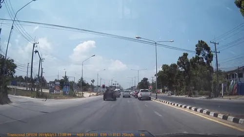


Grandma Puad Restaurant
Restaurant · Diner, Fish, Regional, Local · 2.5 km
Mo-Su 11:00-17:00
The Farmer House
Restaurant · Steak House, Fish, Pasta, Pizza, Arab, Diner, Italian Pizza · 2.8 km
Mo-Su 11:30-20:00
อาหารเจครัวพี่เอสVegan
Restaurant
4 ถนนภูนารถดำเนิน
Mo-Su 06:00-14:30
E-Sarn baan puang Restaurant
Restaurant · Regional, Thai, Local · 2.9 km
Mo-Su 11:00-20:00
30 more on the map.
Where to stay29
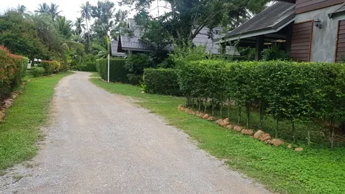



ชุมพรโฮมมี่ Chumphon Homies
Motel and hotel · 1.2 km
88/25 ม.8 Krumluang Chumphon 5 Soi 4, ชุมพร Chumphon
Suda Guesthouse
Motel and hotel · 0.6 km
Basic, clean, including travel agency for ferry tickets
17 more on the map.
History
Chumphon volunteers fought invading Japanese during World War II. Chumphon became a rail hub for Imperial Japan. It was a station on the Southern Line and connected to the short-lived Kra Isthmus Railway.
From the History section of Chumphon on Wikipedia, under CC BY-SA 4.0.
More about Chumphon
Geography
Chumphon lies just inland from the west coast of the Gulf of Thailand. To the west are the northern hills of the Phuket Range, a subrange of the Tenasserim Hills. These hills reach 400 metres (1,300 ft) in the area near Chumphon. There are also many smaller peaks in the area in the range of 100 metres (330 ft) to 200 metres (660 ft) high.
From the Wikipedia article Chumphon, under CC BY-SA 4.0.
Notable people from Chumphon
 Chanin Sae-EaeThai footballerPhoto: www.thai-fussball.com, CC BY 3.0
- Akarapong PumwisatThai footballer
- Kiew ParunchaiThai Muay Thai fighter
- Kengkla Por.PekkoThai Muay Thai fighter

Born in Chumphon, according to Wikidata (CC0). Each name links to its Wikipedia article.
Churches and places of worship7
Shopping9
Gas and EV charging6
Schools, colleges and libraries3
Healthcare6
Map of Chumphon
113 places. The map loads OpenStreetMap tiles when you open it.
Getting there and nearby towns
Chumphon Airport (CJM) is the nearest airport with scheduled flights listed in OpenStreetMap, 31 km away.
- Ban I Let 14 km southeast, about 14 min by car
- Lang Suan 62 km south, about 1 h by car
- Ban Nam Yuen 77 km southwest, about 1 h 15 min by car
- Ranong 84 km southwest, about 1 h 30 min by car
- Koh Tao 85 km southeast, about 1 h 30 min by car
- Bang Saphan 88 km northeast, about 1 h 30 min by car
Drive times are estimates from straight-line distance, not routes.
Keep exploring
Local news
Headlines from INDB.
Reviews, tips and questions
Loading what members have shared...
Sources and licences
- GeoNames (CC BY 4.0): population, coordinates, regions and time zone
- Mapillary (see each image): photos
- OpenStreetMap contributors (ODbL 1.0): places, airports, map data
- Wikidata (CC0 1.0): elevation, founding date, time zone, website, landmarks and historic places
- Wikimedia Commons (see each image): photos
- Wikipedia (CC BY-SA 4.0): overview and history text
Photo credits
- Nationalmuseum Chumphon, Media lib, CC BY-SA 3.0
- Chumphon Palace Hotel - panoramio, easy4444, CC BY 3.0
- A-TE' Hotel Chumphon - panoramio, easy4444, CC BY 3.0
- A-TE' Hotel Chumphon - panoramio (1), easy4444, CC BY 3.0
- Alsthom 4408 ordinary 255 at chumphon, Pakawut kenta, CC BY-SA 4.0
- ตำบลท่าตะเภา อำเภอเมืองชุมพร จังหวัดชุมพร - panoramio, easy4444, CC BY 3.0
- ตลาดสดท่าตะเภา ชุมพร - panoramio, easy4444, CC BY 3.0
- เซียนตี๋ Shabu & Sushi ชุมพร, Ayakln, CC BY-SA 4.0
- โรงหนังศรีรัตน์ (โรงหนังเก่า) จ.ชุมพร - panoramio, easy4444, CC BY 3.0
- ทางเข้าสถานีรถไฟชุมพร - panoramio, easy4444, CC BY 3.0
- สถานีรถไฟ จ.ชุมพร - panoramio, easy4444, CC BY 3.0
- Kromluang Soi.3 - panoramio, easy4444, CC BY 3.0
- Train Station Chumporn - panoramio, Siamike, CC BY 3.0
- Alsthom 4119 ordinary 255, Pakawut kenta, CC BY-SA 4.0
- Special express 40 25-03-2026, Pakawut kenta, CC BY-SA 4.0
- พระอนุสาวรีย์เสด็จเตี่ย (สวนสาธารณะ อ.เมือง จ.ชุมพร) - panoramio, easy4444, CC BY 3.0
- บรรยกาศยามค่ำที่บ้านสวนสายธาร ริเวอร์ไซด์ บางหมาก - panoramio, easy4444, CC BY 3.0
- ร้านอาหารบ้านสวนสายธาร ริเวอร์ไซด์ บางหมาก - panoramio, easy4444, CC BY 3.0
- ISS046-E-5579 - View of Earth, Earth Science and Remote Sensing Unit , Lyndon B. Johnson Space Center, Public domain
- ISS046-E-5578 - View of Earth, Earth Science and Remote Sensing Unit , Lyndon B. Johnson Space Center, Public domain
- ISS046-E-5580 - View of Earth, Earth Science and Remote Sensing Unit , Lyndon B. Johnson Space Center, Public domain
- Cybister rugosus (MacLeay, 1825) female ventral (8122406816), Udo Schmidt from Deutschland, CC BY-SA 2.0
- Saeng Dat Railway Station, Tealsp, CC0
- ทางลัดเข้าอ.เมืองชุมพร (ข้างศูนย์ราชการ) - panoramio, easy4444, CC BY 3.0
- Saeng Dat Station Building, Tealsp, CC0
- World Wall 2 Youth Volunteers Monument - panoramio, easy4444, CC BY 3.0
- ร้านฮอยอัน, Ayakln, CC BY-SA 4.0
- Bangkok - panoramio (28), Siamike, CC BY 3.0
- Cybister rugosus (MacLeay, 1825) female (8122378645), Udo Schmidt from Deutschland, CC BY-SA 2.0
- Street-level photo, mapcreator, CC BY-SA 4.0
- Street-level photo, mapcreator, CC BY-SA 4.0
- Street-level photo, mapcreator, CC BY-SA 4.0
- Street-level photo, kallhoinz, CC BY-SA 4.0
- Street-level photo, mapcreator, CC BY-SA 4.0


Page built November 10, 2026. Spotted a mistake? Tell us or suggest a place.