

Why visit Erawan
Townapedia lists 1 place to eat in and around town.
Weather in Erawan
Forecast from MET Norway (CC BY 4.0). Full forecast
About Erawan
Erawan (Thai: เอราวัณ; IPA: [ʔēːrāːwān]) is a district (amphoe) in the eastern part of Loei province, in northeastern Thailand.
From the Wikipedia article Erawan district (this version), under CC BY-SA 4.0.
Restaurants and cafes1

ก๋วยเตี๋ยวยายแหล่ | Thai Noodle Soup
Restaurant · ก๋วยเตี๋ยว
52 หมู่ 7, ผาอินทร์แปลง
Sa-Su 08:00-16:00
Gas and EV charging1
Schools, colleges and libraries1

Healthcare2


History
The minor district (king amphoe) was established on 1 April 1995 with territory split off from Wang Saphung district.
The Thai government on 15 May 2007 upgraded all 81 minor districts to full districts. With publication in the Royal Gazette on 24 August the upgrade became official.
From the History section of Erawan district on Wikipedia, under CC BY-SA 4.0.
More about Erawan
Geography
Neighboring districts are (from the south clockwise): Pha Khao, Wang Saphung, Mueang Loei, and Na Duang of Loei Province; and Na Wang and Si Bun Rueang of Nong Bua Lamphu province.
From the Wikipedia article Erawan district, under CC BY-SA 4.0.
Map of Erawan
5 places. The map loads OpenStreetMap tiles when you open it.
Getting there and nearby towns
Loei Airport (LOE) is the nearest airport with scheduled flights listed in OpenStreetMap, 29 km away.
- Wang Saphung 20 km west, about 20 min by car
- Na Klang 25 km east, about 25 min by car
- Loei 32 km northwest, about 32 min by car
- Phu Kradueng 47 km south, about 47 min by car
- Si Bun Rueang 51 km southeast, about 51 min by car
- Nong Bua Lamphu 53 km east, about 53 min by car
- Nam Som 58 km northeast, about 58 min by car
- Kut Chap 67 km east, about 1 h by car
- Nong Wua So 68 km east, about 1 h 15 min by car
- Udon Thani 89 km east, about 1 h 30 min by car
Drive times are estimates from straight-line distance, not routes.
Towns near Erawan


Keep exploring
Local news
Headlines from INDB.
Reviews, tips and questions
Loading what members have shared...
Sources and licences
- GeoNames (CC BY 4.0): population, coordinates, regions and time zone
- Mapillary (see each image): photos
- OpenStreetMap contributors (ODbL 1.0): places, airports, map data
- Wikidata (CC0 1.0): elevation, founding date, time zone, website
- Wikimedia Commons (see each image): photos
- Wikipedia (CC BY-SA 4.0): overview and history text
Photo credits
- เข็มกลัดโรงเรียนนาวังศึกษาวิช, Ns11721, CC BY-SA 4.0
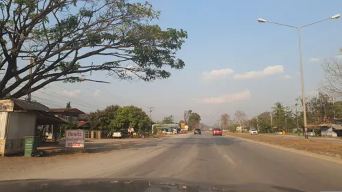
- Street-level photo, jrcarlsen, CC BY-SA 4.0
Page built November 10, 2026. Spotted a mistake? Tell us or suggest a place.