


Kamphaeng Phet, Thailand
เทศบาลเมืองกำแพงเพชร
Kamphaeng Phet is a regional capital of 58,787 people in Kamphaeng Phet, Thailand.
Why visit Kamphaeng Phet
Townapedia lists 71 museums and landmarks, 5 parks and trails, 15 places to eat, 13 places to stay and 1 attraction in and around town.
Highlights include Kamphaeng Phet National Museum, Night Market and Chakangrao Stadium.
Weather in Kamphaeng Phet
Forecast from MET Norway (CC BY 4.0). Full forecast
About Kamphaeng Phet
Kamphaeng Phet is a town (thesaban mueang) in central Thailand, the former capital of Kamphaeng Phet Province. It covers the complete tambon Nai Mueang of the Mueang Kamphaeng Phet district. As of 2020, it has a population of 28,817. The site carries the walls and fortifications of a town of the Sukhothai period.
From the Wikipedia article Kamphaeng Phet (this version), under CC BY-SA 4.0.
Travel tips from other travellers: Kamphaeng Phet on Wikivoyage (CC BY-SA 4.0).
Things to do1

Museums and landmarks71




59 more on the map.
Parks, trails and playgrounds5


Kamphaeng Phet Provincial Administrative Organization 2 Stadium
Sports field and stadium
Restaurants and cafes15

Lab Mae Thong Luean Restaurant
Restaurant · Thai · 1.9 km
Mo-Su 09:00-15:30


3 more on the map.
History
According to the Ayutthaya Testimonies, in 1156 a monarch of Xiān named Suryaraja moved his royal seat to Vicitraprakāra, identified with present-day Kamphaeng Phet. The town thus became the principal centre of his dominion. His successor and son, Candraraja, later moved the seat of power to Sukhothai, leaving Kamphaeng Phet a frontier stronghold of the kingdom.
Read more of the history
Kamphaeng Phet was an ancient outpost town during the Sukhothai period, as evidenced by the city walls and fortifications that remain today. Legend gives two towns on the site before the present one, Chakangrao (ชากังราว) and Nakhon Chum (นครชุม). Chakangrao stood on the east bank of the Ping River and Nakhon Chum on the west. Prince Damrong Rajanubhab assigned the two names the other way. He surmised that the older town, on the west bank at the mouth of Khlong Suan Mak, was first called Chakangrao and took the name Nakhon Chum under the Phra Ruang dynasty. The walled town on the east bank, named Kamphaeng Phet, he held to be later, of the reign of Li Thai. He rested this on the absence of Kamphaeng Phet from any Sukhothai inscription, on Li Thai's inscription at Wat Mahathat calling the place Nakhon Chum, and on Ayutthayan law texts that pair Chakangrao with Kamphaeng Phet. He ranked the newer town as a royal capital or as a town held by a king's son, which he took to explain its palace. Piset Jiachanpong reads the east-bank town as an Ayutthayan foundation placed against Nakhon Chum. On his account it stood on high ground, clear of the flooding that troubled the older town, and could be supplied by river from the lower Chao Phraya. Nakhon Chum's people may on that reading have crossed over to settle there.
Borommarachathirat I of Ayutthaya attacked Chakangrao four times between 1376 and 1388. Tomé Pires, writing early in the 16th century, described the town's governor as a viceroy who within his own territory stood like the king of the land. Chairacha had the governor, Phraya Narai, executed there in 1538, and Bayinnaung took the town in 1563 before moving against Phitsanulok.
A bronze image of Śiva was cast for the town in 1510. Pierre Baptiste reports that the dedicatory inscription on the statue names the donor as Śrī Dharmāśokarāja, a prince of Kamphaeng Phet, and gives the date of casting. Baptiste notes that the attribution of the group of Hindu bronzes to which it belongs has been disputed since 1895, with proposed dates running from the mid-14th to the mid-18th century.
Kamphaeng Phet received municipality status on March 11, 1936. At its establishment it covered 4.5 square kilometers. Later in 1966, it expanded to an area of 14.9 square kilometers.
From the History section of Kamphaeng Phet on Wikipedia, under CC BY-SA 4.0.
Notable people from Kamphaeng Phet
 Chatchai BudpromThai footballerPhoto: Explicit, CC BY-SA 4.0
 Pongpat WachirabunjongThai actor and singerPhoto: Wisekwai, CC BY-SA 3.0
 Wisarut PannasriThai footballerPhoto: Lady.Melon, CC BY-SA 4.0
- Sornpichai KratingdaenggymThai boxer
- Somporn YosThai footballer
- Wattana PlainumThai association football player
- Suradej ThongchaiThai footballer
- Peerakiat SiriluethaiwattanaThai tennis player (1989-)
- Chandet Sor PrantalayThai martial artist
- Kitisak SaengseeThai volleyball player


Born in Kamphaeng Phet, according to Wikidata (CC0). Each name links to its Wikipedia article.
Where to stay13
Churches and places of worship11
Buddhist place of Kamphaengphet Pittayakom School (Thammasukpiti Courtyard)
Church · Theravada · 0.7 km
188 ถนนปิ่นดำริห์, จังหวัดกำแพงเพชร
Shopping6
Gas and EV charging2
Schools, colleges and libraries21
Auditorium of Kamphaengphet Pittayakom School (Watchara-Nari Auditorium)
School · Theravada · 0.7 km
188 ถนนปิ่นดำริห์, จังหวัดกำแพงเพชร
Healthcare1
Map of Kamphaeng Phet
146 places. The map loads OpenStreetMap tiles when you open it.
Getting there and nearby towns
Tak Airport (TKT) is the nearest airport with scheduled flights listed in OpenStreetMap, 54 km away.
- Lan Krabue 37 km east, about 37 min by car
- Khiri Mat 49 km northeast, about 49 min by car
- Ban Dan Lan Hoi 58 km north, about 58 min by car
- Tak 60 km northwest, about 1 h by car
- Khanu Woralaksaburi 59 km southeast, about 59 min by car
- Ban Na 63 km north, about 1 h by car
- Sukhothai 67 km northeast, about 1 h by car
- Bang Rakam 70 km northeast, about 1 h 15 min by car
- Bueng Na Rang 73 km southeast, about 1 h 15 min by car
- Ban Tak 78 km northwest, about 1 h 15 min by car
Drive times are estimates from straight-line distance, not routes.
Keep exploring
Local news
Headlines from INDB.
Reviews, tips and questions
Loading what members have shared...
Sources and licences
- GeoNames (CC BY 4.0): population, coordinates, regions and time zone
- Mapillary (see each image): photos
- OpenStreetMap contributors (ODbL 1.0): places, airports, map data
- Wikidata (CC0 1.0): elevation, founding date, time zone, website
- Wikimedia Commons (see each image): photos
- Wikipedia (CC BY-SA 4.0): overview and history text
Photo credits
- 2006 0930 kamphaeng phet 03, Takeaway at English Wikipedia ( Original text: Takeaway ( talk ) ), CC BY-SA 3.0
- PlateKPP, B nutthapong, CC BY-SA 4.0
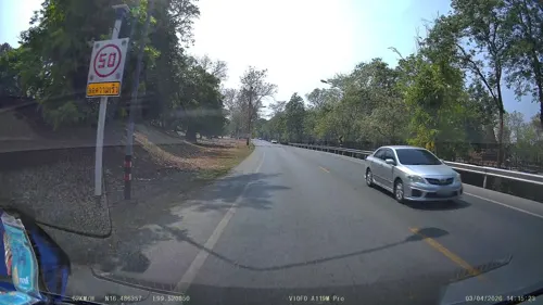
- Street-level photo, ThailandCambodia, CC BY-SA 4.0
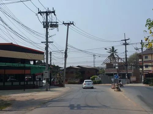
- Street-level photo, jrcarlsen, CC BY-SA 4.0
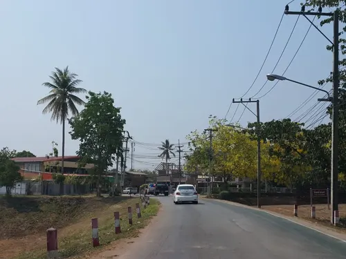
- Street-level photo, jrcarlsen, CC BY-SA 4.0
- Street-level photo, ThailandCambodia, CC BY-SA 4.0
Page built November 10, 2026. Spotted a mistake? Tell us or suggest a place.