


Kanchanaburi, Thailand
เทศบาลเมืองกาญจนบุรี
Kanchanaburi is a regional capital of 63,699 people in Kanchanaburi, Thailand.
Why visit Kanchanaburi
Townapedia lists 4 museums and landmarks, 2 parks and trails, 23 places to eat and 5 places to stay in and around town.
Highlights include Chungkai War Cemetery and Thailand-Burma Railway Centre.
Weather in Kanchanaburi
Forecast from MET Norway (CC BY 4.0). Full forecast
About Kanchanaburi
Kanchanaburi (Thai: กาญจนบุรี, pronounced [kāːn.t͡ɕā.ná(ʔ).bū.rīː]) is a town municipality (thesaban mueang) in Kanchanaburi Province, Thailand. The town of lies to the southeast of Erawan National Park within Kanchanaburi Province, approximately 120km west of Bangkok. In 2006 it had a population of 31,327. That number was reduced to 25,651 in 2017.
From the Wikipedia article Kanchanaburi (this version), under CC BY-SA 4.0.
Travel tips from other travellers: Kanchanaburi on Wikivoyage (CC BY-SA 4.0).
Photos of Kanchanaburi


Museums and landmarks4
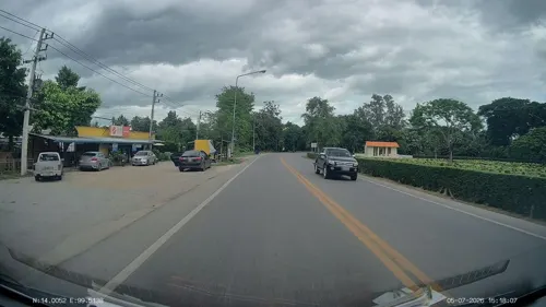
Chungkai War Cemetery
Monument and historic site · 3.7 km
War cemetery in Kanchanaburi province, Thailand
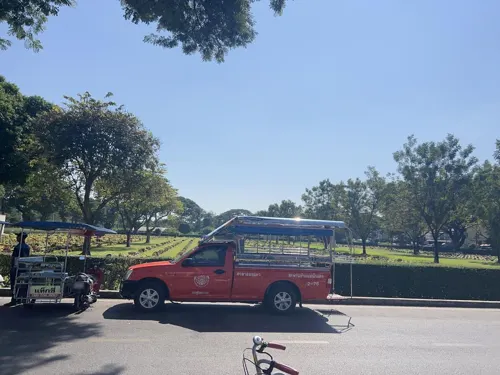
Thailand-Burma Railway Centre
Museum · 4.0 km
Museum and research centre in Kanchanaburi, Thailand


Parks, trails and playgrounds2


Restaurants and cafes23
ร้านเตี๋ยวยำแม่แดง กาญจนบุรี
Restaurant · Thai, Seafood, Asian · 2.1 km
Thai food
65/23 เลี่ยงเมืองกาญจนบุรี, ปากแพรก
10:00-22:00


11 more on the map.
Where to stay5

History
In the late 18th century, Kanchanaburi was established by King Rama I as a defensive outpost against possible Burmese attacks in what is now Lat Ya Sub-district. In 1833, the town was moved about 16 km to the southeast along the river to its present site during the reign of King Rama III.
From the Ayutthaya period to the Thonburi and Rattanakosin periods, Kanchanaburi was an important outpost to defend against Burmese invasions. The old town was located at Tambon Lat Ya (Khao Chon Kai in the present). In 1831, King Rama III moved the city to the southeast, about 16 kilometers, to set at the confluence of the Khwae Yai River and the Khwae Noi River, which is the location of the town today.
On March 25, 1935, a royal decree was issued for Ban Nuea Subdistrict and Ban Tai Subdistrict, which has an area of approximately 2.08 square kilometers.
From the History section of Kanchanaburi on Wikipedia, under CC BY-SA 4.0.
More about Kanchanaburi
Geography
Kanchanaburi, where the Khwae Noi and Khwae Yai Rivers converge into the Mae Klong River, spans the northern banks of the river and is a popular spot for travelers. Its location at the edge of a mountain range keeps it much cooler than the other provinces of central Thailand.
Economy
The city has two major commercial districts: the downtown area consists of a grid of several streets with office buildings, shop fronts, and a shopping mall; and the riverfront area businesses are mostly further west along River Kwai Road. Once a year a carnival comes to town and is set up in the area next to the bridge. At night there is a small pyrotechnics display that re-enacts the wartime bombing of the bridge.
The riverfront has skywalk, and next to it is Walking Street. The skywalk is a "12-metre high and 150 metre-long" glass walkway, owned by the local government; to access the skywalk, one must pay [on site] 60 baht to own a pair of plastic shoes.
From the Wikipedia article Kanchanaburi, under CC BY-SA 4.0.
Notable people from Kanchanaburi
 Wiradech KothnyfencerPhoto: B20180, CC BY-SA 3.0
 Vikrom KromaditThai businessmanPhoto: Government of Thailand, CC BY 2.0
 DattajīvoThai Buddhist monkPhoto: Honey Kochphon Onshawee, CC0
- Suchao NuchnumThai footballer
- Pramote TeerawiwatanaThai badminton player (1967–2012)
- Chatchai PlengpanichThai actor
- Patiparn PhetphunThai footballer
- Praweenwat BoonyongThai footballer
- Sompob NilwongThai footballer
- Supot Jodjamassociation football player
- Kosin HembutThai footballer
- Wichan PreedaboonThai footballer
Born in Kanchanaburi, according to Wikidata (CC0). Each name links to its Wikipedia article.
Churches and places of worship4
Shopping4
Gas and EV charging6
Schools, colleges and libraries1
Healthcare2
Map of Kanchanaburi
51 places. The map loads OpenStreetMap tiles when you open it.
Getting there and nearby towns
Kamphaeng Saen Airport (KDT) is the nearest airport with scheduled flights listed in OpenStreetMap, 41 km away.
- Tha Muang 11 km southeast, about 11 min by car
- Phanom Thuan 21 km northeast, about 21 min by car
- Tha Maka 26 km southeast, about 26 min by car
- Bo Phloi 36 km north, about 36 min by car
- Ban Pong 41 km southeast, about 41 min by car
- Chom Bueng 43 km south, about 43 min by car
- Photharam 48 km southeast, about 48 min by car
- Ban I Chang 50 km southeast, about 50 min by car
- Nakhon Pathom 57 km east, about 57 min by car
- Ratchaburi 60 km southeast, about 1 h by car
Drive times are estimates from straight-line distance, not routes.
Towns near Kanchanaburi


Keep exploring
Local news
Headlines from INDB.
Reviews, tips and questions
Loading what members have shared...
Sources and licences
- GeoNames (CC BY 4.0): population, coordinates, regions and time zone
- Mapillary (see each image): photos
- OpenStreetMap contributors (ODbL 1.0): places, airports, map data
- Wikidata (CC0 1.0): elevation, founding date, time zone, website, landmarks and historic places
- Wikimedia Commons (see each image): photos
- Wikipedia (CC BY-SA 4.0): overview and history text
Photo credits
- Kanchanaburi, Kwai River and River Kwai bridge, Thailand, Vyacheslav Argenberg, CC BY 4.0
- Pak Phraek, Mueang Kanchanaburi District, Kanchanaburi, Thailand - panoramio, Phong Phat G, CC BY-SA 3.0
- Pak Phraek, Mueang Kanchanaburi District, Kanchanaburi, Thailand - panoramio (1), Phong Phat G, CC BY-SA 3.0
- Monument in Kanchanaburi, Supercarwaar, CC BY-SA 3.0
- Long-tail boat, Khwae Yai River, Kanchanaburi, Thailand (7115199985), David McKelvey from Brisbane, Australia, CC BY 2.0
- Houseboats, Khwae Yai River, Kanchanaburi, Thailand (7115199337), David McKelvey from Brisbane, Australia, CC BY 2.0
- Tour Minibus, Kanchanaburi, Thailand (6969117138), David McKelvey from Brisbane, Australia, CC BY 2.0
- Beata Mundi Regina church (Kanchanaburi) 03, Ruslik0, CC BY-SA 4.0
- JEATH War Museum, Horiuchi, Public domain
- Wat Chaichumphon Chana Songkhram (Kanchanaburi) 07, Ruslik0, CC BY-SA 4.0
- JEATH Museum 1, BrokenSphere, CC BY-SA 3.0
- Pak Phraek Halt 20240226 03, Suikotei, CC BY 4.0
- Pak Phraek Halt 20240226 01, Suikotei, CC BY 4.0
- Pak Phraek Halt 20240226 02, Suikotei, CC BY 4.0
- Kanchanburi war cemetery 2 - panoramio, Thajsko, CC BY 3.0
- (2019) วัดไชยชุมพลชนะสงคราม อ.เมือง จ.กาญจนบุรี (4), กสิณธร ราชโอรส, CC BY-SA 4.0
- (2019) วัดไชยชุมพลชนะสงคราม อ.เมือง จ.กาญจนบุรี (6), กสิณธร ราชโอรส, CC BY-SA 4.0
- (2019) วัดไชยชุมพลชนะสงคราม อ.เมือง จ.กาญจนบุรี (7), กสิณธร ราชโอรส, CC BY-SA 4.0
- (2019) วัดไชยชุมพลชนะสงคราม อ.เมือง จ.กาญจนบุรี (3), กสิณธร ราชโอรส, CC BY-SA 4.0
- (2019) วัดไชยชุมพลชนะสงคราม อ.เมือง จ.กาญจนบุรี (5), กสิณธร ราชโอรส, CC BY-SA 4.0
- (2019) วัดไชยชุมพลชนะสงคราม อ.เมือง จ.กาญจนบุรี, กสิณธร ราชโอรส, CC BY-SA 4.0
- (2019) วัดไชยชุมพลชนะสงคราม อ.เมือง จ.กาญจนบุรี (2), กสิณธร ราชโอรส, CC BY-SA 4.0
- Kwai River Boat Wharf - panoramio, Lobster1, CC BY-SA 3.0
- Street-level photo, mishari, CC BY-SA 4.0
- Street-level photo, ThailandCambodia, CC BY-SA 4.0
- Street-level photo, s_09_ll, CC BY-SA 4.0
- Street-level photo, jrcarlsen, CC BY-SA 4.0
- Street-level photo, mapcreator, CC BY-SA 4.0
- Street-level photo, mapcreator, CC BY-SA 4.0
- Street-level photo, ThailandCambodia, CC BY-SA 4.0
- Street-level photo, jrcarlsen, CC BY-SA 4.0
- Street-level photo, mapcreator, CC BY-SA 4.0
- Street-level photo, taweesak, CC BY-SA 4.0


Page built November 10, 2026. Spotted a mistake? Tell us or suggest a place.