


Ratchaburi, Thailand
เทศบาลเมืองราชบุรี
Ratchaburi is a regional capital of 92,448 people in Ratchaburi, Thailand.
Why visit Ratchaburi
Townapedia lists 5 museums and landmarks, 2 parks and trails, 40 places to eat, 16 places to stay and 1 attraction in and around town.
Highlights include Chulalongkorn Bridge, Khu Bua and Ratchaburi National Museum.
Weather in Ratchaburi
Forecast from MET Norway (CC BY 4.0). Full forecast
About Ratchaburi
Ratchaburi (Thai: ราชบุรี, pronounced [râːt.t͡ɕʰā.bū.rīː]; also rendered as Rajburi or Rat Buri) is a historic town (thesaban mueang) in western Thailand and the capital of Ratchaburi Province. The area shows early settlement associated with Dvaravati culture and later became an important trade centre in the Ayutthaya period.
From the Wikipedia article Ratchaburi (this version), under CC BY-SA 4.0.
Travel tips from other travellers: Ratchaburi on Wikivoyage (CC BY-SA 4.0).
Photos of Ratchaburi


Things to do1

Museums and landmarks5

Khu Bua
Monument and historic site · 6.0 km
Archaeological site near Ratchaburi, Thailand


Parks, trails and playgrounds2

The Commemorating his Majesty the King's 60 Birthday Anniversary Park
Park · 0.9 km
Restaurants and cafes40

CocoBee Ratchaburi ไก่ทอดเกาหลี โคโค่บี
Restaurant · Korean
267/6 ถนนศรีสุริยวงค์, หน้าเมือง
Mo-Su 11:00-20:00

The Park Ratchaburi
Restaurant · Thai, Tea, หมูกระทะ, ปิ้งย่าง, เครื่องดื่ม, ชา, ป๊อปคอร์น, หมูกระทะ, เฟรนช์ฟรายส์, ไก่ทอด · 1.1 km
วรเดช
Sa-Su 18:00-02:00
ร้านเจ๊อ๋อย ลุงหมึก อาหารตามสั่ง 10 บาท
Restaurant · ข้าวผัดกระเพรา, ข้าวหมู/ไก่กระเทียม, ข้าวผัดพริกแกง, ราดหน้า, ผัดซีอิ๊ว, ผัดไทย, สุกี้น้ำ/แห้ง, อื่นๆ · 1.4 km
7 ถนนเพชรเกษม, ราชบุรี
07.00 - 16.00 น.

28 more on the map.
History
The earliest evidence of settled habitation is that of the Dvaravati culture. At one time it was thought that the early town was founded on the coast of the Gulf of Thailand, and that over time the coast had moved 30 km (18 miles) away to the south, due to sedimentation coming down the Mae Klong River. However, geological and palynological investigation has shown that these early Dvaravati and proto-Dvaravati towns were all inland, at the edges of swamps when founded. Ratchaburi remains an important commercial centre, however. Archeological discoveries show that the area was already settled in the Bronze Age, and the town itself is known to have existed for at least two thousand years.
In the 13th-century, King Ram Khamhaeng seized Ratchaburi and incorporated it into the Sukhothai Kingdom. Later it was an important trade centre in the Ayutthaya Kingdom. In 1768 the Burmese (who had recently destroyed Ayutthaya) were thrown out of Ratchaburi by King Taksin, and the town became part of Siam.
In 2000, a splinter group of Karen activists from Burma, known as God's Army, briefly took the Ratchaburi hospital staff and patients hostage, before the siege was ended by the Thai army.
From the History section of Ratchaburi on Wikipedia, under CC BY-SA 4.0.
Notable people from Ratchaburi
 Phutthaloetla NaphalaiKing of SiamPhoto: Unknown author Unknown author, Public domain
 Nootsara TomkomThai volleyball playerPhoto: Yakov Fedorov, CC BY-SA 3.0
 Atthaya ThitikulThai professional golferPhoto: All-Pro Reels from District of Columbia, USA, CC BY-SA 2.0
 Khosit Phetpradabbadminton playerPhoto: WIL, CC BY 2.0
 Nawat ItsaragrisilThai TV host and businessmanPhoto: Harald Krichel, CC BY-SA 4.0
 Prayad BoonyaThai footballerPhoto: El_Loko für www.thai-fussball.com, CC BY 4.0
 Pawee TanthatemeeThai association football playerPhoto: EL Loko Foto, CC BY 4.0
 Ekkapoom PotharungrojThai footballerPhoto: www.thai-fussball.com, CC BY 3.0
- Manus BoonjumnongOlympic boxer
- Puttichai KasetsinThai actor
- Nirut SurasiangThai footballer
- Suppanad JittaleelaThai-Chinese actress
Born in Ratchaburi, according to Wikidata (CC0). Each name links to its Wikipedia article.
Where to stay16
Churches and places of worship15
Shopping13
Gas and EV charging6
Schools, colleges and libraries21
Healthcare12
Map of Ratchaburi
131 places. The map loads OpenStreetMap tiles when you open it.
Getting there and nearby towns
Kamphaeng Saen Airport (KDT) is the nearest airport with scheduled flights listed in OpenStreetMap, 64 km away.
- Nakhon Pathom 40 km northeast, about 40 min by car
- Phetchaburi 49 km south, about 49 min by car
- Nong Khaem 60 km east, about 1 h by car
- Bang Bon 64 km east, about 1 h by car
- Bang Khae 66 km east, about 1 h by car
- Bang Khun Thian 68 km east, about 1 h 15 min by car
- Phasi Charoen 70 km east, about 1 h 15 min by car
- Chom Thong 74 km east, about 1 h 15 min by car
- Taling Chan 74 km east, about 1 h 15 min by car
- Bangkok 78 km east, about 1 h 15 min by car
Drive times are estimates from straight-line distance, not routes.
Towns near Ratchaburi


Keep exploring
Local news
Headlines from INDB.
Reviews, tips and questions
Loading what members have shared...
Sources and licences
- GeoNames (CC BY 4.0): population, coordinates, regions and time zone
- Mapillary (see each image): photos
- OpenStreetMap contributors (ODbL 1.0): places, airports, map data
- Wikidata (CC0 1.0): elevation, founding date, time zone, website, landmarks and historic places
- Wikimedia Commons (see each image): photos
- Wikipedia (CC BY-SA 4.0): overview and history text
Photo credits
- Asian highway 2 Ratchaburi, Ahoerstemeier, CC BY-SA 3.0
- NationalMuseumRatchaburi, Toey19863, CC BY-SA 4.0
- NationalMuseumRatchaburi2, Toey19863, CC BY-SA 4.0
- Ku Bua 1, Ahoerstemeier, CC BY-SA 3.0
- WatMaHaTadWorRaWiHarn10, Toey19863, CC BY-SA 4.0
- WatSriSuRiYa WongSaRam2, Toey19863, CC BY-SA 4.0
- วัดมหาธาตุวรวิหาร อ.เมือง จ.ราชบุรี (4), กสิณธร ราชโอรส, CC BY-SA 4.0
- วัดมหาธาตุวรวิหาร อ.เมือง จ.ราชบุรี (6), กสิณธร ราชโอรส, CC BY-SA 4.0
- WatKhaoLeua4, Toey19863, CC BY-SA 4.0
- WatSriSuRiYa WongSaRam3, Toey19863, CC BY-SA 4.0
- WatMaHaTadWorRaWiHarn6, Toey19863, CC BY-SA 4.0
- วัดมหาธาตุวรวิหาร อ.เมือง จ.ราชบุรี (14), กสิณธร ราชโอรส, CC BY-SA 4.0
- WatMaHaTadWorRaWiHarn1, Toey19863, CC BY-SA 4.0
- วัดมหาธาตุวรวิหาร อ.เมือง จ.ราชบุรี (3), กสิณธร ราชโอรส, CC BY-SA 4.0
- WatKhaoLeua5, Toey19863, CC BY-SA 4.0
- WatKhaoLeua2, Toey19863, CC BY-SA 4.0
- WatMaHaTadWorRaWiHarn4, Toey19863, CC BY-SA 4.0
- วัดมหาธาตุวรวิหาร อ.เมือง จ.ราชบุรี (5), กสิณธร ราชโอรส, CC BY-SA 4.0
- WatKhaoLeua1, Toey19863, CC BY-SA 4.0
- WatMaHaTadWorRaWiHarn, Toey19863, CC BY-SA 4.0
- WatMaHaTadWorRaWiHarn5, Toey19863, CC BY-SA 4.0
- วัดมหาธาตุวรวิหาร อ.เมือง จ.ราชบุรี (13), กสิณธร ราชโอรส, CC BY-SA 4.0
- วัดมหาธาตุวรวิหาร อ.เมือง จ.ราชบุรี (27), กสิณธร ราชโอรส, CC BY-SA 4.0
- วัดมหาธาตุวรวิหาร อ.เมือง จ.ราชบุรี (21), กสิณธร ราชโอรส, CC BY-SA 4.0
- วัดมหาธาตุวรวิหาร อ.เมือง จ.ราชบุรี (8), กสิณธร ราชโอรส, CC BY-SA 4.0
- WatMaHaTadWorRaWiHarn3, Toey19863, CC BY-SA 4.0
- วัดมหาธาตุวรวิหาร อ.เมือง จ.ราชบุรี (23), กสิณธร ราชโอรส, CC BY-SA 4.0
- WatKhaoLeua6, Toey19863, CC BY-SA 4.0
- วัดมหาธาตุวรวิหาร อ.เมือง จ.ราชบุรี (25), กสิณธร ราชโอรส, CC BY-SA 4.0
- WatMaHaTadWorRaWiHarn2, Toey19863, CC BY-SA 4.0
- WatSriSuRiYa WongSaRam4, Toey19863, CC BY-SA 4.0
- วัดมหาธาตุวรวิหาร อ.เมือง จ.ราชบุรี (20), กสิณธร ราชโอรส, CC BY-SA 4.0
- วัดมหาธาตุวรวิหาร อ.เมือง จ.ราชบุรี (10), กสิณธร ราชโอรส, CC BY-SA 4.0
- วัดมหาธาตุวรวิหาร อ.เมือง จ.ราชบุรี (16), กสิณธร ราชโอรส, CC BY-SA 4.0
- วัดมหาธาตุวรวิหาร อ.เมือง จ.ราชบุรี (19), กสิณธร ราชโอรส, CC BY-SA 4.0
- วัดมหาธาตุวรวิหาร อ.เมือง จ.ราชบุรี (1), กสิณธร ราชโอรส, CC BY-SA 4.0
- WatSriSuRiYa WongSaRam1, Toey19863, CC BY-SA 4.0
- วัดมหาธาตุวรวิหาร อ.เมือง จ.ราชบุรี (12), กสิณธร ราชโอรส, CC BY-SA 4.0
- วัดมหาธาตุวรวิหาร อ.เมือง จ.ราชบุรี (26), กสิณธร ราชโอรส, CC BY-SA 4.0
- WatKhaoLeua3, Toey19863, CC BY-SA 4.0
- Chulalongkorn Bridge, Ratchaburi, Thanapas.som, CC BY-SA 4.0
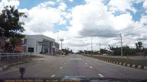
- Street-level photo, mapcreator, CC BY-SA 4.0
- Street-level photo, collectiontrue, CC BY-SA 4.0
- Street-level photo, mapcreator, CC BY-SA 4.0


Page built November 10, 2026. Spotted a mistake? Tell us or suggest a place.