
Tha Maka, Thailand
เทศบาลตำบลท่ามะกา
Tha Maka is a town of 52,907 people in Kanchanaburi, Thailand, founded in October 15, 1956.
Loading the weather...
Population52,907
GeoNames
Local nameเทศบาลตำบลท่ามะกา
RegionKanchanaburi
Elevation15 m
49 ft
FoundedOctober 15, 1956
Time zoneAsia/Bangkok
Nearest airportKamphaeng Saen Airport (KDT)
28 km
Why visit Tha Maka
Townapedia lists 2 museums and landmarks, 1 park or trail and 2 places to eat in and around town.
Weather in Tha Maka
Forecast from MET Norway (CC BY 4.0). Full forecast
Museums and landmarks2

Parks, trails and playgrounds1

Restaurants and cafes2


Churches and places of worship3

Shopping1
Gas and EV charging5
Schools, colleges and libraries4
Healthcare1
Map of Tha Maka
19 places. The map loads OpenStreetMap tiles when you open it.
Getting there and nearby towns
Kamphaeng Saen Airport (KDT) is the nearest airport with scheduled flights listed in OpenStreetMap, 28 km away.
- Nakhon Pathom 31 km east, about 31 min by car
- Nong Khaem 66 km east, about 1 h by car
- Bang Khae 73 km east, about 1 h 15 min by car
- Bang Bon 73 km east, about 1 h 15 min by car
- Phasi Charoen 75 km east, about 1 h 15 min by car
- Taling Chan 76 km east, about 1 h 15 min by car
- Bang Khun Thian 77 km east, about 1 h 15 min by car
- Pak Kret 79 km east, about 1 h 15 min by car
- Bangkok 81 km east, about 1 h 15 min by car
- Mueang Nonthaburi 81 km east, about 1 h 15 min by car
Drive times are estimates from straight-line distance, not routes.
Towns near Tha Maka


Keep exploring
Local news
Headlines from INDB.
Reviews, tips and questions
Loading what members have shared...
Sources and licences
- GeoNames (CC BY 4.0): population, coordinates, regions and time zone
- Mapillary (see each image): photos
- OpenStreetMap contributors (ODbL 1.0): places, airports, map data
- Wikidata (CC0 1.0): elevation, founding date, time zone, website
Photo credits
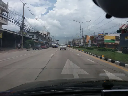
- Street-level photo, mishari, CC BY-SA 4.0
- Street-level photo, beddhist, CC BY-SA 4.0
- Street-level photo, beddhist, CC BY-SA 4.0
- Street-level photo, beddhist, CC BY-SA 4.0
- Street-level photo, beddhist, CC BY-SA 4.0
- Street-level photo, beddhist, CC BY-SA 4.0
Page built November 10, 2026. Spotted a mistake? Tell us or suggest a place.