
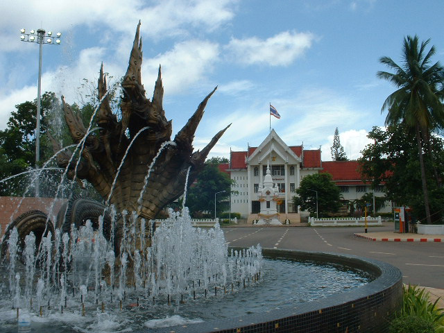


Nong Khai, Thailand
เทศบาลเมืองหนองคาย
Nong Khai is a regional capital of 63,609 people in Nong Khai, Thailand.
Why visit Nong Khai
Townapedia lists 7 museums and landmarks, 5 parks and trails, 82 places to eat, 35 places to stay and 4 attractions in and around town.
Highlights include First Thai–Lao Friendship Bridge, Buddha Park and Sala Keoku.
Weather in Nong Khai
Forecast from MET Norway (CC BY 4.0). Full forecast
About Nong Khai
Nong Khai (Thai: เทศบาลเมืองหนองคาย, RTGS: Thetsaban Mueang Nong Khai; Lao: ໜອງຄາຍ) is a city in northeast Thailand. It is the capital of Nong Khai province. Nong Khai city is located in Mueang Nong Khai district.
From the Wikipedia article Nong Khai (this version), under CC BY-SA 4.0.
Travel tips from other travellers: Nong Khai on Wikivoyage (CC BY-SA 4.0).
Photos of Nong Khai


Things to do4

First Thai–Lao Friendship Bridge
Bridge · 2.8 km
Bridge over Mekong River

Museums and landmarks7


Nong Khai giant lotus นาบัวกระด้งยักษ์ หนองคาย
Monument and historic site · 3.1 km
Parks, trails and playgrounds5




Restaurants and cafes82
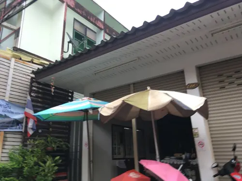

MalaNaZeed BBQ PREMIUM
Restaurant · Thai, Chinese, Barbecue, Soup, Grill · 0.6 km
1152 ถนน แก้ววรวุธ, เมืองหนองคาย
Mo-Su 11:00-23:45
Thanapornnamneung Nongkhai
Restaurant · Vietnamese, Breakfast · 0.7 km
1152/2 Prajak Sillapakhom
Mo-Su 07:30-20:00
Jing Joe
Restaurant · Pizza · 0.7 km
German Bakery, Brot, Brötchen
1128/1 Soi Nitapat, Nong Khai
Mo-Su 09:00-21:00

On The Board Cafe
Cafe · Coffee Shop, Bakery · 1.8 km
654 Thanon Mittraphap
Mo-Fr 09:00-18:00; Sa-Su 09:30-18:00
Vanilla Cafe
Cafe · Deli, Cake, Pancake, Breakfast, Coffee Shop · 0.6 km
1145 ถนนมีชัย
Mo-Su 08:00-19:00
70 more on the map.
History
The Prap Ho Monument before the old city hall (now a museum and cultural center) memorialises the dead of the Haw wars.
Nong Khai has become a popular destination during the Buddhist Lent festival when mysterious balls of light, or Naga fireballs, rise from the Mekong River. The balls resemble an orange sun. They rise out of the river approximately 6–9 meters (20–30 ft) and disappear after three to five seconds. Although the fireballs can be seen at other times, most Thais travel to see them during the full moon in October when the incidence of them is considered to be much higher.
Nong Khai's main sight is Sala Keoku (alternatively spelled as Sala Kaew Ku, also known as Wat Khaek), a park of colossal sculptures, some over 20 m tall. The park is the handiwork of the mystic Luang Pu Bunleua Sulilat, who bought the land in 1978 when he was exiled from his native Laos, where he had built a similar park in Vientiane in the 1950s. Synthesizing Buddhist and Hinduist ideologies, Buddhas, many-armed goddesses, a seven-headed Naga snake, and various human-animal hybrids dominate the site.
Notable figures from twentieth century Buddhist history have lived in Nong Khai – the world renowned Buddhist scholar and leading meditation teacher Ajahn Sumedho was ordained in Wat Sisaket in Nong Khai.
From the History section of Nong Khai on Wikipedia, under CC BY-SA 4.0.
Notable people from Nong Khai
 Tanachai Noorachassociation football playerPhoto: El_Loko für www.thai-fussball.com, CC BY 4.0
- Sen SurintraLaotian monarch (1511-1582)
- Jakkraphan PornsaiThai footballer
- Bunleua SulilatThai artists (1932-1996)
- Umpai MutapornThai footballer
- Tanongsak PrajakkataThai footballer
- Nattawut ChootiwatThai association football player
- Sarun PromkaewThai footballer
- Yutthana PolsakThai footballer
- Kunchit SenyasaenThai association football player
- Anupong PolasakThai beach soccer player
Born in Nong Khai, according to Wikidata (CC0). Each name links to its Wikipedia article.
Where to stay35
Park & Pool Hotel
Motel and hotel · 1.6 km
163/1-3 Moo.3 Soi Dondaeng 3 Sadej Rd T.Meechai A. Muang, Nong Khai
Churches and places of worship14
Shopping13
Gas and EV charging12
Schools, colleges and libraries9
Healthcare16
Map of Nong Khai
197 places. The map loads OpenStreetMap tiles when you open it.
Getting there and nearby towns
Udon Thani International Airport (UTH) is the nearest airport with scheduled flights listed in OpenStreetMap, 55 km away.
- Tha Bo 17 km west, about 17 min by car
- Si Chiang Mai 19 km northwest, about 19 min by car
- Phon Charoen 48 km east, about 48 min by car
- Udon Thani 52 km south, about 52 min by car
- Kut Chap 54 km south, about 54 min by car
- Sangkhom 54 km northwest, about 54 min by car
- Ban Dung 58 km east, about 58 min by car
- Nam Som 60 km west, about 1 h by car
- Nong Bua Lamphu 82 km southwest, about 1 h 15 min by car
- Ban Phan Don 85 km south, about 1 h 30 min by car
Drive times are estimates from straight-line distance, not routes.
Towns near Nong Khai


Keep exploring
Local news
Headlines from INDB.
Reviews, tips and questions
Loading what members have shared...
Sources and licences
- GeoNames (CC BY 4.0): population, coordinates, regions and time zone
- Mapillary (see each image): photos
- OpenStreetMap contributors (ODbL 1.0): places, airports, map data
- Wikidata (CC0 1.0): elevation, founding date, time zone, website, landmarks and historic places
- Wikimedia Commons (see each image): photos
- Wikipedia (CC BY-SA 4.0): overview and history text
Photo credits
- Nong Khai Old City Hall, No machine-readable author provided. Oatz assumed (based on copyright claims)., Public domain
- Square, Nong Khai - panoramio, satori.corvus, CC BY 3.0
- Nai Mueang, Mueang Nong Khai District, Nong Khai, Thailand - panoramio (13), กิตติ เลขะกุล, CC BY 3.0
- Nai Mueang, Mueang Nong Khai District, Nong Khai, Thailand - panoramio (14), กิตติ เลขะกุล, CC BY 3.0
- Nai Mueang, Mueang Nong Khai District, Nong Khai, Thailand - panoramio (1), กิตติ เลขะกุล, CC BY 3.0
- Nong Khai - panoramio, gary4now, CC BY 3.0
- Nong Khai Train Station, Thailand (4243915191), yeowatzup, CC BY 2.0
- Nai Mueang, Mueang Nong Khai District, Nong Khai, Thailand - panoramio (16), ::::=UT=::::, CC BY-SA 3.0
- Nai Mueang, Mueang Nong Khai District, Nong Khai, Thailand - panoramio (18), ::::=UT=::::, CC BY-SA 3.0
- Nai Mueang, Mueang Nong Khai District, Nong Khai, Thailand - panoramio (17), ::::=UT=::::, CC BY-SA 3.0
- Nai Mueang, Mueang Nong Khai District, Nong Khai, Thailand - panoramio (19), ::::=UT=::::, CC BY-SA 3.0
- Wat Hai Sok, Nong Khai, Christophe95, CC BY-SA 4.0
- Mekong in Nong Khai 1, Christophe95, CC BY-SA 4.0
- Mekong in Nong Khai 2, Christophe95, CC BY-SA 4.0
- Nong Khai Saturday Night Market 3, Christophe95, CC BY-SA 4.0
- Nong Khai Saturday Night Market 2, Christophe95, CC BY-SA 4.0
- Nāga in Nong Khai 1, Christophe95, CC BY-SA 4.0
- Nong Khai Saturday Night Market 1, Christophe95, CC BY-SA 4.0
- Nai Mueang, Mueang Nong Khai District, Nong Khai, Thailand - panoramio (3), กิตติ เลขะกุล, CC BY 3.0
- Floating restaurants in Nong Khai - panoramio, Jeremy Holton, CC BY 3.0
- Chinese Gate, Nong Khai - panoramio, satori.corvus, CC BY 3.0
- Nai Mueang, Mueang Nong Khai District, Nong Khai, Thailand - panoramio (5), กิตติ เลขะกุล, CC BY 3.0
- Nai Mueang, Mueang Nong Khai District, Nong Khai, Thailand - panoramio (6), กิตติ เลขะกุล, CC BY 3.0
- Pont de l'amitié 18-12-2010, Siren-Com, CC BY-SA 4.0
- Buddha Park, Dezwitser, CC BY-SA 3.0
- SalaKeoKou 3, Der aus Uebersee kommt, CC BY-SA 3.0
- ไอเอ็มจี 0138, Riwji2001, CC BY-SA 4.0
- Suthida 02, Pitt, CC BY-SA 4.0
- Interior of Wat Hai Sok, Christophe95, CC BY-SA 4.0
- ริมโขง ที่หนองคาย - panoramio, ::::=UT=::::, CC BY-SA 3.0
- Wat Hai Sok - panoramio, satori.corvus, CC BY 3.0
- Wat Hai Sok - panoramio (1), satori.corvus, CC BY 3.0
- ริมโขง - panoramio, ::::=UT=::::, CC BY-SA 3.0
- Wat Si Chomchuen - panoramio, satori.corvus, CC BY 3.0
- Mekong River near Wat Hai Sok - panoramio, satori.corvus, CC BY 3.0
- กาชาดหนองคาย - panoramio, ::::=UT=::::, CC BY-SA 3.0
- Wat Si Chomchuen - panoramio (1), satori.corvus, CC BY 3.0
- Mekong's Embankment - panoramio, satori.corvus, CC BY 3.0
- Wat Sisaket - panoramio, satori.corvus, CC BY 3.0
- Naga:ナーガ - panoramio, studio IRONY, CC BY 3.0
- Nong Thin Public Park, Big Clock Tower, Nong Khai - panoramio, satori.corvus, CC BY 3.0
- Street-level photo, nawiya, CC BY-SA 4.0
- Street-level photo, mishari, CC BY-SA 4.0
- Street-level photo, nawiya, CC BY-SA 4.0
- Street-level photo, mishari, CC BY-SA 4.0


Page built November 10, 2026. Spotted a mistake? Tell us or suggest a place.