


Phasi Charoen, Thailand
เขตภาษีเจริญ
Phasi Charoen is a city of 122,070 people in Bangkok, Thailand.
Why visit Phasi Charoen
Townapedia lists 7 museums and landmarks, 9 parks and trails, 133 places to eat, 6 places to stay and 4 attractions in and around town.
Highlights include Charoenphat Bridge, Charoenrat 31 bridge, Baan Kudichin Museum and The Museum of Siam.
Weather in Phasi Charoen
Forecast from MET Norway (CC BY 4.0). Full forecast
About Phasi Charoen
Phasi Charoen (Thai: ภาษีเจริญ, pronounced [pʰāː.sǐː t͡ɕā.rɤ̄ːn]) is one of the 50 districts (Khet) of Bangkok, Thailand. The district is bounded by other Bangkok districts (from north clockwise): Taling Chan, Bangkok Noi, Bangkok Yai, Thon Buri, Chom Thong, Bang Bon, and Bang Khae.
From the Wikipedia article Phasi Charoen district (this version), under CC BY-SA 4.0.
Photos of Phasi Charoen


Things to do4


Museums and landmarks7


The Museum of Siam
Museum · 7.0 km
Discovery museum in Phra Nakhon District, Bangkok


Parks, trails and playgrounds9



Uncle Sorn's Park
Park · 4.1 km
พื้นที่สีเขียวประเภทสวน ลุงศรณ์ เป็นชาวสวนคนเดียวในบางกอกใหญ่ที่ลงทะเบียนเป็นเกษตรกรในเขตบางกอกใหญ่...

Restaurants and cafes133
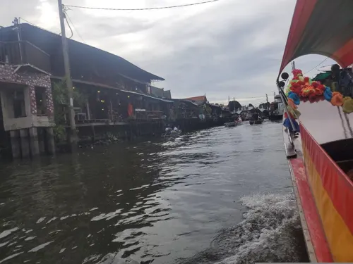
Baan Plern Jitt at Khlong Bang Luang
Restaurant · Thai · 3.4 km
Soi Phet Kasem 20
Mo-Su 11:00-17:00



PaulSugus' Farm Cafe
Restaurant · 3.8 km
Small farm with upscale food and patisserie style cakes
Mo, We-Su 10:30-20:00
Cocoa House
Cafe · Chocolate, Matcha · 1.3 km
188 ซอย 6
Mo-Fr 20:00-00:00; Sa-Su 08:00-00:00
Cococano Cafe & Eatery
Cafe · Coffee Shop · 3.2 km
1/2 หมู่4 ซอยเอกชัย 30
Tu-Fr 08:00-17:00; Sa-Su 09:00-18:00
Why? Co-funning Space (Cafe and Board Games)
Cafe · 1.9 km
25 เพลินพลาซ่า ชั้น 2 ถนนเพชรเกษม, บางหว้า
121 more on the map.
History
The name of the district came from a canal, Khlong Phasi Charoen (คลองภาษีเจริญ), linking Tha Chin River to Khlong Bangkok Yai. The canal project was initiated by Phra Phasi Sombat Boribun (พระภาษีสมบัติบริบูรณ์), who later became Phraya Phison Sombat Boribun (พระยาพิสณฑ์สมบัติบริบูรณ์). Originally Phasi Charoen proposed to fund the project in exchange for the right to collect tolls for passage. It was approved by King Mongkut, however, with the fund given via tax deduction from the amount Phra Phasi Sombat Boriboon had to collect, thus making the canal toll-free. Construction began in 1866 and was completed in 1872 and the canal was named after the man who had overseen the project.
The district was established as Amphoe Phasi Charoen in 1899. It became Khet Phasi Charoen in 1972.
From the History section of Phasi Charoen district on Wikipedia, under CC BY-SA 4.0.
Notable people from Phasi Charoen
 Phumtham WechayachaiActing Prime Minister of Thailand from 14 to 16 August 2024 and from July to September 2025Photo: U.S. Secretary of Defense, Public domain
Born in Phasi Charoen, according to Wikidata (CC0). Each name links to its Wikipedia article.
Where to stay6
Churches and places of worship57
Wat Bang Khun Thian Nok
Place of worship · Thai Mahanikaya · 3.7 km
1 หมู่ 7 Chom Thong 19
Wat Nang Ratchaworawihan
Place of worship · Thai Mahanikaya · 3.2 km
ซอยวุฒากาศ 42
Wat Ratcha-orasaram Ratchaworawihan
Place of worship · Thai Mahanikaya · 3.3 km
เอกชัย, จอมทอง
Wat Apson Sawan Worawihan
Place of worship · Thai Mahanikaya · 3.6 km
Wat Bang Khun Thian Klang
Place of worship · Thai Mahanikaya · 3.8 km
Shopping43
Gas and EV charging14
Schools, colleges and libraries43
Pasanusornbangkae Commercial Technological College
School · 2.1 km
374 ถนนเพชรเกษม
Healthcare19
Map of Phasi Charoen
250 places. The map loads OpenStreetMap tiles when you open it.
Getting there and nearby towns
Don Mueang International Airport (DMK) is the nearest airport with scheduled flights listed in OpenStreetMap, 28 km away.
- Bang Khae 4 km southwest, about 4 min by car
- Thon Buri 5 km east, about 5 min by car
- Bangkok Yai 4 km east, about 4 min by car
- Khwaeng Bang Khae 4 km southwest, about 4 min by car
- Ban Lak Song 5 km southwest, about 5 min by car
- Bang Khun Thian 6 km south, about 6 min by car
- Bangkok 8 km northeast, about 8 min by car
- Taling Chan 7 km north, about 7 min by car
- Samut Prakan 22 km southeast, about 22 min by car
- Si Racha 81 km southeast, about 1 h 15 min by car
Drive times are estimates from straight-line distance, not routes.
Towns near Phasi Charoen


Keep exploring
Local news
Headlines from INDB.
Reviews, tips and questions
Loading what members have shared...
Sources and licences
- GeoNames (CC BY 4.0): population, coordinates, regions and time zone
- Mapillary (see each image): photos
- OpenStreetMap contributors (ODbL 1.0): places, airports, map data
- Wikidata (CC0 1.0): elevation, founding date, time zone, website, landmarks and historic places
- Wikimedia Commons (see each image): photos
- Wikipedia (CC BY-SA 4.0): overview and history text
Photo credits
- View of Khlong Phasi Charoen near Bang Wa BTS Station, This Photo was taken by Supanut Arunoprayote . Feel free to use any of my images, but please mention me as the author and may send me a message. (สามารถใช้ภาพได้อิสระ..., CC BY 4.0
- Pun Tao Kong shrine, Phasi Charoen 06.23, This Photo was taken by Supanut Arunoprayote . Feel free to use any of my images, but please mention me as the author and may send me a message. (สามารถใช้ภาพได้อิสระ..., CC BY 4.0
- Old Village along Khlong Phasi Charoen (I), This Photo was taken by Supanut Arunoprayote . Feel free to use any of my images, but please mention me as the author and may send me a message. (สามารถใช้ภาพได้อิสระ..., CC BY 4.0
- Floating Market, Khlong Phasi Charoen 06.23, Supanut Arunoprayote, CC BY 4.0
- Old Village along Khlong Phasi Charoen (II), This Photo was taken by Supanut Arunoprayote . Feel free to use any of my images, but please mention me as the author and may send me a message. (สามารถใช้ภาพได้อิสระ..., CC BY 4.0
- Charoenpadana bridge, Sry85, CC BY-SA 4.0
- สะพานเจริญรัช 31, BerryJ, CC BY-SA 3.0
- Baan Kudichin Museum (2026) 01, Medelam, CC BY-SA 4.0
- มิวเซียมสยาม พิพิธภัณฑ์การเรียนรู้ 3, Yakuzakorat, CC BY-SA 3.0
- Tampak Depan Gereja Santa Cruz Kudi Chin (2026) 02, Medelam, CC BY-SA 4.0
- Samray Church, Bangkok 1 2, dahlfred, CC BY-SA 3.0
- NV 1035-02-0011, Narongchaiv, CC BY-SA 3.0
- พระอุโบสถ วัดหนังราชวรวิหาร (1), กสิณธร ราชโอรส, CC BY-SA 3.0
- วัดบางขุนเทียนนอก เขตจอมทอง กรุงเทพมหานคร (23), กสิณธร ราชโอรส, CC BY-SA 4.0
- Stupa of Wat Apson Sawan, Supanut Arunoprayote, CC BY 4.0
- วัดโบสถ์อินทรสารเพชร เขตภาษีเจริญ กรุงเทพมหานคร (27), กสิณธร ราชโอรส, CC BY-SA 4.0
- วัดบางขุนเทียนใน เขตจอมทอง กรุงเทพมหานคร (6), กสิณธร ราชโอรส, CC BY-SA 4.0
- วัดบางขุนเทียนกลาง เขตจอมทอง กรุงเทพมหานคร (6), กสิณธร ราชโอรส, CC BY-SA 4.0
- วัดบางประทุนนอก เขตจอมทอง กรุงเทพมหานคร (9), กสิณธร ราชโอรส, CC BY-SA 4.0
- วัดชัยฉิมพลี 03, Dharmadana, CC BY-SA 4.0
- วัดบางแวก 02, Dharmadana, CC BY-SA 4.0
- Bangkok 2014 PD 087, Bin im Garten, CC BY 3.0
- สวนเพชร1, Phoebus 28, CC BY-SA 4.0
- หน้าวัดราชโอรส2, Mastertongapollo, CC BY-SA 4.0
- WatNuannoraditSchoolEmblem, Wat Nuannoradit School, Public domain
- (2023) วัดหนังราชวรวิหาร เขตจอมทอง กรุงเทพมหานคร (23), กสิณธร ราชโอรส, CC BY-SA 4.0
- วิทยาลัยพณิชยการธนบุรี, Dharmadana, CC BY-SA 4.0
- พระวิหารวัดอัปสรสวรรค์วรวิหาร, Mastertongapollo, CC BY-SA 4.0
- วัดบางขุนเทียนนอก เขตจอมทอง กรุงเทพมหานคร (37), กสิณธร ราชโอรส, CC BY-SA 4.0
- (2022) วัดบางขุนเทียนกลาง เขตจอมทอง กรุงเทพมหานคร (6), กสิณธร ราชโอรส, CC BY-SA 4.0
- Seacon Bangkae, This Photo was taken by Supanut Arunoprayote . Feel free to use any of my images, but please mention me as the author and may send me a message. (สามารถใช้ภาพได้อิสระ..., CC BY-SA 4.0
- Seacon Bangkae 06.23, This Photo was taken by Supanut Arunoprayote . Feel free to use any of my images, but please mention me as the author and may send me a message. (สามารถใช้ภาพได้อิสระ..., CC BY 4.0
- Seacon Bangkhae (1), กสิณธร ราชโอรส, CC BY-SA 4.0
- Seacon Bangkhae (2), กสิณธร ราชโอรส, CC BY-SA 4.0
- Seacon Bangkhae (5), กสิณธร ราชโอรส, CC BY-SA 4.0
- Rang Bua Shrine 06.23 (II), This Photo was taken by Supanut Arunoprayote . Feel free to use any of my images, but please mention me as the author and may send me a message. (สามารถใช้ภาพได้อิสระ..., CC BY 4.0
- Rang Bua Shrine 06.23, This Photo was taken by Supanut Arunoprayote . Feel free to use any of my images, but please mention me as the author and may send me a message. (สามารถใช้ภาพได้อิสระ..., CC BY 4.0
- Seacon Bangkhae (3), กสิณธร ราชโอรส, CC BY-SA 4.0
- Seacon Bangkhae (4), กสิณธร ราชโอรส, CC BY-SA 4.0
- Wat Chan Pradittharam 6, Blackpoints, CC BY-SA 4.0
- Street-level photo, ThailandCambodia, CC BY-SA 4.0
- Street-level photo, noonishere, CC BY-SA 4.0
- Street-level photo, ratirat, CC BY-SA 4.0
- Street-level photo, jgauvasu, CC BY-SA 4.0
- Street-level photo, brazilsingh, CC BY-SA 4.0


Page built November 10, 2026. Spotted a mistake? Tell us or suggest a place.