


Phra Khanong, Thailand
เขตพระโขนง
Phra Khanong is a town of 90,354 people in Bangkok, Thailand.
Why visit Phra Khanong
Townapedia lists 29 museums and landmarks, 16 parks and trails, 333 places to eat, 70 places to stay and 5 attractions in and around town.
Highlights include Bang Nam Pheung Floating Market, Green Bridge, Dib International Contemporary Art Museum and Palette Art Space.
Weather in Phra Khanong
Forecast from MET Norway (CC BY 4.0). Full forecast
About Phra Khanong
Phra Khanong (Thai: พระโขนง, pronounced [pʰráʔ kʰā.nǒːŋ]) is one of the 50 districts (Khet) of Bangkok, Thailand. Its neighbours, clockwise from north, are Suan Luang, Prawet, and Bang Na districts of Bangkok, Phra Pradaeng district of Samut Prakan province (across Chao Phraya River), Khlong Toei and Watthana of Bangkok.
From the Wikipedia article Phra Khanong district (this version), under CC BY-SA 4.0.
Photos of Phra Khanong


Things to do5

Bang Nam Pheung Floating Market
Farm and orchard · 3.7 km
Sa-Su 08:00-17:00

Green Bridge
Bridge · 6.5 km
Elevated cycle and footpath in Bangkok, Thailand



Museums and landmarks29

Dib International Contemporary Art Museum
Museum · 2.6 km
111 ซอยบ้านกล้วย
Mo-Su 10:00-19:00; Tu off; We off
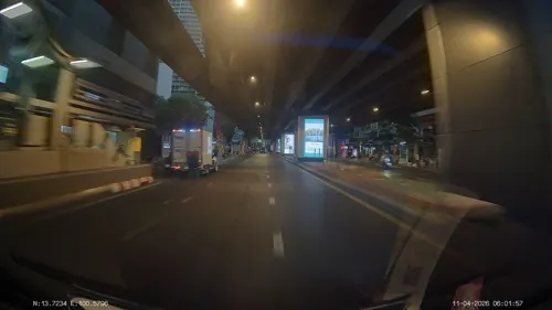
Palette Art Space
Museum · 3.5 km
An art gallery and cafe offering coffee, beer, artwork and paintings.
1057 ถนนสุขุมวิท
Mo-Su 07:30-20:00


Museum of Counterfeit Goods
Museum · 6.2 km
Museum in Bangkok, Thailand

Science Center for Education
Museum · 2.9 km
Science museum in Bangkok, Thailand

Dib Bangkok
Museum · 2.6 km
Contemporary art museum in Bangkok, Thailand

17 more on the map.
Parks, trails and playgrounds16

Benjakitti Park
Park · 5.6 km
Park in the Khlong Toei District of central Bangkok


Si Nakhon Khuean Khan Park and Botanical Garden
Park · 4.0 km
Park and botanical garden in Thailand



4 more on the map.
Restaurants and cafes333
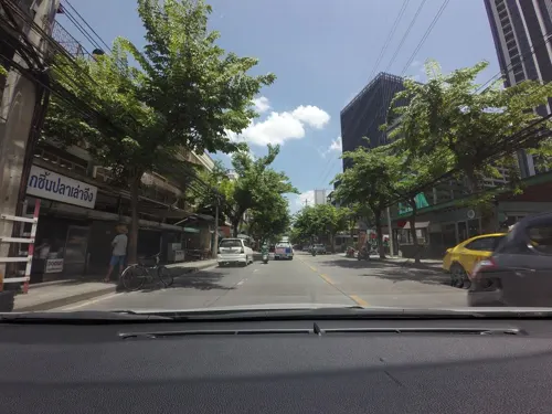
Devilish Chews and Brews
Restaurant · American, Barbecue, Australian, Pie · 2.2 km
American BBQ and Australian Pub Grub. Craft and Draft beers. Desserts and Bakery.
29-29/1 ซอยสุขุมวิท 101/1
Tu-Su 16:00-23:00
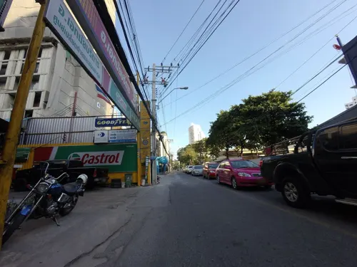

65Cafe'
Cafe · Coffee Shop, Gelato, Ice Cream, Dim Sum · 2.7 km
25 Wachiratham Sathit 23 Sujhumvit 101/1
Mo-Su 07:30-17:30


Mark Wiens spicy Pad Krakow restaurant
Restaurant · Thai · 2.8 km
300 Sukhumvit Rd, Phra Khanong, Khlong Toei, Bangkok 10110, Thailand
Mo-Th 10:00-19:00
Okonomi
Restaurant · Coffee Shop, Japanese · 3.3 km
33/1 ซอยสุขุมวิท 38, แขวงพระโขนง
Mo-Su 08:00-18:00
Phil Coffee
Cafe · Coffee Shop · 3.2 km
21 65/1 Sukhumvit 51 North Klongtan, Wattana Bangkok, 10110
Mo-Fr 08:00-16:30; Sa-Su 09:00-16:30
T-REX BBQ ทีเร็กซ์ย่างมันส์
Restaurant · Barbecue, Shabu, Buffet · 2.2 km
Rama 4 Road, Klong-Toey
Mo-Su 16:30-23:00
VOLARE Italian Restaurant & Pizzeria
Restaurant · Italian · 2.2 km
3789 ถนนพระรามที่ 4
Tu-Su 12:00-23:30; Mo 16:00-23:30
backofhouse coffee
Cafe · Breakfast, Coffee Shop, Sandwich · 3.5 km
414/1 ซอยพัฒนาการ 30
Mo-Fr 07:30-16:00; Sa-Su 08:30-17:00
321 more on the map.
History
Phra Khanong was an amphoe of Nakhon Khuean Khan back in 1902. Nakhon Khuean Khan was renamed to Phra Pradaeng in 1914. In 1927 Phra Khanong was transferred from the then Phra Pradaeng province to Bangkok. It was once very big but it has since been split into several small districts. The districts Khlong Toei, Watthana, Suan Luang, Prawet and Bang Na were all once part of Phra Khanong. Khlong Toei (later split out Watthana) and Prawet (later separate out Suan Luang) districts were carved out of Phra Khanong in 1989. Bang Na was the last district to leave Phra Khanong in 1998.
Even though the administration has been changed, many surrounding areas are still often referred to as Phra Khanong. The Phra Khanong station of Bangkok Skytrain, opened in 1999, is actually outside the Phra Khanong district and located instead in the Phra Khanong Nuea sub-district of Watthana district.
The word Khanong originates from Khmer language and means eyebrow but it was speculated that it may be from Khanon (ขนอน) meaning customhouse. The area has been important gateway from the sea for very long time and the history of Phra Pradaeng dated back to over 1,000 years ago when the area was still ruled by Khmer Empire.
Read more of the history
The shrine dedicated to Mae Nak Phra Khanong at Wat Mahabut was situated in the Phra Khanong district until a 1997 boundary change placed it in neighboring Suan Luang district - much to the consternation of the people of Phra Khanong.
From the History section of Phra Khanong district on Wikipedia, under CC BY-SA 4.0.
More about Phra Khanong
Education
The Anglo Singapore International School has its Campus 64 in the district. Wells International School operates its On Nut Campus, with primary and secondary classes, in Phra Khanong District.
Siam Culinary Academy offering professional culinary training and certification programs in the Phra Khanong District of Bangkok.
Chef Lucas Baking Studio is located in the same district and provides hands-on baking workshops and courses for both hobbyists and aspiring professionals.
From the Wikipedia article Phra Khanong district, under CC BY-SA 4.0.
Where to stay70
Marriott Executive Apartments Bangkok, Sukhumvit Thonglor
Motel and hotel · 3.3 km
2 Soi Sukhumvit 57
Churches and places of worship26
Shopping35
Gas and EV charging14
Schools, colleges and libraries33
Healthcare21
Map of Phra Khanong
250 places. The map loads OpenStreetMap tiles when you open it.
Getting there and nearby towns
Suvarnabhumi Airport (BKK) is the nearest airport with scheduled flights listed in OpenStreetMap, 16 km away.
- Khlong Toei 2 km northwest, about 2 min by car
- Watthana 4 km northwest, about 4 min by car
- Suan Luang 6 km northeast, about 6 min by car
- Yan Nawa 6 km west, about 6 min by car
- Bang Kapi 9 km northeast, about 9 min by car
- Wang Thonglang 9 km north, about 9 min by car
- Din Daeng 10 km north, about 10 min by car
- Rat Burana 11 km west, about 11 min by car
- Samut Prakan 12 km south, about 12 min by car
- Bangkok 12 km northwest, about 12 min by car
Drive times are estimates from straight-line distance, not routes.
Towns near Phra Khanong


Keep exploring
Local news
Headlines from INDB.
Reviews, tips and questions
Loading what members have shared...
Sources and licences
- GeoNames (CC BY 4.0): population, coordinates, regions and time zone
- Mapillary (see each image): photos
- OpenStreetMap contributors (ODbL 1.0): places, airports, map data
- Wikidata (CC0 1.0): elevation, founding date, time zone, website, landmarks and historic places
- Wikimedia Commons (see each image): photos
- Wikipedia (CC BY-SA 4.0): overview and history text
Photo credits
- Phrakhanongwatmahabut, Ananda, Public domain
- Kamthieng, Flickr user: neajjean https://www.flickr.com/people/neajjean/, CC BY-SA 2.0
- Media Museum of Counterfeit Goods, PPun, CC BY-SA 3.0
- Bangkok Benjakiti Park 2, Mr.Peerapong Prasutr, CC BY-SA 4.0
- Benjasiri park, Lerdsuwa, CC BY-SA 3.0
- 2021 สวนชูวิทย์ Chuvit Garden, Chainwit., CC BY-SA 4.0
- Bang Kachao, Phra Pradaeng District, Samut Prakan, Thailand - panoramio (3), mohigan, CC BY-SA 3.0
- Srinakharinwirot University Bangkok Thailand April 2021, Chainwit., CC BY-SA 4.0
- Центр популяризации и развития научных знаний (20250430112057), MikSed, CC BY-SA 4.0
- อุโบสถ วัดปากบ่อ กรุงเทพ, Dharmadana, CC BY-SA 4.0
- Phra Pradaeng District, Samut Prakan, Thailand - panoramio (1), mohigan, CC BY-SA 3.0
- วัดธาตุทอง ปี 2564, Chainwit., CC BY-SA 4.0
- Saint Nicholas Orthodox church in Bangkok (6), Radosław Botev, CC BY 3.0 pl
- Wat Bang Nam Phueng Nok 3, User:HAH, CC BY 2.5
- วัดมหาบุศย์ เขตสวนหลวง กรุงเทพมหานคร (6), กสิณธร ราชโอรส, CC BY-SA 4.0
- วัดบางนานอก เขตบางนา กรุงเทพมหานคร (2), กสิณธร ราชโอรส, CC BY-SA 4.0
- วัดบางนาใน เขตบางนา กรุงเทพมหานคร (13), กสิณธร ราชโอรส, CC BY-SA 4.0
- วัดบางกอบัว 02, Dharmadana, CC BY-SA 4.0
- วัดสะพาน (เขตคลองเตย), Dharmadana, CC BY-SA 4.0
- Bangkok planetarium (cropped), Jirapong CH, CC BY-SA 4.0
- Green Bridge Lumpini-Banjakiti (11), กสิณธร ราชโอรส, CC BY-SA 4.0
- Wtschool, Watchirathamsatit, CC BY-SA 3.0
- Dib Bangkok, Dib Bangkok, CC BY-SA 4.0
- Wat Tai Ahoerstemeier 6, Ahoerstemeier, CC BY 4.0
- مدرسة ويلز الدوليه, Vano111ru, CC BY-SA 4.0
- อพาร์ทเม้นให้เช่า, Hippietrail, CC0
- ISS023-E-35061 - View of Earth, Earth Science and Remote Sensing Unit , Lyndon B. Johnson Space Center, Public domain
- ISS029-E-37097 - View of Earth, Earth Science and Remote Sensing Unit , Lyndon B. Johnson Space Center, Public domain
- ISS018-E-46357 - View of Earth, Earth Science and Remote Sensing Unit , Lyndon B. Johnson Space Center, Public domain
- Abandoned building in Bangkok - panoramio, Gonzo Gooner, CC BY 3.0
- Виски Johnnie Walker (202504292004070, MikSed, CC BY-SA 4.0
- นวด, Hippietrail, CC BY-SA 4.0
- BTS at On Nut (5745369719), My Train Pix, CC BY-SA 2.0
- Onnut - panoramio, mohigan, CC BY-SA 3.0
- Onnut - panoramio (1), mohigan, CC BY-SA 3.0
- น้ำดื่ม ฟรี, Hippietrail, CC0
- ออก, Hippietrail, CC0
- Bubble tea six languages, Hippietrail, CC0
- (THA-Bangkok) BTS 364-464 @ Bang Chak 2024-02-13, S5A-0043, CC BY 2.0
- Bangkok Cat, Mike Dickison, CC0
- Street-level photo, mishari, CC BY-SA 4.0
- Street-level photo, toffy, CC BY-SA 4.0
- Street-level photo, ThailandCambodia, CC BY-SA 4.0
- Street-level photo, mishari, CC BY-SA 4.0
- Street-level photo, pimpitcha, CC BY-SA 4.0
- Street-level photo, toffy, CC BY-SA 4.0
- Street-level photo, mishari, CC BY-SA 4.0
- Street-level photo, mishari, CC BY-SA 4.0
- Street-level photo, kasetitkml_pipitchai, CC BY-SA 4.0
- Street-level photo, mishari, CC BY-SA 4.0
- Street-level photo, mishari, CC BY-SA 4.0
- Street-level photo, ozflor, CC BY-SA 4.0
- Street-level photo, kasetitkml_pipitchai, CC BY-SA 4.0
- Street-level photo, mishari, CC BY-SA 4.0
- Street-level photo, ThailandCambodia, CC BY-SA 4.0
- Street-level photo, mishari, CC BY-SA 4.0
- Street-level photo, pimpitcha, CC BY-SA 4.0


Page built November 10, 2026. Spotted a mistake? Tell us or suggest a place.