


Khlong Toei, Thailand
เขตคลองเตย
Khlong Toei is a city of 109,041 people in Bangkok, Thailand, founded in November 9, 1989.
Why visit Khlong Toei
Townapedia lists 40 museums and landmarks, 31 parks and trails, 247 places to eat, 58 places to stay and 10 attractions in and around town.
Highlights include Bang Nam Pheung Floating Market, Chulalongkorn University Auditorium, Dib International Contemporary Art Museum and Kamthieng House Museum.
Weather in Khlong Toei
Forecast from MET Norway (CC BY 4.0). Full forecast
About Khlong Toei
Khlong Toei (also Klong Toey, Thai: คลองเตย, pronounced [kʰlɔ̄ːŋ tɤ̄ːj]) is a district in central Bangkok, Thailand. It is bordered by the Chao Phraya River and contains major port facilities. Known for its slum, it is also the site of a major market, the Khlong Toei Market.
From the Wikipedia article Khlong Toei district (this version), under CC BY-SA 4.0.
Photos of Khlong Toei


Things to do10

Bang Nam Pheung Floating Market
Farm and orchard · 3.4 km
Sa-Su 08:00-17:00

Chulalongkorn University Auditorium
Cinema and theater · 6.2 km
Chulalongkorn University Auditorium is the main auditorium of Chulalongkorn University in Bangkok, Thailand

Green Bridge
Bridge · 4.3 km
Elevated cycle and footpath in Bangkok, Thailand

Sea Life Bangkok Ocean World
Zoo and aquarium · 6.4 km
Aquarium in Bangkok, Thailand




Museums and landmarks40


Museum of Counterfeit Goods
Museum · 4.8 km
Museum in Bangkok, Thailand

Museum of Imagery Technology
Museum · 6.4 km
Museum in Bangkok, Thailand

Nai Lert Park Heritage Home
Museum · 5.5 km
Historic house museum in Bangkok, Thailand


Palette Art Space
Museum · 1.6 km
An art gallery and cafe offering coffee, beer, artwork and paintings.
1057 ถนนสุขุมวิท
Mo-Su 07:30-20:00
28 more on the map.
Parks, trails and playgrounds31

Benjakitti Park
Park · 3.3 km
Park in the Khlong Toei District of central Bangkok
ถนนรัชดาภิเษก
Mo-Su 04:30-22:00


Khlong Chong Nonsi Public Park
Park · 6.0 km
Park in Bangkok, Thailand


Si Nakhon Khuean Khan Park and Botanical Garden
Park · 2.3 km
Park and botanical garden in Thailand


สวน Park Thonglor Tower
Park · 2.9 km
555 ซอยทองหล่อ 19, คลองตันเหนือ
sunrise-sunset

19 more on the map.
Restaurants and cafes247
Gold Curry
Restaurant · Japanese, Thai · 2.7 km
Famous for Food Challenges, giving out prizes upwards of 40K Baht...
20/3 ซอยสุขุมวิท 39
Mo-Su 11:00-23:30
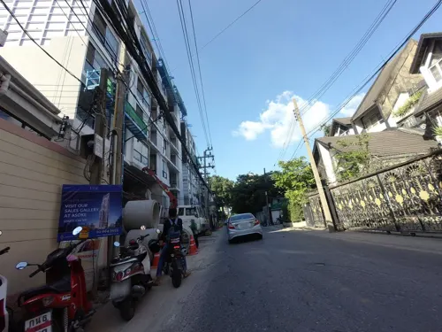
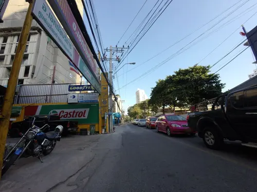

Sun Society
Restaurant · Breakfast, Brunch · 3.6 km
Sun Society is an all-day brunch and breakfast restaurant on Sukhumvit 31 in Bangkok, open from seven in the morning, Wednesday to Monday.
178 ซอยสุขุมวิท 31 แยก 2
We-Mo 07:00-17:00;
Aesops Greek Restaurant & Rooftop
Restaurant · Greek · 3.4 km
FL25, Column Bangkok Hotel 199 Soi Sukhumvit 16 Khlong Toei
Mo-Su 17:00-00:00
Beach Coconuts Bowls Bangkok
Restaurant · Breakfast · 2.4 km
Sukhumvit 53 Unit 101-2 Community Mall 953 Klongton Nua Watthana
Th-Tu 10:00-15:00

235 more on the map.
History
The area has a history dating back to the ninth century as a port to cities upstream along the Chao Phraya River, such as Pak Nam Phra Pradaeng (Thai: เมืองปากน้ำพระประแดง) (as opposed to the current Phra Pradaeng district) built during the King Phutthayotfa Chulalok period.
Khlong Thanon Trong (Thai: คลองถนนตรง) was a khlong (canal) and a parallel road built by King Mongkut around 1857. Later, different sections of the canal became known as Khlong Toei and Khlong Hua Lamphong. Khlong Toei means 'the canal of pandan', as the plant grew along the southern bank of the canal. The road was renamed Rama IV Road by King Vajiravudh in 1919. In 1947, a large portion of Khlong Toei canal was filled to expand the Rama IV Road surface.
The area was once part of the Phra Khanong district, but on 9 November 1989 it was separated to form the new Khlong Toei District. Originally Khlong Toei consisted of six sub-districts, three of which later formed the new Watthana district (announced on 14 October 1997, effective 6 March 1998).
The squatted informal settlement was surveyed in 1971 and is one of the largest slums in Bangkok. In 2006, it was estimated that between 80,000 and 100,000 people live there.
From the History section of Khlong Toei district on Wikipedia, under CC BY-SA 4.0.
More about Khlong Toei
Economy
The head office of Asia Atlantic Airlines is on the 11th floor of the Times Square Building in Khlong Toei District.
The State Railway of Thailand (SRT) is a large landowner in Thailand. Its latest property development scheme is the Chao Phraya Gateway project, a mix of hotels, shopping centers, and condominiums. It capitalizes on SRT's 277 rai, 1.16 kilometer-long stretch of land on the river in the Khlong Toei District. The SRT hopes the project will help clear its 100 billion baht debt. The project is projected to break even within eight years and deliver profits of 140 billion baht. As of April 2019, SRT's plans are being submitted to the Transport Ministry for approval.
From the Wikipedia article Khlong Toei district, under CC BY-SA 4.0.
Where to stay58
Churches and places of worship26
Shopping90
Gas and EV charging20
Schools, colleges and libraries43
Healthcare39
Map of Khlong Toei
250 places. The map loads OpenStreetMap tiles when you open it.
Getting there and nearby towns
Suvarnabhumi Airport (BKK) is the nearest airport with scheduled flights listed in OpenStreetMap, 19 km away.
- Bangkok 10 km northwest, about 10 min by car
- Din Daeng 9 km north, about 9 min by car
- Bang Kapi 9 km northeast, about 9 min by car
- Dusit 10 km northwest, about 10 min by car
- Thon Buri 11 km west, about 11 min by car
- Samut Prakan 13 km south, about 13 min by car
- Bang Sue 12 km northwest, about 12 min by car
- Bueng Kum 13 km northeast, about 13 min by car
- Bangkok Noi 13 km northwest, about 13 min by car
- Taling Chan 15 km northwest, about 15 min by car
Drive times are estimates from straight-line distance, not routes.
Towns near Khlong Toei


Keep exploring
Local news
Headlines from INDB.
Reviews, tips and questions
Loading what members have shared...
Sources and licences
- GeoNames (CC BY 4.0): population, coordinates, regions and time zone
- Mapillary (see each image): photos
- OpenStreetMap contributors (ODbL 1.0): places, airports, map data
- Wikidata (CC0 1.0): elevation, founding date, time zone, website, landmarks and historic places
- Wikimedia Commons (see each image): photos
- Wikipedia (CC BY-SA 4.0): overview and history text
Photo credits
- Sukhumvit panorama A, Bjoertvedt, CC BY-SA 4.0
- Phra Khanong, Khlong Toei, Bangkok, Thailand - panoramio (2), Serj Kras, CC BY-SA 3.0
- Phra Khanong, Khlong Toei, Bangkok, Thailand - panoramio (1), Serj Kras, CC BY-SA 3.0
- Chulalongkorn University Auditorium, Supanut Arunoprayote, CC BY-SA 4.0
- Siam Ocean World, Terence Ong, CC BY 2.5
- Kamthieng, Flickr user: neajjean https://www.flickr.com/people/neajjean/, CC BY-SA 2.0
- M.R. Kukrit’s Heritage Home (6980958709), Johan Fantenberg from Melbourne, Australia, CC BY-SA 2.0
- Media Museum of Counterfeit Goods, PPun, CC BY-SA 3.0
- Imaging Technology Museum, ScorpianPK, CC BY-SA 3.0
- พิพิธภัณฑ์พัฒน์พงศ์, พิพิธภัณฑ์พัฒน์พงศ์, CC BY-SA 4.0
- Bangkok Benjakiti Park 2, Mr.Peerapong Prasutr, CC BY-SA 4.0
- 2021 สวนชูวิทย์ Chuvit Garden, Chainwit., CC BY-SA 4.0
- สวนสาธารณะคลองช่องนนทรี 01, Dharmadana, CC BY-SA 4.0
- Lumphini Park as seen from Dusit Arun (2025) - img 01, Chainwit., CC BY 4.0
- Парк Патхумвананурак (20250319120345), MikSed, CC BY-SA 4.0
- Bangkok Thailand Temple (2026) 01, Medelam, CC BY-SA 4.0
- คริสตจักรไครสต์เชิร์ช เขตบางรัก กรุงเทพมหานคร (6), กสิณธร ราชโอรส, CC BY-SA 4.0
- วัดพระมหาไถ่ April2021 Holy Redeemer Church Bangkok 05, Chainwit., CC BY-SA 4.0
- Mahavajiravut Building 06.23, This Photo was taken by Supanut Arunoprayote . Feel free to use any of my images, but please mention me as the author and may send me a message. (สามารถใช้ภาพได้อิสระ..., CC BY 4.0
- Srinakharinwirot University Bangkok Thailand April 2021, Chainwit., CC BY-SA 4.0
- Benjasiri park, Lerdsuwa, CC BY-SA 3.0
- Bang Kachao, Phra Pradaeng District, Samut Prakan, Thailand - panoramio (3), mohigan, CC BY-SA 3.0
- Emporium bangkok, Lerdsuwa, CC BY-SA 3.0
- Thai Port Stadium, www.thai-fussball.com, CC BY 3.0
- โรงพยาบาลคามิลเลียน1, Dharmadana, CC BY-SA 4.0
- Phra Pradaeng District, Samut Prakan, Thailand - panoramio (1), mohigan, CC BY-SA 3.0
- Emquartier 1-4-2015, Sry85, CC BY-SA 4.0
- Wat Bang Nam Phueng Nok 3, User:HAH, CC BY 2.5
- วัดมหาบุศย์ เขตสวนหลวง กรุงเทพมหานคร (6), กสิณธร ราชโอรส, CC BY-SA 4.0
- Wat Khlong Toei Nok 02, Ruslik0, CC BY-SA 4.0
- วัดบางกอบัว 02, Dharmadana, CC BY-SA 4.0
- วัดคลองเตยใน, Dharmadana, CC BY-SA 4.0
- วัดสะพาน (เขตคลองเตย), Dharmadana, CC BY-SA 4.0
- Wat Tai Ahoerstemeier 6, Ahoerstemeier, CC BY 4.0
- EmQuartier 2018, Wpcpey, CC BY-SA 4.0
- Nai Lert Park Heritage Home (2023 December) - img 01, Chainwit., CC BY 4.0
- Green Bridge Lumpini-Banjakiti (11), กสิณธร ราชโอรส, CC BY-SA 4.0
- Emporium Bangkok 2020, Chainwit., CC BY-SA 4.0
- Bird Watching Tower at Si Nakhon Khuean Khan Park, Thohig, CC0
- Dib Bangkok, Dib Bangkok, CC BY-SA 4.0
- Street-level photo, toffy, CC BY-SA 4.0
- Street-level photo, pimpitcha, CC BY-SA 4.0
- Street-level photo, mishari, CC BY-SA 4.0
- Street-level photo, kasetitkml_pipitchai, CC BY-SA 4.0
- Street-level photo, mishari, CC BY-SA 4.0
- Street-level photo, pimpitcha, CC BY-SA 4.0
- Street-level photo, mishari, CC BY-SA 4.0
- Street-level photo, toffy, CC BY-SA 4.0
- Street-level photo, kasetitkml_pipitchai, CC BY-SA 4.0
- Street-level photo, kasetitkml_pipitchai, CC BY-SA 4.0
- Street-level photo, mishari, CC BY-SA 4.0
- Street-level photo, mishari, CC BY-SA 4.0
- Street-level photo, toffy, CC BY-SA 4.0
- Street-level photo, lin_wang, CC BY-SA 4.0
- Street-level photo, lin_wang, CC BY-SA 4.0
- Street-level photo, toffy, CC BY-SA 4.0
- Street-level photo, mishari, CC BY-SA 4.0


Page built November 10, 2026. Spotted a mistake? Tell us or suggest a place.