


Wang Thonglang, Thailand
เขตวังทองหลาง
Wang Thonglang is a city of 114,768 people in Bangkok, Thailand, founded in November 21, 1997.
Why visit Wang Thonglang
Townapedia lists 14 museums and landmarks, 17 parks and trails, 194 places to eat, 55 places to stay and 4 attractions in and around town.
Highlights include Dan Neramit, Happyland, Museum of Buddhist Art and Prasart Museum.
Weather in Wang Thonglang
Forecast from MET Norway (CC BY 4.0). Full forecast
About Wang Thonglang
Wang Thonglang (Thai: วังทองหลาง, pronounced [wāŋ tʰɔ̄ːŋ.lǎːŋ]) is one of the 50 districts (khet) of Bangkok, Thailand. It is bounded by other Bangkok districts (from north clockwise): Lat Phrao, Bang Kapi, Huai Khwang, and Chatuchak.
From the Wikipedia article Wang Thonglang district (this version), under CC BY-SA 4.0.
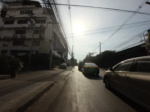
Photos of Wang Thonglang


Things to do4

Dan Neramit
Monument and historic site · 6.4 km
Amusement park in Thailand

Happyland
Monument and historic site · 3.2 km
Former amusement park in Bangkok, Thailand


Museums and landmarks14
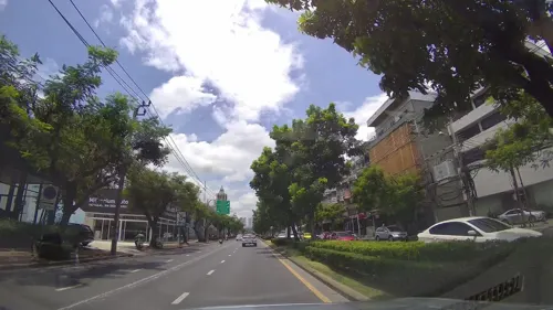



Children's Discovery Museum
Museum · 6.8 km
Museum in Bangkok, Thailand
Baan Kusuma
Monument and historic site · 2.5 km
31/11 ถนนนาคนิวาส
Mo, We, Fr 17:00-20:00
ณ สยาม แกลเลอรี่
Museum · 1.8 km
2452-2456 ซอยลาดพร้าว 122-124 ถนนลาดพร้าว, แขวงพลับพลา
2 more on the map.
Parks, trails and playgrounds17

Chatuchak Park
Park · 6.6 km
Public park just north of Chatuchak Weekend Market



Chak Phupha Su Maha Nathee Park
Park · 6.8 km
Park in Bangkok, Thailand

Indoor Stadium Huamark
Sports field and stadium · 3.4 km
286 ถนนรามคำแหง
5 more on the map.
Restaurants and cafes194

TA Kachin Restaurant
Restaurant · Kachin, Burmese, Myanmar · 4.0 km
4105 ซอยรามคำแหง 24 แยก 28
Mo-Sa 08:00-20:00
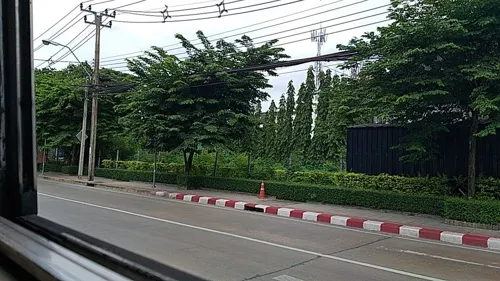
amphawa นาคนิวาส
Restaurant · Thai, Regional · 1.2 km
ร้านอาหารไทย วิถีพื้นบ้าน
45, 48 ซอยนาคนิวาส 1, แขวงลาดพร้าว
Mo-Su 10:00-22:00
Lively Machine Ratchadapisek 24
Cafe · Coffee Shop, International · 4.2 km
44-45 Ratchadapisek
Mo-Su 07:00-17:00
Mama Bingsu , Bangkok 10310, Thaïlande
Cafe · Bingsu, Coffee Shop, Ice Cream · 2.4 km
999/166 Condo Than Living Ratchada-Prachauthit Ramkhamhaeng Soi, 39, Prachauthit Road, whangthonglang, Wang Thonglang
10:00-22:30
Pho Van Vietnamese Restaurant
Restaurant · Vietnamese · 3.7 km
8 124/8 รามคำแหง 24 (หลังราม)
Mo-Su 10:00-22:00

Kyuka Izakaya
Restaurant · Japanese · 2.8 km
KYUKA Izakaya (きゅうか ) is not a regular Japanese restaurant, but space for people to gather up and share delicious eats and happiness.
Lat Phrao District
18:00-01:00

BEANHOUND by Greyhound Cafe - แม็คโคร ประดิษฐ์มนูธรรม
Cafe · Coffee Shop · 2.7 km
BEANHOUND by Greyhound Cafe - แม็คโคร ประดิษฐ์มนูธรรม เลขที่ 173 ถนนประดิษฐ์มนูธรรม, กรุงเทพมหานคร
Mo-Su 07:00-21:00
Gatta Café
Cafe · Coffee Shop · 2.0 km
69/3, FL.1 ถนนประดิษฐ์มนูธรรม
Mo-Fr 10:30-21:30; Sa-Su 10:00-21:30
ตัวมัมชาบูหม่าล่าสายพาน & บุฟเฟต์หมูกะทะ
Restaurant · Asian, ขาบูหม่าล่า, หมูกะทะ · 4.2 km
1521 ซอยนวมินทร์ 14, แขวงคลองจั่น
10.00- 00.00
182 more on the map.
History
The district was established on 21 November 1997 (announced 14 October 1997) occupying Wang Thonglang and part of Khlong Chan sub-district of Bang Kapi and part of Lat Phrao sub-district of Lat Phrao district. The total area was 19.205 km2. In 2002 (announced 24 January, effective 11 March) the district boundary between Wang Thonglang and Lat Phrao districts was adjusted. Now Wang Thonglang has 18.905 km2 of area.
The name Wang Thonglang means 'the deep body of water around which Erythrina fusca grows'.
From the History section of Wang Thonglang district on Wikipedia, under CC BY-SA 4.0.
Where to stay55
Churches and places of worship18
Wat Phra Ram 9 Kanchanaphisek
Place of worship · Thai Thammayut · 3.4 km
อาจารย์พุทธประตูน้ำ ซอยมหาดไทย
Place of worship · 2.2 km
187 95 ซอยลาดพร้าว 122 แยก 13
Shopping49
Growpets โกรว์เพ็ทช็อป สาขาลาดพร้าววังหิน
Grocery · 2.9 km
99/188 ซอยลาดพร้าววัังหิน 13
Gas and EV charging23
Schools, colleges and libraries53
Healthcare22
La Purita CLINIC (ลา พูริต้า คลินิก) สาขารัชดาภิเษก
Clinic and pharmacy · 3.1 km
444 olympia thai plaza, แขวงสามเสนนอก
Map of Wang Thonglang
250 places. The map loads OpenStreetMap tiles when you open it.
Getting there and nearby towns
Don Mueang International Airport (DMK) is the nearest airport with scheduled flights listed in OpenStreetMap, 14 km away.
- Lat Phrao 2 km north, about 2 min by car
- Bang Kapi 4 km southeast, about 4 min by car
- Din Daeng 5 km west, about 5 min by car
- Bueng Kum 6 km east, about 6 min by car
- Chatuchak 7 km northwest, about 7 min by car
- Suan Luang 7 km southeast, about 7 min by car
- Khlong Toei 9 km south, about 9 min by car
- Bang Sue 9 km west, about 9 min by car
- Dusit 10 km west, about 10 min by car
- Bangkok 12 km west, about 12 min by car
Drive times are estimates from straight-line distance, not routes.
Towns near Wang Thonglang


Keep exploring
Local news
Headlines from INDB.
Reviews, tips and questions
Loading what members have shared...
Sources and licences
- GeoNames (CC BY 4.0): population, coordinates, regions and time zone
- Mapillary (see each image): photos
- OpenStreetMap contributors (ODbL 1.0): places, airports, map data
- Wikidata (CC0 1.0): elevation, founding date, time zone, website, landmarks and historic places
- Wikimedia Commons (see each image): photos
- Wikipedia (CC BY-SA 4.0): overview and history text
Photo credits
- BTSサムロン駅予定地, 暇・カキコ, CC BY-SA 4.0
- Prasart Museum palms, Flickr user: scott.zona Miami https://www.flickr.com/people/scottzona/, CC BY 2.0
- Exterior of Thai Bank Museum (2026) 01, Medelam, CC BY-SA 4.0
- Postal scale, Lerdsuwa, CC BY-SA 3.0
- Chatuchak park, Lerdsuwa, CC BY-SA 3.0
- สวนวชิรเบญจทัศ (สวนรถไฟ) IMG 7315, PEAK99, CC BY-SA 4.0
- Bangkok Thailand Temple (2026) 01, Medelam, CC BY-SA 4.0
- Srinakharinwirot University Bangkok Thailand April 2021, Chainwit., CC BY-SA 4.0
- Rajamangala Stadium in Bangkok, AsianFC, CC BY 2.0
- Kachin women in traditional dress, Yoav David, CC BY-SA 3.0
- NMR 1536, Noobythailand, CC BY-SA 4.0
- Regents-Bangkok, Aliciaregents, CC BY-SA 4.0
- วัดพระราม 9 กาญจนาภิเษก King Rama IX Golden Jubilee Temple (41), กสิณธร ราชโอรส, CC BY-SA 4.0
- Luangpoopuk, Raphind, CC BY-SA 3.0
- เมรุวัดลาดพร้าว2562, Mythorn, CC BY-SA 4.0
- วัดเทพลีลา เขตบางกะปิ กรุงเทพมหานคร (2), กสิณธร ราชโอรส, CC BY-SA 4.0
- วัดพระไกรสีห์ (3), Dharmadana, CC BY 4.0
- Dan Neramit castle in 2005, ong from Seattle, USA, CC BY 2.0
- สะพานเสรีไทย3, Phoebus 28, CC BY-SA 4.0
- พระนวกะ ๑๗๔ รูป ณ วัดพระราม ๙ กาญจนาภิเษก ในโครงการ “อ - Flickr - Abhisit Vejjajiva, Government of Thailand, CC BY 2.0
- วัดบึงทองหลาง, Dektonk, CC BY-SA 4.0
- DAEWOO BH115 73 (2-46) 8-67042, Khxwklong, CC BY-SA 4.0
- Bodin3– 18072024, Noobythailand, CC0
- View Bangkok from ban Manos - panoramio - CHAMRAT CHAROENKHET (1), CHAMRAT CHAROENKHET, CC BY 3.0
- View Bangkok from ban Manos - panoramio - CHAMRAT CHAROENKHET (6), CHAMRAT CHAROENKHET, CC BY 3.0
- View Bangkok from ban Manos - panoramio - CHAMRAT CHAROENKHET (2), CHAMRAT CHAROENKHET, CC BY 3.0
- View Bangkok from ban Manos - panoramio - CHAMRAT CHAROENKHET (4), CHAMRAT CHAROENKHET, CC BY 3.0
- View Bangkok from ban Manos - panoramio - CHAMRAT CHAROENKHET, CHAMRAT CHAROENKHET, CC BY 3.0
- View Bangkok from ban Manos - panoramio - CHAMRAT CHAROENKHET (3), CHAMRAT CHAROENKHET, CC BY 3.0
- View Bangkok from ban Manos - panoramio, CHAMRAT CHAROENKHET, CC BY 3.0
- View Bangkok from ban Manos - panoramio - CHAMRAT CHAROENKHET (7), CHAMRAT CHAROENKHET, CC BY 3.0
- View Bangkok from ban Manos - panoramio - CHAMRAT CHAROENKHET (5), CHAMRAT CHAROENKHET, CC BY 3.0
- Tampak Depan Gereja Maria Rosa Mystica Bangkok (2026) 05, Medelam, CC BY-SA 4.0
- Patung BMV Rosa Mystica di Gereja Maria Rosa Mystica Bangkok (2026), Medelam, CC BY-SA 4.0
- Tampak Depan Gereja Maria Rosa Mystica Bangkok (2026) 01, Medelam, CC BY-SA 4.0
- Tampak Depan Gereja Maria Rosa Mystica Bangkok (2026) 03, Medelam, CC BY-SA 4.0
- Tampak Depan Gereja Maria Rosa Mystica Bangkok (2026) 04, Medelam, CC BY-SA 4.0
- Tampak Depan Gereja Maria Rosa Mystica Bangkok (2026) 02, Medelam, CC BY-SA 4.0
- Central Eastville, Bangkok - Lat Phrao (2025) - img 01, Chainwit., CC BY 4.0
- Central Eastville, Bangkok - Lat Phrao (2025) - img 02, Chainwit., CC BY 4.0
- Tower of David di Kampus Universitas Assumption Hua Mak (2026), Medelam, CC BY-SA 4.0
- Street-level photo, ozflor, CC BY-SA 4.0
- Street-level photo, kasetitkml_pipitchai, CC BY-SA 4.0
- Street-level photo, mishari, CC BY-SA 4.0
- Street-level photo, ThailandCambodia, CC BY-SA 4.0
- Street-level photo, kasetitkml_pipitchai, CC BY-SA 4.0
- Street-level photo, lvl5, CC BY-SA 4.0
- Street-level photo, kasetitkml_pipitchai, CC BY-SA 4.0
- Street-level photo, toffy, CC BY-SA 4.0
- Street-level photo, mishari, CC BY-SA 4.0
- Street-level photo, mishari, CC BY-SA 4.0
- Street-level photo, toffy, CC BY-SA 4.0
- Street-level photo, ThailandCambodia, CC BY-SA 4.0
- Street-level photo, toffy, CC BY-SA 4.0
- Street-level photo, toffy, CC BY-SA 4.0


Page built November 10, 2026. Spotted a mistake? Tell us or suggest a place.