


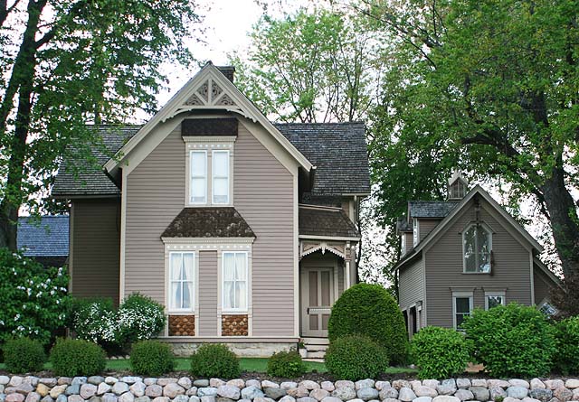


Thiensville, Wisconsin
Thiensville is a village of 3,299 people in Ozaukee County, Wisconsin.
Why visit Thiensville
Townapedia lists 13 museums and landmarks, 14 parks and trails, 13 places to eat and 1 attraction in and around town.
Highlights include Concordia University Wisconsin, Isham Day House, Bigelow School and Ozaukee Country Club.
July is the warmest month, with average highs of 81°F; January lows average 17°F.
Weather in Thiensville
Forecast from the National Weather Service. Full forecast
About Thiensville
Thiensville is a village in Ozaukee County, Wisconsin, United States. Located on the west bank of a bend in the Milwaukee River, the community is bordered on all sides by the City of Mequon and is a suburb in the Milwaukee metropolitan area. The population was 3,290 at the 2020 census.
From the Wikipedia article Thiensville, Wisconsin (this version), under CC BY-SA 4.0.
Things to do1

Concordia University Wisconsin
School · 3.3 mi
Lutheran university near Milwaukee, Wisconsin
Museums and landmarks13

Isham Day House
Monument and historic site · National Register of Historic Places · 0.9 mi
Historic house in Wisconsin, United States
Bigelow School
Monument and historic site · National Register of Historic Places · 2.2 mi
Former school in Mequon, Wisconsin
Edwin J. Nieman Sr. House
Monument and historic site · National Register of Historic Places · 1.5 mi
Historic house in Wisconsin, United States
Green Bay Road Historic District
Monument and historic site · National Register of Historic Places · 0.4 mi
Listed on the National Register of Historic Places in Ozaukee County, Wisconsin
Hamilton Historic District
Monument and historic site · National Register of Historic Places · 3.3 mi
Listed on the NRHP in Ozaukee County, Wisconsin
Jacob Voigt House
Monument and historic site · National Register of Historic Places · 1.4 mi
Historic house in Wisconsin, United States
John Reichert Farmhouse
Monument and historic site · National Register of Historic Places · 3.0 mi
Historic house in Wisconsin, United States
Jonathan Clark House
Monument and historic site · National Register of Historic Places · 2.2 mi
Historic house in Wisconsin, United States
Main Street Historic District
Monument and historic site · National Register of Historic Places · 0.6 mi
Historic district in Thiensville, Wisconsin, United States

Mequon Town Hall and Fire Station Complex
Monument and historic site · National Register of Historic Places · 0.9 mi
City hall in Mequon, Wisconsin, United States

O'Brien–Peuschel Farmstead
Monument and historic site · National Register of Historic Places · 1.5 mi
Farmhouse in Ozaukee County, United States of America
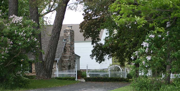


William F. Jahn Farmstead
Monument and historic site · National Register of Historic Places · 1.3 mi
Building in Mequon, United States of America
1 more on the map.
Parks, trails and playgrounds14




2 more on the map.
Restaurants and cafes13

Chuck's Place
Restaurant · Burger, Italian, Pizza, Sandwich, Soup · 0.4 mi
406 North Main Street, Thiensville
We-Mo 06:30-14:00; Tu off
Daily Taco and Cantina
Restaurant · Mexican · 0.4 mi
105 West Freistadt Road, Thiensville
Tu-Th 11:30-20:00; Fr-Sa 11:30-21:00; Su-Mo off

Prime Minister Restaurant and Catering
Restaurant · 0.6 mi
517 North Main Street, Thiensville
07:00-20:00


Fiddleheads Coffee Roasters - Thiensville
Cafe · Coffee Shop · 0.6 mi
192 South Main Street
1 more on the map.
History
In the early 19th century, the Potawatomi lived on the west bank of the Milwaukee River and had a village in present-day Thiensville, located on Pigeon Creek, north of Freistadt Road. They surrendered their land to the United States federal government through the 1833 Treaty of Chicago, which was ratified in 1835 and required them to leave the area by 1838.
The first permanent white settlers arrived in the mid-1830s from New York, England, and Ireland. One of the first settlers was John Weston, who settled near present-day Thiensville in 1837 and served as the first postmaster of the Town of Mequon. The first Germans arrived in 1839, and in the 1840s Germans became the largest ethnic group in Thiensville, the Town of Mequon, and Ozaukee County.
Joachim Heinrich Thien moved to the area in 1842 from Oldenburg, Prussia, and helped design a plan for the settlement that would become Thiensville. A year later he employed a group of Native American laborers to construct a dam and a canal on the Milwaukee River. He then built a sawmill and a store. Thien hosted the first town meeting for the Town of Mequon in 1846, and in 1857 he established the volunteer fire department and served as its first captain.
From the History section of Thiensville, Wisconsin on Wikipedia, under CC BY-SA 4.0.
Churches and places of worship5
Shopping3
Schools, colleges and libraries28
Healthcare1
Map of Thiensville
78 places. The map loads OpenStreetMap tiles when you open it.
Climate by month
Monthly table
| Month | High | Low | Rain |
|---|---|---|---|
| Jan | 30°F | 17°F | 1.6 in |
| Feb | 33°F | 18°F | 1.7 in |
| Mar | 43°F | 26°F | 2.1 in |
| Apr | 54°F | 36°F | 3.9 in |
| May | 66°F | 46°F | 4.0 in |
| Jun | 76°F | 56°F | 4.5 in |
| Jul | 81°F | 62°F | 3.6 in |
| Aug | 80°F | 61°F | 3.8 in |
| Sep | 72°F | 54°F | 3.2 in |
| Oct | 60°F | 43°F | 3.0 in |
| Nov | 46°F | 31°F | 2.1 in |
| Dec | 35°F | 21°F | 2.0 in |
U.S. Climate Normals 1991-2020 for Grafton Wwtp (5 mi away), NOAA NCEI.
People and cost of living
American Community Survey 5-year estimates, 2020-2024, U.S. Census Bureau. Estimates have margins of error, larger for small towns.
Disaster history
Ozaukee County has had 7 federal disaster declarations since 2000, most often for biologicals.
- 2020-04-04: Covid-19 Pandemic (Biological)
- 2020-03-13: Covid-19 (Biological)
- 2018-10-18: Severe Storms, Tornadoes, Straight-Line Winds, Flooding, And Landslides (Flood)
- 2008-06-14: Severe Storms, Tornadoes, And Flooding (Severe Storm)
- 2005-09-13: Hurricane Katrina Evacuation (Hurricane)
- 2004-06-18: Severe Storms And Flooding (Severe Storm)
OpenFEMA disaster declarations summaries.
Getting there and nearby towns
Lawrence J. Timmerman Airport (MWC) is the nearest airport with scheduled flights listed in OpenStreetMap, 9 miles away.
- Mequon 3 mi southwest, about 4 min by car
- Brown Deer 4 mi south, about 7 min by car
- Cedarburg 4 mi north, about 7 min by car
- River Hills 5 mi southeast, about 8 min by car
- Bayside 5 mi southeast, about 8 min by car
- Grafton 6 mi north, about 10 min by car
- Fox Point 7 mi southeast, about 11 min by car
- Germantown 7 mi west, about 12 min by car
- Glendale 8 mi south, about 13 min by car
- Menomonee Falls 9 mi southwest, about 14 min by car
Drive times are estimates from straight-line distance, not routes.
Local news
Headlines from INDB, the NEMICO news database.
Reviews, tips and questions
Loading what members have shared...
Sources and licences
- NCES EDGE (Public domain): public schools
- NOAA NCEI U.S. Climate Normals 1991-2020 (Public domain): climate by month
- OpenFEMA (Public domain): disaster declarations
- OpenStreetMap contributors (ODbL 1.0): places, airports, map data
- U.S. Census Bureau (Public domain): population, income, housing, education, commute
- Wikidata (CC0 1.0): elevation, founding date, time zone, website, landmarks and historic places
- Wikimedia Commons (see each image): photos
- Wikipedia (CC BY-SA 4.0): overview and history text
Photo credits
- Thiensville Main St May09, Freekee /Kevin Hansen, CC BY-SA 3.0
- Hamilton Historic District May09, Freekee, Public domain
- Green Bay Rd Thiensville WI May-09, Freekee /Kevin Hansen, Public domain
- John Reichert Farmhouse May09, Freekee, Public domain
- Jonathan Clark House Mequon WI May-09, Freekee, Public domain
- Bigelow School Mequon Dec09, Freekee, Public domain
- Jahn Farmstead Mequon WI May-09, Freekee, Public domain
- O'Brien-Peuschel Farmstead Mequon WI May-09, Freekee, Public domain
- Mequon Town Hall Dec09, Freekee, Public domain
- CUW Pharmacy School, Thewind1956, CC BY-SA 3.0
- Goniochloris mutica 263473363, Michael Brondino, CC BY-SA 4.0
- Tetradesmus dimorphus 199891683, Michael Brondino, CC BY-SA 4.0
- Sphenomonas teres, Michael Brondino, CC BY-SA 4.0
- Homestead Pregame vs Whitefish Bay - panoramio, Danny Berger, CC BY 3.0
- Gtown @ Homestead 2007 - panoramio, Danny Berger, CC BY 3.0
- Skyline 1 - panoramio, Danny Berger, CC BY 3.0
- Skyline 2 - panoramio, Danny Berger, CC BY 3.0
- Edwin J. Nieman Sr. House, Jim Roberts, CC BY-SA 4.0


Page built October 30, 2026. Spotted a mistake? Tell us or suggest a place.