


Bozcaada, Turkey
Bozcaada (ilçe merkezi)
Bozcaada is a town of 2,635 people in Canakkale, Turkey.
Why visit Bozcaada
Townapedia lists 10 museums and landmarks, 4 parks and trails, 69 places to eat, 95 places to stay and 3 attractions in and around town.
Highlights include Göztepe and Bozcaada Yerel Tarih Araştırma Müzesi.
Weather in Bozcaada
Forecast from MET Norway (CC BY 4.0). Full forecast
About Bozcaada
Tenedos (Greek: Τένεδος; pronounced [ˈteneðos]; Latin: Tenedus), or Bozcaada in Turkish, is an island of Turkey in the northeastern part of the Aegean Sea. Administratively, the island constitutes the Bozcaada district of Çanakkale Province. With an area of 39.9 km2 (15 sq mi), it is the third-largest Turkish island after Imbros (Gökçeada) and Marmara. In 2022, the district had a population of 3,120 inhabitants.
From the Wikipedia article Tenedos (this version), under CC BY-SA 4.0.
Travel tips from other travellers: Bozcaada on Wikivoyage (CC BY-SA 4.0).
Things to do3


Museums and landmarks10
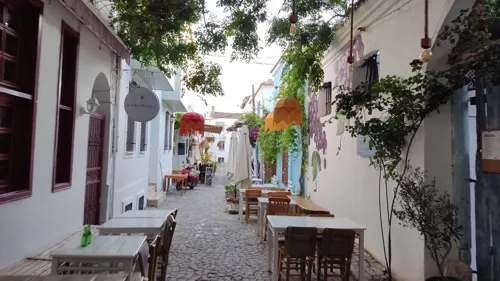



Parks, trails and playgrounds4


Restaurants and cafes69
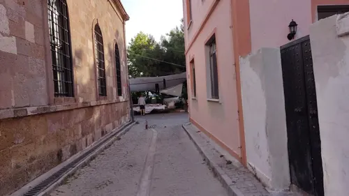

Bozca9 Restoran
Restaurant · Regional, Turkish, Mediterranean, Diner, Fish, Steak House, Salad, Fine Dining
17 İstiklal Sokak, Çanakkale
12:00-01:00





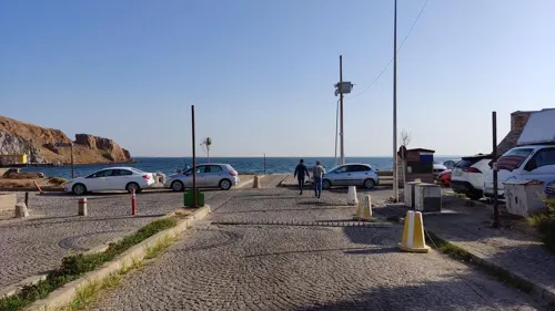


57 more on the map.
Where to stay95
Churches and places of worship5
Shopping15
Gas and EV charging1
Schools, colleges and libraries6
Healthcare2
Map of Bozcaada
210 places. The map loads OpenStreetMap tiles when you open it.
Getting there and nearby towns
Gökçeada Havalimanı (GKD) is the nearest airport with scheduled flights listed in OpenStreetMap, 44 km away.
- Geyikli 12 km east, about 12 min by car
- Kalafat 19 km northeast, about 19 min by car
- Ezine 24 km east, about 24 min by car
- Çanakkale 46 km northeast, about 46 min by car
- Altınoluk 64 km southeast, about 1 h by car
- Lapseki 77 km northeast, about 1 h 15 min by car
- Gelibolu 82 km northeast, about 1 h 15 min by car
- Gömeç 83 km southeast, about 1 h 30 min by car
- Edremit 86 km east, about 1 h 30 min by car
- Burhaniye 86 km southeast, about 1 h 30 min by car
Drive times are estimates from straight-line distance, not routes.
Local news
Headlines from INDB.
Reviews, tips and questions
Loading what members have shared...
Sources and licences
- GeoNames (CC BY 4.0): population, coordinates, regions and time zone
- Mapillary (see each image): photos
- OpenStreetMap contributors (ODbL 1.0): places, airports, map data
- Wikidata (CC0 1.0): elevation, founding date, time zone, website
- Wikimedia Commons (see each image): photos
- Wikipedia (CC BY-SA 4.0): overview and history text
Photo credits
- Bozcaada 021, Nevit Dilmen ( talk ), CC BY-SA 3.0
- Bozcaada (31072023) - 53083805462, Kadı Kadı, CC BY 2.0
- BOZCAADA ALAYBEYİ CAMİ - panoramio, Hüseyin Öcal, CC BY 3.0
- Bozcaada - panoramio (21), HALUK COMERTEL, CC BY 3.0
- Bozcaada - panoramio (21) (cropped), HALUK COMERTEL, CC BY 3.0
- Bozcaada (31072023) - 53084867913, Kadı Kadı, CC BY 2.0
- Bozcaada - panoramio (20), HALUK COMERTEL, CC BY 3.0
- Bozcaada - panoramio (7), HALUK COMERTEL, CC BY 3.0
- Bozcaada - panoramio (19), HALUK COMERTEL, CC BY 3.0
- Bozcaada, 17680 Tenedos-Çanakkale, Turkey - panoramio - hakan kozan (1), hakan kozan, CC BY 3.0
- Bozcaada (31072023) - 53084867933, Kadı Kadı, CC BY 2.0
- Bozcaada (31072023), Kadı Kadı, CC BY 2.0
- Cat in Bozcaada, Kadı Kadı, CC BY 2.0
- Bozcaada, 17680 Tenedos-Çanakkale, Turkey - panoramio - hakan kozan (2), hakan kozan, CC BY 3.0
- Bozcaada Building, Glassmug29, CC BY-SA 4.0
- Bozcaada (31072023) - 53084867958, Kadı Kadı, CC BY 2.0
- Bozcaada Castle (31072023), Kadı Kadı, CC BY 2.0
- Cat in Bozcaada - 53096733169, Kadı Kadı, CC BY 2.0
- Bozcaada, 17680 Tenedos-Çanakkale, Turkey - panoramio, hakan kozan, CC BY 3.0
- Bozcaada, 17680 Tenedos-Çanakkale, Turkey - panoramio - hakan kozan, hakan kozan, CC BY 3.0
- Bozcaada - Balık lokantaları - panoramio, HALUK COMERTEL, CC BY 3.0
- BOZCAADA - panoramio, HALUK COMERTEL, CC BY 3.0
- BOZCAADA - panoramio - Hüseyin Öcal, Hüseyin Öcal, CC BY 3.0
- Bozcaada - panoramio (23), HALUK COMERTEL, CC BY 3.0
- Ferry leaving Bozcaada at dawn, Raicem, CC BY 4.0
- Bozcaada - panoramio (22), HALUK COMERTEL, CC BY 3.0
- Bozcaada Castle 2 (31072023), Kadı Kadı, CC BY 2.0
- Ferry leaving Bozcaada at dawn - 2, Raicem, CC BY 4.0
- Çanakkale Bozcaada Kalesi, Özge Hawking, CC BY-SA 4.0
- Bozcaada - panoramio (24), HALUK COMERTEL, CC BY 3.0
- Bozcaada - panoramio (18), HALUK COMERTEL, CC BY 3.0
- Bozcaada - panoramio (11), HALUK COMERTEL, CC BY 3.0
- Bozcaada - panoramio (8), HALUK COMERTEL, CC BY 3.0
- BOZCAADA 2008 - panoramio - nurettingülay(from T… (1), nurettingülay(from T…, CC BY-SA 3.0
- Bozcaada - panoramio (9), HALUK COMERTEL, CC BY 3.0
- Bozcaada - panoramio (10), HALUK COMERTEL, CC BY 3.0
- Bozcaada - panoramio (13), HALUK COMERTEL, CC BY 3.0
- Turkish pottery, Glassmug29, CC BY-SA 4.0
- Turkish Breakfast Spread, Glassmug29, CC BY-SA 4.0
- BOZCAADA KALESİ 2008 - panoramio, nurettingülay(from T…, CC BY-SA 3.0
- Street-level photo, orkut, CC BY-SA 4.0
- Street-level photo, orkut, CC BY-SA 4.0
- Street-level photo, orkut, CC BY-SA 4.0
- Street-level photo, orkut, CC BY-SA 4.0
- Street-level photo, orkut, CC BY-SA 4.0
- Street-level photo, orkut, CC BY-SA 4.0
- Street-level photo, orkut, CC BY-SA 4.0
- Street-level photo, orkut, CC BY-SA 4.0
- Street-level photo, orkut, CC BY-SA 4.0
- Street-level photo, orkut, CC BY-SA 4.0
- Street-level photo, orkut, CC BY-SA 4.0
- Street-level photo, orkut, CC BY-SA 4.0
- Street-level photo, orkut, CC BY-SA 4.0
- Street-level photo, orkut, CC BY-SA 4.0
- Street-level photo, orkut, CC BY-SA 4.0
- Street-level photo, orkut, CC BY-SA 4.0
- Street-level photo, orkut, CC BY-SA 4.0
- Street-level photo, orkut, CC BY-SA 4.0


.jpg)


Page built November 8, 2026. Spotted a mistake? Tell us or suggest a place.