


Kırklareli, Turkey
Kırklareli is a regional capital of 58,223 people in Kırklareli, Turkey.
Why visit Kırklareli
Townapedia lists 65 museums and landmarks, 23 parks and trails, 84 places to eat, 12 places to stay and 1 attraction in and around town.
Highlights include T.C. Kırklareli Valiliği Binasi, Kırklareli Museum, Atatürk Stadyumu and Şevket Dingiloğlu Parkı.
Weather in Kırklareli
Forecast from MET Norway (CC BY 4.0). Full forecast
About Kırklareli
Kırklareli (Turkish pronunciation: [kɯɾkˈɫaɾeli]) is a city in the European part of Turkey. It is the seat of Kırklareli Province and Kırklareli District. Its population is 85,493 (2022).
From the Wikipedia article Kırklareli (this version), under CC BY-SA 4.0.
Travel tips from other travellers: Kırklareli on Wikivoyage (CC BY-SA 4.0).
Things to do1

Museums and landmarks65

T.C. Kırklareli Valiliği Binasi
Monument and historic site · 0.6 km
5 Özgürlük ve Demokrasi, Kırklareli
Mo-Fr 08:00-17:00

Kırklareli Museum
Museum
Natural history museum, Archaeology museum, Ethnographic museum in Mustafa Kemal Bulvarı , Kırklareli



Kırklareli Eski Vali Konağı
Monument and historic site
Namazgah Caddesi, Kırklareli

Kırklareli Gençlerbirliği Spor Kulübü Binası
Monument and historic site
18 Namazgah Caddesi, Kırklareli
Kırklareli Hardaliye Evi
Monument and historic site
14 Karakaş Bey Sokak, Kırklareli

Kırklareli Sağlık Tarihi Evi
Monument and historic site
Namazgah Caddesi, Kırklareli

Kırklareli Tren İstasyonu Makasçı Binası
Monument and historic site · 1.0 km
Dostluk Evi Cafe

53 more on the map.
Parks, trails and playgrounds23




11 more on the map.
Restaurants and cafes84


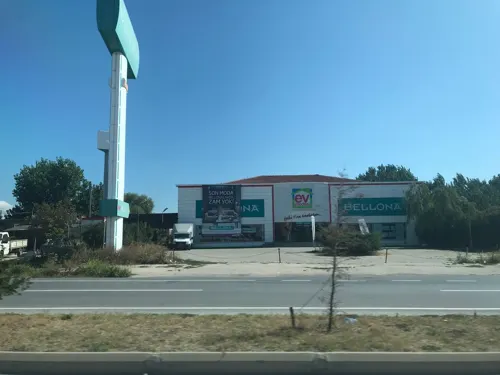



Logra Coffee Roastery
Cafe · 2.0 km
13 Kazım Karabekir Caddesi, Kırklareli


72 more on the map.
History
Ongoing archeological excavations in the city support the claim that the area was the location of one of the first organized settlements on the European continent, with artifacts from the Paleolithic and Neolithic periods.
The settlement and its surrounding areas were conquered by the Persians in 513–512 BC, during the reign of King Darius I.
In 914 during the Bulgarian invasion in Adrianople led by Simeon I, the settlement was captured by the Bulgarians and was under Bulgarian rule until 1003 when it was lost to the Byzantines.
The Ottoman Turks took the city and its region from the Byzantines in 1363, during the reign of Sultan Murad I.
The city was damaged during the Greek War of Independence (1821–1829).
According to the 1878 record "Ethnography of the Wilayahs Adrianopol, Monastir and Thessaloniki" Kırk Kilise was inhabited by 6,700 Bulgarians, 2,850 Greeks, and 2,700 belonging to other ethnic groups (Turks, Gajals, Dağlılar, Pomaks, Circassians).
In 1906, the Diocese of Saranda Ekklisies was detached from the Metropolis of Adrianople and was elevated to the status of Metropolis.
From the History section of Kırklareli on Wikipedia, under CC BY-SA 4.0.
Where to stay12
Churches and places of worship19
Köy Hizmetleri Camii
Place of worship · Sunni · 1.2 km
Turist Caddesi, Kırklareli
Shopping34
Gas and EV charging8
Schools, colleges and libraries19
Healthcare42
Berkay Eczanesi
Clinic and pharmacy · 0.6 km
37/A Şehit Komiser Yardımcısı Selim Sarıkaya Caddesi, Kırklareli
Map of Kırklareli
250 places. The map loads OpenStreetMap tiles when you open it.
Getting there and nearby towns
Tekirdağ Çorlu Atatürk Airport (TEQ) is the nearest airport with scheduled flights listed in OpenStreetMap, 88 km away.
- Üsküp 15 km east, about 15 min by car
- Kofçaz 24 km north, about 24 min by car
- Hamitabat 26 km south, about 26 min by car
- Pınarhisar 27 km southeast, about 27 min by car
- Babaeski 36 km south, about 36 min by car
- Lüleburgaz 39 km south, about 39 min by car
- Vize 48 km east, about 48 min by car
- Edirne 56 km west, about 56 min by car
- Çorlu 80 km southeast, about 1 h 15 min by car
- Tekirdağ 87 km south, about 1 h 30 min by car
Drive times are estimates from straight-line distance, not routes.
Local news
Headlines from INDB.
Reviews, tips and questions
Loading what members have shared...
Sources and licences
- GeoNames (CC BY 4.0): population, coordinates, regions and time zone
- Mapillary (see each image): photos
- OpenStreetMap contributors (ODbL 1.0): places, airports, map data
- Wikidata (CC0 1.0): elevation, founding date, time zone, website, landmarks and historic places
- Wikimedia Commons (see each image): photos
- Wikipedia (CC BY-SA 4.0): overview and history text
Photo credits
- Kirklareli mosque, Piotr Tysarczyk, CC BY-SA 2.5
- Musa Sinagogu, Kırklareli - 20250601203027, Sadrettin, CC BY-SA 4.0
- Kırklareli Atatürk Anıtı 2026-10-20 14.30.52 1792513050, Alicembasli, CC BY-SA 4.0
- Kırklareli Atatürk Anıtı 2026-10-20 14.30.46 1792513057, Alicembasli, CC BY-SA 4.0
- Kırklareli Atatürk Anıtı 2026-10-20 14.31.24 1792513039, Alicembasli, CC BY-SA 4.0
- Kırklareli Halkevi Binası 2026-10-20 14.57.54 1792513424, Alicembasli, CC BY-SA 4.0
- Kırklareli Zentrum, Julian Nyča, CC BY-SA 4.0
- Hızır Bey Arastası, Kırklareli - 20250601142256, Sadrettin, CC BY-SA 4.0
- Kırklareli Province - Kapan Mosque - 20250601175902, Sadrettin, CC BY-SA 4.0
- Kırklareli Province - Kapan Mosque - 20250601175919, Sadrettin, CC BY-SA 4.0
- Kırklareli Province - Kapan Mosque - 20250601175933, Sadrettin, CC BY-SA 4.0
- Kırklareli Province - Kapan Mosque - 20250601180403, Sadrettin, CC BY-SA 4.0
- Kırklareli Province - Kapan Mosque - 20250601181045, Sadrettin, CC BY-SA 4.0
- Kırklareli Province - Kapan Mosque - 20250601180950, Sadrettin, CC BY-SA 4.0
- Kırklareli Province - Kapan Mosque - 20250601180253, Sadrettin, CC BY-SA 4.0
- Kırklareli Province - Kapan Mosque - 20250601180222, Sadrettin, CC BY-SA 4.0
- Kırklareli Province - Kapan Mosque - 20250601180314, Sadrettin, CC BY-SA 4.0
- Kırklareli Province - Kapan Mosque - 20250601180020, Sadrettin, CC BY-SA 4.0
- Kırklareli Province - Kapan Mosque - 20250601180152, Sadrettin, CC BY-SA 4.0
- Hızır Bey Arastası, Kırklareli - 20250601142136, Sadrettin, CC BY-SA 4.0
- Hızır Bey Arastası, Kırklareli - 20250601142056, Sadrettin, CC BY-SA 4.0
- Kırklareli Province - Kapan Mosque - 20250601180331, Sadrettin, CC BY-SA 4.0
- Kırklareli Province - Kapan Mosque - 20250601175738, Sadrettin, CC BY-SA 4.0
- Hızır Bey Arastası, Kırklareli - 20250601142032, Sadrettin, CC BY-SA 4.0
- KırklareliMuseum (1), CeeGee, CC BY-SA 4.0
- Kirklareli kadi emin ali celebi camii 01, Alicembasli, CC BY 4.0
- Dodoğlu Konağı 03, Alicembasli, CC BY-SA 4.0
- Hızırbey Mosque, Kırklareli, User:Darwinek, CC BY-SA 3.0
- Kirklareli kapan camii 01, Alicembasli, CC BY 4.0
- Kırklareli - Kırklareli Sağlık Tarihi Evi - 20250601153635, Sadrettin, CC BY-SA 4.0
- Karakaşbey Camii 01, Alicembasli, CC BY 4.0
- Kırklareli Tren İstasyonu Makasçı Binası 2026-10-18 10.10.43 1792308532, Alicembasli, CC BY-SA 4.0
- Kırklareli Vilayet Binası - 20250601204424, Sadrettin, CC BY-SA 4.0
- Dükkan (Karakaş, Tırnova Caddesi, 2) - 20250601144249, Sadrettin, CC BY-SA 4.0
- Arion Müzik Okulu - 01, Alicembasli, CC BY 4.0
- Kırklareli Rum Okulu 01, Alicembasli, CC BY-SA 4.0
- Eski Vali Konağı, Kırklareli - 20250601153904, Sadrettin, CC BY-SA 4.0
- Konut 1 — Camikebir, Yayla Caddesi 02, Alicembasli, CC BY 4.0
- Kırklareli Gençlerbirliği Spor Kulübü Building 20260223 134922, Alicembasli, CC BY 4.0
- Kırklareli 5190, User:Darwinek, CC BY-SA 3.0
- Kirklareli pasa camii 01, Alicembasli, CC BY 4.0
- Şevket Dingiloğlu Parkı 2026-10-20 14.30.58 1792512937, Alicembasli, CC BY-SA 4.0
- Koza Pastanesi 01, Alicembasli, CC BY 4.0
- Street-level photo, hderinoz, CC BY-SA 4.0
- Street-level photo, hderinoz, CC BY-SA 4.0
- Street-level photo, hderinoz, CC BY-SA 4.0
- Street-level photo, hderinoz, CC BY-SA 4.0
- Street-level photo, hderinoz, CC BY-SA 4.0
- Street-level photo, hderinoz, CC BY-SA 4.0


Page built November 8, 2026. Spotted a mistake? Tell us or suggest a place.