


Pınarhisar, Turkey
Pınarhisar ilçesi
Pınarhisar is a town of 11,180 people in Kırklareli, Turkey.
Why visit Pınarhisar
Townapedia lists 7 museums and landmarks, 3 parks and trails, 12 places to eat, 4 places to stay and 2 attractions in and around town.
Highlights include Ambarkaya Kaya Mezarı and Haydar Baba Tümülüsü.
Weather in Pınarhisar
Forecast from MET Norway (CC BY 4.0). Full forecast
About Pınarhisar
Pınarhisar, ancient Bryses or Brysis (Βρύσις in Ancient Greek), is a town in Kırklareli Province in the Marmara region of Turkey. It is the seat of Pınarhisar District. Its population is 10,497 (2022). The mayor is İhsan Talay (AKP).
From the Wikipedia article Pınarhisar (this version), under CC BY-SA 4.0.
Things to do2

Museums and landmarks7

Parks, trails and playgrounds3

Restaurants and cafes12

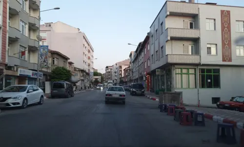
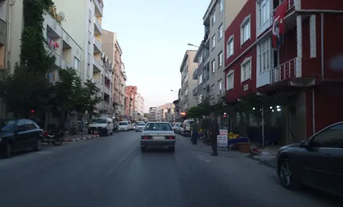
Pınarhisar Avcılar ve Atıcılar İhtisas Kulübü Derneği
Cafe · 0.8 km
79A Mehmet Efendi Caddesi, Kırklareli
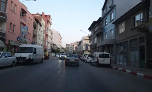
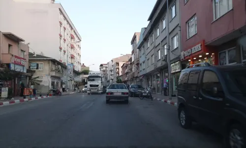


History
According to Turkish government resources, Pınarhisar was founded during the reign of Theodosius II, by c. 425, under the name "Brysis" meaning "spring" in Greek. The town's fortress was built during the Byzantine era. In 1190, the town was significantly damaged by Crusader occupation. It was attacked by Tatars in 1264.
The town was captured by the Ottomans in 1368, by the forces under the command of Ghazi Mihal, as a part of a campaign led by Murad I.
From the History section of Pınarhisar on Wikipedia, under CC BY-SA 4.0.
Where to stay4
Churches and places of worship7
Ahmet İsmail Dağcı Camii
Place of worship · 1.3 km
82 Şehit Murat Koç Caddesi, Kırklareli
Shopping3
Ustalar Dekorasyon
Hardware store · 0.8 km
53/1 Mehmet Efendi Caddesi, Kırklareli
Gas and EV charging4
Schools, colleges and libraries5
Healthcare9
Balıklı Eczanesi
Clinic and pharmacy · 0.9 km
89/A Salih Bilinmez Caddesi, Kırklareli
Map of Pınarhisar
56 places. The map loads OpenStreetMap tiles when you open it.
Getting there and nearby towns
Tekirdağ Çorlu Atatürk Airport (TEQ) is the nearest airport with scheduled flights listed in OpenStreetMap, 64 km away.
- Üsküp 15 km northwest, about 15 min by car
- Vize 22 km east, about 22 min by car
- Hamitabat 23 km southwest, about 23 min by car
- Kırklareli 27 km northwest, about 27 min by car
- Lüleburgaz 28 km southwest, about 28 min by car
- Babaeski 41 km southwest, about 41 min by car
- Çorlu 57 km southeast, about 57 min by car
- Tekirdağ 72 km south, about 1 h 15 min by car
- Edirne 80 km west, about 1 h 15 min by car
- Silivri 87 km southeast, about 1 h 30 min by car
Drive times are estimates from straight-line distance, not routes.
Local news
Headlines from INDB.
Reviews, tips and questions
Loading what members have shared...
Sources and licences
- GeoNames (CC BY 4.0): population, coordinates, regions and time zone
- Mapillary (see each image): photos
- OpenStreetMap contributors (ODbL 1.0): places, airports, map data
- Wikidata (CC0 1.0): elevation, founding date, time zone, website
- Wikimedia Commons (see each image): photos
- Wikipedia (CC BY-SA 4.0): overview and history text
Photo credits
- Pınarhisar - panoramio, Hüseyin Öcal, CC BY 3.0
- Atatürk Anıtı-Pınarhisar - panoramio, Hüseyin Öcal, CC BY 3.0
- Street-level photo, sis651, CC BY-SA 4.0
- Street-level photo, sis651, CC BY-SA 4.0
- Street-level photo, sis651, CC BY-SA 4.0
- Street-level photo, sis651, CC BY-SA 4.0
- Street-level photo, sis651, CC BY-SA 4.0
- Street-level photo, sis651, CC BY-SA 4.0
- Street-level photo, sis651, CC BY-SA 4.0
- Street-level photo, sis651, CC BY-SA 4.0
- Street-level photo, sis651, CC BY-SA 4.0
- Street-level photo, sis651, CC BY-SA 4.0
- Street-level photo, sis651, CC BY-SA 4.0
- Street-level photo, sis651, CC BY-SA 4.0
- Street-level photo, sis651, CC BY-SA 4.0
- Street-level photo, sis651, CC BY-SA 4.0
- Street-level photo, sis651, CC BY-SA 4.0
- Street-level photo, sis651, CC BY-SA 4.0
- Street-level photo, sis651, CC BY-SA 4.0
- Street-level photo, sis651, CC BY-SA 4.0
Page built November 8, 2026. Spotted a mistake? Tell us or suggest a place.