


Why visit Silivri
Townapedia lists 16 museums and landmarks, 24 parks and trails, 137 places to eat, 12 places to stay and 19 attractions in and around town.
Highlights include Mandıra Tepesi, Poyraz Tepe, Anastasian Wall and Caenophrurium.
Weather in Silivri
Forecast from MET Norway (CC BY 4.0). Full forecast
About Silivri
Silivri is a municipality and district of Istanbul Province, Turkey. The population is 217,163 (2022). Lying along the Sea of Marmara, outside the urban core of Istanbul, the district contains many holiday and weekend homes for residents of the city. The largest settlement in the district is also named Silivri.
From the Wikipedia article Silivri (this version), under CC BY-SA 4.0.
Things to do19

7 more on the map.
Museums and landmarks16

Anastasian Wall
Monument and historic site · 15.8 km
Defensive wall in Thrace
Caenophrurium
Monument and historic site · 17.9 km
Roman settlement between Byzantium and Heraclea Perinthus
Callum
Monument and historic site · 14.6 km
Settlement and station of ancient Thrace
Daminon Teichos
Monument and historic site · 17.6 km
Ancient city of Thrace in modern-day Turkey

Selymbria
Monument and historic site
Ancient city of Thrace in modern-day Turkey
4 more on the map.
Parks, trails and playgrounds24



12 more on the map.
Restaurants and cafes137

Villa Restaurant Silivri
Restaurant · Turkish, Kebab, Breakfast, Barbecue, Mediterranean, Grill, Diner · 4.2 km
No: 3 Fahrettin Berktaş Sokağı, Istanbul
Mo-Su 08:30-23:00
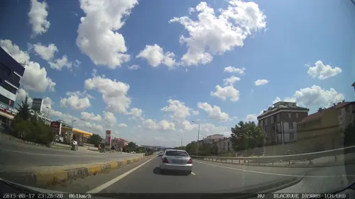
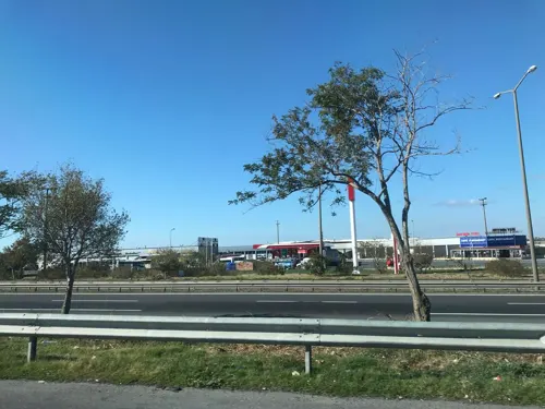


Acarpark Restaurant
Restaurant · Turkish · 10.4 km
In the service area ahead of petrol ofisi
Gölbaşı Et ve Balık Restaurant ve Balık Çiftliği Kır Bahçesi
Restaurant · Fish · 14.3 km
125 more on the map.
Where to stay12
Churches and places of worship39
Shopping64
Gas and EV charging28
SHARZ Selimpaşa Petrol
EV charging · 12.4 km
Selimpaşa Mahallesi Halaskargazi Caddesi No:158 Silivri /, İstanbul
Schools, colleges and libraries32
İstanbul Rumeli Üniversitesi Silivri Mehmet Balcı Yerleşkesi
School · 2.0 km
38 Mehmet Silivrili, İstanbul
Gülsen Ökkeş Nakıpoğlu Engelsiz Yaşam ve Eğitim Merkezi, Ömer Seyfettin Kütüphanesi
Library · 1.3 km
80. Yıl Cumhuriyet İlköğretim Okulu
School · 13.9 km
60 Atatürk Bulvarı, İstanbul
Healthcare76
Çanta Eczanesi
Clinic and pharmacy · 13.7 km
94/A Büyük Önder Atatürk Caddesi, İstanbul
Güner Eczanesi
Clinic and pharmacy
5/C General Ali İhsan Türkkan Caddesi, İstanbul
Ecem Eczanesi
Clinic and pharmacy · 2.2 km
74/1 Mimar Sinan Caddesi Yanyolu, İstanbul
Map of Silivri
250 places. The map loads OpenStreetMap tiles when you open it.
Getting there and nearby towns
Tekirdağ Çorlu Atatürk Airport (TEQ) is the nearest airport with scheduled flights listed in OpenStreetMap, 29 km away.
- Tepecik 26 km east, about 26 min by car
- Beylikdüzü 35 km east, about 35 min by car
- Çorlu 39 km west, about 39 min by car
- Arnavutköy 43 km east, about 43 min by car
- Küçükçekmece 45 km east, about 45 min by car
- Bağcılar 51 km east, about 51 min by car
- Bahçelievler 52 km east, about 52 min by car
- Esenler 53 km east, about 53 min by car
- Fatih 59 km east, about 59 min by car
- Istanbul 59 km east, about 59 min by car
Drive times are estimates from straight-line distance, not routes.
Local news
Headlines from INDB.
Reviews, tips and questions
Loading what members have shared...
Sources and licences
- GeoNames (CC BY 4.0): population, coordinates, regions and time zone
- Mapillary (see each image): photos
- OpenStreetMap contributors (ODbL 1.0): places, airports, map data
- Wikidata (CC0 1.0): elevation, founding date, time zone, website, landmarks and historic places
- Wikimedia Commons (see each image): photos
- Wikipedia (CC BY-SA 4.0): overview and history text
Photo credits
- Silivri Yukarıdan, Bursasporlu, Public domain
- Silivri sahil - panoramio, osmanm, CC BY 3.0
- Silivri Sahil... - panoramio, Sinan Şahin, CC BY 3.0
- Silivri Günbatımı... - panoramio, Sinan Şahin, CC BY 3.0
- Kayıklar ve Silivri... - panoramio, Sinan Şahin, CC BY 3.0
- Silivri Mimar Sinan Köprüsü, Canercangul, CC BY-SA 4.0
- Silivri - panoramio, www.gursoyweb.com, CC BY 3.0
- Silivri Bizimköy Güllüoğlu - panoramio, Aziz Akbiyik, CC BY-SA 3.0
- Alipaşa, 34570 Silivri-İstanbul, Turkey - panoramio (1), Dalibor Z. Chvatal, CC BY 3.0
- Alipaşa, 34570 Silivri-İstanbul, Turkey - panoramio (4), Dalibor Z. Chvatal, CC BY 3.0
- Alipaşa, 34570 Silivri-İstanbul, Turkey - panoramio (3), Dalibor Z. Chvatal, CC BY 3.0
- The fort and town of Silivria, the ancient Selymbria, on the Sea of Marmara - Francis Hervé - 1832, Francis Hervé, Public domain
- SilivriCastlePark (1), CeeGee, CC BY-SA 4.0
- CaveMonasteryİnceğiz (1), CeeGee, CC BY-SA 4.0
- PiriMehmetPashaMosqueSilivri (38), CeeGee, CC BY-SA 4.0
- Marina... - panoramio, Sinan Şahin, CC BY 3.0
- Gecenin Işıkları... - panoramio, Sinan Şahin, CC BY 3.0
- Balıkçılar... - panoramio, Sinan Şahin, CC BY 3.0
- Alexios Apokaukos Kilise Sarnıcı, Allmuud, CC BY-SA 4.0
- Günbatımı... - panoramio, Sinan Şahin, CC BY 3.0
- Balık Pazarı... - panoramio, Sinan Şahin, CC BY 3.0
- Holocnemus pluchei from Istanbul, 0959kedi, CC0
- Holocnemus pluchei mother with her eggs, 0959kedi, CC0
- ISS056-E-44098 - View of Earth, Earth Science and Remote Sensing Unit, NASA Johnson Space Center, Public domain
- ISS047-E-117485 - View of Earth, Earth Science and Remote Sensing Unit , Lyndon B. Johnson Space Center, Public domain
- ISS053-E-64872 - View of Earth, Earth Science and Remote Sensing Unit , Lyndon B. Johnson Space Center, Public domain
- ISS023-E-56706 - View of Earth, Earth Science and Remote Sensing Unit , Lyndon B. Johnson Space Center, Public domain
- ISS047-E-117484 - View of Earth, Earth Science and Remote Sensing Unit , Lyndon B. Johnson Space Center, Public domain
- ISS053-E-63557 - View of Earth, Earth Science and Remote Sensing Unit , Lyndon B. Johnson Space Center, Public domain
- ISS056-E-44099 - View of Earth, Earth Science and Remote Sensing Unit, NASA Johnson Space Center, Public domain
- ISS053-E-67343 - View of Earth, Earth Science and Remote Sensing Unit , Lyndon B. Johnson Space Center, Public domain
- ISS047-E-117487 - View of Earth, Earth Science and Remote Sensing Unit , Lyndon B. Johnson Space Center, Public domain
- ISS047-E-117486 - View of Earth, Earth Science and Remote Sensing Unit , Lyndon B. Johnson Space Center, Public domain
- ISS029-E-40200 - View of Turkey, Earth Science and Remote Sensing Unit , Lyndon B. Johnson Space Center, Public domain
- ISS042-E-261111 - View of Earth, Earth Science and Remote Sensing Unit , Lyndon B. Johnson Space Center, Public domain
- ISS019-E-22209 - View of Turkey, Earth Science and Remote Sensing Unit , Lyndon B. Johnson Space Center, Public domain
- ISS042-E-261112 - View of Earth, Earth Science and Remote Sensing Unit , Lyndon B. Johnson Space Center, Public domain
- Kınalı tesis - panoramio, Aziz Akbiyik, CC BY-SA 3.0
- Tuvturk Kavaklı - panoramio (3), Aziz Akbiyik, CC BY-SA 3.0
- Fiat 500 Sport 2009, Umt963, CC BY-SA 4.0
- Street-level photo, ahmetegri, CC BY-SA 4.0
- Street-level photo, hauserulrich, CC BY-SA 4.0
- Street-level photo, ahmetegri, CC BY-SA 4.0
- Street-level photo, yercizenler, CC BY-SA 4.0
- Street-level photo, ahmetegri, CC BY-SA 4.0
- Street-level photo, ozkanilyasaksu, CC BY-SA 4.0
- Street-level photo, ahmetegri, CC BY-SA 4.0
- Street-level photo, ahmetegri, CC BY-SA 4.0
- Street-level photo, hderinoz, CC BY-SA 4.0
- Street-level photo, yercizenler, CC BY-SA 4.0


Page built November 8, 2026. Spotted a mistake? Tell us or suggest a place.