


Why visit Seyitgazi
Townapedia lists 6 museums and landmarks and 1 place to stay in and around town.
Highlights include Abouadeineita and Nacolea.
Weather in Seyitgazi
Forecast from MET Norway (CC BY 4.0). Full forecast
About Seyitgazi
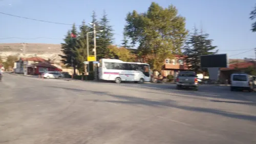
Seyitgazi is a municipality and district of Eskişehir Province, Turkey. Its area is 1,578 km2, and its population is 12,587 (2022). The central town of Seyitgazi lies at a distance of 43 km (27 mi) towards the south from the province capital of Eskişehir. The town was known formerly as Nakoleia.
From the Wikipedia article Seyitgazi (this version), under CC BY-SA 4.0.
Museums and landmarks6

Abouadeineita
Monument and historic site · 16.1 km
Ancient city of Phrygia in modern-day Turkey
Nacolea
Monument and historic site
Ancient city of Phrygia in modern-day Turkey
Pontanena
Monument and historic site · 17.7 km
Ancient city of Phrygia, in modern-day Turkey


Where to stay1

Churches and places of worship2

Healthcare2

History
The town occupies the site of the Byzantine city of Nakoleia which is attested from Roman times.
After the town was conquered by the Seljuk Turks, it was known as Kala'-i-Mashihya, the Christian Castle. During that time the old monastic centre dedicated to the archangel Michael was converted into a shrine to the 8th-century Muslim saint (seyyid) and warrior Battal Gazi, who allegedly fell in a battle nearby in 740. The town was eventually renamed after Battal Gazi.
From 1867 until 1922, Seyitgazi was part of Hüdavendigâr vilayet.
From the History section of Seyitgazi on Wikipedia, under CC BY-SA 4.0.
Map of Seyitgazi
11 places. The map loads OpenStreetMap tiles when you open it.
Getting there and nearby towns
1. Ana Jet Üs Komutanlığı (ESK) is the nearest airport with scheduled flights listed in OpenStreetMap, 39 km away.
- Doğançayır 15 km northeast, about 15 min by car
- Kırka 23 km southwest, about 23 min by car
- Çifteler 30 km east, about 30 min by car
- Eskişehir 40 km north, about 40 min by car
- Kütahya 61 km west, about 1 h by car
- Emirdağ 61 km southeast, about 1 h by car
- Sivrihisar 72 km east, about 1 h 15 min by car
- Afyonkarahisar 78 km south, about 1 h 15 min by car
- Bolvadin 87 km south, about 1 h 30 min by car
- Sinanpaşa 87 km southwest, about 1 h 30 min by car
Drive times are estimates from straight-line distance, not routes.
Local news
Headlines from INDB.
Reviews, tips and questions
Loading what members have shared...
Sources and licences
- GeoNames (CC BY 4.0): population, coordinates, regions and time zone
- Mapillary (see each image): photos
- OpenStreetMap contributors (ODbL 1.0): places, airports, map data
- Wikidata (CC0 1.0): elevation, founding date, time zone, website, landmarks and historic places
- Wikimedia Commons (see each image): photos
- Wikipedia (CC BY-SA 4.0): overview and history text
Photo credits
- Seyitgazi, Eskişehir 13, Zeynel Cebeci, CC BY-SA 4.0
- Seyitgazi, Eskişehir 17, Zeynel Cebeci, CC BY-SA 4.0
- Seyitgazi, Eskişehir 01, Zeynel Cebeci, CC BY-SA 4.0
- Seyitgazi, Eskişehir 03, Zeynel Cebeci, CC BY-SA 4.0
- Seyitgazi, Eskişehir 02, Zeynel Cebeci, CC BY-SA 4.0
- Seyitgazi village in 2012 1609, Dosseman, CC BY-SA 4.0
- Seyitgazi, Eskişehir 18, Zeynel Cebeci, CC BY-SA 4.0
- Seyitgazi, Eskişehir 15, Zeynel Cebeci, CC BY-SA 4.0
- Seyitgazi, Eskişehir 16, Zeynel Cebeci, CC BY-SA 4.0
- Seyitgazi, Eskişehir 14, Zeynel Cebeci, CC BY-SA 4.0
- Seyitgazi, Eskişehir 12, Zeynel Cebeci, CC BY-SA 4.0
- Seyitgazi, Eskişehir 21, Zeynel Cebeci, CC BY-SA 4.0
- Seyitgazi, Eskişehir 10, Zeynel Cebeci, CC BY-SA 4.0
- Seyitgazi, Eskişehir 09, Zeynel Cebeci, CC BY-SA 4.0
- Seyitgazi, Eskişehir 20, Zeynel Cebeci, CC BY-SA 4.0
- Eskişehir Archaeological Museum Two handled vessel, Early Bronze Age, 3000-2000 BC from Küllüoba in 2018 8446, Dosseman, CC BY-SA 4.0
- Seyit Battal Gazi Külliyesi from lower levels in 2012 1605, Dosseman, CC BY-SA 4.0
- Seyit Battal Gazi Külliyesi from lower levels in 2012 1606, Dosseman, CC BY-SA 4.0
- Seyit Battal Gazi Külliyesi from lower levels in 2012 1608, Dosseman, CC BY-SA 4.0
- Seyit Battal Gazi Külliyesi from lower levels in 2012 1607, Dosseman, CC BY-SA 4.0
- Seyit Battal Gazi Külliyesi from lower levels in 2012 1602, Dosseman, CC BY-SA 4.0
- Seyit Battal Gazi Külliyesi from lower levels in 2012 1601, Dosseman, CC BY-SA 4.0
- Seyit Battal Gazi Külliyesi in 2012 1599, Dosseman, CC BY-SA 4.0
- Seyit Battal Gazi Külliyesi in 2012 1600, Dosseman, CC BY-SA 4.0
- Seyit Battal Gazi Külliyesi in 2012 1598, Dosseman, CC BY-SA 4.0
- Seyit Battal Gazi Külliyesi 10, Zeynel Cebeci, CC BY-SA 4.0
- Seyit Battal Gazi Külliyesi 11, Zeynel Cebeci, CC BY-SA 4.0
- Seyit Battal Gazi Külliyesi 09, Zeynel Cebeci, CC BY-SA 4.0
- Seyit Battal Gazi Külliyesi 01, Zeynel Cebeci, CC BY-SA 4.0
- Seyit Battal Gazi Külliyesi Battal Gazi Tomb in 2012 1460, Dosseman, CC BY-SA 4.0
- Entrance, Seyit Battal Gazi Külliyesi 02, Zeynel Cebeci, CC BY-SA 4.0
- Seyit Battal Gazi Külliyesi 02, Zeynel Cebeci, CC BY-SA 4.0
- Entrance, Seyit Battal Gazi Külliyesi, Zeynel Cebeci, CC BY-SA 4.0
- Inner Court, Seyit Battal Gazi Külliyesi 03, Zeynel Cebeci, CC BY-SA 4.0
- Seyit Battal Gazi Külliyesi 06, Zeynel Cebeci, CC BY-SA 4.0
- Seyit Battal Gazi Külliyesi courtyard left building at north side right medrese in 2012 Panorama 1570, Dosseman, CC BY-SA 4.0
- Seyit Battal Gazi Külliyesi fountain in courtyard in 2012 1459, Dosseman, CC BY-SA 4.0
- Inner Court, Seyit Battal Gazi Külliyesi 02, Zeynel Cebeci, CC BY-SA 4.0
- Seyit Battal Gazi Külliyesi 13, Zeynel Cebeci, CC BY-SA 4.0
- Seyit Battal Gazi Külliyesi fountain in courtyard in 2012 1462, Dosseman, CC BY-SA 4.0
- Street-level photo, aliaktrk52, CC BY-SA 4.0


Page built November 8, 2026. Spotted a mistake? Tell us or suggest a place.