


Why visit Uskumruköy
Townapedia lists 14 museums and landmarks, 17 parks and trails, 32 places to eat, 2 places to stay and 14 attractions in and around town.
Highlights include Chalcaea and Maslak Pavilion.
Weather in Uskumruköy
Forecast from MET Norway (CC BY 4.0). Full forecast
About Uskumruköy
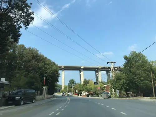
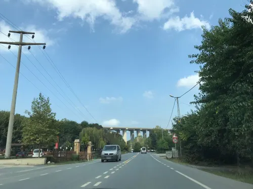
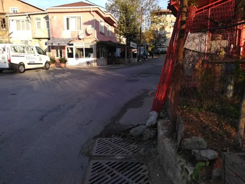
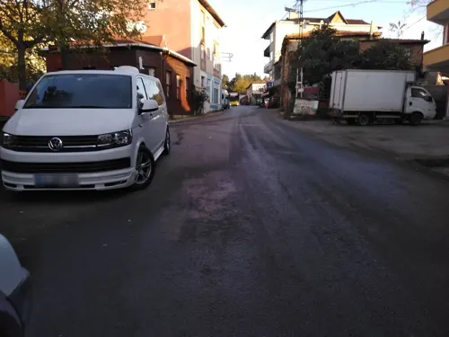
Uskumruköy (literally mackerel village) is a neighbourhood in the municipality and district of Sarıyer, Istanbul Province, Turkey. Its population is 9,864 (2022). It is situated to the north of Belgrad Forest which is one of the most popular excursion areas of Istanbul citizens. It is 8 km (5 mi) west of Sarıyer centre and a suburb of Greater Istanbul.
From the Wikipedia article Uskumruköy (this version), under CC BY-SA 4.0.
Things to do14


2 more on the map.
Museums and landmarks14

Chalcaea
Monument and historic site · 5.9 km
Ancient city of Thrace in modern-day Turkey

Maslak Pavilion
Museum · 4.2 km
Maslak Pavilion is a former imperial Ottoman pavilion located in Istanbul, Turkey. It was constructed during the reign of Sultan...
Phosphorus
Monument and historic site · 5.9 km
Ancient city of Thrace in modern-day Turkey
2 more on the map.
Parks, trails and playgrounds17


5 more on the map.
Restaurants and cafes32
Brio İtalian İstanbul
Restaurant · Italian, Pizza, European · 1.2 km
322 Kilyos Caddesi, İstanbul
Mo-Su 12:00-24:00





20 more on the map.
Where to stay2
Churches and places of worship9
Shopping18
Gas and EV charging2
Schools, colleges and libraries10
Healthcare17
Köy Eczanesi
Clinic and pharmacy · 2.2 km
6B/12-13 Profesör Doktor Oktay Sinanoğlu Caddesi, İstanbul
Demirciköy Eczanesi
Clinic and pharmacy · 3.2 km
64/D Demirciköy Caddesi, İstanbul
Map of Uskumruköy
135 places. The map loads OpenStreetMap tiles when you open it.
Getting there and nearby towns
Istanbul Airport (IST) is the nearest airport with scheduled flights listed in OpenStreetMap, 23 km away.
- Zekeriya 3 km south, about 3 min by car
- Üsküdar 22 km south, about 22 min by car
- Esenler 23 km southwest, about 23 min by car
- Fatih 23 km south, about 23 min by car
- Istanbul 24 km south, about 24 min by car
- Bağcılar 25 km southwest, about 25 min by car
- Ümraniye 24 km south, about 24 min by car
- Arnavutköy 24 km west, about 24 min by car
- İmrahor 23 km west, about 23 min by car
- Bahçelievler 28 km southwest, about 28 min by car
Drive times are estimates from straight-line distance, not routes.
Local news
Headlines from INDB.
Reviews, tips and questions
Loading what members have shared...
Sources and licences
- GeoNames (CC BY 4.0): population, coordinates, regions and time zone
- Mapillary (see each image): photos
- OpenStreetMap contributors (ODbL 1.0): places, airports, map data
- Wikidata (CC0 1.0): elevation, founding date, time zone, website, landmarks and historic places
- Wikimedia Commons (see each image): photos
- Wikipedia (CC BY-SA 4.0): overview and history text
Photo credits
- Maslak Kasrı, KalafatElif, CC BY-SA 4.0
- Sadberkhanımmüzesi1, Berfu at Turkish Wikipedia, CC BY-SA 3.0
- Surp Hripsimyants Kilisesi, Özgür Arda BAYRAM, CC BY-SA 3.0
- KoçUniversity2, Jorge1767, Public domain
- Kumköy Camii 2024-02-24 16.06.05 1791373973, Ali Osman Dilekoğlu, CC BY-SA 4.0
- Necip Ağa Çeşmesi IMG 0364, Ali Osman Dilekoğlu, CC BY-SA 4.0
- Zekeriyaköy Cami 2024-02-24 17.44.16 1791374216, Ali Osman Dilekoğlu, CC BY-SA 4.0
- Necip Ağa Çeşmesi IMG 0360, Ali Osman Dilekoğlu, CC BY-SA 4.0
- İmam Hasan Efendi Çeşmesi IMG 0375, Ali Osman Dilekoğlu, CC BY-SA 4.0
- Bridge3Istanbul, Elgaard, CC BY-SA 3.0
- Mehmetopolis (41588955750), Cristian Iohan Ştefănescu from Buharest, Romania, CC BY 2.0
- Emetullah Hatun Çeşmesi (Sarıyer) Kitabe, Ali Osman Dilekoğlu, CC BY-SA 4.0
- Emetullah Hatun Çeşmesi (Sarıyer), Ali Osman Dilekoğlu, CC BY-SA 4.0
- Tırmata Beach - panoramio, Ersin Biçer, CC BY-SA 3.0
- Tırmata Beach - panoramio (1), Ersin Biçer, CC BY-SA 3.0
- Su Terazisi, Kilyos 1 2025-10-12 14-46-53, Özgür Arda BAYRAM, CC BY-SA 4.0
- Su Terazisi, Kilyos 1 2025-10-12 14-47-18, Özgür Arda BAYRAM, CC BY-SA 4.0
- WFMD TURKEY2018, Fishmigration, CC BY-SA 4.0
- Su Terazisi, Kilyos 1 2024-02-24 16.19.44 1791373505, Ali Osman Dilekoğlu, CC BY-SA 4.0
- Su Terazisi, Kilyos 1 2024-02-24 16.19.26 1791373500, Ali Osman Dilekoğlu, CC BY-SA 4.0
- Su Terazisi, Kilyos 1 2025-10-12 14-47-33, Özgür Arda BAYRAM, CC BY-SA 4.0
- Su Terazisi, Kilyos 12025-10-12 14-48-13, Özgür Arda BAYRAM, CC BY-SA 4.0
- Kirazlıbahçe Çeşmeleri 2, Ali Osman Dilekoğlu, CC BY-SA 4.0
- Kirazlıbahçe Çeşmeleri, Ali Osman Dilekoğlu, CC BY-SA 4.0
- Ayşe Hanım Çeşmesi, Zekeriyaköy IMG 0415, Ali Osman Dilekoğlu, CC BY-SA 4.0
- Ayşe Hanım Çeşmesi, Zekeriyaköy IMG 0405, Ali Osman Dilekoğlu, CC BY-SA 4.0
- Ayşe Hanım Çeşmesi, Zekeriyaköy IMG 0408, Ali Osman Dilekoğlu, CC BY-SA 4.0
- Turban Cd. No-39, 34450 Kumköy-Sarıyer-İstanbul, Turkey - panoramio, eleesege, CC BY 3.0
- ISS044-E-59354 - View of Earth, Earth Science and Remote Sensing Unit , Lyndon B. Johnson Space Center, Public domain
- ISS044-E-59353 - View of Earth, Earth Science and Remote Sensing Unit , Lyndon B. Johnson Space Center, Public domain
- ISS065-E-30813 - View of Earth, Earth Science and Remote Sensing Unit , Lyndon B. Johnson Space Center, Public domain
- ISS065-E-30814 - View of Earth, Earth Science and Remote Sensing Unit , Lyndon B. Johnson Space Center, Public domain
- ISS044-E-59352 - View of Earth, Earth Science and Remote Sensing Unit , Lyndon B. Johnson Space Center, Public domain
- Su Terazisi, Kilyos 2 2025-10-12 14-40-04, Özgür Arda BAYRAM, CC BY-SA 4.0
- Su Terazisi, Kilyos 2 2025-10-12 14-39-44, Özgür Arda BAYRAM, CC BY-SA 4.0
- Su Terazisi, Kilyos 2 2025-10-12 14-39-31, Özgür Arda BAYRAM, CC BY-SA 4.0
- Su Terazisi, Kilyos 2 2024-02-24 16.22.52 1791373667, Ali Osman Dilekoğlu, CC BY-SA 4.0
- Su Terazisi, Kilyos 2 2024-02-24 16.16.40 1791373664, Ali Osman Dilekoğlu, CC BY-SA 4.0
- 16991656 original, Unknown author Unknown author, Public domain
- Kylyos Beach on the Black Sea, Turkey - panoramio, eleesege, CC BY 3.0
- Street-level photo, ferahkoksal, CC BY-SA 4.0
- Street-level photo, ferahkoksal, CC BY-SA 4.0
- Street-level photo, ferahkoksal, CC BY-SA 4.0
- Street-level photo, ferahkoksal, CC BY-SA 4.0
- Street-level photo, ferahkoksal, CC BY-SA 4.0
- Street-level photo, ferahkoksal, CC BY-SA 4.0
- Street-level photo, boracasli, CC BY-SA 4.0
- Street-level photo, ferahkoksal, CC BY-SA 4.0
- Street-level photo, ferahkoksal, CC BY-SA 4.0
- Street-level photo, ferahkoksal, CC BY-SA 4.0
- Street-level photo, boracasli, CC BY-SA 4.0
- Street-level photo, boracasli, CC BY-SA 4.0
- Street-level photo, boracasli, CC BY-SA 4.0
- Street-level photo, boracasli, CC BY-SA 4.0


Page built November 8, 2026. Spotted a mistake? Tell us or suggest a place.