

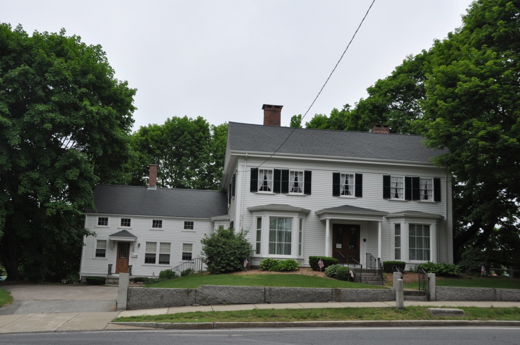


Walpole, Massachusetts
Walpole is a community of 6,461 people in Norfolk County, Massachusetts.
Why visit Walpole
Townapedia lists 17 museums and landmarks, 21 parks and trails, 22 places to eat, 4 places to stay and 2 attractions in and around town.
Highlights include Pierce Hill, Deacon Willard Lewis House, Walpole Town Hall and Moose Hill Wildlife Sanctuary.
July is the warmest month, with average highs of 83°F; January lows average 20°F, and about 56 inches of snow fall in a normal year.
Weather in Walpole
Forecast from the National Weather Service. Full forecast
About Walpole
Walpole is a town in Norfolk County, Massachusetts, United States. Walpole Town, as the Census refers to it, is located approximately 18 miles (29 km) south of downtown Boston, Massachusetts, and 30 miles (48 km) north of Providence, Rhode Island. The population of Walpole was 26,383 at the 2020 census. Walpole was first settled in 1659 and was considered a part of Dedham until officially incorporated in 1724.
From the Wikipedia article Walpole, Massachusetts (this version), under CC BY-SA 4.0.
Things to do2

Museums and landmarks17
Deacon Willard Lewis House
Monument and historic site · National Register of Historic Places · 1.1 mi
Historic house in Massachusetts, United States
33 West Street

Walpole Town Hall
Monument and historic site · National Register of Historic Places · 1.1 mi
Rathaus in Massachusetts, United States of America
135 School Street, Walpole
Amos Morse House
Monument and historic site · National Register of Historic Places · 3.5 mi
House in Foxborough, Massachusetts
Charles R. Wilber School
Monument and historic site · National Register of Historic Places · 3.2 mi
School building in Sharon, Massachusetts, United States

Sharon Historic District
Monument and historic site · National Register of Historic Places · 3.2 mi
Historic district in Sharon, Massachusetts
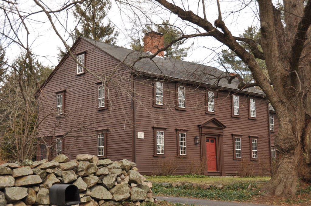
Stephen Turner House
Monument and historic site · National Register of Historic Places · 3.6 mi
Historic house in Norfolk, Massachusetts
Sullivan's Corner Historic District
Monument and historic site · National Register of Historic Places · 3.7 mi
Historic district in Massachusetts, United States

Walpole station
Monument and historic site · National Register of Historic Places · 1.2 mi
Railway station in Walpole, Massachusetts

Old Walpole Town Hall
Monument and historic site · 1.0 mi
972 Main Street, Walpole

5 more on the map.
Parks, trails and playgrounds21


Moose Hill Farm
Hiking and trails · 1.4 mi
Open space preserve and historic farm complex in Sharon, Massachusetts
396 Moose Hill Street, Sharon


Francis William Bird Park
Park · 2.0 mi
Park in Walpole, United States of America




9 more on the map.
Restaurants and cafes22

Sticks & Stones
Restaurant · Lebanese · 1.3 mi
506;514 High Plain Street, Walpole
Sa 12:00-22:00; Su 12:00-20:00; Tu-Th 11:00-21:00; Fr 11:00-22:00
Bianco's Italian Pizzeria and Grill
Restaurant · Italian · 1.1 mi
938 Main Street
Mo 16:00-20:00; Tu-Su 11:00-20:00; Fr,Sa 11:00-21:00
Kosmos
Restaurant · Greek · 1.1 mi
944 Main Street
Tu-Th 16:00-22:00; Fr 16:00-23:00; Sa 12:00-23:00; Su 12:00-21:45


Red Cherry
Ice cream · Frozen Yogurt · 1.0 mi
No longer in business.
1049 Main Street, Walpole
Mo-Su 10:00-21:00


10 more on the map.
History
It started out as a territory that was claimed by the Neponset band of the Massachusett Native American tribe. The Neponset tribe officially claimed the area that is now Walpole, and some of its surrounding territory, in 1635. The town of Dedham was not included in this claim, so they began to negotiate with the Neponset tribe to gain land. In 1636, a deal was made between the town of Dedham and the Neponsets to grant Dedham lands that now comprise the towns of Walpole, Norwood, Westwood, Medfield, Norfolk and Dover as well as Dedham. The land given to Dedham in this deal currently includes parts of 16 different towns.
After the territory was bought from Dedham, the saw mill industry began to rise in the area. The first saw mill in Walpole was built near what is now School Meadow Brook and the Neponset River. It was located in the area that is now the Walpole Town Forest. The mill was built and later owned by Joshua Fisher and Major Eleazer Lusher, two wealthy men of Dedham.
From the History section of Walpole, Massachusetts on Wikipedia, under CC BY-SA 4.0.
Where to stay4
Churches and places of worship8
BAPS South Boston Hindu Mandir
Place of worship · 1.3 mi
4 Commercial Street, Sharon
Shopping5
Gas and EV charging8
Schools, colleges and libraries47
Map of Walpole
134 places. The map loads OpenStreetMap tiles when you open it.
Climate by month
Monthly table
| Month | High | Low | Rain | Snow |
|---|---|---|---|---|
| Jan | 37°F | 20°F | 3.9 in | 15.1 in |
| Feb | 40°F | 21°F | 3.4 in | 14.1 in |
| Mar | 47°F | 28°F | 4.8 in | 11.6 in |
| Apr | 59°F | 38°F | 4.4 in | 2.5 in |
| May | 70°F | 48°F | 3.6 in | 0.0 in |
| Jun | 78°F | 57°F | 4.2 in | 0.0 in |
| Jul | 83°F | 63°F | 3.6 in | 0.0 in |
| Aug | 82°F | 62°F | 4.0 in | 0.0 in |
| Sep | 74°F | 54°F | 3.7 in | 0.0 in |
| Oct | 62°F | 43°F | 5.0 in | 0.3 in |
| Nov | 51°F | 34°F | 4.1 in | 1.7 in |
| Dec | 42°F | 25°F | 5.0 in | 10.8 in |
U.S. Climate Normals 1991-2020 for Walpole 2 Hcn (2 mi away), NOAA NCEI.
People and cost of living
American Community Survey 5-year estimates, 2020-2024, U.S. Census Bureau. Estimates have margins of error, larger for small towns.
Disaster history
Norfolk County has had 25 federal disaster declarations since 2000, most often for snowstorms.
- 2023-09-15: Hurricane Lee (Hurricane)
- 2022-04-18: Severe Winter Storm And Snowstorm (Snowstorm)
- 2020-03-27: Covid-19 Pandemic (Biological)
- 2020-03-13: Covid-19 (Biological)
- 2018-07-19: Severe Winter Storm And Snowstorm (Snowstorm)
- 2018-06-25: Severe Winter Storm And Flooding (Severe Storm)
OpenFEMA disaster declarations summaries.
Getting there and nearby towns
Norwood Memorial Airport (OWD) is the nearest airport with scheduled flights listed in OpenStreetMap, 5 miles away.
- Sharon 3 mi east, about 5 min by car
- Norwood 4 mi northeast, about 7 min by car
- Medfield 5 mi northwest, about 8 min by car
- Foxborough 5 mi south, about 8 min by car
- Millis-Clicquot 6 mi west, about 10 min by car
- Dedham 8 mi north, about 14 min by car
- Mansfield Center 8 mi south, about 13 min by car
- Dover 8 mi north, about 13 min by car
- Franklin Town 9 mi west, about 15 min by car
- Randolph Town 10 mi east, about 16 min by car
Drive times are estimates from straight-line distance, not routes.
Local news
Headlines from INDB, the NEMICO news database.
Reviews, tips and questions
Loading what members have shared...
Sources and licences
- NCES EDGE (Public domain): public schools
- NOAA NCEI U.S. Climate Normals 1991-2020 (Public domain): climate by month
- OpenFEMA (Public domain): disaster declarations
- OpenStreetMap contributors (ODbL 1.0): places, airports, map data
- U.S. Census Bureau (Public domain): population, income, housing, education, commute
- Wikidata (CC0 1.0): elevation, founding date, time zone, website, landmarks and historic places
- Wikimedia Commons (see each image): photos
- Wikipedia (CC BY-SA 4.0): overview and history text
Photo credits
- Walpole Massachusetts Town Hall, Kenneth C. Zirkel, CC BY-SA 4.0
- WalpoleMA DeaconWillardLewisHouse, User:Magicpiano, CC BY-SA 4.0
- Sharon Mass Historic Center, Marcbela (Marc N. Belanger), Public domain
- FoxboroughMA AmosMorseHouse, User:Magicpiano, CC BY-SA 4.0
- SharonMA CharlesRWilberSchool, User:Magicpiano, CC BY-SA 4.0
- NorfolkMA 23SeekonkStreet, User:Magicpiano, CC BY-SA 4.0
- Union Station, Walpole Massachusetts street side, Kenneth C. Zirkel, CC BY-SA 4.0
- NorfolkMA StephenTurnerHouse, User:Magicpiano, CC BY-SA 4.0
- Moose Hill Farm stone fence P1080625, NewtonCourt, CC BY-SA 4.0
- Bird Park, Red Thunder, CC BY-SA 3.0
Page built October 30, 2026. Spotted a mistake? Tell us or suggest a place.