



Why visit Wilton Center
Townapedia lists 13 museums and landmarks, 12 parks and trails, 3 places to eat and 2 attractions in and around town.
Highlights include White Barn Theatre, Belden Hill, Cannondale Historic District and David Lambert House.
July is the warmest month, with average highs of 85°F; January lows average 22°F, and about 34 inches of snow fall in a normal year.
Weather in Wilton Center
Forecast from the National Weather Service. Full forecast
About Wilton Center
Wilton Center is a neighborhood/section and census-designated place (CDP) in the town of Wilton, Connecticut, United States. As of the 2020 census, Wilton Center had a population of 1,466. The CDP partially overlaps the Wilton Center Historic District.
From the Wikipedia article Wilton Center, Connecticut (this version), under CC BY-SA 4.0.
Things to do2

White Barn Theatre
Cinema and theater · 3.3 mi
Theater in Norwalk, Connecticut

Museums and landmarks13

Cannondale Historic District
Monument and historic site · National Register of Historic Places · 2.2 mi
Historic district in Connecticut, United States

David Lambert House
Monument and historic site · National Register of Historic Places · 0.8 mi
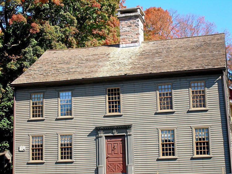
Historic house in Connecticut built by David Lambert in the 1700s

Hurlbutt Street School
Museum · National Register of Historic Places · 1.1 mi
Museum in Connecticut, United States of America
Kettle Creek Historic District
Monument and historic site · National Register of Historic Places · 2.9 mi
Historic district in Connecticut

Marvin Tavern
Monument and historic site · National Register of Historic Places · 1.5 mi
Building in Connecticut, United States
Merritt Parkway
Monument and historic site · National Register of Historic Places · 2.9 mi
Highway in Connecticut
Norfield Historic District
Monument and historic site · National Register of Historic Places · 2.5 mi
Historic district in Connecticut, United States

Perry Avenue Bridge
Bridge · National Register of Historic Places · 3.0 mi
Bridge in Connecticut, United States of America

Silvermine
Monument and historic site · National Register of Historic Places · 2.9 mi
Human settlement in Norwalk, Connecticut, United States of America
Sloan-Raymond-Fitch House
Monument and historic site · National Register of Historic Places
Wilton, Connecticut, listed on the NRHP in Fairfield County
Wilton Center Historic District
Monument and historic site · National Register of Historic Places · 0.7 mi
Historic district in Connecticut, United States
1 more on the map.
Parks, trails and playgrounds12





Restaurants and cafes3


Scoops
Ice cream · 0.4 mi
92 Old Ridgefield Road, Wilton
Mo-Su 11:00-22:00

Sipstirs Wilton Fine Wines Artisanal Spirits Craft Brews
Brewery and winery · 0.4 mi
203 Danbury Road, Wilton
Churches and places of worship9
Shopping1
Schools, colleges and libraries39
Jefferson Marine Science Elementary School
School · 5.2 mi
75 Van Buren Avenue, Norwalk
Map of Wilton Center
79 places. The map loads OpenStreetMap tiles when you open it.
Climate by month
Monthly table
| Month | High | Low | Rain | Snow |
|---|---|---|---|---|
| Jan | 38°F | 22°F | 4.3 in | 9.1 in |
| Feb | 41°F | 23°F | 3.1 in | 11.9 in |
| Mar | 49°F | 30°F | 4.7 in | 5.9 in |
| Apr | 62°F | 40°F | 4.4 in | 0.5 in |
| May | 72°F | 50°F | 4.1 in | 0.0 in |
| Jun | 80°F | 58°F | 4.9 in | 0.0 in |
| Jul | 85°F | 64°F | 3.8 in | 0.0 in |
| Aug | 83°F | 63°F | 3.8 in | 0.0 in |
| Sep | 76°F | 56°F | 5.2 in | 0.0 in |
| Oct | 64°F | 45°F | 4.6 in | 0.0 in |
| Nov | 53°F | 35°F | 4.2 in | 0.8 in |
| Dec | 43°F | 27°F | 4.4 in | 5.8 in |
U.S. Climate Normals 1991-2020 for Stamford 5 N Hcn (8 mi away), NOAA NCEI.
People and cost of living
American Community Survey 5-year estimates, 2020-2024, U.S. Census Bureau. Estimates have margins of error, larger for small towns.
Disaster history
The county has had 25 federal disaster declarations since 2000, most often for hurricanes.
- 2024-09-20: Severe Storm, Flooding, Landslides, And Mudslides (Severe Storm)
- 2024-08-21: Severe Storms, Flooding, Landslides, And Mudslides (Severe Storm)
- 2021-10-30: Remnants Of Hurricane Ida (Hurricane)
- 2021-08-22: Hurricane Henri (Hurricane)
- 2021-01-12: Tropical Storm Isaias (Hurricane)
- 2020-08-06: Tropical Storm Isaias (Hurricane)
OpenFEMA disaster declarations summaries.
Getting there and nearby towns
Danbury Municipal Airport (DXR) is the nearest airport with scheduled flights listed in OpenStreetMap, 13 miles away.
- South Wilton 2 mi south, about 3 min by car
- Poplar Plains 3 mi southeast, about 5 min by car
- Georgetown 4 mi north, about 6 min by car
- Old Hill 4 mi southeast, about 6 min by car
- Coleytown 4 mi east, about 7 min by car
- New Canaan 5 mi southwest, about 8 min by car
- Westport Village 5 mi southeast, about 8 min by car
- Staples 6 mi southeast, about 9 min by car
- Compo 6 mi southeast, about 10 min by car
- Norwalk 7 mi south, about 11 min by car
Drive times are estimates from straight-line distance, not routes.
Local news
Headlines from INDB, the NEMICO news database.
Reviews, tips and questions
Loading what members have shared...
Sources and licences
- NCES EDGE (Public domain): public schools
- NOAA NCEI U.S. Climate Normals 1991-2020 (Public domain): climate by month
- OpenFEMA (Public domain): disaster declarations
- OpenStreetMap contributors (ODbL 1.0): places, airports, map data
- U.S. Census Bureau (Public domain): population, income, housing, education, commute
- Wikidata (CC0 1.0): elevation, founding date, time zone, website, landmarks and historic places
- Wikimedia Commons (see each image): photos
- Wikipedia (CC BY-SA 4.0): overview and history text
Photo credits
- Wilton Town Hall, Wilton (Fairfield County, Connecticut), James Rainey, Photographer, Public domain
- WestonCT KettleCreekHD 4, Magicpiano, CC BY-SA 3.0
- Perry Avenue Bridge 011, Pedro Xing, CC0
- SilvermineTavernMillPond08042007, Noroton at en.wikipedia, Public domain
- FitchHouseWiltonCT, Jerry Dougherty, CC BY 2.5
- Marvin Tavern, DavidAFinkelstein, CC BY-SA 3.0
- WiltonCTCannonXingSchoolhouse09162007, Noroton, Public domain
- GuilfordCT FirstCongregationalChurch, Magicpiano, CC BY-SA 4.0
- Saint Matthew's Parish Cemetery, Packer1028, CC0
- Wilton, CT town hall, June 2024, Mr. Matté (if there is an issue with this image, contact me using this image's Commons talk page , my Commons user talk page , or my English Wikipedia user talk page ; I'll know about it a lot faster), CC BY-SA 4.0
- WiltonCT SloanRaymondFitchHouse, Magicpiano, CC BY-SA 4.0
- Sloan-Raymond-Fitch house 080, Pedro Xing, CC0
- Wilton Historical Society 078, Pedro Xing, CC0
- Betts-Sturgis-Blackmar house 079, Pedro Xing, CC0
- Sharp Hill Cemetery (Wilton, CT), Packer1028, CC0
- Wilton Station Platform (1), AirportExpert, CC0
- Wilton Station Platform (4), AirportExpert, CC0
- Wilton Station Platform (3), AirportExpert, CC0
- Wilton station postcard, Unknown author Unknown author, Public domain
- Wilton Station Platform (2), AirportExpert, CC0
- Wilton Station Platform, AirportExpert, CC0
- Wilton Station Building, AirportExpert, CC0
- Bridge over Norwalk River, AirportExpert, CC0
- Wilton Station 2026 (2), AirportExpert, CC0
- Wilton Station 2026 (1), AirportExpert, CC0
- Wilton station 1905 postcard, Unknown author Unknown author, Public domain
- Bryant Brook (Wilton, CT), Packer1028, CC0
- WiltonCT CenterHD1, Magicpiano, CC BY-SA 4.0
- WiltonCT CenterHD3, Magicpiano, CC BY-SA 4.0
- WiltonCT CenterHD2, Magicpiano, CC BY-SA 4.0
- WiltonCT DavidLambertHouse, Magicpiano, CC BY-SA 3.0
- David Lambert House, James Rainey, Public domain
- Chestnut Hill Brook (Wilton, CT), Packer1028, CC0
- Wilton Station relocated 009, Pedro Xing, CC0
- Norwalk River in Wilton, CT, Packer1028, CC0
- US 7 nb approaching CT 33, June 2024, Mr. Matté (if there is an issue with this image, contact me using this image's Commons talk page , my Commons user talk page , or my English Wikipedia user talk page ; I'll know about it a lot faster), CC BY-SA 4.0
- Obliquity a Re-examination of Reality for the Creative(s) Use of Identity, Chasealias, CC0
- Hurlbutt Street Schoolhouse, DavidAFinkelstein, CC BY-SA 3.0
- Wilton High School, 2024, Packer1028, CC0


Page built October 30, 2026. Spotted a mistake? Tell us or suggest a place.