


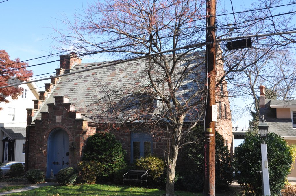


Blauvelt, New York
Blauvelt is a community of 5,406 people in Rockland County, New York.
Why visit Blauvelt
Townapedia lists 34 museums and landmarks, 9 parks and trails, 30 places to eat, 5 places to stay and 8 attractions in and around town.
Highlights include Rockland Road Bridge, Sparkill Creek Drawbridge, Ross-Hand Mansion and Brookside.
July is the warmest month, with average highs of 86°F; January lows average 23°F, and about 33 inches of snow fall in a normal year.
Weather in Blauvelt
Forecast from the National Weather Service. Full forecast
About Blauvelt
Blauvelt (English pronunciation: /ˈblɔːvɛlt/ ) is a hamlet, about 20 miles northwest of New York City. It is a census-designated place, formerly known as Greenbush and then Blauveltville, in Orangetown, Rockland County, New York, United States. It is located north of Tappan, east of Nauraushaun and Pearl River, south of Central Nyack, and west of Orangeburg. As of the 2020 census, Blauvelt had a population of 5,548.
From the Wikipedia article Blauvelt, New York (this version), under CC BY-SA 4.0.
Things to do8

Rockland Road Bridge
Bridge · National Register of Historic Places · 2.9 mi
Bridge in United States of America

Sparkill Creek Drawbridge
Bridge · National Register of Historic Places · 2.9 mi
Bridge in United States of America


New Tappan Zee Bridge
Bridge · 3.3 mi
Bridge across the Hudson River, New York, United States of America

St. Thomas Aquinas College
School · 2.1 mi
Liberal arts college in New York
Tappan Zee Bridge
Bridge · 3.3 mi
Former road bridge in the State of New York

Museums and landmarks34
Ross-Hand Mansion
Monument and historic site · National Register of Historic Places · 2.1 mi
South Nyack, New York, listed on the NRHP in New York
122 South Franklin Street, Nyack

Brookside
Monument and historic site · National Register of Historic Places · 3.2 mi
Historic home located at Upper Nyack, Rockland County, New York

Carson McCullers House
Monument and historic site · National Register of Historic Places · 2.2 mi
Historic home museum of writer Carson McCullers, in Nyack, New York, USA

Dederer Stone House-Stonehurst
Monument and historic site · National Register of Historic Places · 3.1 mi
Historic house in New York, United States

DeWint House
Monument and historic site · National Register of Historic Places · 3.4 mi
Historic house in New York, United States

Edward Hopper Birthplace and Boyhood Home
Monument and historic site · National Register of Historic Places · 2.6 mi
Historic house museum in Nyack, New York

Edward Salyer House
Monument and historic site · National Register of Historic Places · 3.3 mi
Historic house in New York, United States

Frederick Haring House
Monument and historic site · National Register of Historic Places · 3.7 mi
Historic house in New Jersey, United States

Haddock's Hall
Monument and historic site · National Register of Historic Places · 3.0 mi
Historic commercial building in New York, United States

Haring-Blauvelt House
Monument and historic site · National Register of Historic Places · 3.8 mi
Historic house in New Jersey, United States

Haring-DeWolf House
Monument and historic site · National Register of Historic Places · 3.3 mi
Historic house in New Jersey, United States


Hopson-Swan Estate
Monument and historic site · National Register of Historic Places · 3.5 mi
Historic house in New York, United States
22 more on the map.
Parks, trails and playgrounds9



Palisades Center Ice Rink
Sports field and stadium · 1.9 mi
4900 Palisades Center Drive, West Nyack

Restaurants and cafes30

Pizzarena West Nyack
Restaurant · Pizza · 1.9 mi
Very popular pizza/ Italian restaurant in the town of west nyack. Often caters local school and sport team events and meetings.
82 West Nyack Road, West Nyack
Mo-Sa 11:00-21:00; Su 12:00-21:00
Giovanni's Pizza
Restaurant · Pizza, Pasta, Salad, Sandwich, Fries, Italian, Chicken, Seafood · 0.6 mi
535 Western Highway South, Blauvelt


Little Tokyo Sushi
Restaurant · Japanese · 2.0 mi
3563 Palisades Center Drive, West Nyack

Louie's Ice Cream
Ice cream · 0.7 mi
533 Western Highway South, Blauvelt

18 more on the map.
History
The name "Blauvelt", of Dutch origin, is that of a prominent family that settled in the area in the 17th century. The etymology of the name probably comes from the coat of arms adopted by the first Blauvelt, Pieter Blauwveld, a prominent trader in the Netherlands. Literally, it means "blue-field", or "blue pasture fields", likely a reference to the blue and yellow shields hung on Blauwveld's ships (a common 14th century Dutch method of identifying the owner). The first Blauvelt in America was a peasant farmer who cultivated tobacco on the estate of Kiliaen van Rensselaer, the first patroon of the Manor of Rensselaerswyck near Albany, New York, in 1638.
In 1909, New York State purchased property in Blauvelt to create Camp Bluefields, a large rifle range used to train members of the New York National Guard prior to World War I. The property was later used by the YWCA, ROTC, Columbia University and the U.S. Army for various purposes before being abandoned following World War II. The land is today the site of Blauvelt State Park.
From the History section of Blauvelt, New York on Wikipedia, under CC BY-SA 4.0.
Where to stay5
Churches and places of worship13
Christ Church
Church · National Register of Historic Places · 3.0 mi
First Methodist Episcopal Church of Nyack
Church · National Register of Historic Places · 3.1 mi
First Reformed Church
Church · National Register of Historic Places · 3.0 mi
Former Wayside Chapel
Church · National Register of Historic Places · 1.8 mi
St. Paul's United Methodist Church
Church · National Register of Historic Places · 2.1 mi
Holy Virgin Protection Russian Orthodox Church
Church · Russian Orthodox · 2.2 mi
38;44 South Mill Street;Prospect Street, Nyack
Orthodox Christian Church of the Holy Transfiguration
Church · Orthodox · 2.1 mi
35 Sickletown Road, Pearl River
Saints Constantine and Helen Greek Orthodox Church
Church · Greek Orthodox · 1.5 mi
1 Marycrest Road, West Nyack
Shopping12
Gas and EV charging4
Schools, colleges and libraries51
Clarkstown South Senior High School
School · 2.7 mi
31 Demarest Mill Rd, West Nyack
Healthcare3
Map of Blauvelt
169 places. The map loads OpenStreetMap tiles when you open it.
Climate by month
Monthly table
| Month | High | Low | Rain | Snow |
|---|---|---|---|---|
| Jan | 40°F | 23°F | 3.9 in | 9.4 in |
| Feb | 43°F | 24°F | 3.3 in | 10.9 in |
| Mar | 51°F | 31°F | 4.4 in | 5.8 in |
| Apr | 63°F | 40°F | 4.3 in | 0.7 in |
| May | 73°F | 50°F | 4.3 in | 0.0 in |
| Jun | 81°F | 59°F | 4.6 in | 0.0 in |
| Jul | 86°F | 64°F | 4.5 in | 0.0 in |
| Aug | 84°F | 63°F | 4.4 in | 0.0 in |
| Sep | 77°F | 56°F | 4.6 in | 0.0 in |
| Oct | 65°F | 45°F | 4.4 in | 0.0 in |
| Nov | 54°F | 36°F | 3.9 in | 0.3 in |
| Dec | 44°F | 29°F | 4.7 in | 5.6 in |
U.S. Climate Normals 1991-2020 for Dobbs Ferry-Ardsley Hcn (8 mi away), NOAA NCEI.
People and cost of living
American Community Survey 5-year estimates, 2020-2024, U.S. Census Bureau. Estimates have margins of error, larger for small towns.
Disaster history
Rockland County has had 20 federal disaster declarations since 2000, most often for hurricanes.
- 2023-07-22: Severe Storms And Flooding (Severe Storm)
- 2021-09-05: Remnants Of Hurricane Ida (Hurricane)
- 2021-09-02: Remnants Of Hurricane Ida (Hurricane)
- 2021-08-22: Hurricane Henri (Hurricane)
- 2020-10-02: Tropical Storm Isaias (Hurricane)
- 2020-03-20: Covid-19 Pandemic (Biological)
OpenFEMA disaster declarations summaries.
Getting there and nearby towns
Westchester County Airport (HPN) is the nearest airport with scheduled flights listed in OpenStreetMap, 13 miles away.
- Pearl River 3 mi west, about 4 min by car
- Sparkill 3 mi southeast, about 5 min by car
- Old Tappan 3 mi southwest, about 6 min by car
- Bardonia 3 mi north, about 5 min by car
- Nanuet 4 mi northwest, about 6 min by car
- Northvale 4 mi south, about 6 min by car
- Upper Nyack 4 mi northeast, about 7 min by car
- Tarrytown 5 mi east, about 7 min by car
- Sleepy Hollow 5 mi northeast, about 8 min by car
- Montvale 5 mi west, about 8 min by car
Drive times are estimates from straight-line distance, not routes.
Local news
Headlines from INDB, the NEMICO news database.
Reviews, tips and questions
Loading what members have shared...
Sources and licences
- NCES EDGE (Public domain): public schools
- NOAA NCEI U.S. Climate Normals 1991-2020 (Public domain): climate by month
- OpenFEMA (Public domain): disaster declarations
- OpenStreetMap contributors (ODbL 1.0): places, airports, map data
- U.S. Census Bureau (Public domain): population, income, housing, education, commute
- Wikidata (CC0 1.0): elevation, founding date, time zone, website, landmarks and historic places
- Wikimedia Commons (see each image): photos
- Wikipedia (CC BY-SA 4.0): overview and history text
Photo credits
- SouthNyackNY RossHandMansion, User:Magicpiano, CC BY-SA 4.0
- HARING-BLAUVELT HOUSE, NORTHVALE, BERGEN COUNTY, NJ, JERRYE & ROY KLOTZ M.D., CC BY-SA 4.0
- GrandViewOnHudsonNY FormerWaysideChapel, User:Magicpiano, CC BY-SA 4.0
- TEUNIS HARING HOUSE, OLD TAPPAN, BERGEN COUNTY, JERRYE AND ROY KLOTZ M.D., CC BY-SA 4.0
- HADDOCK'S HALL, PIERMONT, ROCKLAND COUNTY, NY, JERRYE & ROY KLOTZ, M.D., CC BY-SA 4.0
- JohnAndreMemorial 2007 02, Rolf Müller ( User:Rolfmueller ), CC BY-SA 3.0
- Pearl River, NY, post office, Daniel Case, CC BY-SA 3.0
- Rockland ROAD BRIDGE, PIERMONT, ROCKLAND COUNTY, NY, JERRYE & ROY KLOTZ, M.D., CC BY-SA 4.0
- Upper Nyack Firehouse, David Rivera, CC BY-SA 3.0
- Brookside-Lochbourn, Izzy406, CC BY-SA 3.0
- DEDERER STONE HOUSE, ORANGETOWN, ROCKLAND COUNTY, NY, JERRYE & ROY KLOTZ, M.D., CC BY-SA 4.0
- New York - Palisades Interstate Parkway - 20180904201335, Kapitangrant, CC BY-SA 4.0
- 352 Piermont Avenue - Piermont NY, Adam Moss, CC BY-SA 2.0
- ONDERDONK HOUSE, PIERMONT, ROCKLAND COUNTY, NY, JERRYE & ROY KLOTZ, M.D., CC BY-SA 4.0
- Edward Salyer House, Pearl River, NY, Daniel Case, CC BY-SA 3.0
- Piermont Erie Railroad station, RussNelson, CC BY-SA 3.0
- Jacob P Perry House, Pearl River, NY, Daniel Case, CC BY-SA 3.0
- Old76House 2007 02, Rolf Müller ( User:Rolfmueller ), CC BY-SA 3.0
- WestNyackNY MountMoorCemetery 01, User:Magicpiano, CC BY-SA 4.0
- Nyack, NY, post office, Daniel Case, CC BY-SA 3.0
- DeWint House Tappan, Alexisrael, CC BY-SA 3.0
- 1HOPSON-SWAN ESTATE, SPARKILL, ROCKLAND COUNTY, NY, JERRYE & ROY KLOTZ, M.D., CC BY-SA 4.0
- WILLIAM FERDON HOUSE, PIERMONT, ROCKLAND COUNTY NY, JERRYE & ROY KLOTZ, M.D., CC BY-SA 4.0
- First Methodist Episcopal Church of Nyack 4, David Rivera, CC BY-SA 3.0
- Edward Hopper`s birthplace Nyack, Ritzel, CC BY-SA 3.0
- CHRIST CHURCH, SPARKILL, ROCKLAND COUNTY, NY, JERRYE & ROY KLOTZ, M.D., CC BY-SA 4.0
- Shadowcliff Shadowcliff, also known as the Fellowship of Reconciliation Headquarters, is a historic home located at Upper Nyack, Rockland County, New York, Jimstu8, CC BY-SA 3.0
- St. Paul's United Methodist Church, David Rivera, CC BY-SA 3.0
- Piermont Drawbridge, Alexisrael, CC BY-SA 3.0
- HARING-DEWOLF HOUSE, OLD TAPPAN, BERGEN COUNTY, JERRYE & ROY KLOTZ M.D., CC BY-SA 4.0
- Michael Salyer Stone House, Orangetown, NY, Daniel Case, CC BY-SA 3.0
- ROCKLAND ROAD BRIDGE HISTORIC DISTRICT, PIERMONT, ROCKLAND COUNTY, NY, JERRYE AND ROY KLOTZ, M.D., CC BY-SA 4.0
- SouthNyackNY CarsonMcCullersHouse, User:Magicpiano, CC BY-SA 4.0
- WestNyackNY TerneurHuttonHouse, User:Magicpiano, CC BY-SA 4.0
- FIRST REFORMED CHURCH, PIEDMONT, ROCKLAND COUNTY NY, JERRYE & ROY KLOTZ, M.D., CC BY-SA 4.0
- VAN HOUTEN'S LANDING HISTORIC DISTRICT, ROCKLAND COUNTY NY, JERRYE & ROY KLOTZ, M.D., CC BY-SA 4.0
- TappanZeePlayhouse, A. O'Brien, Public domain
- 9.6.07PalisadesCenterMallFoodCourtbyLuigiNovi, Nightscream at English Wikipedia, CC BY-SA 2.5


Page built October 30, 2026. Spotted a mistake? Tell us or suggest a place.