


Why visit Aue
Townapedia lists 58 museums and landmarks, 17 parks and trails, 88 places to eat, 13 places to stay and 25 attractions in and around town.
Highlights include Zoo der Minis, Nickel-Odeon Kino-Center, Museum Uranbergbau and Edelhof Alberoda.
Weather in Aue
Forecast from MET Norway (CC BY 4.0). Full forecast
About Aue
Aue (German pronunciation: [ˈaʊ̯ə] ) is a small town in Germany at the outlet of the river Schwarzwasser into the river Zwickauer Mulde in the Ore Mountains, and has roughly 16,000 inhabitants. It was merged into the new town Aue-Bad Schlema in January 2019. Aue was the administrative seat of the former district of Aue-Schwarzenberg in Saxony, and is part of the Erzgebirgskreis since August 2008. It belongs to the Silberberg Town League (Städtebund Silberberg)
From the Wikipedia article Aue, Saxony (this version), under CC BY-SA 4.0.
Travel tips from other travellers: Aue on Wikivoyage (CC BY-SA 4.0).
Things to do25






13 more on the map.
Museums and landmarks58

Museum Uranbergbau
Museum · 2.5 km
20 Bergstraße, Aue-Bad Schlema
Mo-Th 09:00-17:00, Fr off, Sa-Su,PH 10:00-17:00

Edelhof Alberoda
Monument and historic site · 4.3 km
Ehemalige Wasserburg, jetzt als Gasthof genutzt.
7 An den Teichen


ehem. Oberschlemaer Bahnhof
Monument and historic site · 3.0 km
2i Hauptstraße, Aue-Bad Schlema


Hertha Thorn
Monument and historic site
Stolperstein für Hertha Thorn verh. Kreinberg; Rosa Hertha Kreinberg


46 more on the map.
Parks, trails and playgrounds17

Erzgebirgsstadion
Sports field and stadium · 0.9 km
95 Lößnitzer Straße, Aue-Bad Schlema






5 more on the map.
Restaurants and cafes88
Caramba - Die Spanische Kneipe
Bar and pub · Spanish, Ice Cream · 2.6 km
35 Alte Lößnitzer Straße, Aue-Bad Schlema
Mo-Su 14:30-24:00

Dino Döner - Pizzeria
Restaurant · Pizza, Kebab · 3.6 km
22 Sachsenstraße, Lauter-Bernsbach
Tu-Su,PH 17:00-21:00; Mo off
Einkehr am Tiergarten
Restaurant · Regional · 0.9 km
1 Damaschkestraße, Aue-Bad Schlema
Mo-Su 11:00-21:00
Gasthof Dreihansen
Restaurant · Regional, German · 4.0 km
8 Dreihansner Straße, Lößnitz
We,Th 11:00-14:00,17:00-24:00; Fr 17:00-00:00; Sa 11:00-00:00; Su...
Parkwarte
Restaurant · Regional, German · 1.1 km
50 Zur Parkwarte, Aue-Bad Schlema
Th,Fr 17:00-22:00; Sa,Su 11:00-22:00
Brethaus
Restaurant · German · 3.0 km
4 Am Brethaus, Lauter-Bernsbach
We-Su 11:00-20:00

Bäckerei Friedrich
Bakery · 3.9 km
7 Rathausplatz, Lößnitz
Mo-Fr 05:00-18:00; Sa 05:00-11:00; Su,PH off
Bäckerei Zum Schellenberger
Bakery
1 Altmarkt, Aue-Bad Schlema
Mo-Fr 06:00-18:00; Sa 06:00-11:30; Su,PH off
Bäckerei Zum Schellenberger
Bakery · 1.9 km
16 Forstweg, Aue-Bad Schlema
Mo-Fr 06:45-18:00; Sa 06:00-13:30; Su 07:00-11:00
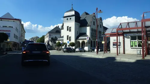
Cafe am Postplatz
Cafe · 0.6 km
1 Postplatz, Aue-Bad Schlema
Mo-Fr 07:00-17:00; Sa 07:00-12:00; Su 07:00-10:00,13:30-16:00
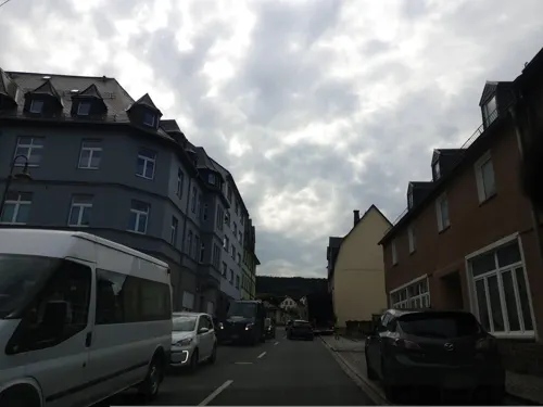


Eiscafé Eisbär
Cafe · Ice Cream, Coffee Shop · 4.2 km
7 Hauptstraße, Lauter-Bernsbach
Mo-Su 13:00-18:00
76 more on the map.
History
The town's first mention came in 1219 when it was named in a document as Bertoldus prepositus de Owa. Owa, later also Awe or Aw referred to the meadow (although Aue in German actually means “floodplain”) at the forks of the Schwarzwasser und Zwickauer Mulde, where the first settlers had their homes next to the small monastery of Zelle, founded in 1173. In 1479, tin and silver mining began, leading to an upswing in the town's fortunes. In 1526, the Auerhammer (ironworks), later called Eisenwerk and now a constituent community of Aue, had its first documentary mention.
The first St. Nicholas' Church, of which no details have been passed down, was located on the former church square, the Kirchplatz (the present Neumarkt) and must have been replaced by a new building between 1625 and 1628. On 4 August 1633 this building, together with a large part of the town, was destroyed in a raid by imperial troops. By 1636 the church had been temporarily rebuilt.
From the History section of Aue, Saxony on Wikipedia, under CC BY-SA 4.0.
Where to stay13
Altes Huthaus
Motel and hotel · 1.8 km
96 Schwarzenberger Straße, Aue-Bad Schlema
Hotel am Kurhaus
Motel and hotel · 3.4 km
16 Richard-Friedrich-Straße, Aue-Bad Schlema
Churches and places of worship24
Martin-Luther-Kirche
Church · Lutheran · 2.9 km
9 Schulberg, Aue-Bad Schlema
Nicolaikirche
Church · Lutheran · 0.6 km
12 Schwarzenberger Straße, Aue-Bad Schlema
Shopping25
Gas and EV charging7
Schools, colleges and libraries15
Berufliches Schulzentrum Erdmann Kircheis
School
27 Rudolf-Breitscheid-Straße, Aue-Bad Schlema
Healthcare13
Apotheke Zeller Berg
Clinic and pharmacy · 0.7 km
1 Prof.-Richard-Beck-Straße, Aue-Bad Schlema
Dialyse Zentrum
Clinic and pharmacy · 0.9 km
33 Albert-Schweitzer-Straße, Aue-Bad Schlema
Map of Aue
250 places. The map loads OpenStreetMap tiles when you open it.
Getting there and nearby towns
Leipzig-Altenburg Airport (AOC) is the nearest airport with scheduled flights listed in OpenStreetMap, 46 km away.
- Lößnitz 4 km northeast, about 4 min by car
- Schneeberg 5 km west, about 5 min by car
- Schwarzenberg 8 km southeast, about 8 min by car
- Zwönitz 9 km northeast, about 9 min by car
- Stollberg 14 km north, about 14 min by car
- Wilkau-Haßlau 16 km northwest, about 16 min by car
- Lichtenstein 19 km north, about 19 min by car
- Zwickau 22 km northwest, about 22 min by car
- Mülsen 20 km northwest, about 20 min by car
- Hohenstein-Ernstthal 23 km north, about 23 min by car
Drive times are estimates from straight-line distance, not routes.
Local news
Headlines from INDB.
Reviews, tips and questions
Loading what members have shared...
Sources and licences
- GeoNames (CC BY 4.0): population, coordinates, regions and time zone
- Mapillary (see each image): photos
- OpenStreetMap contributors (ODbL 1.0): places, airports, map data
- Wikidata (CC0 1.0): elevation, founding date, time zone, website, landmarks and historic places
- Wikimedia Commons (see each image): photos
- Wikipedia (CC BY-SA 4.0): overview and history text
Photo credits
- Aue Panorama mit Nummern, Devilsanddust, CC BY-SA 3.0
- 2020-02-01 Panorama Aue Friedenskirche, Kreuzschnabel, CC BY-SA 3.0
- Jehmlich-Orgel Aue, Ἀστερίσκος, CC BY-SA 4.0
- 13063-Aue - Zelle-1911-Bürgerschule-Brück & Sohn Kunstverlag, Brück & Sohn Kunstverlag Meißen, CC0
- Ortspyramide Aue, Erzgebirgskreis 2H1A4714WI, Kora27, CC BY-SA 4.0
- 19930402.Aue.Plandampf.-012, Bybbisch94, Christian Gebhardt, CC BY-SA 4.0
- Bergmannfigur in Aue. Erzgebirgische Holzkunst in Sachsen 2H1A4737WI, Kora27, CC BY-SA 4.0
- Bergmannfigur in Aue. Erzgebirgische Holzkunst in Sachsen 2H1A4699WI, Kora27, CC BY-SA 4.0
- 19930402.Aue.Plandampf.-011, Bybbisch94, Christian Gebhardt, CC BY-SA 4.0
- Altmarkt in Aue Erzgebirgskreis, Sachsen 2H1A4718WI, Kora27, CC BY-SA 4.0
- 19930402.Aue.Plandampf.-013, Bybbisch94, Christian Gebhardt, CC BY-SA 4.0
- Bushaltestelle Aue, Bahnhof, Richtung Alberoda, Stadtigel, CC BY-SA 4.0
- Aue(Sachs) 2021 (1), MOs810, CC BY-SA 4.0
- Aue(Sachs) 2021 (2), MOs810, CC BY-SA 4.0
- 2024-12-03 City-Bahn Chemnitz - Citylink 436 im Bahnhof Aue (Sachs) 2, Mkkagain, CC BY 4.0
- 2024-12-03 City-Bahn Chemnitz Citylink 436 in Aue, Mkkagain, CC BY 4.0
- 2024-12-03 City-Bahn Chemnitz - Citylink 436 im Bahnhof Aue (Sachs), Mkkagain, CC BY 4.0
- 2024-12-03 DSA der Oltmann GmbH in Aue (Sachs), Mkkagain, CC BY 4.0
- 19930402.Aue.Plandampf.-014, Bybbisch94, Christian Gebhardt, CC BY-SA 4.0
- Altstadt Aue. Erzgebirgskreis, Sachsen. 2H1A5446WI, Kora27, CC BY-SA 4.0
- Tag der Sachsen 2023 in Aue 2H1A6790WI, Kora27, CC BY-SA 4.0
- Tag der Sachsen 2023 in Aue 2H1A6792WI, Kora27, CC BY-SA 4.0
- Bushaltestelle Aue, Bahnhofsvorplatz Bst 1, Stadtigel, CC BY-SA 4.0
- Hotel Blauer Engel vor 1960 - panoramio, qwesy qwesy, CC BY 3.0
- St. Nicolai Kirche in Aue. Erzgebirgskreis, Sachsen. 2H1A5416WI, Kora27, CC BY-SA 4.0
- Bushaltestelle Aue, Bahnhofsvorplatz Ankunft, Stadtigel, CC BY-SA 4.0
- Weihnachtspyramide am Hotel Blauer Engel in Aue, Erzgebirgskreis 2H1A4691WI, Kora27, CC BY-SA 4.0
- Aue - panoramio (1), Maurice Meeden, CC BY-SA 3.0
- Altstadt Aue. Erzgebirgskreis, Sachsen. 2H1A5441WI, Kora27, CC BY-SA 4.0
- Pyramide am Hotel Blauer Engel in Aue, Erzgebirgskreis 2H1A4693WI, Kora27, CC BY-SA 4.0
- Bushaltestelle Aue, Bahnhofsvorplatz Bst 2, Stadtigel, CC BY-SA 4.0
- St. Nicolai Kirche in Aue. Erzgebirgskreis, Sachsen. 2H1A5411WI, Kora27, CC BY-SA 4.0
- St. Nicolai Kirche (Detail) in Aue. Erzgebirgskreis, Sachsen. 2H1A5551WI, Kora27, CC BY-SA 4.0
- St. Nicolai Kirche in Aue. Erzgebirgskreis, Sachsen. 2H1A5405WI, Kora27, CC BY-SA 4.0
- Bushaltestelle Aue, Bahnhofsvorplatz Bst 3, Stadtigel, CC BY-SA 4.0
- 2024-12-03 Schneepflug 855 (Bauart Meiningen W) in Aue (Sachs) 01, Mkkagain, CC BY 4.0
- 2024-12-03 Schneepflug 855 (Bauart Meiningen W) in Aue (Sachs) 02, Mkkagain, CC BY 4.0
- Bushaltestelle Aue, Bahnhof, Richtung Aue, Stadtigel, CC BY-SA 4.0
- Schneeberg St. Wolfgangskirche 1 (aka), André Karwath aka Aka, CC BY-SA 2.5
- Aue 110430 AMA fec (291k), Angela M. Arnold (=44penguins), CC BY-SA 3.0
- Kloesterlein Zelle, Devilsanddust, CC BY-SA 3.0
- Gleesberg 110430 AMA fec (116), 44 penguins (Arnold), CC BY-SA 3.0
- Edelhof Alberoda, Druck L. Blau, Leipzig, Public domain
- Eisenstein (Erzgebirge), Sewan, CC BY-SA 3.0
- 2009-05-16 120 Aue Friedenskirche, Angela Monika Arnold, CC BY-SA 3.0
- 2009-05-16 195 Aue Gemauerter Stein von Friedenskirche, Angela M. Arnold, Berlin, CC BY-SA 3.0
- Aue Kirche Mater Dolorosa, Amiconn, CC BY-SA 3.0
- Hospitalkirche St. Georg Lößitz 2014-05-17 ama fec (3), Angela Monika Arnold, Berlin (=44Pinguine/44penguins), CC BY-SA 3.0
- 2009-05-16 396 Aue Hohes Holz mit Bruenlasberg, Angela M. Arnold, Berlin, CC BY-SA 3.0
- Eisenbrücke Niederschlema–Alberoda (2), Aagnverglaser, CC BY-SA 4.0
- Johanniskirche Lößnitz, Devilsanddust, CC BY-SA 3.0
- Bahnhof Oberschlema, Empfangsgebäude (jetzt FFW Bad Schlema) (2), Aagnverglaser, CC BY-SA 4.0
- Martin-Luther-Kirche Niederschlema (2), Aagnverglaser, CC BY-SA 4.0
- 2010-07-14 Aue-alberoda Angela M. Arnold fec -809, Angela M. Arnold, Berlin (=44penguins), CC BY-SA 3.0
- Postmeilensäule Lauter Süd, Devilsanddust, CC BY-SA 3.0
- Stolperstein Schüftan, Betty (Aue), Jana Hecker, uploaded by 44penguins , edited by Cookroach, CC BY-SA 4.0
- Stolperstein Thorn, David (Aue), Jana Hecker, uploaded by 44penguins , edited by Cookroach, CC BY-SA 4.0
- Stolperstein Thorn, Rosette (Aue), Jana Hecker, uploaded by 44penguins , edited by Cookroach, CC BY-SA 4.0
- Stolperstein Schüftan, Max (Aue), Jana Hecker, uploaded by 44penguins , edited by Cookroach, CC BY-SA 4.0
- St Anna Zschorlau 14, Berggeist101 Sebastian Schieck, CC BY-SA 3.0
- Erzgebirgsstadion im Juni 2018 1, MAyo, CC BY-SA 4.0
- Naturschutzgebiet Kuttenbach 2H1A8710WI, Kora27, CC BY-SA 4.0
- Zoo der Minis aue, 2012-09-08, ama fec (1), Angela M. Arnold, Berlin (=44Pinguine))), CC BY-SA 3.0
- Museum Uranbergbau - Bohrgestänge, Bad Schlema-175634, Raimond Spekking, CC BY-SA 4.0
- Hirsch im Kurpark Bad Schlema, Sachsen 2H1A8435WI, Kora27, CC BY-SA 4.0
- Street-level photo, canislupus, CC BY-SA 4.0
- Street-level photo, canislupus, CC BY-SA 4.0
- Street-level photo, canislupus, CC BY-SA 4.0
- Street-level photo, canislupus, CC BY-SA 4.0
- Street-level photo, canislupus, CC BY-SA 4.0
- Street-level photo, canislupus, CC BY-SA 4.0
- Street-level photo, canislupus, CC BY-SA 4.0
- Street-level photo, canislupus, CC BY-SA 4.0
- Street-level photo, canislupus, CC BY-SA 4.0
- Street-level photo, canislupus, CC BY-SA 4.0
- Street-level photo, canislupus, CC BY-SA 4.0
- Street-level photo, canislupus, CC BY-SA 4.0
- Street-level photo, csl_doebeln, CC BY-SA 4.0
- Street-level photo, canislupus, CC BY-SA 4.0
- Street-level photo, Senfkorn, CC BY-SA 4.0
- Street-level photo, canislupus, CC BY-SA 4.0
- Street-level photo, canislupus, CC BY-SA 4.0
- Street-level photo, canislupus, CC BY-SA 4.0
- Street-level photo, canislupus, CC BY-SA 4.0


Page built November 8, 2026. Spotted a mistake? Tell us or suggest a place.