


Auerbach, Germany
Auerbach/Vogtl.
Auerbach is a town of 21,358 people in Saxony, Germany.
Why visit Auerbach
Townapedia lists 57 museums and landmarks, 43 parks and trails, 103 places to eat, 16 places to stay and 30 attractions in and around town.
Highlights include Passage Clubkino, Falkenstein, Bauernhof Gruschwitz, Deutsche Raumfahrtausstellung Morgenröthe-Rautenkranz and Rittergut Obergöltzsch.
Weather in Auerbach
Forecast from MET Norway (CC BY 4.0). Full forecast
About Auerbach
Auerbach (German pronunciation: [ˈaʊɐbax] . Official name Auerbach/Vogtl.) is a town in the Vogtlandkreis, Saxony, Germany. It is the regional centre of the eastern Vogtland. The economy is mainly based on textile manufacturing, food processing and machine industry.
From the Wikipedia article Auerbach (Vogtland) (this version), under CC BY-SA 4.0.
Things to do30

Passage Clubkino, Falkenstein
Cinema and theater · 4.6 km
8 Schloßstraße, Falkenstein/Vogtl.

Kino Rekord Lichtspiele
Cinema and theater · 0.9 km
35 Göltzschtalstraße, Auerbach



Bio Hofladen Grünheide
Farm and orchard · 4.9 km
27 Waldhofstraße, Auerbach
Carlsturm
Scenic view · 4.4 km
Schlüssel benötigt; Schlüsselausgabe: - Waldpark Grünheide
18 more on the map.
Museums and landmarks57

Deutsche Raumfahrtausstellung Morgenröthe-Rautenkranz
Museum · 8.5 km
Museum in Germany

Rittergut Obergöltzsch
Monument and historic site · 1.5 km
2 Schloßstraße, Rodewisch


Kriegerdenkmal für die Gefallenen des Ersten Weltkrieges
Monument and historic site · 2.8 km

Altes Sägewerk in Wildenau
Monument and historic site · 5.5 km
10 Röthenbacher Straße, Steinberg

Vogtländische Latschenkiefer
Monument and historic site · 5.8 km
Eine Kiefer am Wegesrand, an welcher etliche alte "Latschen", also Schuhe, hängen.
45 more on the map.
Parks, trails and playgrounds43

Tiergarten Falkenstein
Park · 4.1 km
9 Allee, Falkenstein/Vogtl.
Apr-Sep 10:00-18:00; Mar,Oct 10:00-17:00; Nov-Feb 10:00-16:00; Dec...

Freizeitpark Plohn
Sports field and stadium · 5.9 km
Amusement park located in Lengenfeld, Germany
21 Rodewischer Straße, Lengenfeld




31 more on the map.
Restaurants and cafes103

Berggaststätte Steinberg
Restaurant · Regional · 5.8 km
1 Steinbergstraße, Steinberg
We-Su 11:00-21:00
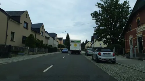
Gasthof zur Eiche
Restaurant · German · 1.6 km
22 Klingenthaler Straße, Auerbach
We-Sa 11:30-21:00; Su,PH 11:30-14:00; Mo,Tu off
Hinterhainer Hutznstub
Restaurant · German · 1.5 km
45C Klingenthaler Straße, Auerbach
Tu,We,Fr 11:30-13:30,17:00+; Tu 17:00+; Sa,Su,PH 11:00-14:00,17:00+
Landgasthof Plohnbachtal
Restaurant · Regional · 5.5 km
23 Rodewischer Straße, Lengenfeld
We-Fr 11:00-21:00; Sa,Su 11:00-14:00,17:00-21:00
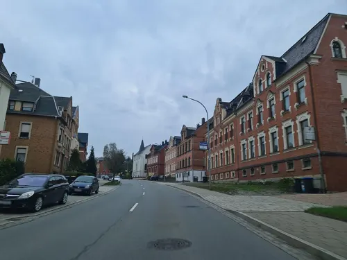
Pizzeria Arcobaleno
Restaurant · Pizza · 3.8 km
58 Ellefelder Straße, Falkenstein/Vogtland
Mo-Su 10:00-22:00
Restaurant Brauschenke
Restaurant · German, Regional · 5.7 km
2 Bergstraße, Steinberg
Fr-We 11:30-21:00
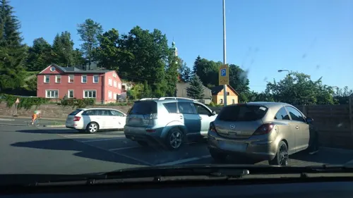
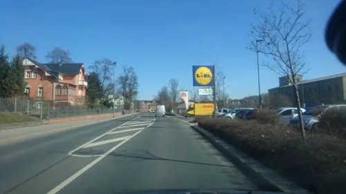


Bäckerei Trützschler
Bakery
16a Göltzschtalstraße, Auerbach/Vogtland
Tu-Fr 06:00-14:00; Mo,Sa,Su,PH off

Bäckerei Trützschler
Bakery · 1.6 km
13 Ottostraße, Auerbach
Tu-Fr 05:30-17:00; Sa 05:00-10:00; Su 06:00-10:00; Mo,PH off
91 more on the map.
Where to stay16
Green Night Hotel
Motel and hotel · 4.7 km
16 Lauterbacher Straße, Falkenstein/Vogtl.
Churches and places of worship25
Evangelisch-Lutherische Kreuzkirche Wildenau
Church · Lutheran · 5.9 km
6 Blumenweg, Steinberg
Königreichssaal Jehovas Zeugen
Church · Jehovahs Witness · 6.3 km
9 Neustädter Straße, Neustadt/Vogtl.
Shopping30
Frischehalle Ellefeld
Grocery · 3.1 km
38 Alte Auerbacher Straße, Ellefeld
Gas and EV charging8
Tank- und Waschcenter Auerbach
Gas station · 2.1 km
111 Klingenthaler Straße, Auerbach
Schools, colleges and libraries15
Berufliches Schulzentrum Vogtland Schulteil für Wirtschaft und Informatik Rodewisch
School · 1.8 km
5 Parkstraße
Healthcare12
Sächsisches Krankenhaus für Psychiatrie und Neurologie Rodewisch
Clinic and pharmacy · 2.2 km
Map of Auerbach
250 places. The map loads OpenStreetMap tiles when you open it.
Getting there and nearby towns
Verkehrslandeplatz Hof-Plauen (HOQ) is the nearest airport with scheduled flights listed in OpenStreetMap, 46 km away.
- Reichenbach/Vogtland 14 km northwest, about 14 min by car
- Plauen 19 km west, about 19 min by car
- Schneeberg 19 km northeast, about 19 min by car
- Oelsnitz 20 km southwest, about 20 min by car
- Wilkau-Haßlau 20 km northeast, about 20 min by car
- Aue 23 km east, about 23 min by car
- Zwickau 25 km north, about 25 min by car
- Werdau 25 km north, about 25 min by car
- Lößnitz 26 km northeast, about 26 min by car
- Schwarzenberg 27 km east, about 27 min by car
Drive times are estimates from straight-line distance, not routes.
Local news
Headlines from INDB.
Reviews, tips and questions
Loading what members have shared...
Sources and licences
- GeoNames (CC BY 4.0): population, coordinates, regions and time zone
- Mapillary (see each image): photos
- OpenStreetMap contributors (ODbL 1.0): places, airports, map data
- Wikidata (CC0 1.0): elevation, founding date, time zone, website, landmarks and historic places
- Wikimedia Commons (see each image): photos
- Wikipedia (CC BY-SA 4.0): overview and history text
Photo credits
- Auerbach Vogtl 015, PeterBraun74, CC BY-SA 3.0
- Kirche Zum Heiligen Kreuz Auerbach, ernstol, CC BY-SA 3.0
- Auerbach (Vogtland), Kursächsische Distanzsäule (1), Manfred Schröter, Berga, CC BY-SA 4.0
- 15.8.2018 Stolperstein von Harry Levy Auerbach Vogtl. Kaiserstraße 19, E.H.M.Plauen, CC BY-SA 4.0
- Ortspyramide Auerbach-Vogtland (1), Dor Jörsch, CC BY-SA 4.0
- 15.8.2018 Stolperstein von Erich Barthel Auerbach Vogtl. Falkensteiner Str. 40, E.H.M.Plauen, CC BY-SA 4.0
- 15.8.2018 Stolperstein von Alfred Seltmann Auerbach Vogtl. Liebknechtstr. 1a, E.H.M.Plauen, CC BY-SA 4.0
- Deutsche Raumfahrtausstellung in Morgenröthe-Rautenkranz, Photographer: Mosbatho, CC BY 4.0
- El-Toro, Micha71, CC BY-SA 3.0
- Steinberg Aussichtsturm, Markscheider, CC BY 3.0
- Auerbach Vogtl 030, PeterBraun74, CC BY-SA 3.0
- Kirche Wernesgrün (5), Aagnverglaser, CC BY-SA 4.0
- Kirche Wildenau 10-02-2013 - panoramio, Rico Baumgärtel, CC BY-SA 3.0
- St.-Petri-Kirche Rodewisch (2), Aagnverglaser, CC BY-SA 4.0
- Auerbach Innenstadt Sankt Laurentius, Michael von Preussen, CC BY-SA 4.0
- NSG Grünheider Hochmoor (6), Aagnverglaser, CC BY 4.0
- Auerbach (Vogtland), Kursächsische Distanzsäule (3) Wappen, Manfred Schröter, Berga, CC BY-SA 4.0
- Ellefeld, Auferstehungskirche - saxony, Lysippos, CC BY-SA 4.0
- Reumtengrün, Kirche (01), Subbass1, CC BY-SA 4.0
- Rodewisch Vogtl 001, PeterBraun74, CC BY-SA 3.0
- Auerbach (Vogtland), Kursächsische Distanzsäule (2), Manfred Schröter, Berga, CC BY-SA 4.0
- Tiergarten Falkenstein 01, Dor Jörsch, CC BY-SA 4.0
- Attagenus schaefferi 398179326, Peter Gabler, CC0
- ISS066-E-112276 - View of Earth, Earth Science and Remote Sensing Unit , Lyndon B. Johnson Space Center, Public domain
- ISS064-E-32104 - View of Earth, Earth Science and Remote Sensing Unit, NASA Johnson Space Center, Public domain
- ISS066-E-112275 - View of Earth, Earth Science and Remote Sensing Unit , Lyndon B. Johnson Space Center, Public domain
- Infotafel Wasserturm Rebesgrün, Dor Jörsch, CC BY-SA 4.0
- Wasserturm Rebesgrün, Dor Jörsch, CC BY-SA 4.0
- Parkbrücke-Rodewisch-20220415 142830, Marcozero, CC BY-SA 4.0
- Rützengrün 01, Dor Jörsch, CC BY-SA 4.0
- Rodewisch Gedenkstätte2 19. 5.2018, E.H.M.Plauen, CC BY-SA 4.0
- Rodewisch Gedenkstätte seitlich 19. 5. 2018, E.H.M.Plauen, CC BY-SA 4.0
- Martin-Luther-Kirche Rützengrün, Dor Jörsch, CC BY-SA 4.0
- Rodewisch, St. Petri, Jehmlich-Orgel, Spieltisch, Siegfried Meyer, CC BY-SA 4.0
- Rodewisch, St. Petri, Jehmlich-Orgel, Siegfried Meyer, CC BY-SA 4.0
- Rodewisch, St. Petri, Jehmlich-Orgel, Firmenschild, Siegfried Meyer, CC BY-SA 4.0
- Ortspyramide Rodewisch neu 02, Dor Jörsch, CC BY-SA 4.0
- Ortspyramide Rodewisch neu 01, Dor Jörsch, CC BY-SA 4.0
- Rützengrün 02, Dor Jörsch, CC BY-SA 4.0
- Rützengrün 04, Dor Jörsch, CC BY-SA 4.0
- Street-level photo, canislupus, CC BY-SA 4.0
- Street-level photo, canislupus, CC BY-SA 4.0
- Street-level photo, canislupus, CC BY-SA 4.0
- Street-level photo, canislupus, CC BY-SA 4.0
- Street-level photo, canislupus, CC BY-SA 4.0
- Street-level photo, canislupus, CC BY-SA 4.0
- Street-level photo, hdmn, CC BY-SA 4.0
- Street-level photo, hdmn, CC BY-SA 4.0
- Street-level photo, hdmn, CC BY-SA 4.0
- Street-level photo, canislupus, CC BY-SA 4.0
- Street-level photo, Senfkorn, CC BY-SA 4.0
- Street-level photo, maikm, CC BY-SA 4.0
- Street-level photo, canislupus, CC BY-SA 4.0
- Street-level photo, canislupus, CC BY-SA 4.0
- Street-level photo, canislupus, CC BY-SA 4.0
- Street-level photo, canislupus, CC BY-SA 4.0
- Street-level photo, hdmn, CC BY-SA 4.0
- Street-level photo, canislupus, CC BY-SA 4.0
- Street-level photo, canislupus, CC BY-SA 4.0
- Street-level photo, canislupus, CC BY-SA 4.0


Page built November 8, 2026. Spotted a mistake? Tell us or suggest a place.