


Why visit Bad Abbach
Townapedia lists 17 museums and landmarks, 15 parks and trails, 61 places to eat, 12 places to stay and 18 attractions in and around town.
Highlights include Dachsberg, Laden zur Selbstbedienung, Prüfening Abbey and Wohnhaus Papst Benedikt XVI..
Weather in Bad Abbach
Forecast from MET Norway (CC BY 4.0). Full forecast
About Bad Abbach
Bad Abbach (German pronunciation: [baːt ˈabax]) is a municipality in the district of Kelheim, Bavaria, Germany. Due to its sulphurous springs it has the status of a spa town.
From the Wikipedia article Bad Abbach (this version), under CC BY-SA 4.0.
Things to do18


Laden zur Selbstbedienung
Farm and orchard · 5.8 km
Selbstbedienungsladenhütte
Mo-Su 07:00-20:00

6 more on the map.
Museums and landmarks17


Wohnhaus Papst Benedikt XVI.
Monument and historic site · 5.8 km
6 Bergstraße, Pentling



Mittelalterlicher Turmhügel "Schlössl" (sog. "Römerschanze")
Monument and historic site · 4.2 km
Aktennummer D-3-7038-0015 Mittelalterlicher Turmhügel "Schlössl" (sog. "Römerschanze"), Früher eine vorgeschichtliche Siedlung.
Strecke 89
Monument and historic site · 5.8 km
Reichsautobahn Strecke 89, Augsburg-Regensburg
5 more on the map.
Parks, trails and playgrounds15

Golf Sinzing am Gut Minoritenhof
Golf course · 4.6 km
18 hole Par 72 + 9 hole Par 29
1 Minoritenhof, Sinzing
Golfanlage Bad Abbach - Deutenhof
Golf course · 4.9 km
18 hole Par 72 + 9 hole Par 28
Gut Deutenhof, Bad Abbach

Kelheimer Yachtclub e.V.
Marina and boat launch · 4.2 km
Km 2403,5 LU, Wasser/Strom, Dusche/WC, Slipanlage





3 more on the map.
Restaurants and cafes61
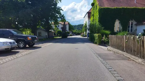
Brauereigaststätte Berghammer
Restaurant · Regional, Bavarian · 2.3 km
55 Donaustraße, Bad Abbach
Apr-Oct: Mo-Sa 11:00+, Su 10:00+, Oct-Mar: Th off || "nach Vereinbarung"
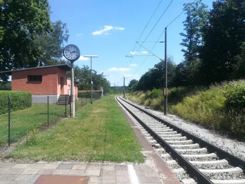
Gasthof Kellner
Restaurant · Regional · 3.1 km
73 Gundelshausener Straße, Kelheim
Mo-Su 08:00-24:00; We off

Gasthaus Zirngibl
Restaurant · Regional
29 Am Markt, Bad Abbach
Tu-Sa 11:00-23:00; Su,PH 11:00-23:00; Mo off
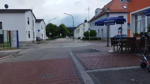
Hotel-Cafe Rathaus
Restaurant · Regional
6 Kaiser-Karl-V.-Allee, Bad Abbach
Mo-Th 11:00-22:00; Su 11:00-18:00
Höhenhof zum Schützenwirt
Restaurant · Regional · 5.0 km
15 Höhenhof, Obertraubling
We-Sa 11:00-23:00; Su 11:00-21:30
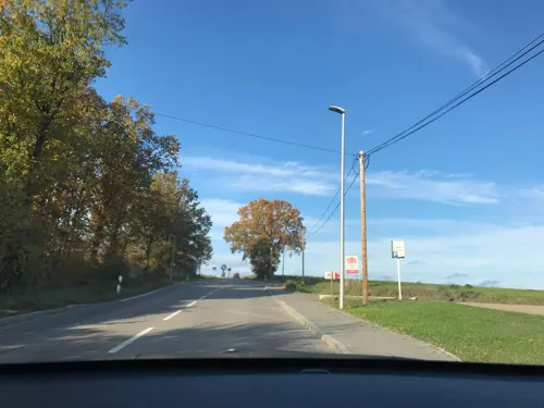
Wirtshaus beim Schweinswirt
Restaurant · Regional · 2.4 km
48 Geberichstraße, Pentling
Mo-Fr 17:00-24:00; Sa,Su 10:30-24:00
Bullen und Bären Restaurant & Bar
Restaurant · 4.4 km
35 Römerbruchstraße, Kelheim
Mo 17:00-22:00; We-Fr 17:00-22:00, Sa 17:00-23:00; Su 11:30-14:00,...


Waldwiese
Restaurant · Regional · 6.1 km
42 Bruckdorfer Straße, Sinzing
Mo-Sa 17:00-22:00; Tu off; We off; Su 11:00-20:00
49 more on the map.
Where to stay12
Churches and places of worship33
St. Johannes der Täufer
Church · Catholic · 5.1 km
10 Schulstraße, Pentling
Maria Immaculata
Church · Roman Catholic · 4.5 km
5 Marienplatz, Kelheim
St. Bartholomäus
Church · Roman Catholic · 3.5 km
12 Kirchstraße, Bad Abbach
Zur Schmerzhaften Muttergottes
Church · Roman Catholic · 2.7 km
1 Frauenbründl, Bad Abbach
Shopping15
Gas and EV charging14
Schools, colleges and libraries6
Healthcare8
Map of Bad Abbach
199 places. The map loads OpenStreetMap tiles when you open it.
Getting there and nearby towns
Flugplatz Straubing-Wallmühle (RBM) is the nearest airport with scheduled flights listed in OpenStreetMap, 35 km away.
- Regensburg 10 km northeast, about 10 min by car
- Kelheim 12 km west, about 12 min by car
- Lappersdorf 13 km north, about 13 min by car
- Neutraubling 13 km northeast, about 13 min by car
- Regenstauf 21 km north, about 21 min by car
- Neustadt an der Donau 25 km southwest, about 25 min by car
- Maxhütte-Haidhof 29 km north, about 29 min by car
- Burglengenfeld 30 km north, about 30 min by car
- Straubing 39 km east, about 39 min by car
- Mainburg 38 km southwest, about 38 min by car
Drive times are estimates from straight-line distance, not routes.
Local news
Headlines from INDB.
Reviews, tips and questions
Loading what members have shared...
Sources and licences
- GeoNames (CC BY 4.0): population, coordinates, regions and time zone
- Mapillary (see each image): photos
- OpenStreetMap contributors (ODbL 1.0): places, airports, map data
- Wikidata (CC0 1.0): elevation, founding date, time zone, website, landmarks and historic places
- Wikimedia Commons (see each image): photos
- Wikipedia (CC BY-SA 4.0): overview and history text
Photo credits
- Aerial image of the Prüfening Abbey (view from the southwest), Carsten Steger, CC BY-SA 4.0
- Ruine-obermuenster-regensburg, sue107, CC BY-SA 3.0
- Campus OTH Regensburg, K4210, CC BY-SA 3.0
- Universität Regensburg Forum, High Contrast, CC BY 3.0 de
- Bad Abbach Innenstadt, Reise-Line, CC BY-SA 3.0
- Regensburg Universitaetsklinikum, Manuel Strehl, CC BY-SA 2.5
- St. Josef (Ziegetsdorf), MagnusBB, CC BY-SA 3.0
- 15.04.20 Pentling St.Johannes, Gehsport-sepp ( Diskussion ), CC BY-SA 4.0
- Bad-Abbach-Christophorus-Kapelle, Elcom.stadler, CC BY-SA 3.0
- Frauenbründl Kapelle 01, H.Helmlechner, CC BY-SA 4.0
- 14.07.19 Lengfeld St.Bartolomä, Gehsport-sepp ( Diskussion ), CC BY-SA 4.0
- 14.07.19 Saalhaupt St.Peter u. Paul, Gehsport-sepp ( Diskussion ), CC BY-SA 4.0
- 13.08.01 Kapfelberg Maria Immaculata, Gehsport-sepp ( Diskussion ), CC BY-SA 4.0
- 13.04.25 Sinzing Mariä Himmelfahrt, Gehsport-sepp ( Diskussion ), CC BY-SA 4.0
- 13.04.25 Bruckdorf Hl.Kreuz, Gehsport-sepp ( Diskussion ), CC BY-SA 4.0
- Kreuzkirche Bad Abbach, H.Helmlechner, CC BY-SA 4.0
- Pfarrkirche Mariä Himmelfahrt Sinzing 01, H.Helmlechner, CC BY-SA 4.0
- D-R-Oberndorf1, Szeder László, CC BY-SA 4.0
- Wohnhaus Papst Benedikt XVI., Pentling 04, Derbrauni, CC BY-SA 4.0
- Bad Abbach Burg, Reise-Line, CC BY-SA 3.0
- St. Johannes Pentling 01, Helmlechner, CC0
- Mariä Himmelfahrt (Sinzing), Kd6=dra, CC0
- Heinrichsturm (Reste Burgmauer), luckyprof, CC BY-SA 3.0
- Street-level photo, changchun1, CC BY-SA 4.0
- Street-level photo, zugnomade, CC BY-SA 4.0
- Street-level photo, wegatest, CC BY-SA 4.0
- Street-level photo, changchun1, CC BY-SA 4.0
- Street-level photo, buchenhaus, CC BY-SA 4.0
- Street-level photo, changchun1, CC BY-SA 4.0
- Street-level photo, wegatest, CC BY-SA 4.0
- Street-level photo, AR88, CC BY-SA 4.0
- Street-level photo, geoeki, CC BY-SA 4.0
- Street-level photo, geoeki, CC BY-SA 4.0
- Street-level photo, changchun1, CC BY-SA 4.0
- Street-level photo, ramap, CC BY-SA 4.0
- Street-level photo, changchun1, CC BY-SA 4.0
- Street-level photo, it_s_so_funny, CC BY-SA 4.0
- Street-level photo, rnissl, CC BY-SA 4.0
- Street-level photo, rnissl, CC BY-SA 4.0
- Street-level photo, geoeki, CC BY-SA 4.0
- Street-level photo, changchun1, CC BY-SA 4.0
- Street-level photo, AR88, CC BY-SA 4.0
- Street-level photo, wegatest, CC BY-SA 4.0
- Street-level photo, wegatest, CC BY-SA 4.0
- Street-level photo, changchun1, CC BY-SA 4.0
- Street-level photo, wegatest, CC BY-SA 4.0
- Street-level photo, changchun1, CC BY-SA 4.0


Page built November 8, 2026. Spotted a mistake? Tell us or suggest a place.