


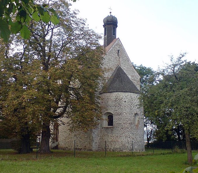


Why visit Neutraubling
Townapedia lists 3 museums and landmarks, 17 parks and trails, 49 places to eat, 4 places to stay and 2 attractions in and around town.
Highlights include MarOle’s Hofladen, Donaustauf Castle and Walhalla memorial.
Weather in Neutraubling
Forecast from MET Norway (CC BY 4.0). Full forecast
About Neutraubling
Neutraubling (German pronunciation: [nɔʏˈtʁaʊplɪŋ] ) is a town in the state of Bavaria in southern Germany, in the district of Regensburg.
From the Wikipedia article Neutraubling (this version), under CC BY-SA 4.0.
Things to do2


Museums and landmarks3

Donaustauf Castle
Monument and historic site · 4.9 km
Building in Donaustauf, Upper Palatinate, Germany

Walhalla memorial
Monument and historic site · 5.2 km
Memorial in Donaustauf, Bavaria

Parks, trails and playgrounds17



5 more on the map.
Restaurants and cafes49

Burek & Pite Kalambura
Restaurant · Balkan · 0.6 km
24 Sudetenstraße
Mo-Fr 06:00-20:00; Sa-Su 08:00-18:00


Gasthof & Pension Deutsch
Restaurant · Bavarian · 1.8 km
15 Straubinger Straße, Barbing
Mo 10:00-15:00; Tu-Th 10:00-23:00; Fr,Sa 10:00-24:00; Su 10:00-21:00
Restaurant Dalmacija
Restaurant · Croatian · 0.7 km
9 Haidauer Straße, Neutraubling
Tu-Sa 17:00-22:00; Su 11:00-15:00,17:00-20:00 || "Küchenschluss...
Restaurant Dubrovnik by Mile
Restaurant · Balkan
6 Sudetenstraße, Neutraubling
Mo, We-Fr 11:00-14:00, 17:00-22:00; Sa, Su, PH 11:00-22:00
Tennisstüberl
Restaurant · German · 1.1 km
10 Moosgrabenstraße, Neutraubling
Mo-Sa 17:00-22:00; Su 10:00-22:00
Vereinsgaststätte TSV Wacker 50 e.V. Neutraubling
Restaurant · Regional · 1.3 km
1 Am Sportpark, Neutraubling
Tu-Fr 16:00-01:00, Sa,Su 10:00-01:00


37 more on the map.
Where to stay4
Churches and places of worship10
St. Michael
Church · Catholic · 0.7 km
6 Sankt-Michael-Platz, Neutraubling
St. Coloman
Church · Roman Catholic · 2.1 km
26 Neutraublinger Straße, Regensburg
Shopping21
Gas and EV charging11
Schools, colleges and libraries5
Healthcare5
Map of Neutraubling
127 places. The map loads OpenStreetMap tiles when you open it.
Getting there and nearby towns
Flugplatz Straubing-Wallmühle (RBM) is the nearest airport with scheduled flights listed in OpenStreetMap, 25 km away.
- Regensburg 8 km northwest, about 8 min by car
- Regenstauf 16 km north, about 16 min by car
- Straubing 30 km southeast, about 30 min by car
- Roding 33 km northeast, about 33 min by car
- Plattling 54 km southeast, about 54 min by car
- Wolnzach 60 km southwest, about 1 h by car
- Vilsbiburg 61 km south, about 1 h by car
- Ingolstadt 62 km southwest, about 1 h by car
- Sulzbach-Rosenberg 66 km northwest, about 1 h by car
- Regen 68 km east, about 1 h 15 min by car
Drive times are estimates from straight-line distance, not routes.
Local news
Headlines from INDB.
Reviews, tips and questions
Loading what members have shared...
Sources and licences
- GeoNames (CC BY 4.0): population, coordinates, regions and time zone
- Mapillary (see each image): photos
- OpenStreetMap contributors (ODbL 1.0): places, airports, map data
- Wikidata (CC0 1.0): elevation, founding date, time zone, website, landmarks and historic places
- Wikimedia Commons (see each image): photos
- Wikipedia (CC BY-SA 4.0): overview and history text
Photo credits
- Neutraubling St.-Michaels-Platz, Helmlechner, CC BY-SA 4.0
- Burg bei Donaustauf 3, Bkmd, Public domain
- Walhalla-Memorial 01, SimonWaldherr, CC BY-SA 4.0
- Kreuzhofkapelle (1), Hersendis, Public domain
- StPeterLerchenfeld, AxeEffect, CC BY-SA 3.0
- Harting Kirche St Coloman, Unknown author, CC BY-SA 3.0
- LutherkircheNeutraubling, AxeEffect, CC BY-SA 3.0
- St. Maria (Irl) Regensburg 2014, Johanning, CC BY-SA 3.0
- PfarrkircheNeutraubling, AxeEffect, CC BY-SA 3.0
- Barbing-Kirche-Sankt-Martin, Elcom.stadler, CC BY-SA 3.0
- Griposia aprilina, Franz 1960, CC0
- ISS040-E-16010 - View of Earth, Earth Science and Remote Sensing Unit , Lyndon B. Johnson Space Center, Public domain
- ISS067-E-123445 - View of Earth, Earth Science and Remote Sensing Unit , Lyndon B. Johnson Space Center, Public domain
- ISS066-E-82056 - View of Earth, Earth Science and Remote Sensing Unit , Lyndon B. Johnson Space Center, Public domain
- ISS065-E-382108 - View of Earth, Earth Science and Remote Sensing Unit , Lyndon B. Johnson Space Center, Public domain
- ISS065-E-382106 - View of Earth, Earth Science and Remote Sensing Unit , Lyndon B. Johnson Space Center, Public domain
- ISS065-E-382107 - View of Earth, Earth Science and Remote Sensing Unit , Lyndon B. Johnson Space Center, Public domain
- ISS015-E-27001 - View of Earth, Earth Science and Remote Sensing Unit , Lyndon B. Johnson Space Center, Public domain
- ISS047-E-69718 - View of Earth, Earth Science and Remote Sensing Unit , Lyndon B. Johnson Space Center, Public domain
- Prince Ludwig who initiated the monument, Ddesilva1992, CC BY-SA 4.0
- Barbing - panoramio (6), Hans100, CC BY 3.0
- Street-level photo, tbeckler, CC BY-SA 4.0
- Street-level photo, rnissl, CC BY-SA 4.0
- Street-level photo, tbeckler, CC BY-SA 4.0
- Street-level photo, SuedOstLink, CC BY-SA 4.0
- Street-level photo, plonma1, CC BY-SA 4.0


Page built November 8, 2026. Spotted a mistake? Tell us or suggest a place.