


Why visit Bad Camberg
Townapedia lists 52 museums and landmarks, 20 parks and trails, 89 places to eat, 5 places to stay and 25 attractions in and around town.
Highlights include Obertorturm, Hofladen Taunushof Volz, Stadtmauer and Bagges.
Weather in Bad Camberg
Forecast from MET Norway (CC BY 4.0). Full forecast
About Bad Camberg
Bad Camberg (German: [baːt ˈkambɛʁk] ) is, with 14,500 inhabitants, the second largest town in Limburg-Weilburg district in Hesse, Germany, as well as the southernmost town in the Regierungsbezirk of Gießen. It is located in the eastern Taunus in the Goldener Grund (“Golden Ground”) some 30 km north of Wiesbaden, 18 km southeast of Limburg an der Lahn, and 44 km northwest of Frankfurt, as well as on the German Timber-Frame Road. Bad Camberg is the central community of the Goldener Grund with good infrastructure, and a lower centre partly with a middle centre's function.
From the Wikipedia article Bad Camberg (this version), under CC BY-SA 4.0.
Things to do25


Hofladen Taunushof Volz
Farm and orchard · 6.1 km
5 Hohe Straße, Idstein
Fr 16:00-18:00; Sa 10:00-12:00



13 more on the map.
Museums and landmarks52





Alte Amtsapotheke
Monument and historic site
4 Am Amthof, Bad Camberg

Kulturzentrum "Alte Kirche"
Museum · 5.2 km
22 Alois-Born-Straße, Selters (Taunus)



Alte Poststraße
Monument and historic site · 5.9 km
August 2025, sichtbare Pfadspur, gut passierbar, Hohlweg, Hindernisse umgehbar
40 more on the map.
Parks, trails and playgrounds20



Spielplatz Waldems/Steinfischbach
Playground · 5.7 km
Mo-Su 10:00-18:00



8 more on the map.
Restaurants and cafes89

Kurhaus Bad Camberg
Restaurant · Croatian
Küche von 11:00-14:00 und 17:00-22:00
2 Chambray-lès-Tours-Platz, Bad Camberg
Tu-Su 11:00-23:00; Mo off
Morcher Mühle
Restaurant · Regional · 3.6 km
Landgasthof. Durchgehend warme Küche. Sonntags Brunch 10:30-15:00.
1, Idstein
Tu-Sa 17:00-22:00; Su 11:30-22:00; Mo off

Pizzeria Bacco
Restaurant · Pizza, Italian · 1.6 km
Kleine Pizzeria
146 Frankfurter Straße, Bad Camberg
Mo-Su 11:30-14:00,17:00-22:30
Zum Schwarzen Hahn
Restaurant · International · 5.3 km
(Am Sportplatz)
32 Am Forsthaus, Hünstetten
Mo-Fr 17:30-23:00; Sa 16:00-22:00; Su,PH 11:00-22:00; We off
Zum schwarzen Roß
Restaurant · German, Pizza, International, Pasta, Pakistani · 1.7 km
Seit 1996 bin ich Inhaber des Restaurants "Zum Schwarzen Ross".Zusammen mit meinem erfahrenen Team biete ich Ihnen ein großes Angebot an...
148 Frankfurter Straße, Bad Camberg
Mo-Su 11:00-14:00,17:30-22:30

Amthof Cafe
Cafe · Coffee Shop, Mittagstisch
10 Obertorstraße, Bad Camberg
Mo-We, Fr-Sa 09:00-18:00; Su 10:00-18:00; Th 14:00-00:00
Bürgerhaus Oberselters
Restaurant · Italian, Pizza · 3.5 km
1 Am Emsbach, Bad Camberg
Th-Tu 11:00-14:30,17:00-23:00; Apr-Sep Sa,Su 11:00-23:00; We off
Gaststätte Gilberg
Restaurant · German · 4.7 km
5 Wörsbachstraße, Hünstetten
Tu-Sa 17:30+; Su 10:30-14:30,17:30+; Mo off
Gut Henriettenthal
Restaurant · German, Tapas, Burger · 4.5 km
10 Am Nassen Berg, Idstein
Oct-Mar 12:00+; Apr-Sep 11:00+
Sankt Josefshaus
Restaurant · International, Pizza, Italian
13 Marktplatz, Bad Camberg
Mo-Su 11:30-14:30,17:00-22:00; Tu off
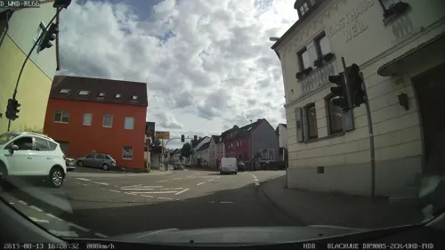


Sellinis Café und Eisparadies
Cafe · Breakfast, Coffee Shop, Ice Cream · 1.7 km
161 Limburger Straße
Th 18:00-21:30; Fr 09:00-13:30,18:00-21:30; Sa 09:00-17:00; Su 14:00-18:00
77 more on the map.
Where to stay5
Frühstücks-Pension Schikowsky
Motel and hotel · 3.5 km
13 An der Siebenmeisterbrücke, Idstein
Churches and places of worship35
St. Georg
Church · Catholic · 2.3 km
1 Heiligenwaldstraße, Bad Camberg
Pfarrkirche Dombach St. Wendelin
Church · Catholic · 3.8 km
4 Hauptstraße, Bad Camberg
Shopping22
Gas and EV charging11
Schools, colleges and libraries10
Mittelpunktschule Goldener Grund
School · 5.1 km
10 Goethestraße, Selters (Taunus)
Healthcare6
Map of Bad Camberg
250 places. The map loads OpenStreetMap tiles when you open it.
Getting there and nearby towns
Wiesbaden Army Airfield (WIE) is the nearest airport with scheduled flights listed in OpenStreetMap, 28 km away.
- Niedernhausen 15 km south, about 15 min by car
- Neu-Anspach 17 km east, about 17 min by car
- Königstein im Taunus 19 km southeast, about 19 min by car
- Eppstein 19 km southeast, about 19 min by car
- Usingen 20 km east, about 20 min by car
- Weilburg 21 km north, about 21 min by car
- Hadamar 23 km northwest, about 23 min by car
- Wiesbaden 24 km south, about 24 min by car
- Klarenthal 24 km south, about 24 min by car
- Schwalbach am Taunus 25 km southeast, about 25 min by car
Drive times are estimates from straight-line distance, not routes.
Local news
Headlines from INDB.
Reviews, tips and questions
Loading what members have shared...
Sources and licences
- GeoNames (CC BY 4.0): population, coordinates, regions and time zone
- Mapillary (see each image): photos
- OpenStreetMap contributors (ODbL 1.0): places, airports, map data
- Wikidata (CC0 1.0): elevation, founding date, time zone, website, landmarks and historic places
- Wikimedia Commons (see each image): photos
- Wikipedia (CC BY-SA 4.0): overview and history text
Photo credits
- Stolperstein Bad Camberg Frankfurter Straße 34 Arnold Krings, Gmbo 2013, CC0
- Stolpersteinlage Bad Camberg Frankfurter Straße 34, Gmbo 2013, CC0
- Stolpersteinlage Bad Camberg Frankfurter Straße 32, Gmbo 2013, CC0
- Stolperstein Bad Camberg Neumarkt 1 Franz Hollingshaus, Gmbo 2013, CC0
- Stolperstein Bad Camberg Neumarkt 1 Josef Hollingshaus, Gmbo 2013, CC0
- Stolpersteine Bad Camberg Neumarkt 1, Gmbo 2013, CC0
- Stolpersteinlage Bad Camberg Neumarkt 1, Gmbo 2013, CC0
- Stolperstein Bad Camberg Frankfurter Straße 32 Hedwig May, Gmbo 2013, CC0
- Stolperstein Bad Camberg Frankfurter Straße 32 Moritz May, Gmbo 2013, CC0
- Stolpersteine Bad Camberg Frankfurter Straße 32, Gmbo 2013, CC0
- Bad Camberg, Schmiedgasse 6, Gmbo 2013, CC BY-SA 4.0
- Bad Camberg, Schmiedgasse 4 Mahntafel zerstörte Synagoge, Gmbo 2013, CC BY-SA 4.0
- Bad Camberg - Fachwerkstraße, Oliver Abels ( SBT ), CC BY 2.5
- Bad Camberg, Schmiedgasse 2 Seite, Gmbo 2013, CC BY-SA 4.0
- Bad Camberg, Schmiedgasse 2, Gmbo 2013, CC BY-SA 4.0
- Bad Camberg - Unterturm, Oliver Abels ( SBT ), CC BY 2.5
- Stolperstein Bad Camberg Neumarkt 11 Johanna Liebmann, Gmbo 2013, CC0
- Stolperstein Bad Camberg Neumarkt 11 David Liebmann, Gmbo 2013, CC0
- Stolpersteine Bad Camberg Neumarkt 11, Gmbo 2013, CC0
- Stolpersteinlage Bad Camberg Neumarkt 11, Gmbo 2013, CC0
- Bad Camberg - Rathaus, Oliver Abels ( SBT ), CC BY 2.5
- Bad Camberg, Kirchgasse 1, Gmbo 2013, CC BY-SA 4.0
- Bad Camberg - Marktplatz, Oliver Abels ( SBT ), CC BY 2.5
- Bad Camberg, Kirchstraße 3, Rolf Kranz, CC BY-SA 4.0
- Bad Camberg - Klösterchen und Kirche, Oliver Abels ( SBT ), CC BY 2.5
- Bad Camberg 2 - panoramio, till.karsten, CC BY-SA 3.0
- Stolpersteinlage Bad Camberg Obertorstraße 11, Gmbo 2013, CC0
- Bad Camberg 1 - panoramio, till.karsten, CC BY-SA 3.0
- Stolperstein Bad Camberg Obertorstraße 11 Recha Oppenheimer, Gmbo 2013, CC0
- Bad Camberg, Amthof mit Obertorturm (Bad Camberg, Amthof with Obertorturm) - geo.hlipp.de - 17680, Helmut Zozmann on geo.hlipp.de, CC BY-SA 2.0
- Stolpersteinlage Bad Camberg Mühlweg 14, Gmbo 2013, CC0
- Stolperstein Bad Camberg Mühlweg14 Ernst Löwenberg, Gmbo 2013, CC0
- Stolpersteine Bad Camberg Frankfurter Straße 8, Gmbo 2013, CC0
- Stolpersteinlage Bad Camberg Frankfurter Straße 8, Gmbo 2013, CC0
- Bad Camberg - Obertor 2, Oliver Abels ( SBT ), CC BY 2.5
- Kreuzkapelle Bad Camberg aussen, Frank Winkelmann, CC BY 3.0
- Bad Camberg, Freiherr von Schütz-Schule, Altbau, Karsten Ratzke, CC0
- Kirche Walsdorf, Frank Winkelmann, CC BY 3.0
- Burg-Wallrabenstein-JR-A40-0669-2009-06-13, Johannes Robalotoff, CC BY-SA 3.0 de
- Kloster Gnadenthal, Karsten Ratzke, CC0
- Kuhbett im Östlichen Hintertaunus, Hoscher, Public domain
- Stückelberg, privat, Public domain
- Nassauer Hof - Scheuer Wörsdorf, Frank Winkelmann, CC BY 3.0
- Kirche Wörsdorf 114, Frank Winkelmann, CC BY 3.0
- Bad Camberg - Amtsapotheke, Oliver Abels ( SBT ), CC BY 2.5
- Bad Camberg, Hohenfeld-Kapelle, Karsten Ratzke, CC0
- Bad Camberg, Oberes Dombachtal (3), Karsten Ratzke, CC0
- Bad Camberg, ehemaliger Stadtturm Hainstraße, Karsten Ratzke, CC0
- Bad Camberg - Obertor, Oliver Abels ( SBT ), CC BY 2.5
- Dombach St.Wendelin außen, Volker Thies ( Asdrubal ), CC BY 2.5
- St Georg Schwickershausen, Volker Thies ( Asdrubal ), CC BY-SA 3.0
- Niederselters alte Kirche, Volker Thies ( Asdrubal ), CC BY-SA 3.0
- Wallrabenstein, Peterskirche, Karsten Ratzke, CC0
- Esch, Kriegerdenkmal, Karsten Ratzke, CC0
- Esch Kirche, Karsten11, Public domain
- Steinfischbach, Kirche, Karsten Ratzke, CC0
- Steinfischbach, Usinger Straße 2, Karsten Ratzke, CC0
- Wörsdorf, Katholische Pfarrkirche Nikolaus-von-Flüe-Friedenskirche, Karsten Ratzke, CC0
- Bad Camberg, Kreuzweg zur Kreuzkapelle, Station 1, Karsten Ratzke, CC0
- Street-level photo, b166er, CC BY-SA 4.0
- Street-level photo, b166er, CC BY-SA 4.0
- Street-level photo, basxto, CC BY-SA 4.0
- Street-level photo, b166er, CC BY-SA 4.0
- Street-level photo, mapcreator, CC BY-SA 4.0
- Street-level photo, b166er, CC BY-SA 4.0
- Street-level photo, b166er, CC BY-SA 4.0
- Street-level photo, b166er, CC BY-SA 4.0
- Street-level photo, b166er, CC BY-SA 4.0
- Street-level photo, basxto, CC BY-SA 4.0
- Street-level photo, soulcover, CC BY-SA 4.0
- Street-level photo, b166er, CC BY-SA 4.0
- Street-level photo, basxto, CC BY-SA 4.0
- Street-level photo, b166er, CC BY-SA 4.0
- Street-level photo, b166er, CC BY-SA 4.0
- Street-level photo, b166er, CC BY-SA 4.0
- Street-level photo, b166er, CC BY-SA 4.0
- Street-level photo, b166er, CC BY-SA 4.0
- Street-level photo, b166er, CC BY-SA 4.0
- Street-level photo, b166er, CC BY-SA 4.0
- Street-level photo, b166er, CC BY-SA 4.0
- Street-level photo, mapcreator, CC BY-SA 4.0
- Street-level photo, mapcreator, CC BY-SA 4.0
- Street-level photo, b166er, CC BY-SA 4.0


Page built November 8, 2026. Spotted a mistake? Tell us or suggest a place.