


Why visit Klarenthal
Townapedia lists 59 museums and landmarks, 25 parks and trails, 290 places to eat, 10 places to stay and 20 attractions in and around town.
Highlights include Tier- und Pflanzenpark Fasanerie, Gustav Vietor Tower, Frauen Museum Wiesbaden and Leichtweißhöhle.
Weather in Klarenthal
Forecast from MET Norway (CC BY 4.0). Full forecast
About Klarenthal
Klarenthal is a borough of Wiesbaden, capital of the federal state of Hesse, Germany. The community, situated on the slopes of the Taunus Mountains, was planned by architect and urban planner Ernst May in the style of a commuter town in the early 1960s. It was built on free arable land between the railway line to Bad Schwalbach and Klarenthaler Straße, overlooking the city center of Wiesbaden proper. Klarenthal consists mainly of large multi-family homes and residential high-rise buildings, surrounded with much green space, as well as many townhouses.
From the Wikipedia article Klarenthal (this version), under CC BY-SA 4.0.
Things to do20

Tier- und Pflanzenpark Fasanerie
Zoo and aquarium · 2.0 km
22 Wilfried-Ries-Straße, Wiesbaden
Apr-Oct 09:00-18:00; Nov-Mar 09:00-16:00

Gustav Vietor Tower
Monument and historic site · 5.2 km
Former observation tower in Taunusstein, Hesse, Germany
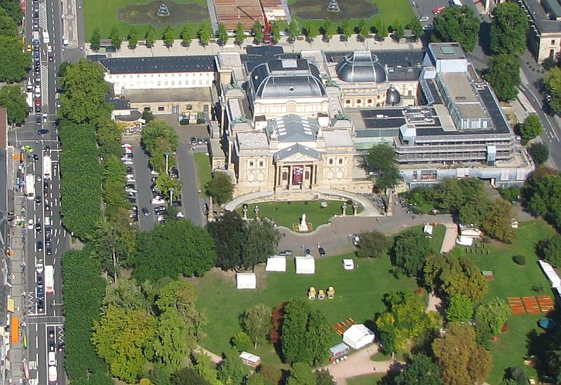
Hessisches Staatstheater Wiesbaden
Cinema and theater · 3.2 km
Theatre and opera house in Wiesbaden, Germany




Blick zur 'Hohen Wurzel'
Scenic view · 2.6 km
Ziemlich zugewachsen, der Fernsehturm ist in der Ferne zu sehen

8 more on the map.
Museums and landmarks59



Dotzheimer Museum
Museum · 1.7 km
We 17:00-19:00; Su 10:00-12:00; SH off


Reinhard Ernst Museum
Museum · 3.3 km
Art museum for abstract art in Wiesbaden, Hesse, Germany


47 more on the map.
Parks, trails and playgrounds25

Frei- und Hallenbad Kleinfeldchen
Sports field and stadium · 1.4 km
9 Hollerbornstraße, Wiesbaden
Mo,Tu,Th,Fr 07:00-21:45; Sa 10:00-18:00; Su 08:00-10:00,14:00-18:00






13 more on the map.
Restaurants and cafes290

Harput
Restaurant · Turkish · 2.4 km
Restaurant extends to neighboring buildings Bleichstrasse 7 and 11
9 Bleichstraße, Wiesbaden
Mo-Th 11:00-23:00,Fr-Sa 11:00-02:00,Su 11:00-23:00; PH off
Pizzeria Bacco
Restaurant · Pizza, Burger · 2.4 km
Derzeit nur Lieferando-Bestellungen / Currently Lieferando delivery only
35 Dotzheimer Straße, Wiesbaden
Tu-Su 11:30-22:30
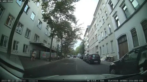
Pizzeria bei Simon
Restaurant · Pizza, Italian Pizza, Burger, Tapas, Kebab, Salad, Pasta · 2.3 km
10 Kastellstraße, Wiesbaden
Mo-Su 18:00-01:00
Red Onion
Restaurant · Pizza, Indian, American · 2.4 km
Derzeit Bestellungen über Lieferando / Currently Lieferando delivery service
35 Dotzheimer Straße, Wiesbaden
Tu-Su 11:30-22:30
Äbbelwoi Schmidt
Restaurant · German · 1.0 km
17 Bornhofenweg, Wiesbaden
Th-Sa 16:00-21:30; Su 14:00-21:30
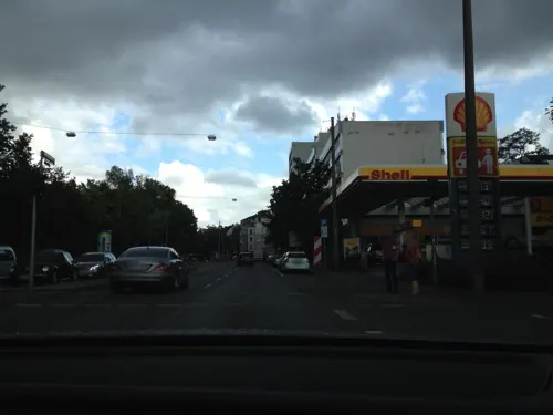
Alt Wiesbaden
Restaurant · Italian · 1.6 km
17 Kurt-Schumacher-Ring, Wiesbaden
Mo-Fr 11:30-14:00,17:30-23:00; Sa 17:30-23:00; Su 11:30-14:00,17:30-22:00
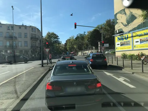


Bodega De Musica
Restaurant · Spanish, Tapas · 2.5 km
69 Schwalbacher Straße, Wiesbaden
Mo-Sa 18:00-01:00

Bäcker Dries - Rheingau
Bakery · 1.8 km
116 Dotzheimer Straße, Wiesbaden
Mo-Fr 06:30-18:00; Sa 06:30-17:00; Su 07:30-13:00
Café de Colombia
Restaurant · Colombian · 2.4 km
37 Dotzheimer Straße, Wiesbaden
Mo-Fr 07:30-19:00; Sa 08:30-14:00
278 more on the map.
Where to stay10
Churches and places of worship41
Ev. Kirche Klarenthal
Church · Protestant · 0.9 km
12 Am Kloster Klarenthal, Wiesbaden
Shopping69
Gas and EV charging9
Freie Tankstelle Klarenthaler Straße
Gas station · 1.2 km
44 Klarenthaler Straße, Wiesbaden
Schools, colleges and libraries41
Hessische Hochschule für öffentliches Management und Sicherheit
School · 0.9 km
100 Schönbergstraße, Wiesbaden
Mauritius-Mediathek mit Stadt- und Musikbibliothek Wiesbaden sowie Medienzentrum
Library · 2.6 km
6-10 Hochstättenstraße, Wiesbaden
Healthcare17
Map of Klarenthal
250 places. The map loads OpenStreetMap tiles when you open it.
Getting there and nearby towns
Wiesbaden Army Airfield (WIE) is the nearest airport with scheduled flights listed in OpenStreetMap, 10 km away.
- Nerotal map
- Wiesbaden 3 km east, about 3 min by car
- Niedernhausen 11 km northeast, about 11 min by car
- Mainz 13 km southeast, about 13 min by car
- Kriftel 19 km east, about 19 min by car
- Raunheim 20 km southeast, about 20 min by car
- Königstein im Taunus 22 km northeast, about 22 min by car
- Königstädten 23 km southeast, about 23 min by car
- Trebur 23 km southeast, about 23 min by car
- Nauheim 24 km southeast, about 24 min by car
- Schwalbach am Taunus 25 km east, about 25 min by car
Drive times are estimates from straight-line distance, not routes.
Local news
Headlines from INDB.
Reviews, tips and questions
Loading what members have shared...
Sources and licences
- GeoNames (CC BY 4.0): population, coordinates, regions and time zone
- Mapillary (see each image): photos
- OpenStreetMap contributors (ODbL 1.0): places, airports, map data
- Wikidata (CC0 1.0): elevation, founding date, time zone, website, landmarks and historic places
- Wikimedia Commons (see each image): photos
- Wikipedia (CC BY-SA 4.0): overview and history text
Photo credits
- Gleise der Aartalbahn in Klarenthal-Dotzheim, ManuelB701, CC0
- Wiesbaden Klarenthal - ev Kapelle, Oliver Abels ( SBT ), CC BY-SA 3.0
- Wiesbaden Klarenthal - Ehrenmal, Oliver Abels ( SBT ), CC BY-SA 3.0
- Wellritzbach beim Kloster Klarenthal 01, Hans Kastellano, CC BY-SA 4.0
- Wiesbaden Klarenthal - Ökonomiegebäude, Oliver Abels ( SBT ), CC BY-SA 3.0
- Wellritzbach beim Kloster Klarenthal 02, Hans Kastellano, CC BY-SA 4.0
- Wiesbaden Klarenthal - Scheune (1854), Oliver Abels ( SBT ), CC BY-SA 3.0
- Luftbild Wiesbaden Hessisches Staatstheater IMG 0130, Wolfgang Pehlemann at de.wikipedia, CC BY-SA 3.0 de
- Wiesbaden Schiersteiner Brücke 2013-08 Gesamt 2, Oliver Abels ( SBT ), CC BY-SA 3.0
- Museum Wiesbaden 2019, Museumwiesbaden, CC BY-SA 4.0
- Museum Reinhard Ernst Wiesbaden 8376 7 8, Welt-der-Form, CC BY-SA 4.0
- MK10831 Nerotalanlagen, Martin Kraft, CC BY-SA 3.0
- Bowling Green, Wiesbaden, Basti007, CC BY-SA 3.0
- Kurhaus Parkseite 100Jahr 0212, Pedelecs, CC BY 3.0
- Ein Wiese in Rabengrund, T, CC BY-SA 3.0
- BD 130424-Warmer Damm Wiesbaden-IMG 1153, Benjamin Dahlhoff, CC BY-SA 3.0
- Ringkirche 2025, Martin Fisch, CC BY 4.0
- Schierstein - Christophoruskirche, Oliver Abels ( SBT ), CC BY 2.5
- AnglikanischeKircheWiesbaden, Unbekannter Fotograf vor 1887, Public domain
- 2010-03-02 Herz-Jesu-Kirche Wiesbaden-Sonnenberg 01, Wo st 01 (There are 682 Pictures in my Category ) See also Toolserver, CC BY-SA 3.0 de
- Lutherkirche wiesbaden 1, Toddy, Public domain
- Luftbild Neroberg Opelbad russisch-orthodoxe Kirche 2008, de:User:Wolfgang Pehlemann Wiesbaden, CC BY-SA 3.0 de
- Hochschule RheinMain Wiesbaden Bleichstrasse, Oliver Abels ( SBT ) modified by xavax, CC BY 2.5
- Wiesbaden - Altkatholische Friedenskirche, Oliver Abels ( SBT ), CC BY 2.5
- Wiesbaden - Maria Hilf Kirche, Oliver Abels ( SBT ), CC BY 2.5
- Fasanerie fg03, Fritz Geller-Grimm, CC BY-SA 3.0
- HSK-Wiesbaden, Amras wi at German Wikipedia, Public domain
- Wiesbaden Leichtweishöhle, Oliver Abels ( SBT ), CC BY-SA 3.0
- Sankt-Elisabeth-Kirche Wiesbaden 01, Wo st 01 (There are 682 Pictures in my Category ) See also Toolserver, CC BY-SA 3.0 de
- WI-V-317H 2011-07-10, M. Burggraf, CC BY-SA 3.0
- Wiesbaden Leibnizschule, Oliver Abels ( SBT ), CC BY-SA 3.0
- Alicia Capell geb. Joseph, Kaiser-Friedrich-Ring 34 (Wiesbaden), Renate007, CC BY-SA 4.0
- Sophie Morgenthau geb. Bender, Adelheidstr. 94 (Wiesbaden), Renate007, CC BY-SA 4.0
- Alfred Scherer, Adelheidstr. 82 (Wiesbaden), Renate007, CC BY-SA 4.0
- Wiesbaden-Frauenmuseum3-Asio, Asio otus, CC BY-SA 3.0
- Evangelische Kreuzkirche Wiesbaden 001, Marion Halft, CC BY-SA 4.0
- Neroberg 1900, Unknown author Unknown author, Public domain
- Wiesbaden Fasanerie Jagdschloss, Oliver Abels ( SBT ), CC BY-SA 3.0
- Heidenmauer in Wiesbaden, No machine-readable author provided. Ygrek assumed (based on copyright claims)., CC BY 2.5
- Wiesbaden - Alter Friedhof - Grab Fresenius, Oliver Abels ( SBT ), CC BY-SA 3.0
- Wiesbaden - Mariae Heimsuchung, Oliver Abels ( SBT ), CC BY 2.5
- Carl-von-Ossietzky-Schule (Wiesbaden) Frontansicht, Altbau, AGF075, CC BY-SA 4.0
- Street-level photo, mapcreator, CC BY-SA 4.0
- Street-level photo, hahn112, CC BY-SA 4.0
- Street-level photo, b166er, CC BY-SA 4.0
- Street-level photo, teddy73, CC BY-SA 4.0
- Street-level photo, hahn112, CC BY-SA 4.0
- Street-level photo, marpa, CC BY-SA 4.0
- Street-level photo, mapcreator, CC BY-SA 4.0
- Street-level photo, hahn112, CC BY-SA 4.0
- Street-level photo, b166er, CC BY-SA 4.0
- Street-level photo, b166er, CC BY-SA 4.0
- Street-level photo, kreuzschnabel, CC BY-SA 4.0
- Street-level photo, stephanmn, CC BY-SA 4.0
- Street-level photo, b166er, CC BY-SA 4.0
- Street-level photo, miguel_andrade, CC BY-SA 4.0
- Street-level photo, marpa, CC BY-SA 4.0
- Street-level photo, miguel_andrade, CC BY-SA 4.0
- Street-level photo, mfa, CC BY-SA 4.0
- Street-level photo, hahn112, CC BY-SA 4.0
- Street-level photo, marpa, CC BY-SA 4.0


Page built November 8, 2026. Spotted a mistake? Tell us or suggest a place.