


Why visit Öhringen
Townapedia lists 33 museums and landmarks, 26 parks and trails, 124 places to eat, 16 places to stay and 23 attractions in and around town.
Highlights include Holi, Scala, Neuenstein Castle and motormuseum-oehringen.
Weather in Öhringen
Forecast from MET Norway (CC BY 4.0). Full forecast
About Öhringen
Öhringen (German pronunciation: [ˈøːʁɪŋən] ; East Franconian: Ähringe) is the largest town in Hohenlohe (district) in the state of Baden-Württemberg, in southwest Germany, near Heilbronn. Öhringen is on the railline to Schwäbisch Hall and Crailsheim.
From the Wikipedia article Öhringen (this version), under CC BY-SA 4.0.
Things to do23
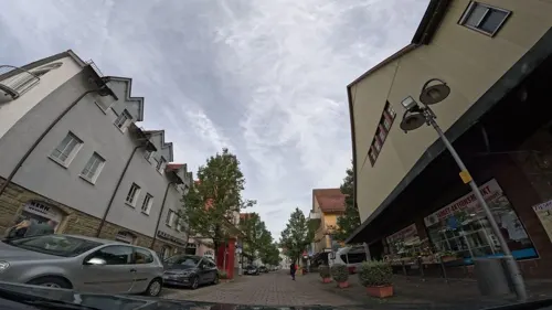
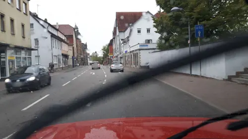

Hofladen Fischer GbR
Farm and orchard · 3.6 km
6, Pfedelbach
We 09:00-13:00; Fr 09:00-18:00; Sa 08:00-14:00



Roth Hofladen
Farm and orchard · 5.6 km
Mo off; Tu-Fr 09:30-11:30, 15:00-18:00; Sa 09:00-12:00; Su off; PH off



Limes Blick Zweiflingen
Scenic view · 5.0 km
Aussichtsplattform am Limes am Pfahldöbel
11 more on the map.
Museums and landmarks33

Neuenstein Castle
Monument and historic site · 5.2 km
49 Schloßstraße, Neuenstein
Tu-Su 10:00-12:00, 13:00-17:30


Schloss Pfedelbach
Monument and historic site · 2.5 km
5 Schloßstraße, Pfedelbach

Jagdschloss Friedrichsruhe
Monument and historic site · 5.1 km
9 Kärcherstraße, Zweiflingen





21 more on the map.
Parks, trails and playgrounds26


Brettachtal Stadion
Sports field and stadium · 5.7 km
19 Einsteinstraße, Bretzfeld


14 more on the map.
Restaurants and cafes124

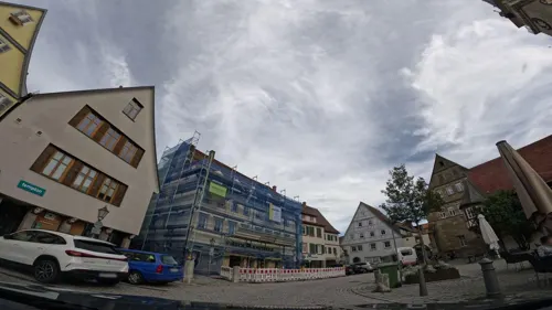
Da Luana
Restaurant · Pizza
23 Marktstraße
11:30-14:00,17:00-22:00; Tu off; PH 11:30-14:00,17:00-22:00
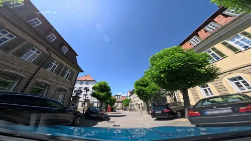
Da Vinci
Restaurant · Italian
97 Poststraße, Öhringen
Tu-Fr 11:30-13:30,17:00-21:00; Sa 17:00-21:00; Su...

Di Martino
Restaurant · Italian · 1.9 km
4/1 Brunnenfeldstraße, Pfedelbach
Tu-Fr 11:30-14:00,17:30-22:30; Sa 17:30-22:30; Su 11:30-14:30,17:30-22:00
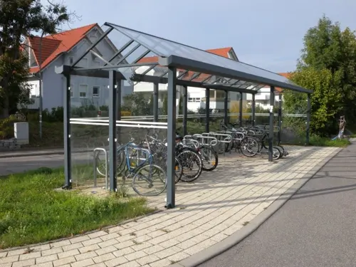
Hotel Restaurant Bahnhof Busch
Restaurant · Regional · 5.6 km
23 Bahnhofstraße, Bretzfeld
Mo-Su 07:30-10:30; Tu-Sa 17:30-21:30

Kolb
Cafe · Ice Cream, Bakery · 5.4 km
1 Bitzfelder Straße, Bretzfeld
Mo-Sa 06:00-18:00; Su 07:30-18:00
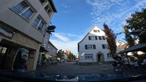
Lo Spuntino
Restaurant · Italian
5 Bismarckstraße, Öhringen
Mo off; Tu-Sa 10:30-14:00,17:00-22:00; Su,PH 16:00-22:00
Mediterraneo
Restaurant · Mediterranean
44 Pfaffenmühlweg
Mo-Su 11:30-14:00,17:30-22:30; Tu off; We 17:30-22:30
Namaste India
Restaurant · Indian
49 Münzstraße, Öhringen
Mo 17:00-22:00; Tu-Su 11:30-14:30,17:00-22:00


Pizzeria Burim´Os
Restaurant · Italian, Pizza
27 Karlsvorstadt, Öhringen
Tu-Fr 10:30-14:00,17:00-22:00; Sa 16:00-22:00; Su,PH 16:00-21:00
Seeklause
Restaurant · German · 4.9 km
30 Am Wasserturm, Pfedelbach
We 17:00-23:00; Th-Fr 10:00-14:30,17:00-23:00; Sa-Su 10:00-23:00
112 more on the map.
Where to stay16
Churches and places of worship32
Evangelische Kirche
Church · Protestant · 5.5 km
6 Adolzfurter Straße
Evangelische Kirche Baumerlenbach
Church · Protestant · 6.7 km
25 Kirchsteige, Öhringen
Nikolauskirche
Church · Protestant · 6.3 km
30 Pfahlbacher Straße, Zweiflingen
Sankt Petrus und Paulus
Church · Catholic · 2.4 km
12 Windischenbacher Straße, Pfedelbach
Shopping34
Gas and EV charging10
Schools, colleges and libraries24
Healthcare8
Map of Öhringen
250 places. The map loads OpenStreetMap tiles when you open it.
Getting there and nearby towns
Verkehrslandeplatz Giebelstadt (GHF) is the nearest airport with scheduled flights listed in OpenStreetMap, 60 km away.
- Weinsberg 17 km west, about 17 min by car
- Schwäbisch Hall 19 km southeast, about 19 min by car
- Bad Friedrichshall 21 km west, about 21 min by car
- Heilbronn 22 km west, about 22 min by car
- Steinheim an der Murr 31 km southwest, about 31 min by car
- Schwaigern 33 km west, about 33 min by car
- Rudersberg 35 km south, about 35 min by car
- Winnenden 37 km south, about 37 min by car
- Welzheim 37 km south, about 37 min by car
- Waiblingen 43 km south, about 43 min by car
Drive times are estimates from straight-line distance, not routes.
Local news
Headlines from INDB.
Reviews, tips and questions
Loading what members have shared...
Sources and licences
- GeoNames (CC BY 4.0): population, coordinates, regions and time zone
- Mapillary (see each image): photos
- OpenStreetMap contributors (ODbL 1.0): places, airports, map data
- Wikidata (CC0 1.0): elevation, founding date, time zone, website
- Wikimedia Commons (see each image): photos
- Wikipedia (CC BY-SA 4.0): overview and history text
Photo credits
- Öhringen Marktplatzansicht, Markus Hassler, CC BY 3.0
- Öhringen Stiftskirche 20100911, Rudolf Stricker, Attribution
- Evangelisch-methodistische Kirche Öhringen, Wolfgang Ellsässer ( Geryones ), CC BY-SA 3.0 de
- Landesgartenschau Öhringen 2016 - Hofgarten 09, Triplec85, CC0
- Landesgartenschau Öhringen (27985830602), marsupium photography, CC BY-SA 2.0
- Flowers creepy crawlies Landesgartenschau Öhringen (27473619383), marsupium photography, CC BY-SA 2.0
- Hohenlohekreis Öhringen Hoftheater Bürgerhaus 4, MSeses, CC BY-SA 4.0
- Landesgartenschau Öhringen (27985831252), marsupium photography, CC BY-SA 2.0
- Flowers Landesgartenschau Öhringen (27473622813), marsupium photography, CC BY-SA 2.0
- Flowers Landesgartenschau Öhringen (28054343796), marsupium photography, CC BY-SA 2.0
- Hohenlohekreis Öhringen Historische Gewächshäuser4, MSeses, CC BY-SA 4.0
- Landesgartenschau Öhringen 2016 - Cappelrain 06, Triplec85, CC0
- Hohenlohekreis Öhringen Historische Gewächshäuser2, MSeses, CC BY-SA 4.0
- Hohenlohekreis Öhringen Historische Gewächshäuser3, MSeses, CC BY-SA 4.0
- Landesgartenschau Öhringen 2016 - Hofgarten 04, Triplec85, CC0
- Hohenlohekreis Öhringen Historische Gewächshäuser1, MSeses, CC BY-SA 4.0
- Hohenlohekreis Öhringen Hoftheater Bürgerhaus, MSeses, CC BY-SA 4.0
- Öhringen - Altstadt - Hofgarten - Blick auf Schloss und Stiftskirchen-Türme, Roman Eisele, CC BY-SA 4.0
- Hohenlohekreis Öhringen Markplatz Kirchbrunnengasse 13 ehemalige Stiftskurie zum Hohensteg, MSeses, CC BY-SA 4.0
- Öhringen - Altstadt - Hofgarten - ehem. Hoftheater - Nordfassade mit Abendlicht, Roman Eisele, CC BY-SA 4.0
- Hohenlohekreis Öhringen Stiftskirche Epitaph2, MSeses, CC BY-SA 4.0
- Hohenlohekreis Öhringen Stiftskirche Epitaph4, MSeses, CC BY-SA 4.0
- Hohenlohekreis Öhringen Stiftskirche Hochaltar, MSeses, CC BY-SA 4.0
- Hohenlohekreis Öhringen Stiftskirche Epitaph1, MSeses, CC BY-SA 4.0
- Hohenlohekreis Öhringen Stiftskirche Epitaph3, MSeses, CC BY-SA 4.0
- Hohenlohekreis Öhringen Stiftskirche Innen2, MSeses, CC BY-SA 4.0
- Flowers Landesgartenschau Öhringen (28054338146), marsupium photography, CC BY-SA 2.0
- Landesgartenschau Öhringen 2016 - Hofgarten 03, Triplec85, CC0
- Landesgartenschau Öhringen 2016 - Hofgarten 02, Triplec85, CC0
- Bürgerturm (Neuenstein)-01, Muck, CC BY-SA 4.0
- Pfedelbach-Katholische-Kirche, Pfedelbacher at German Wikipedia ( Original text: Pfedelbacher ), CC BY-SA 3.0
- Jagdschloss Friedrichsruhe, Maramaracuja, Public domain
- Neuensteinschloss, No machine-readable author provided. Xocolatl assumed (based on copyright claims)., Public domain
- Öhringen Spitalkirche, Markus Hassler, CC BY 3.0
- Öhringen St. Joseph, Markus Hassler, CC BY 3.0
- Pfedelbach-Buchhorn-Wasserturm, Pfedelbacher, CC BY-SA 3.0 de
- Baumerlenbach-kirche3, Peter Schmelzle, CC BY-SA 3.0
- Stadtbücherei Öhringen Außenansicht, KleineLesemaus, CC BY-SA 4.0
- Weygang-Museum 03, Florian Hoffmann, CC BY-SA 3.0 de
- 198810Oehringen16, AnRo0002, CC0
- Adolzfurt evangelische Kirche 20110417, Rudolf Stricker, Attribution
- Betzfeld-kirche, Peter Schmelzle, CC BY-SA 3.0
- Neuenstein, Christus König (05) (cropped), Subbass1, CC BY-SA 4.0
- Zweiflingen-kirche, Peter Schmelzle, CC BY-SA 3.0
- NeuensteinBuergerturm, Ssch, CC BY-SA 3.0
- Neuenstein Schloss01 crop1 2007-09-22, Klaus with K, CC BY-SA 3.0
- Pfedelbach-Schloss, Pfedelbacher at German Wikipedia ( Original text: Pfedelbacher ), CC BY-SA 3.0
- Oehringen Michelbach Burgstall Gabelstein 20120828 1, User:Rosenzweig, CC BY-SA 3.0
- Marktplatz, Marktplatzbrunnen Öhringen 20180913 001, Tilman2007, CC BY-SA 4.0
- Hohenlohekreis Öhringen Oberes Tor, MSeses, CC BY-SA 4.0
- Marktplatz 21 Öhringen 20180913 001, Tilman2007, CC BY-SA 4.0
- Markptplatz 20, Stiftskirche Öhringen 20180914 006, Tilman2007, CC BY-SA 4.0
- Pfedelbach-Evangelische-Kirche, Pfedelbacher at German Wikipedia ( Original text: Pfedelbacher ), CC BY-SA 3.0
- Neuenstein Kirche, SimonWaldherr, CC BY-SA 4.0
- Baumerlenbach-kirche, Peter Schmelzle, CC BY-SA 3.0
- Pfedelbach-Sankt Petrus und Paulus 03, Pfedelbacher, CC BY-SA 3.0
- Limes Blick Öhringen-03-Aussicht Süd, Muck, CC BY-SA 4.0
- Limes Blick Zweiflingen-01, Muck, CC BY-SA 4.0
- Street-level photo, dns_vlpt, CC BY-SA 4.0
- Street-level photo, changchun1, CC BY-SA 4.0
- Street-level photo, fx7, CC BY-SA 4.0
- Street-level photo, fx7, CC BY-SA 4.0
- Street-level photo, fx7, CC BY-SA 4.0
- Street-level photo, fx7, CC BY-SA 4.0
- Street-level photo, changchun1, CC BY-SA 4.0
- Street-level photo, fx7, CC BY-SA 4.0
- Street-level photo, changchun1, CC BY-SA 4.0
- Street-level photo, changchun1, CC BY-SA 4.0
- Street-level photo, nvbwseifert, CC BY-SA 4.0
- Street-level photo, fx7, CC BY-SA 4.0
- Street-level photo, changchun1, CC BY-SA 4.0
- Street-level photo, dns_vlpt, CC BY-SA 4.0
- Street-level photo, fx7, CC BY-SA 4.0
- Street-level photo, fx7, CC BY-SA 4.0
- Street-level photo, fx7, CC BY-SA 4.0
- Street-level photo, Felix23, CC BY-SA 4.0
- Street-level photo, fx7, CC BY-SA 4.0
- Street-level photo, changchun1, CC BY-SA 4.0
- Street-level photo, teddy73, CC BY-SA 4.0
- Street-level photo, teddy73, CC BY-SA 4.0


Page built November 8, 2026. Spotted a mistake? Tell us or suggest a place.