


Bad Wünnenberg, Germany
Bad Wünnenberg is a town of 12,439 people in North Rhine-Westphalia, Germany.
Why visit Bad Wünnenberg
Townapedia lists 91 museums and landmarks, 48 parks and trails, 61 places to eat, 17 places to stay and 28 attractions in and around town.
Highlights include Milchhäuschen Büren Hegensdorf, Eikenberg, Erinnerungsstätte Wewelsburg 1933–1945 and Kreismuseum Wewelsburg.
Weather in Bad Wünnenberg
Forecast from MET Norway (CC BY 4.0). Full forecast
About Bad Wünnenberg
Bad Wünnenberg (German pronunciation: [baːt ˈvʏnənbɛʁk] ) is a town in the district of Paderborn, in North Rhine-Westphalia, Germany. It is situated on the river Aabach, approximately 20 km south of Paderborn.
From the Wikipedia article Bad Wünnenberg (this version), under CC BY-SA 4.0.
Things to do28

Milchhäuschen Büren Hegensdorf
Farm and orchard · 5.9 km
Frische Milch ,Getränke, Eis, Snacks ,Eier, Kartoffeln, Gemüse Hofführungen ,Sitz Möglichkeiten ,kleiner Spielplatz ,
20 Alter Weg
Mo-So 8:00-20.00

16 more on the map.
Museums and landmarks91

Erinnerungsstätte Wewelsburg 1933–1945
Museum · 10.2 km
19 Burgwall, Büren
Tu-Fr 10:00-17:00; Sa-Su 10:00-18:00


Schloss Fürstenberg
Monument and historic site · 2.6 km
Das 2-geshossige spätbarocke Schloss der Grafen von Westphalen errichtete der hessische Baumeister Simon Louis du Ry 1776-1783 auf den...
10 Am Schloßpark, Bad Wünnenberg


Altes Gericht Fürstenberg
Monument and historic site · 2.8 km
Das Patrimonialgericht der Grafen von Westphalen zu Fürstenberg wurde im Jahr 1736 errichtet. Es diente bis 1848 als Gerichtsstätte der...
6 Am Schloßpark, Bad Wünnenberg


Galeriegrab Brenken
Monument and historic site · 9.0 km
Unter der Oberfläche verborgenes Galeriegrab, 2008 wieder entdeckt.


Schloss Alme
Monument and historic site · 8.4 km
20 Schlossstraße, Brilon
Station 37 Preußischer optischer Telegraf
Monument and historic site · 3.6 km
Ehemalige preußische optische Telegraphenstation 37, Von 1832 bis 1849 genutzt.

79 more on the map.
Parks, trails and playgrounds48






36 more on the map.
Restaurants and cafes61
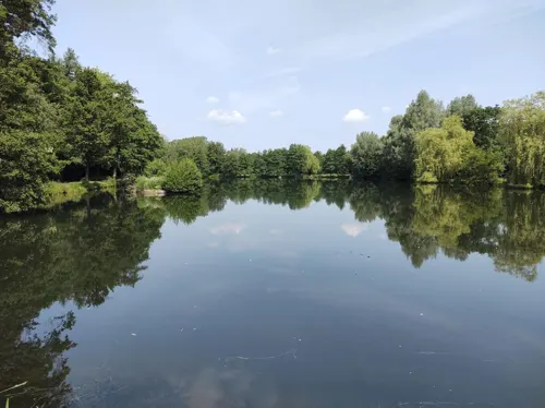
Aatalhaus
Cafe · Cake, Coffee Shop, Friture, Sausage · 1.2 km
3 Am Kurpark, Bad Wünnenberg
Mo-Su 10:00-20:00

Berghof
Restaurant · German · 0.6 km
1 Zum Schlankerberg, Bad Wünnenberg
Sa 17:00-20:30; Su 11:30-13:30, 17:00-20:30
Das Copper
Cafe · Coffee Shop, Cake · 4.8 km
69 Graf-Zeppelin-Straße, Bad Wünnenberg
Mo-Fr 09:00-17:00; Sa 09:00-12:00
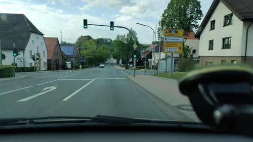
Pizza Margherita
Restaurant · Burger, Kebab, Pasta, Pizza, Sausage
3 Heuweg
Su-Tu, Th 11:30-22:00; Fr-Sa 11:30-23:00

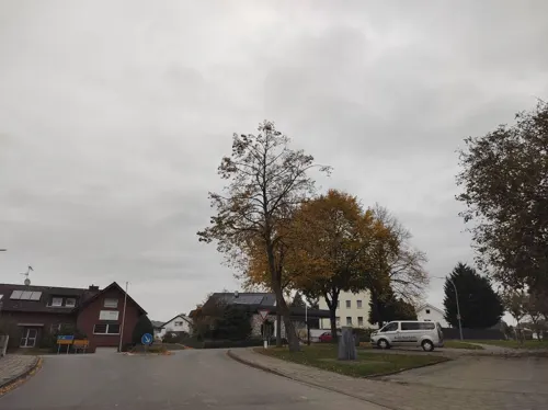
Baku Bistro
Restaurant · Burger, Kebab, Noodles, Pizza · 10.0 km
Pizza, Nudeln, Döner, Burger & Salale
2 Lange Straße, Büren
Tu-Fr 16:00-22:00; Sa, Su 12:00-22:00
Bäckerei und Konditorei Linnenweber
Bakery
20 Rosenstraße, Bad Wünnenberg
Mo-We,Fr 06:00-18:00; Th 06:00-12:30; Sa 06:00-13:30; Su 07:30-11:00
Gaststätte Bei Wilm's
Restaurant
18 Burgstraße, Bad Wünnenberg
Mo-Tu 17:00+; Th 17:00+; Sa 15:00+; Su 10:30+; We off
Goeken backen
Bakery
30 Zinsdorfer Weg, Bad Wünnenberg
Mo-Fr 06:00-20:00; Sa 06:00-20:00; Su 08:00-17:00
Goeken backen
Bakery · 0.9 km
3a Iserkuhle, Bad Wünnenberg
Mo-Fr 06:00-18:00; Sa 07:00-17:00; Su 08:00-17:00


49 more on the map.
Where to stay17
Churches and places of worship23
Sankt Margaretha
Church · Catholic · 10.0 km
19 Bernhard-Bartmann-Straße, Brilon
St. Antonius von Padua
Church · Catholic · 10.2 km
33 Fürstenberger Straße, Marsberg
Shopping12
Gas and EV charging13
Schools, colleges and libraries10
Katholische öffentliche Bücherei
Library · Roman Catholic · 10.1 km
12 Alter Hof, Büren
Healthcare4
Map of Bad Wünnenberg
250 places. The map loads OpenStreetMap tiles when you open it.
Getting there and nearby towns
Airport Paderborn/Lippstadt (PAD) is the nearest airport with scheduled flights listed in OpenStreetMap, 12 km away.
- Paderborn 22 km north, about 22 min by car
- Bad Arolsen 27 km southeast, about 27 min by car
- Korbach 30 km southeast, about 30 min by car
- Wolfhagen 39 km southeast, about 39 min by car
- Hofgeismar 48 km east, about 48 min by car
- Frankenberg 52 km south, about 52 min by car
- Bad Wildungen 53 km southeast, about 53 min by car
- Bielefeld 58 km north, about 58 min by car
- Kassel 60 km east, about 1 h by car
- Hamm 63 km west, about 1 h by car
Drive times are estimates from straight-line distance, not routes.
Local news
Headlines from INDB.
Reviews, tips and questions
Loading what members have shared...
Sources and licences
- GeoNames (CC BY 4.0): population, coordinates, regions and time zone
- Mapillary (see each image): photos
- OpenStreetMap contributors (ODbL 1.0): places, airports, map data
- Wikidata (CC0 1.0): elevation, founding date, time zone, website
- Wikimedia Commons (see each image): photos
- Wikipedia (CC BY-SA 4.0): overview and history text
Photo credits
- Bad Wünnenberg Sauerland-Ost 253, Michael Kramer, CC BY-SA 3.0
- Bad Wünnenberg Schloss Fürstenberg Sauerland-Ost 255, Michael Kramer, CC BY-SA 3.0
- Bad Wünnenberg geothermische Karte, Hagar66, CC BY-SA 3.0
- Bad Wünnenberg - 2017-09-16 - Waldbachtal (02), Tsungam, CC BY-SA 4.0
- Bad Wünnenberg Schloss Fürstenberg Sauerland-Ost 254, Michael Kramer, CC BY-SA 3.0
- Bad Wünnenberg - 2017-09-16 - Waldbachtal (06), Tsungam, CC BY-SA 4.0
- Bad Wünnenberg - 2017-09-16 - Waldbachtal (03), Tsungam, CC BY-SA 4.0
- Ringelstein1, Marco Bollheimer (Marcobolli), CC BY-SA 3.0
- Alme-Haus Tinne-2009-04-26, SteveK, CC BY-SA 3.0
- Meinolfuskapelle bei Böddeken, Dirk D., CC BY-SA 3.0
- Brilon-Alme Schloss Alme Sauerland-Ost 302, Michael Kramer, CC BY-SA 3.0
- Innenansicht der Kirche St. Agatha in Bleiwäsche, Volker.Ramsloh, CC BY-SA 4.0
- Bad Wünnenberg - St. Antonius - 5, Ath, CC0
- Essentho - St. Antonius von Padua - 2, Ath, CC0
- Hochaltar der Sankt-Birgitta-Kirche in Weiberg, Volker.Ramsloh, CC BY-SA 4.0
- Kirchewewelsburg, Pvanderloewe, CC BY-SA 3.0
- Madfeld, St. Margaretha, Malchen53, CC BY-SA 3.0
- St. Vitus Haaren1, de:Benutzer:THWler 33142, Public domain
- Helmern Kath.Kirche St.Apollonia, ludger1961 ( talk · contribs ), CC BY-SA 3.0
- Brilon-Alme NSG Almetal Sauerland Ost 669 pk, Teta, CC BY-SA 3.0
- Brilon - Landschaftsschutzgebiet Freiflächen im Lühlingsbachtal - 1, Ath, CC0
- Marsberg-Essentho NATO-Siedlung Sauerland Ost 555 pk, Teta, CC BY-SA 3.0
- DJH Jugendherberge Wewelsburg -DJH Jugendherbergen in Westfalen-Lippe - aussen 1 - Bjoern Reschabek, Björn Reschabek, CC BY-SA 4.0
- Fürstenberg - Mariä Himmelfahrt - 1, Ath, CC0
- Leiberg - St. Agatha, Ath, CC0
- Erinnerungsstätte Wewelsburg 1933–1945, Reclus, CC0
- Wewelsburg2010 b, Wewelsburg2010.jpg : Tbachner derivative work: Alupus ( talk ), CC BY 3.0
- Stolperstein Arthur Rosenthal, 1, Birkenweg 16, Weiberg, Büren, Landkreis Paderborn, GeorgDerReisende, CC BY-SA 4.0
- Brilon Kalksteinbruch Rösenbeck Sauerland Ost 605 pk, Teta, CC BY-SA 3.0
- Aabachtal, Falkmart, CC BY-SA 3.0
- Harth - NSG Almetal - 5, Ath, CC0
- Brilon-Alme NSG Almetal Sauerland Ost 668 pk, Teta, CC BY-SA 3.0
- Bad Wünnenberg - 2019-05-19 - PB-045 Altehaier Bruch (DSC01261), Tsungam, CC BY-SA 4.0
- Marsberg - 2019-05-19 - HSK-384 Auf dem Bruch, Tsungam, CC BY-SA 4.0
- Lichtenau - Geimer Berg - 07, Ath, CC0
- Bad Wünnenberg - 2017-09-16 - NSG Große Aa (16), Tsungam, CC BY-SA 4.0
- Kirche Wewelsburg, Drahreg01, CC BY-SA 3.0
- Alme-Schloss-Gesamtansicht, SteveK, CC BY-SA 3.0
- Madfeld Kirche St. Margaretha, SteveK, CC BY-SA 3.0
- Naturschutzgebiet Aabachtal, Martin Lindner, CC BY-SA 4.0
- Kreismuseum Wewelsburg, Die Kunst des Sterbens, Dguendel, CC BY 4.0
- Street-level photo, thetornado76, CC BY-SA 4.0
- Street-level photo, poxonline, CC BY-SA 4.0
- Street-level photo, saschahaberkorn, CC BY-SA 4.0
- Street-level photo, herrtichy, CC BY-SA 4.0
- Street-level photo, thetornado76, CC BY-SA 4.0
- Street-level photo, thetornado76, CC BY-SA 4.0
- Street-level photo, thetornado76, CC BY-SA 4.0
- Street-level photo, thetornado76, CC BY-SA 4.0
- Street-level photo, bielebog, CC BY-SA 4.0
- Street-level photo, Schmarvis, CC BY-SA 4.0
- Street-level photo, thetornado76, CC BY-SA 4.0
- Street-level photo, thetornado76, CC BY-SA 4.0
- Street-level photo, thetornado76, CC BY-SA 4.0
- Street-level photo, saschahaberkorn, CC BY-SA 4.0
- Street-level photo, thetornado76, CC BY-SA 4.0
- Street-level photo, thetornado76, CC BY-SA 4.0
- Street-level photo, thetornado76, CC BY-SA 4.0
- Street-level photo, thetornado76, CC BY-SA 4.0
- Street-level photo, thetornado76, CC BY-SA 4.0
- Street-level photo, saschahaberkorn, CC BY-SA 4.0


Page built November 8, 2026. Spotted a mistake? Tell us or suggest a place.