


Bergisch Gladbach, Germany
Bergisch Gladbach is a city of 106,184 people in North Rhine-Westphalia, Germany.
Why visit Bergisch Gladbach
Townapedia lists 78 museums and landmarks, 43 parks and trails, 223 places to eat, 17 places to stay and 11 attractions in and around town.
Highlights include Geflügelhof Steffens - Hofladen, Gut Schiff Erlebnisbauernhof, Kunstmuseum Villa Zanders and Kriegerdenkmal Bensberg.
Weather in Bergisch Gladbach
Forecast from MET Norway (CC BY 4.0). Full forecast
About Bergisch Gladbach
Bergisch Gladbach (German pronunciation: [ˌbɛʁɡɪʃ ˈɡlatbax] ) is a city in the Cologne/Bonn Region of North Rhine-Westphalia, Germany, and capital of the Rheinisch-Bergischer Kreis (district).
From the Wikipedia article Bergisch Gladbach (this version), under CC BY-SA 4.0.
Travel tips from other travellers: Bergisch Gladbach on Wikivoyage (CC BY-SA 4.0).
Things to do11

Geflügelhof Steffens - Hofladen
Farm and orchard · 3.1 km
2, Bergisch Gladbach
We-Fr 09:00-12:00,15:00-18:00; Sa 09:00-13:00
Gut Schiff Erlebnisbauernhof
Farm and orchard · 3.3 km
Wurst, Rind-,Schweinefleisch, Erier, Geflügel
Tu-Fr 09:00-12:00, 15:00-18:00; Sa 09:00-14:00; Su,PH closed

Mülheim Bridge
Bridge · 9.9 km
Bridge on the river Rhine in Western Germany


Museums and landmarks78

Kunstmuseum Villa Zanders
Museum · 0.6 km
8 Konrad-Adenauer-Platz, Bergisch Gladbach
Tu 14:00-18:00; We 10:00-18:00; Th 14:00-20:00; Fr 14:00-18:00; Sa...

Kriegerdenkmal Bensberg
Monument and historic site · 2.8 km
„Victoria, den stürmenden Krieger schützend“
Kadettenstraße, Bergisch Gladbach


Bergisches Museum für Bergbau, Handwerk und Gewerbe
Museum · 3.2 km
9-21 Burggraben, Bergisch Gladbach

Burg Zweiffel
Monument and historic site · 3.8 km
1 Herrenstrunden, Bergisch Gladbach

Haus Lerbach
Monument and historic site · 1.5 km
1 Lerbacher Weg, Bergisch Gladbach

Hebborner Hof
Monument and historic site · 2.5 km
1 Hebborner Hof, Bergisch Gladbach

Maltesermühle
Monument and historic site · 4.0 km
1 Malteserweg, Bergisch Gladbach

Rittergut Dombach
Monument and historic site · 2.5 km
2 Halfen Dombach, Bergisch Gladbach

66 more on the map.
Parks, trails and playgrounds43

Kombibad Paffrath
Sports field and stadium · 3.5 km
Freibad (50m), Hallenbad (25m), Kinderbecken
2 Borngasse, Bergisch Gladbach
Mo-Fr 06:15-21:30; Tu off; Th off; Sa 06:15-20:00; Su,PH 08:00-20:00





31 more on the map.
Restaurants and cafes223

Cafe Extrablatt
Cafe · Coffee Shop · 0.7 km
166a Hauptstraße, Bergisch Gladbach
Mo-Sa 09:00-00:00; Su 09:30-00:00
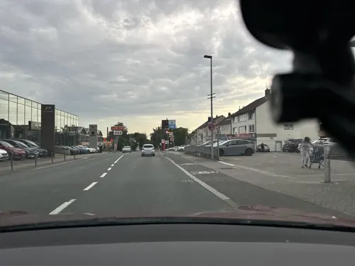
Klausmann
Restaurant · German, Regional · 3.0 km
100 Kölner Straße, Bergisch Gladbach
We-Th 16:30-23:00; Fr-Sa 12:00-01:00; Su 12:00-22:00
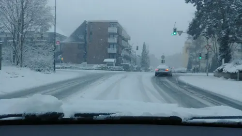
Al Capriccio
Restaurant · Pizza · 4.0 km
2a Vürfelser Kaule, Bergisch Gladbach
Mo-Sa 11:00-14:00,17:00-21:45; Su 11:00-21:45

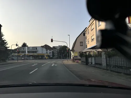
Burgerfaktur
Restaurant · Burger, Salad, Beef, Fries, Chicken, Drinks · 3.7 km
53 Vürfelser Kaule, Bergisch Gladbach
Mo-Su 11:30-22:00
Café Buchmühle
Restaurant · Coffee Shop, Regional, German, Cake, Salad · 0.8 km
17 Buchmühlenstraße, Bergisch Gladbach
Tu-Sa 10:00-17:00
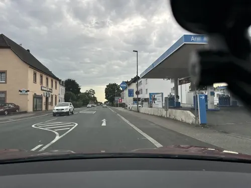
Da Turi
Restaurant · Italian · 2.8 km
72 Kölner Straße, Bergisch Gladbach
Mo-Fr 15:00-22:00; Sa 13:00-22:00; Su,PH off
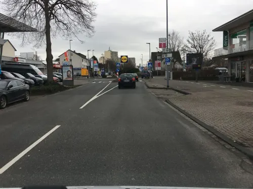
Dschingis Khan
Restaurant · Mongolian, Chinese · 2.2 km
60 Mülheimer Straße, Bergisch Gladbach
11:30-15:00,17:30-23:30
Eddy's 2.0
Restaurant · Burger · 0.7 km
2 Buchmühlenstraße, Bergisch Gladbach
Mo 18:00-21:45, Tu-Sa 16:00-22:45, Su 14:00-21:45
Gasthaus Schwäke
Restaurant · German · 1.6 km
65 Ommerbornstraße
Mo, We-Fr 17:30-22:00, Sa 15:00-22:00, Su 12:00-21:00
Gasthaus Wermelskirchen
Restaurant · Regional · 3.1 km
8 Burggraben, Bergisch Gladbach
Th-Tu 12:00-14:00, 18:00-22:00
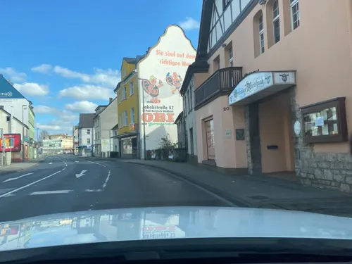


Gronauer Wirtshaus
Restaurant · German · 0.9 km
20 Hauptstraße, Bergisch Gladbach
Mo,Th,Fr 17:30-21:30; PH,Su 12:00-14:00,17:00-21:00
211 more on the map.
History
Early settlements existed in the 13th century, but the town was officially founded only in 1856.
The word Bergisch in the name does not originate from its location in the county of Berg, and it was not added to distinguish it from Mönchengladbach, as is believed by many people, but from the counts who gave their name to the region.
In the early 12th century, the counts of Berg settled in the area, which later became the Duchy of Berg (under Napoleon, it became a grand duchy). That is where the first part of the name (Bergisch) comes from, the town being located in the former County of Berg. The town is the administrative headquarters (Kreisstadt) of the Rheinish-Bergisch district (Kreis).
The second part of the name, Gladbach, originates from Low Rhenish (Bergisches Platt) and means canalised stream in reference to the small river (the Strunde) that was artificially canalised in early medieval times. In Bergisch Platt, the regional dialect, gelaat (laid) eventually evolved to glad (the 'd' is often pronounced as a 't'). The second part of the word, Bach, is the Standard German word for a small stream and refers to the Strunde.
In 1975, the town incorporated the neighbouring Bensberg, and when it reached a population of 100,000 in 1977, it was given city status.
From the History section of Bergisch Gladbach on Wikipedia, under CC BY-SA 4.0.
Where to stay17
Kardinal-Schulte-Haus
Motel and hotel · 3.8 km
51-53 Overather Straße, Bergisch Gladbach
Churches and places of worship44
Heilige Drei Könige
Church · Catholic · 2.0 km
261 Odenthaler Straße, Bergisch Gladbach
St. Antonius Abbas
Church · Catholic · 3.7 km
24 Im Fronhof, Bergisch Gladbach
St. Johann Baptist
Church · Roman Catholic · 4.1 km
Herrenstrunden, Bergisch Gladbach
Alte Katholische Pfarrkirche Refrath
Church · 2.5 km
Alt Refrath, Bergisch Gladbach
Shopping69
Gas and EV charging19
Schools, colleges and libraries50
Campus Bergisch Gladbach des b.i.b. International College und der Fachhochschule der Wirtschaft FHDW
School · 0.9 km
2 Hauptstraße, Bergisch Gladbach
Katholische Bücherei St. Antonius
Library · 3.7 km
22 Im Fronhof, Bergisch Gladbach
Healthcare28
Map of Bergisch Gladbach
250 places. The map loads OpenStreetMap tiles when you open it.
Getting there and nearby towns
Cologne Bonn Airport (CGN) is the nearest airport with scheduled flights listed in OpenStreetMap, 13 km away.
- Leverkusen 12 km northwest, about 12 min by car
- Köln 14 km southwest, about 14 min by car
- Solingen 21 km north, about 21 min by car
- Remscheid 22 km north, about 22 min by car
- Bonn 28 km south, about 28 min by car
- Wuppertal 30 km north, about 30 min by car
- Düsseldorf 36 km northwest, about 36 min by car
- Neuss 39 km northwest, about 39 min by car
- Hagen 48 km northeast, about 48 min by car
- Essen 53 km north, about 53 min by car
Drive times are estimates from straight-line distance, not routes.
Local news
Headlines from INDB.
Reviews, tips and questions
Loading what members have shared...
Sources and licences
- GeoNames (CC BY 4.0): population, coordinates, regions and time zone
- Mapillary (see each image): photos
- OpenStreetMap contributors (ODbL 1.0): places, airports, map data
- Wikidata (CC0 1.0): elevation, founding date, time zone, website, landmarks and historic places
- Wikimedia Commons (see each image): photos
- Wikipedia (CC BY-SA 4.0): overview and history text
Photo credits
- Bensberger Rathaus-2018-Bergisch Gladbach, Kameister, CC BY-SA 4.0
- Bergisch Gladbach Papierfabrik Weig 2021 RG IMB 2213, Montanussecundus, CC BY-SA 4.0
- Bergisch Gladbach Papierfabrik Weig 2021 RG IMG 2216, Montanussecundus, CC BY-SA 4.0
- Bergisch Gladbach Papierfabrik Weig 2021 RG IMG 2277, Montanussecundus, CC BY-SA 4.0
- Bergisch Gladbach Papierfabrik Weig 2021 RG IMG 2242, Montanussecundus, CC BY-SA 4.0
- Bergisch Gladbach Papierfabrik Weig 2021 RG IMG 2225, Montanussecundus, CC BY-SA 4.0
- Bergisch Gladbach Papierfabrik Weig 2021 RG IMG 2245, Montanussecundus, CC BY-SA 4.0
- Bergisch Gladbach Papierfabrik Weig 2021 RG IMG 2272, Montanussecundus, CC BY-SA 4.0
- Bergisch Gladbach Papierfabrik Weig 2021 RG IMG 2257, Montanussecundus, CC BY-SA 4.0
- Bergisch Gladbach Papierfabrik Weig 2021 RG IIMG 2259, Montanussecundus, CC BY-SA 4.0
- Bergisch Gladbach Papierfabrik Weig 2021 RG IMG 2234, Montanussecundus, CC BY-SA 4.0
- MuelheimerBrueckeKoeln, Túrelio, CC BY-SA 2.5
- Aerial image of the Bensberg Castle (view from the southeast), Carsten Steger, CC BY-SA 4.0
- Alte Kirche (Refrath) (07), Chris06, CC BY-SA 4.0
- Bergisch Gladbach - Bergisches Museum 07 ies, Frank Vincentz, CC BY-SA 3.0
- Bergisch Gladbach Herrenstrunden - Herrenstrunden - Burg Zweiffel 07 ies, Frank Vincentz, CC BY-SA 3.0
- St. Antonius Abbas (Herkenrath)2a, Chris06, CC BY-SA 4.0
- Albertus-Magnus-Gymnasium Bensberg Eingang, Jan Wellem ( Jan Wellem ( talk )), CC BY-SA 3.0
- Bergisch Gladbach - Hauptstraße - Gnadenkirche 03 ies, Frank Vincentz, CC BY-SA 3.0
- Evangelische Kirche (Bensberg)1, Chris06, CC0
- Villa Zanders, Hermann Otto Pflaume , Architekt, CC BY-SA 3.0
- Bergisch Gladbach - Lerbacher Weg - Schloss Lerbach 04 ies, Frank Vincentz, CC BY-SA 3.0
- RadioMuseum Köln, Pingsjong, GFDL
- Paffrath St Clemens, No machine-readable author provided. Jan Wellem~commonswiki assumed (based on copyright claims)., CC BY-SA 3.0
- Bergisch Gladbach Herrenstrunden - Komturei 02 ies, Frank Vincentz, CC BY-SA 3.0
- Maltesermühle, Pingsjong, GFDL
- Bergisch Gladbach Herrenstrunden - Sankt Johann Baptist 07 ies, Frank Vincentz, CC BY-SA 3.0
- St Nikolaus, Bensberg (2004), Jochen Teufel, CC BY-SA 3.0
- Tw 1155 im Museum Thielenbruch, Mike Stephan, CC BY 2.5
- Bensberg Kardinal-Schulte-Haus Denkmal 71 b ShiftN, Mich.kramer, CC BY-SA 3.0
- Otto Hahn Gymnasium Bensberg Außenansicht, OHGGruppeProjekt, CC BY-SA 4.0
- Hebborner Hof, Pingsjong, GFDL
- Schluchter Heide - Ruine, Rick Hoppmann, CC BY 4.0
- Kath. Kirche Hebborn, Pingsjong, GFDL
- NSG Grube Cox 08, Moramaso, CC BY-SA 4.0
- Naturschutzgebiet Diepeschrather Wald, Pingsjong, GFDL
- Pinge Eduard Amalia.2, Pingsjong, GFDL
- NSG Schlade.1, Pingsjong, GFDL
- NSG Bechsiefen und Hundberger Siefen, Pingsjong, GFDL
- Kriegerdenkmal in Bensberg, Elisabeth van Langen, CC BY-SA 3.0
- Zum Frieden Gottes Heidkamp Spitzturm, Mabit1, CC BY-SA 4.0
- Evangelisches Gemeindezentrum (Herkenrath) (1), Chris06, CC BY-SA 4.0
- Evangelische Kirche zum Heilsbrunnen (Hebborn) (1), Chris06, CC BY-SA 4.0
- Stolperstein Bergisch Gladbach An der Tent 2 Elise Joschkowitz, Tomtom10, CC BY-SA 4.0
- Thielenbruch.2, Pingsjong, GFDL
- Kardinal-Schulte-Haus, Pingsjong, GFDL
- Halfendombach 2, Pingsjong, GFDL
- Street-level photo, maxd, CC BY-SA 4.0
- Street-level photo, wladimir, CC BY-SA 4.0
- Street-level photo, joergpauly, CC BY-SA 4.0
- Street-level photo, knoppers, CC BY-SA 4.0
- Street-level photo, wladimir, CC BY-SA 4.0
- Street-level photo, wladimir, CC BY-SA 4.0
- Street-level photo, raymond, CC BY-SA 4.0
- Street-level photo, raymond, CC BY-SA 4.0
- Street-level photo, maxd, CC BY-SA 4.0
- Street-level photo, maxd, CC BY-SA 4.0
- Street-level photo, maxd, CC BY-SA 4.0
- Street-level photo, maxd, CC BY-SA 4.0
- Street-level photo, joergpauly, CC BY-SA 4.0
- Street-level photo, maxd, CC BY-SA 4.0
- Street-level photo, joergpauly, CC BY-SA 4.0
- Street-level photo, StefanS79, CC BY-SA 4.0
- Street-level photo, maxd, CC BY-SA 4.0
- Street-level photo, StefanS79, CC BY-SA 4.0
- Street-level photo, StefanS79, CC BY-SA 4.0
- Street-level photo, StefanS79, CC BY-SA 4.0


Page built November 8, 2026. Spotted a mistake? Tell us or suggest a place.