


Why visit Bischofsheim
Townapedia lists 29 museums and landmarks, 23 parks and trails, 128 places to eat, 15 places to stay and 6 attractions in and around town.
Highlights include Eisenbaum, Hofladen Fam. Bersch/Mähn, Hochheimer Kunstsammlung and Mausoleum der Opel Familie.
Weather in Bischofsheim
Forecast from MET Norway (CC BY 4.0). Full forecast
About Bischofsheim
Bischofsheim (German pronunciation: [ˈbɪʃɔfsˌhaɪm] ) is a municipality in Groß-Gerau district in Hesse, Germany with a population of more than 13,000.
From the Wikipedia article Bischofsheim, Hesse (this version), under CC BY-SA 4.0.
Things to do6


Hofladen Fam. Bersch/Mähn
Farm and orchard · 1.6 km
44, Bischofsheim
Mo,Tu,Th,Fr 09:00-12:00,16:00-18:00; We,Sa 09:00-12:00; Su,PH off
Gemüsehof Reinheimer
Farm and orchard · 2.6 km
54 Unter der Ruth, Ginsheim-Gustavsburg
Mo-Fr 09:00-18:00; Sa 08:30-13:00; Su,PH off


Museums and landmarks29

Hochheimer Kunstsammlung
Museum · 2.4 km
Kunst des 20. Jahrhunderts
23 Mainzer Straße, Hochheim am Main
We,Su 15:00-17:00; Fr 17:00-19:00

Mausoleum der Opel Familie
Monument and historic site · 2.4 km
71 Mainzer Straße, Rüsselsheim am Main
Hochheimer Weinbaumuseum
Museum · 2.4 km
1 Wiesbadener Straße, Hochheim am Main
Sa 14:00-16:00; Su 15:00-17:00
Museum im Alten Rathaus Bischofsheim
Museum · 1.0 km
2 Darmstädter Straße, Bischofsheim
Oct-Apr Su[1] 14:00-18:00; Oct-Apr Su[2,4] 14:00-18:00 "mit...

Römisch-Germanisches Zentralmuseum
Museum · 6.2 km
Archaeological research institute and museum in Mainz



Küsterhaus (Kirchtor)
Monument and historic site · 2.0 km
29 Kirchstraße, Hochheim

17 more on the map.
Parks, trails and playgrounds23





11 more on the map.
Restaurants and cafes128

Weingut Preis
Restaurant · Regional · 2.2 km
Telefon Gutsausschank: 06146-9674
17 Rathausstraße, Hochheim am Main
We,Th,Fr,Sa 17:00+; PH,Su 12:00+; Mo,Tu off
Das Mangold
Restaurant · Regional, German · 1.2 km
1 A Im Attich, Bischofsheim
Mo off; Tu-Fr 11:30-14:30, 17:00-22:00; Sa 17:00-22:00; Su 12:00-20:00
Delicato
Restaurant · Italian · 3.2 km
5 Marktstraße, Rüsselsheim am Main
Mo-Sa 11:30-14:40,17:30-23:00
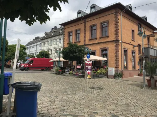
Eis & More
Cafe · Ice Cream · 2.2 km
2 Kirchstraße, Hochheim am Main
Mo 12:00-20:00; Tu-Th 10:30-20:00; Fr 10:30-21:00; Sa 09:00-21:00;...
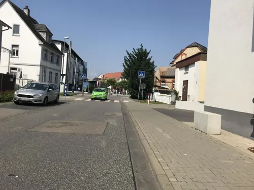
Eiscafe Orchidea
Cafe · Ice Cream · 2.1 km
13 Frankfurter Straße, Hochheim am Main
Tu-Su 11:00-21:00; Mo off
Gutsschänke Pfaff "Zum Kamin"
Restaurant · German · 3.1 km
13 Dresdener Ring, Hochheim am Main
Fr,Sa 17:00+; PH,Su 16:00+
Göllner's Kulinarium
Restaurant · Regional, Mediterranean, Mittagstisch · 0.7 km
2 Rheinstraße, Bischofsheim
We,Th 12:00-14:00, 17:00-21:30; Fr,Sa 12:00-14:00, 17:00-22:00; Su...
Hacibey Kebap & Baklava
Restaurant · Turkish · 3.0 km
18 Mainzer Straße, Rüsselsheim am Main
Mo-Fr 08:30-22:00; Sa-Su 09:00-22:00
La Grotta
Restaurant · Italian · 2.2 km
2 Am Plan, Hochheim am Main
Mo off; Tu-Fr,Su 11:30-14:30,17:30-22:00; Sa 18:00-22:00
La Vigna
Restaurant · Italian · 2.3 km
13 Weiherstraße, Hochheim am Main
Mo-Sa 11:30-14:30,17:00-23:00; Su 11:00-14:30,17:00-22:30


Mediterraneo da Mimmo
Restaurant · Italian · 2.9 km
8 Bouguenais-Allee, Ginsheim-Gustavsburg
Tu off; Mo-Fr 11:30-14:00,17:00-24:00; Sa 17:00-24:00; Su...
116 more on the map.
History
In the Middle Ages, Bischofsheim was ruled by the Archbishop of Mainz, but fell to Hesse-Darmstadt in 1579. In 1930 it was incorporated to the city of Mainz, remaining a constituent community of that city until 1945. Due to its infrastructure Bischofsheim was subject to air raids bombing of Mainz in World War II. Since the American and French occupying powers severed the links between Mainz and the so-called Rechtsrheinische Stadtteile von Mainz (Mainz constituent communities on the Rhine's right bank) – the Rhine was the boundary between their two occupational zones – these six communities effectively ceased to be part of the city of Mainz. Whereas the three former constituent communities north of the Main were administered by Wiesbaden since then, Bischofsheim and neighbouring Ginsheim-Gustavsburg once again became independent municipalities in Groß-Gerau district.
From the History section of Bischofsheim, Hesse on Wikipedia, under CC BY-SA 4.0.
Where to stay15
Motel Terminalpark
Motel and hotel · 2.4 km
12-16 Neben dem Mühlweg, Bischofsheim
Churches and places of worship15
Evangelische Kirche
Church · Lutheran · 1.0 km
3 Darmstädter Straße, Bischofsheim
Ev. Matthäusgemeinde
Church · Evangelical · 2.8 km
13 Böllenseeplatz, Rüsselsheim am Main
Fatih Camii - Mevlana Moschee -IGMG
Place of worship · 2.8 km
2 Schwedenstraße, Rüsselsheim am Main
Shopping24
Gas and EV charging13
Schools, colleges and libraries15
Integrierte Gesamtschule Mainspitze
School · 3.0 km
Sophie-und-Hans-Scholl-Straße, Ginsheim-Gustavsburg
Albert-Schweitzer-Schule
School · 3.1 km
18 Karl-Liebknecht-Straße, Ginsheim-Gustavsburg
Healthcare11
Böllensee Apotheke
Clinic and pharmacy · 3.2 km
18 Wilhelm-Sturmfels-Straße, Rüsselsheim am Main
Mainspitz Apotheke
Clinic and pharmacy · 2.8 km
2 Taunusstraße, Ginsheim-Gustavsburg
Sonnenapotheke
Clinic and pharmacy · 3.2 km
72 Darmstädter Landstraße, Ginsheim-Gustavsburg
Map of Bischofsheim
250 places. The map loads OpenStreetMap tiles when you open it.
Getting there and nearby towns
Wiesbaden Army Airfield (WIE) is the nearest airport with scheduled flights listed in OpenStreetMap, 7 km away.
- Ginsheim-Gustavsburg 3 km southwest, about 3 min by car
- Mainz 6 km west, about 6 min by car
- Raunheim 6 km east, about 6 min by car
- Königstädten 7 km southeast, about 7 min by car
- Trebur 8 km south, about 8 min by car
- Nauheim 8 km southeast, about 8 min by car
- Wiesbaden 13 km northwest, about 13 min by car
- Kriftel 12 km northeast, about 12 min by car
- Kelsterbach 14 km northeast, about 14 min by car
- Büttelborn 15 km southeast, about 15 min by car
Drive times are estimates from straight-line distance, not routes.
Local news
Headlines from INDB.
Reviews, tips and questions
Loading what members have shared...
Sources and licences
- GeoNames (CC BY 4.0): population, coordinates, regions and time zone
- Mapillary (see each image): photos
- OpenStreetMap contributors (ODbL 1.0): places, airports, map data
- Wikidata (CC0 1.0): elevation, founding date, time zone, website, landmarks and historic places
- Wikimedia Commons (see each image): photos
- Wikipedia (CC BY-SA 4.0): overview and history text
Photo credits
- Bischofsheim, Paulknuthy, CC BY-SA 3.0
- Stone circle, Bischofsheim (LRM 20210110 142217), Matti Blume, CC BY-SA 4.0
- Spotting, Bischofsheim (1X7A5129), Matti Blume, CC BY-SA 4.0
- Spotting, Bischofsheim (1X7A4902), Matti Blume, CC BY-SA 4.0
- D-AIRH, Bischofsheim (1X7A4965), Matti Blume, CC BY-SA 4.0
- Insalata Caprese, Bischofsheim (20180909 185758), Matti Blume, CC BY-SA 4.0
- Tortellini Quattro Formaggi, Bischofsheim (20180909 185747), Matti Blume, CC BY-SA 4.0
- Mitfahrerbank, Bischofsheim (P1070820), Matti Blume, CC BY-SA 4.0
- Gueterbahnhof, Bischofsheim (LRM 20210725 210625), Matti Blume, CC BY-SA 4.0
- HLB, Bischofsheim (LRM 20200815 140209-hdr), Matti Blume, CC BY-SA 4.0
- Rail service vehicle, Bischofsheim (IMG 20230512 203801), Matti Blume, CC BY-SA 4.0
- Rail service vehicle, Bischofsheim (IMG 20230512 203727), Matti Blume, CC BY-SA 4.0
- Rail service vehicle, Bischofsheim (IMG 20230512 203723), Matti Blume, CC BY-SA 4.0
- Bahnhof, Bischofsheim (P1070819), Matti Blume, CC BY-SA 4.0
- BR50-1904-241103-SD, Bischofsheim (20181223 153630), Matti Blume, CC BY-SA 4.0
- Bischofsheim Neuer Bahnhof 20110506, Rudolf Stricker, Attribution
- Plaque Bahnhof, Bischofsheim (20181223 153527), Matti Blume, CC BY-SA 4.0
- Bischofsheim ND057 linden trees, KaiBorgeest, CC BY 4.0
- Bahnhof Mainz-Bischofsheim, Bushalte des Bahnhofs, ManuelB701, CC0
- Bischofsheim Stolperstein Frankfurter Straße 50 Hartwig Kahn, Alfons Tewes, CC BY-SA 4.0
- Bischofsheim Stolperstein Frankfurter Straße 50 Bina Kahn, Alfons Tewes, CC BY-SA 4.0
- Bischofsheim Stolpersteine Frankfurter Straße 50, Alfons Tewes, CC BY-SA 4.0
- Bischofsheim Stolperstein Frankfurter Straße 50 Dr. Friedrich Kahn, Alfons Tewes, CC BY-SA 4.0
- Bischofsheim Stolperstein Frankfurter Straße 50 Therese Kahn, Alfons Tewes, CC BY-SA 4.0
- Suedbruecke Mainz, Felix.matheis, Public domain
- Kurfuerstliches Schloss Mainz s, Unknown author, CC BY-SA 3.0
- Floersheim-Kirche2, R. Duchmann, Hochheim, CC BY-SA 2.5
- Kirche in Hochheim am Main, Peter, CC BY 2.0
- Wasserturm Hochheim, Frank Winkelmann, CC BY 3.0
- Opel-mausoleum-2010-ruesselsheim-091, Dontworry, CC BY-SA 3.0
- Bait ul-Ghafur (Ginsheim), Ceddyfresse, Public domain
- Bischofsheim Christ-König-Kirche 20110506, Rudolf Stricker, Attribution
- FlörsheimWiesnmühleStAnnaKapelle, Brühl, Public domain
- 45847 Hochheim - Burgeffstraße 5 ev Pfarrkirche a, Oliver Abels ( SBT ), CC BY-SA 3.0
- NSG Hochheimer Mainufer1, BBjoern78, CC BY-SA 4.0
- NSG Wickerbachaue von Flörsheim und Hochheim2, BBjoern78, CC BY-SA 4.0
- Eisenbaum 2, Muck, CC BY-SA 4.0
- Russelsheim pomnik jezdzca, Andrzej Otrębski, CC BY-SA 4.0
- Bischofsheim evangelische Kirche 20110505, Rudolf Stricker, Attribution
- Basketballbereich der HvB aus Hochheim, Marvin26757, CC BY-SA 4.0
- Königin Victoria Denkmal Hochheim am Main, Frank Winkelmann, CC BY 3.0
- Street-level photo, miguel_andrade, CC BY-SA 4.0
- Street-level photo, miguel_andrade, CC BY-SA 4.0
- Street-level photo, teddy73, CC BY-SA 4.0
- Street-level photo, miguel_andrade, CC BY-SA 4.0
- Street-level photo, miguel_andrade, CC BY-SA 4.0
- Street-level photo, miguel_andrade, CC BY-SA 4.0
- Street-level photo, miguel_andrade, CC BY-SA 4.0
- Street-level photo, miguel_andrade, CC BY-SA 4.0
- Street-level photo, miguel_andrade, CC BY-SA 4.0
- Street-level photo, chuck, CC BY-SA 4.0
- Street-level photo, curtisnewton, CC BY-SA 4.0
- Street-level photo, miguel_andrade, CC BY-SA 4.0
- Street-level photo, miguel_andrade, CC BY-SA 4.0
- Street-level photo, chuck, CC BY-SA 4.0
- Street-level photo, miguel_andrade, CC BY-SA 4.0
- Street-level photo, miguel_andrade, CC BY-SA 4.0
- Street-level photo, miguel_andrade, CC BY-SA 4.0
- Street-level photo, miguel_andrade, CC BY-SA 4.0


Page built November 8, 2026. Spotted a mistake? Tell us or suggest a place.