


Why visit Kelsterbach
Townapedia lists 15 museums and landmarks, 32 parks and trails, 179 places to eat, 23 places to stay and 5 attractions in and around town.
Highlights include Hofladen der Schlocker-Stiftung, Stadtmuseum Kelsterbach, Römische Villa and Rosarium.
Weather in Kelsterbach
Forecast from MET Norway (CC BY 4.0). Full forecast
About Kelsterbach
Kelsterbach (German pronunciation: [ˈkɛlstɐˌbax] ) is a town in Groß-Gerau district in Hessen, Germany, part of the Frankfurt Rhein-Main urban area. It is located on Frankfurt's southwestern outskirts at a bend on the left bank of the river Main, right where a small brook, called the Kelster (Bach means "brook" in German) joins the river.
From the Wikipedia article Kelsterbach (this version), under CC BY-SA 4.0.
Travel tips from other travellers: Kelsterbach on Wikivoyage (CC BY-SA 4.0).
Things to do5

Hofladen der Schlocker-Stiftung
Farm and orchard · 3.8 km
25 Dürerstraße, Hattersheim
Tu-Fr 10:00-18:00


Museums and landmarks15



Zeppelin Museum Zeppelinheim
Museum · 6.8 km
Airship museum in Neu-Isenburg at Frankfurt/Main


Stadtmuseum Hattersheim
Museum · 2.7 km
Im ehemaligen Sarotti-Werkstattgebäude hat das Stadtmuseum Hattersheim seine neue Heimat gefunden. Auf etwa 465 Quadratmetern erwartet...
1 Platz der Deutschen Einheit, Hattersheim am Main
3 more on the map.
Parks, trails and playgrounds32




20 more on the map.
Restaurants and cafes179
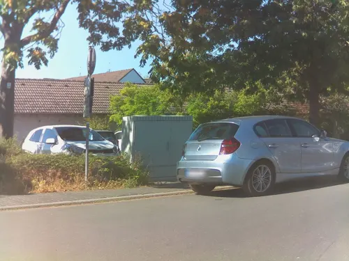
Pane e Vino
Restaurant · Italian · 3.3 km
Trattoria
5 Sandstraße
11:30-14:00, 17:30-22:30; Sa 17:30-22:30; Tu off

Ristorante Luna Bianca
Restaurant · Italian · 3.8 km
Nach Schließung des Restaurantgs La Carafa (alt: Hattersheiner Kanne) Neueröffnung 2021
1a Ladislaus-Winterstein-Ring, Hattersheim
Tu-Su 11:00-22:30
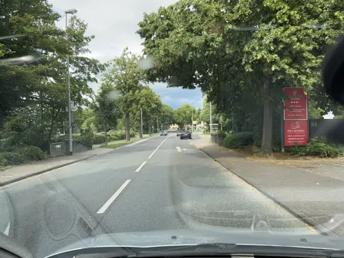
Spice Tandoori
Restaurant · Indian · 3.3 km
Dienstags exklusiv für Gruppen und besondere Anlässe nach vorheriger Reservierung geöffnet.
33 Mainzer Landstraße
Mo, We-Sa 11:30-14:30, 17:00-22:30; Su, PH 12:00-22:30

ALEX
Restaurant · International · 2.9 km
17 The Squaire, Ebene 5 West, Frankfurt am Main
Mo-Su,PH 09:00-22:00
Café Ernst
Cafe
22 Mörfelder Straße, Kelsterbach
Mo-Fr 06:30-20:00; Sa 07:00-20:00; Su 08:00-17:30; PH 08:00-13:00
Kristall Grill Kebap Restaurant
Restaurant · Kebab, Turkish
6 Frankfurter Straße, Kelsterbach
Mo-Su 08:00-24:00
Pizzeria Da Michele
Restaurant · Italian
11 Mainzer Straße, Kelsterbach
Mo-Fr 11:30-14:30,17:30-22:00; Su 17:30-22:00
Sportlertreff
Restaurant · Balkan · 1.1 km
65 Kirschenallee, Kelsterbach
Tu-Sa 17:00-22:00; Su 11:30-14:30, 17:00-21:00
Tennis-Club Schwanheim e.V.
Restaurant · Italian, Pizza · 3.6 km
108 Schwanheimer Bahnstraße, Frankfurt am Main
Mo,We-Fr 17:00-22:00; Sa,Su 11:30-14:30,17:30-21:30


Zum Anglerheim
Restaurant · German · 1.2 km
19 Am Südpark, Kelsterbach
Mo-Fr 15:30-21:30; Sa-Su,PH 11:00-21:30
167 more on the map.
Where to stay23
Churches and places of worship20
Evangelische Kirche Sindlingen
Church · Protestant · 2.6 km
46 Sindlinger Bahnstraße, Frankfurt am Main
Matthäuskirche
Church · Protestant · 2.4 km
9 Alte Mainstraße, Hattersheim am Main
Evangelische Kirchengemeinde
Church · Protestant · 3.1 km
12 Schulstraße, Hattersheim
Fatih Moschee
Place of worship · Sunni · 2.8 km
1 Vogelweidestraße, Hattersheim am Main
Shopping32
Gas and EV charging16
Aldi West-Höchster Str. 50
EV charging · 3.9 km
50 West-Höchster Straße, Frankfurt am Main
Schools, colleges and libraries13
International School Frankfurt Rhein-Main
School · 3.3 km
33 Straße zur Internationalen Schule, Frankfurt am Main
Healthcare11
Flughafen Medical Center
Clinic and pharmacy · 3.0 km
Flughafen Frankfurt am Main
Map of Kelsterbach
250 places. The map loads OpenStreetMap tiles when you open it.
Getting there and nearby towns
Frankfurt Airport (FRA) is the nearest airport with scheduled flights listed in OpenStreetMap, 4 km away.
- Kriftel 5 km northwest, about 5 min by car
- Raunheim 8 km southwest, about 8 min by car
- Schwalbach am Taunus 10 km north, about 10 min by car
- Frankfurt am Main 13 km northeast, about 13 min by car
- Steinbach am Taunus 12 km north, about 12 min by car
- Königstädten 12 km southwest, about 12 min by car
- Nauheim 13 km south, about 13 min by car
- Königstein im Taunus 14 km north, about 14 min by car
- Offenbach 17 km east, about 17 min by car
- Mainz 20 km southwest, about 20 min by car
Drive times are estimates from straight-line distance, not routes.
Local news
Headlines from INDB.
Reviews, tips and questions
Loading what members have shared...
Sources and licences
- GeoNames (CC BY 4.0): population, coordinates, regions and time zone
- Mapillary (see each image): photos
- OpenStreetMap contributors (ODbL 1.0): places, airports, map data
- Wikidata (CC0 1.0): elevation, founding date, time zone, website, landmarks and historic places
- Wikimedia Commons (see each image): photos
- Wikipedia (CC BY-SA 4.0): overview and history text
Photo credits
- Mainufer Kelsterbach, A. Köhler, CC BY-SA 3.0
- Kelsterbach, Christuskirche (08), Subbass1, CC BY-SA 4.0
- Rüsselsheimer Straße 25, 1, Kelsterbach, Landkreis Groß-Gerau, GeorgDerReisende, CC BY-SA 4.0
- Kelsterbach, Christuskirche (09), Subbass1, CC BY-SA 4.0
- Kelsterbach, Christuskirche (07), Subbass1, CC BY-SA 4.0
- Stolpersteinlage, 2, Rüsselsheimer Straße 25, Kelsterbach, Landkreis Groß-Gerau, GeorgDerReisende, CC BY-SA 4.0
- Kelsterbach, Christuskirche (04), Subbass1, CC BY-SA 4.0
- Stolperstein Julius Adler, 1, Rüsselsheimer Straße 25, Kelsterbach, Landkreis Groß-Gerau, GeorgDerReisende, CC BY-SA 4.0
- Stolperstein Katharina Beretz, 1, Rüsselsheimer Straße 25, Kelsterbach, Landkreis Groß-Gerau, GeorgDerReisende, CC BY-SA 4.0
- Stolpersteinlage, 1, Rüsselsheimer Straße 25, Kelsterbach, Landkreis Groß-Gerau, GeorgDerReisende, CC BY-SA 4.0
- Stolperstein Jenny Adler, 1, Rüsselsheimer Straße 25, Kelsterbach, Landkreis Groß-Gerau, GeorgDerReisende, CC BY-SA 4.0
- Stolperstein Friedrich Adler, 1, Rüsselsheimer Straße 25, Kelsterbach, Landkreis Groß-Gerau, GeorgDerReisende, CC BY-SA 4.0
- Stolperstein Hermann Adler, 1, Rüsselsheimer Straße 25, Kelsterbach, Landkreis Groß-Gerau, GeorgDerReisende, CC BY-SA 4.0
- Kelsterbach, Christuskirche (06), Subbass1, CC BY-SA 4.0
- Kelsterbach, Christuskirche (11), Subbass1, CC BY-SA 4.0
- Kelsterbach, Christuskirche (10), Subbass1, CC BY-SA 4.0
- Kelsterbach, Christuskirche (16), Subbass1, CC BY-SA 4.0
- Kelsterbach, Christuskirche (05), Subbass1, CC BY-SA 4.0
- Kelsterbach, Christuskirche (20), Subbass1, CC BY-SA 4.0
- Kelsterbach, Christuskirche (02), Subbass1, CC BY-SA 4.0
- Kelsterbach, Christuskirche (18) (cropped), Subbass1, CC BY-SA 4.0
- Kelsterbach, Christuskirche (17), Subbass1, CC BY-SA 4.0
- Kelsterbach, Christuskirche (01), Subbass1, CC BY-SA 4.0
- Kelsterbach, Christuskirche (18), Subbass1, CC BY-SA 4.0
- Kelsterbach, Christuskirche (19), Subbass1, CC BY-SA 4.0
- Kelsterbach, Christuskirche (28), Subbass1, CC BY-SA 4.0
- Kelsterbach, Christuskirche (27), Subbass1, CC BY-SA 4.0
- Kelsterbach, Christuskirche (15), Subbass1, CC BY-SA 4.0
- Kelsterbach, Christuskirche (13), Subbass1, CC BY-SA 4.0
- Kelsterbach, Christuskirche (14), Subbass1, CC BY-SA 4.0
- Kelsterbach, Christuskirche (21), Subbass1, CC BY-SA 4.0
- Kelsterbach, Christuskirche (12), Subbass1, CC BY-SA 4.0
- Kelsterbach, Christuskirche (26), Subbass1, CC BY-SA 4.0
- Kelsterbach, Christuskirche (24), Subbass1, CC BY-SA 4.0
- Kelsterbach, Christuskirche (25), Subbass1, CC BY-SA 4.0
- Kelsterbach, Christuskirche (22), Subbass1, CC BY-SA 4.0
- Kelsterbach, Christuskirche (03), Subbass1, CC BY-SA 4.0
- Kelsterbach, Christuskirche (23), Subbass1, CC BY-SA 4.0
- Kelsterbach Bahnhof 420er by Niederkasseler - panoramio, Niederkasseler, CC BY-SA 3.0
- Bergstraße 23, 1, Kelsterbach, Landkreis Groß-Gerau, GeorgDerReisende, CC BY-SA 4.0
- Zeppelin museum Frankfurt, Andy Dingley, Public domain
- Hattersheim, Kirche, Karsten Ratzke, CC0
- Justinuskirche Höchst south-east view November 2006, Eva K. / Eva K., CC BY-SA 2.5
- Die Schwanheimer Düne im Westen von Frankfurt a. Main-Schwanheim, Lesniewski, CC BY-SA 4.0
- St. Martin evangelisch Kelsterbach, A. Köhler, CC BY-SA 3.0
- Internationale Schule Frankfurt Rhein-Main, ISF Marketing Department. Uploaded by Zabadab 10:56, 4 October 2006 (UTC), CC BY-SA 3.0
- St-Dionysius Frankfurt-Sindlingen, Gaki64, CC BY-SA 4.0
- Okriftel, Kirche, Karsten11, Public domain
- Evangelische Kirche Sindlingen Süd, S. Kasten, CC BY-SA 3.0
- IPH Behrensbau Ehrenhalle vor 2007 Scheibe-Denkmal ek, Flibbertigibbet / image edited by Eva K., CC BY-SA 3.0
- The Squaire, Frankfurt am Main-1060, Raimond Spekking, CC BY-SA 4.0
- FFM Stadtwald Grenzschneise Wegweiser, Frank Behnsen, CC BY-SA 3.0
- Street-level photo, robffm, CC BY-SA 4.0
- Street-level photo, ramap, CC BY-SA 4.0
- Street-level photo, miguel_andrade, CC BY-SA 4.0
- Street-level photo, chuck, CC BY-SA 4.0
- Street-level photo, wegavision, CC BY-SA 4.0
- Street-level photo, robffm, CC BY-SA 4.0
- Street-level photo, jurgenweighardt, CC BY-SA 4.0
- Street-level photo, miguel_andrade, CC BY-SA 4.0
- Street-level photo, robffm, CC BY-SA 4.0
- Street-level photo, miguel_andrade, CC BY-SA 4.0
- Street-level photo, miguel_andrade, CC BY-SA 4.0
- Street-level photo, fod, CC BY-SA 4.0
- Street-level photo, hkb, CC BY-SA 4.0
- Street-level photo, chuck, CC BY-SA 4.0
- Street-level photo, teddy73, CC BY-SA 4.0


Page built November 8, 2026. Spotted a mistake? Tell us or suggest a place.