


Bottrop, Germany
Bottrop is a city of 119,909 people in North Rhine-Westphalia, Germany.
Why visit Bottrop
Townapedia lists 133 museums and landmarks, 40 parks and trails, 199 places to eat, 8 places to stay and 21 attractions in and around town.
Highlights include Tetraeder, Liesenfeldhof, Josef-Albers-Museum/Quadrat and Burg Vondern.
Weather in Bottrop
Forecast from MET Norway (CC BY 4.0). Full forecast
About Bottrop
Bottrop (German pronunciation: [ˈbɔtʁɔp] ) is a city in west-central Germany, on the Rhine–Herne Canal, in North Rhine-Westphalia. Located in the Ruhr industrial area, Bottrop adjoins Essen, Oberhausen, Gladbeck, and Dorsten. The city had been a coal-mining and rail center and contains factories producing coal-tar derivatives, chemicals, textiles, and machinery. Bottrop grew as a mining center beginning in the 1860s, was chartered as a city in 1921, and bombed during the Oil Campaign of World War II.
From the Wikipedia article Bottrop (this version), under CC BY-SA 4.0.
Things to do21


Liesenfeldhof
Farm and orchard · 3.1 km
37A Liesenfeldstraße
Mo-Th 09:30-12:00; Fr 09:30-17:00; Sa 09:30-14:00; Su,PH off

Aalto Theatre
Cinema and theater · 10.4 km
Opera house in Essen, Germany

Colosseum Theater
Cinema and theater · 8.9 km
Theater in Essen, Germany

Das Kleine Theater Essen
Cinema and theater · 9.2 km
German private theater based in Essen, Northrhine-Westphalia

Grillo-Theater
Cinema and theater · 9.6 km
Theatre in Essen, Germany, used by the municipal drama company


Metronom Theater
Cinema and theater · 4.7 km
Theater in Oberhausen, North Rhine-Westphalia, Germany

Movie Park Germany
Monument and historic site · 11.1 km
Theme park in Bottrop, Germany

Musiktheater im Revier
Cinema and theater · 11.3 km
Opera house in Gelsenkirchen, North Rhine-Westphalia, Germany

9 more on the map.
Museums and landmarks133

Josef-Albers-Museum/Quadrat
Museum · 1.1 km
1 Anni-Albers-Platz, Bottrop
Tu-Sa 11:00-17:00; Su 10:00-17:00



Indoor Skydiving
Monument and historic site · 2.5 km
297 Prosperstraße, Bottrop
Mo-Fr 10:00-20:00; Sa-Su 09:00-21:00

Museum St. Antony Hütte
Museum · 3.9 km
32-34 Antoniestraße, Oberhausen
Tu-Fr 10:00-17:00; Sa, Su, PH 11:00-18:00; Mo off
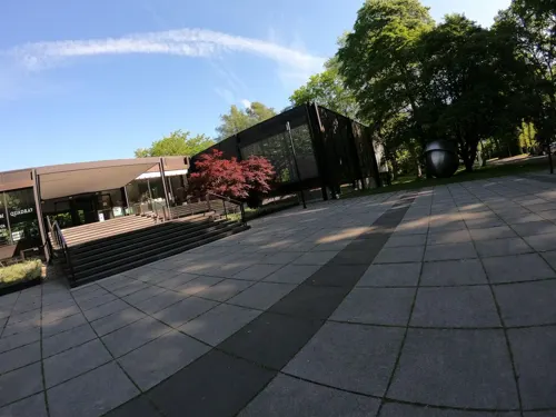

LVR-Industriemuseum
Museum · 7.8 km
Decentral organized Industry Museum in Germany's Rhineland Area with seven locations.


Malakoffturm von Schacht Prosper 2
Monument and historic site · 2.2 km
34 Knappenstraße, Bottrop


121 more on the map.
Parks, trails and playgrounds40



Landschaftspark Duisburg-Nord
Park · 11.4 km
Park in Duisburg, Germany



28 more on the map.
Restaurants and cafes199

Bistro Jederman
Cafe · Regional, Breakfast · 3.9 km
Ein Standort der Caritas Oberhausen Es bietet in Küche und Service rund dreißig Menschen mit Beeinträchtigung Tagesstruktur und Beschäftigung.
19 Gildenstraße, Oberhausen
Mo,We-Th 08:00-18:00; Tu,Fr 07:00-18:00; Sa 09:00-15:00; Su 15:00-18:00
Bistro Jederman - Caritas Oberhausen e.V.
Cafe · Regional, Breakfast · 3.9 km
Ein Standort der Caritas Oberhausen Es bietet in Küche und Service rund dreißig Menschen mit Beeinträchtigung Tagesstruktur und Beschäftigung.
19 Gildenstraße, Oberhausen
Mo,We-Th 08:00-18:00; Tu,Fr 07:00-18:00; Sa 09:00-15:00; Su 15:00-18:00
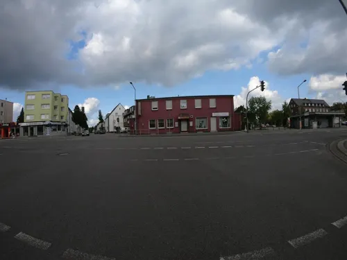
Pizzeria Grand Italia
Restaurant · Pizza, Burger, Italian, Indian, Grill, Dessert, Salad · 3.3 km
Pizzeria
22 Boyer Markt, Bottrop
Mo-Fr 11:30-15:30, Sa 11:30-22:30, Su 14:00-22:00
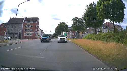
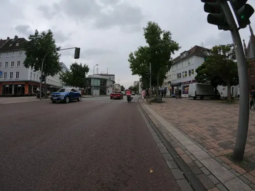

Maschinenhaus Lecker-im-Pott
Restaurant · Regional · 2.4 km
25a Ebelstraße, Bottrop
Th,Fr 14:00-20:00; Sa,Su 09:30-20:00
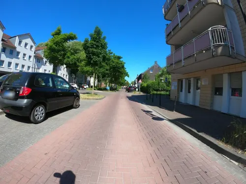
Pizzeria Gianni Rino
Restaurant · Italian · 2.2 km
246 Kirchhellener Straße, Bottrop
We-Fr 11:30-14:30,17:00-22:00; Tu,Sa,Su,PH 17:00-22:00
Zur Antony-Hütte
Restaurant · Regional · 3.8 km
20 Hasenstraße, Oberhausen
Mo-Sa 16:00-24:00;Su,PH 11:00-24:00
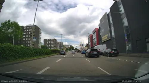
Zurheide Gourmet Bistro
Restaurant · Mediterranean · 1.6 km
11 Am Südring-Center, Bottrop
Mo-Sa 12:00-22:00
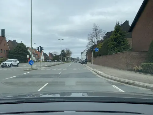
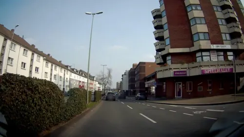


Asia Vegan Chay
Restaurant · Asian · 0.6 km
24 Essener Straße
Tu-Fr 12:00-15:00,17:00-21:30 open "Wenn Montag ein Feiertag war,...
187 more on the map.
Where to stay8
Churches and places of worship45
Liebfrauenkirche
Church · Roman Catholic · 1.9 km
76 Nordring, Bottrop
St. Franziskus
Church · Roman Catholic · 3.8 km
8 An St. Franziskus, Bottrop
St. Ludgerus
Church · Roman Catholic · 2.2 km
75 Birkenstraße, Bottrop
Shopping55
Gas and EV charging20
Schools, colleges and libraries50
Healthcare23
Map of Bottrop
250 places. The map loads OpenStreetMap tiles when you open it.
Getting there and nearby towns
Flughafen Essen-Mülheim (ESS) is the nearest airport with scheduled flights listed in OpenStreetMap, 13 km away.
- Oberhausen 7 km southwest, about 7 min by car
- Essen 9 km southeast, about 9 min by car
- Gelsenkirchen 12 km east, about 12 min by car
- Duisburg 15 km southwest, about 15 min by car
- Herne 21 km east, about 21 min by car
- Recklinghausen 21 km northeast, about 21 min by car
- Moers 22 km west, about 22 min by car
- Wuppertal 33 km southeast, about 33 min by car
- Krefeld 33 km southwest, about 33 min by car
- Düsseldorf 35 km south, about 35 min by car
Drive times are estimates from straight-line distance, not routes.
Local news
Headlines from INDB.
Reviews, tips and questions
Loading what members have shared...
Sources and licences
- GeoNames (CC BY 4.0): population, coordinates, regions and time zone
- Mapillary (see each image): photos
- OpenStreetMap contributors (ODbL 1.0): places, airports, map data
- Wikidata (CC0 1.0): elevation, founding date, time zone, website, landmarks and historic places
- Wikimedia Commons (see each image): photos
- Wikipedia (CC BY-SA 4.0): overview and history text
Photo credits
- Bottrop - Altmarkt 02 ies, Frank Vincentz, CC BY-SA 3.0
- Bottrop Monument 28 Kirche Heilig Kreuz, W.Strickling, CC BY-SA 4.0
- Bottrop Baudenkmal 23 Gerichtsstrasse 3 0040, Dr. W. Strickling, CC BY-SA 4.0
- Bottrop Baudenkmal 12 Vietormühle 0044, Dr. W. Strickling, CC BY-SA 4.0
- Kath. Kreuzkampkapelle in Bottrop - panoramio, Edgar El, CC BY 3.0
- Bottrop Baudenkmal 52 Gladbecker Strasse 13 0050, Dr. W. Strickling, CC BY-SA 4.0
- Kreuzkampkapelle Bottrop - panoramio, giggel, CC BY 3.0
- Wohngebäude von Josef Franke, Gerichtsstr 5., Bottrop, Stefan Freund, CC BY-SA 3.0 de
- Bottrop Monument 05 Kreuzkampkapelle, W.Strickling, CC BY-SA 4.0
- Bottrop Baudenkmal 50 Luise-Hensel-Strasse 6 0045, Dr. W. Strickling, CC BY-SA 4.0
- Bottrop Baudenkmal 58 Arbeitsamt Gerichtsstrasse 10 0039, Dr. W. Strickling, CC BY-SA 4.0
- 2010-04-27 – Bottrop – alte Mühle - panoramio, giggel, CC BY 3.0
- 2010-04-27 – Bottrop – Saalbau - panoramio, giggel, CC BY 3.0
- Bottrop Baudenkmal 19 Droste-Hülshoff-Platz 5 0056, Dr. W. Strickling, CC BY-SA 4.0
- Bottrop Monument 46 Gladbecker Str 1, W.Strickling, CC BY-SA 4.0
- Bottrop Monument 51 Gladbecker Str 1a, W.Strickling, CC BY-SA 4.0
- 2023-08-12 Hauptpost Bottrop 01, Bärbel Miemietz, CC BY-SA 4.0
- 2023-08-12 Hauptpost Bottrop 03, Bärbel Miemietz, CC BY-SA 4.0
- 2023-08-12 Hauptpost Bottrop 02, Bärbel Miemietz, CC BY-SA 4.0
- 2010-04-27 – Bottrop – Amtsgericht – Droste-Hülshoff-Platz - panoramio, giggel, CC BY 3.0
- Bottrop Baudenkmal 44 Hauptpost 0101, Dr. W. Strickling, CC BY-SA 4.0
- 2023-08-12 Hansa-Zentrum Bottrop 01, Bärbel Miemietz, CC BY-SA 4.0
- 2023-08-12 Hansa-Zentrum Bottrop 02, Bärbel Miemietz, CC BY-SA 4.0
- 2010-04-27 – Bottrop – Rathaus 1 - panoramio, giggel, CC BY 3.0
- Bottrop Baudenkmal 25 Finanzamt 0055, Dr. W. Strickling, CC BY-SA 4.0
- 2010-04-27 – Bottrop – Stadtmitte - panoramio, giggel, CC BY 3.0
- Turm der Kath. Kirche Heilig-Kreuz in Bottrop - panoramio, Edgar El, CC BY 3.0
- Bottrop Heilig-Kreuz - panoramio, giggel, CC BY 3.0
- Kath. Kirche Heilig-Kreuz in Bottrop - ICE-Panorama - panoramio, Edgar El, CC BY 3.0
- 2023-08-12 Berliner Bär (Bottrop), Bärbel Miemietz, CC BY-SA 4.0
- Bottrop Baudenkmal 57 Bank Kirchhellener Strasse 10 0069, Dr. W. Strickling, CC BY-SA 4.0
- Bottrop Monument 24 Rathaus, W.Strickling, CC BY-SA 4.0
- Das Meistermann-Fenster der Kath. Kirche Heilig-Kreuz in Bottrop - panoramio, Edgar El, CC BY 3.0
- 2010-04-27 – Bottrop – Rathaus 2 - panoramio, giggel, CC BY 3.0
- Aalto-Theater-Abends-02-2014, Tuxyso, CC BY-SA 3.0
- Colosseum Theater Essen 2011, Wiki05, CC0
- Kleines Theater Essen Gaensemarkt, Kungfuman, CC BY-SA 3.0
- Grillo-Theater-2012, Tuxyso, CC BY-SA 3.0
- Neue Mitte Oberhausen - Kino und Metronom Theater, Raimond Spekking, CC BY-SA 4.0
- Eingangspforte moviepark, Schue~commonswiki, Public domain
- MiR außen ganz, MiR Gelsenkirchen, CC BY-SA 3.0
- Schloss beck, Stefan Scheer, CC BY-SA 2.5
- Rheinisches Industriemuseum, Daniel Ullrich, Threedots, CC BY-SA 3.0
- Mülheim an der Ruhr, Camera Obscura, 2011-03 CN-01, kaʁstn Disk / Cat, CC BY-SA 3.0 de
- Alte Synagoge Essen 2014, Tuxyso, CC BY-SA 3.0
- Grugapark Essen, Wiki05, CC0
- Duisburg, Landschaftspark Duisburg-Nord, Hochofen 2 -- 2016 -- 1115, Dietmar Rabich, CC BY-SA 4.0
- Gelsenkirchen - Nordsternpark - Kohlenbunker+Bandbrücke+Kohlenmischanlage (Pyramide) 03 ies, Frank Vincentz, CC BY-SA 3.0
- Dom-Essen-mit-Burgplatz-und-Rathaus-2016, Tuxyso, CC BY-SA 3.0
- Universität Duisburg Essen, Wiki05, CC BY-SA 3.0
- Bottrop - Im Stadtgarten - Stadtgarten - Quadrat 06 ies, Frank Vincentz, CC BY-SA 3.0
- Burg-Vondern-Westen-vom-Weg-2013, Tuxyso, CC BY-SA 3.0
- Bottrop - Halde Beckstraße (Halde Prosperstraße) 01 ies, Frank Vincentz, CC BY-SA 3.0
- St Antony, MAN SE, CC BY 3.0
- Propsteikirche St. Cyriakus Bottrop, noebse, CC BY-SA 3.0
- Liebfrauenkirche Bottrop, Turm, Bancun, CC BY-SA 4.0
- Friedenskirche Essen-Dellwig, Wiki05, Public domain
- Gesamtschule Osterfeld, SilvioMartin, CC BY-SA 4.0
- Heinrich-Heine-Gymnasium Bottrop Gebäude B (Vordergebäude), Krabbenpulen, CC BY-SA 4.0
- Bottrop Baudenkmal 68 Kirche Herz Jesu Brauerstrasse 55 9241, Dr. W. Strickling, CC BY-SA 4.0
- Bottrop Baudenkmal 107 Kirche St. Franziskus 9266, Dr. W. Strickling, CC BY-SA 4.0
- Die Kath. Parabelkirche St. Ludgerus in Bottrop – Fuhlenbrock - panoramio, Edgar El, CC BY 3.0
- Bottrop - Halde Beckstraße (Halde Prosperstraße) 02 ies, Frank Vincentz, CC BY-SA 3.0
- Zeche Prosper II Schacht 2, Benutzer:Rasi57, CC BY-SA 3.0
- Essen-Gerschede Levinstrasse 161, Es-Punkt-Ge-Punkt, CC0
- Gladbeck - Industriestraße (Bottrop) - Halde Rheinbaben 11 ies, Frank Vincentz, CC BY-SA 3.0
- NSG Koellnischer Wald, 3, Grafenwald, Bottrop, GeorgDerReisende@Vicuna, CC BY-SA 4.0
- 2022-12-30 Martinskirche 03, Bärbel Miemietz, CC BY-SA 4.0
- St. Michael Essen-Dellwig, Wiki05, Public domain
- Essen-Dellwig Schule Kraienbruch, Es-Punkt-Ge-Punkt, CC0
- Indoor skydiving Bottrop wind tunnel scheme, Narkulome, CC BY 4.0
- Street-level photo, geogladbecker, CC BY-SA 4.0
- Street-level photo, heetENkoel, CC BY-SA 4.0
- Street-level photo, geogladbecker, CC BY-SA 4.0
- Street-level photo, bejotel, CC BY-SA 4.0
- Street-level photo, heetENkoel, CC BY-SA 4.0
- Street-level photo, geogladbecker, CC BY-SA 4.0
- Street-level photo, geogladbecker, CC BY-SA 4.0
- Street-level photo, geogladbecker, CC BY-SA 4.0
- Street-level photo, wladimir, CC BY-SA 4.0
- Street-level photo, geogladbecker, CC BY-SA 4.0
- Street-level photo, geogladbecker, CC BY-SA 4.0
- Street-level photo, heetENkoel, CC BY-SA 4.0
- Street-level photo, geogladbecker, CC BY-SA 4.0
- Street-level photo, heetENkoel, CC BY-SA 4.0
- Street-level photo, geogladbecker, CC BY-SA 4.0
- Street-level photo, geogladbecker, CC BY-SA 4.0
- Street-level photo, wladimir, CC BY-SA 4.0
- Street-level photo, geogladbecker, CC BY-SA 4.0
- Street-level photo, geogladbecker, CC BY-SA 4.0
- Street-level photo, geogladbecker, CC BY-SA 4.0
- Street-level photo, geogladbecker, CC BY-SA 4.0
- Street-level photo, wladimir, CC BY-SA 4.0
- Street-level photo, jakre73, CC BY-SA 4.0
- Street-level photo, geogladbecker, CC BY-SA 4.0


Page built November 8, 2026. Spotted a mistake? Tell us or suggest a place.