


Brake (Unterweser), Germany
Brake
Brake (Unterweser) is a town of 16,150 people in Lower Saxony, Germany.
Why visit Brake (Unterweser)
Townapedia lists 9 museums and landmarks, 10 parks and trails, 56 places to eat, 19 places to stay and 11 attractions in and around town.
Highlights include Centraltheater Brake, Oberfeuer Großerpater, Handwerksmuseum Ovelgönne and Schiffahrtsmuseum der Oldenburgischen Unterweser Borgstede & Becker (Haus2).
Weather in Brake (Unterweser)
Forecast from MET Norway (CC BY 4.0). Full forecast
About Brake (Unterweser)
Brake (German pronunciation: [ˈbʁaːkə]; Low German: Broak) is the district seat of Wesermarsch district in northern Germany.
From the Wikipedia article Brake, Lower Saxony (this version), under CC BY-SA 4.0.
Things to do11



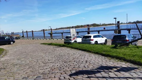
Harrier Kaje
Scenic view · 1.5 km
Fahrradrastpunkt mit sehr guter Aussicht auf Strom und Hafen

Museums and landmarks9

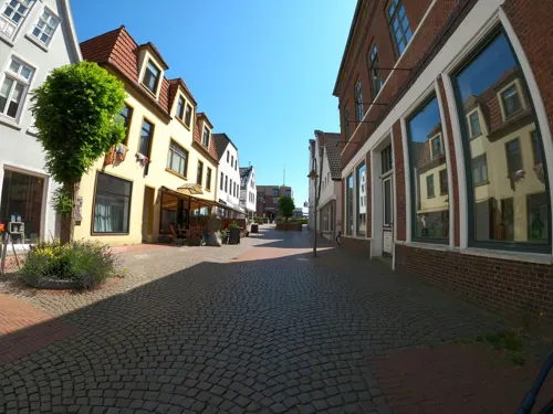
Schiffahrtsmuseum der Oldenburgischen Unterweser Borgstede & Becker (Haus2)
Museum · 0.8 km
9 Breite Straße, Brake (Unterweser)
Apr-Oct: Tu-Su 10:00-17:00; Nov-Mar Tu-Sa 11:00-17:00, Su...



Parks, trails and playgrounds10





Restaurants and cafes56

Charisma
Restaurant · Greek · 0.8 km
53 Breite Straße, Brake (Unterweser)
Su-Th 17:30-22:00; Fr,Sa 17:30-23:00; Tu off
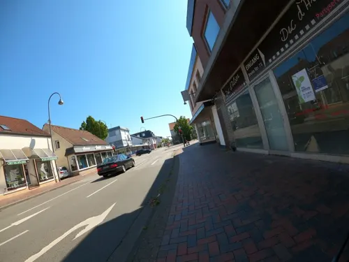
Duc d'Alben
Restaurant · Regional, Burger · 0.9 km
71 Breite Straße, Brake (Unterweser)
Tu-Su 17:00-23:00;Mo off
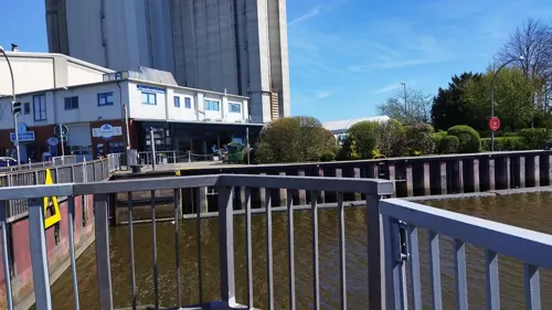

aipi.cafe
Cafe · Coffee Shop
Firmeninternes Mini-Internet-Café für Kunden und Mitarbeiter.
38 Bahnhofstraße, Brake (Unterweser)
"nach Vereinbarung"

#datenschutz.bar
Bar and pub
Nicht öffentliche Bar von aipi - nur für Geschäftskunden
38 Bahnhofstraße, Brake (Unterweser)
"nach Vereinbarung"

Bäckermeister Haferkamp GmbH
Bakery · 2.3 km
118 Kirchenstraße, Brake
Mo-Sa 06:30-19:00; Su 07:30-12:00
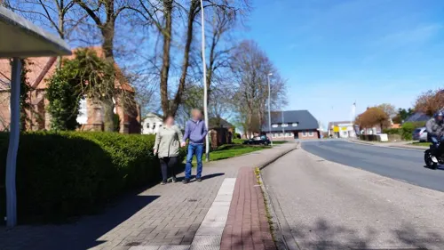


Bei Michi & Holger
Restaurant · German · 4.2 km
6 Kirchenstraße, Ovelgönne
18:00-22:00
Bistro Bodrum
Restaurant · International, Kebab, Pizza, Turkish · 0.9 km
8 Kirchenstraße, Brake
Mo-Fr 11:00-22:00; Sa-Su 12:00-22:00
44 more on the map.
History
The term "Brake" first cropped up in the 14th century when an unsealed break in a dike led to flooding in the Harrier area. The actual documentary mention, dating from 25 to 30 May 1384, says "brake to Harghen (Harrien)". By the 17th century, "Brake" was ever more often being used not simply as the word for the old dikeburst, but as the community's name. From that time come the names Braksiel and Harrierbrake.
In 1731, the old Fischerhaus, Brake's oldest maintained house, was built. In 1756 came Brake's first documentary mention as a port city. During the 19th century, Brake became an important industrial centre for shipping, and the port facilities along the Weser were further expanded. In 1814, Brake set up its first council, Amt Brake. In 1835, Brake was declared a free port. In 1846, the telegraph was set up to relay shipping news between Bremen and Bremerhaven. In 1848–52 Brake was the first base of the German Imperial Fleet under Admiral Karl Rudolf Brommy, the first ever commander of a unified German fleet.
From the History section of Brake, Lower Saxony on Wikipedia, under CC BY-SA 4.0.
Where to stay19
Churches and places of worship12
St. Bartholomäus-Kirche Golzwarden
Church · Lutheran · 2.4 km
21 Raiffeisenstraße, Brake
Friedrichskirche Hammelwarden
Church · Lutheran · 3.1 km
Hammelwarder Straße, Brake
St. Johanniskirche Sandstedt
Church · Evangelisch · 4.1 km
Marktstraße, Hagen im Bremischen
Shopping15
Fahrradwerkstatt Zweiraddiele Norbert Lang
Shop · 2.1 km
170a Lange Straße, Brake
Gas and EV charging6
Schools, colleges and libraries14
Healthcare6
Map of Brake (Unterweser)
158 places. The map loads OpenStreetMap tiles when you open it.
Getting there and nearby towns
JadeWeserAirport (WVN) is the nearest airport with scheduled flights listed in OpenStreetMap, 34 km away.
- Schwanewede 14 km southeast, about 14 min by car
- Nordenham 19 km north, about 19 min by car
- Loxstedt 19 km northeast, about 19 min by car
- Rastede 21 km southwest, about 21 min by car
- Osterholz-Scharmbeck 24 km southeast, about 24 min by car
- Varel 24 km west, about 24 min by car
- Ritterhude 24 km southeast, about 24 min by car
- Schiffdorf 25 km northeast, about 25 min by car
- Bremerhaven 25 km north, about 25 min by car
- Oldenburg 28 km southwest, about 28 min by car
Drive times are estimates from straight-line distance, not routes.
Local news
Headlines from INDB.
Reviews, tips and questions
Loading what members have shared...
Sources and licences
- GeoNames (CC BY 4.0): population, coordinates, regions and time zone
- Mapillary (see each image): photos
- OpenStreetMap contributors (ODbL 1.0): places, airports, map data
- Wikidata (CC0 1.0): elevation, founding date, time zone, website
- Wikimedia Commons (see each image): photos
- Wikipedia (CC BY-SA 4.0): overview and history text
Photo credits
- Brake Schifffahrtsmuseum (01), Hombre, CC BY-SA 3.0
- 189 800-6 der Pressnitztalbahn in Brake (Unterweser), JoachimKohler-HB, CC BY-SA 4.0
- 2-Kraftlokomotive Stadler Eurodual 2159 234-4 in Brake (Unterweser), JoachimKohler-HB, CC BY-SA 4.0
- Sonntags geschlossen - Videoreisezentrum am Bahnhof Brake (Unterweser), JoachimKohler-HB, CC BY-SA 4.0
- Diesellok 650 006-3 Freightliner PL in Brake (Unterweser), JoachimKohler-HB, CC BY-SA 4.0
- EMD JT42M N° 66006 der Freightliner PL in Brake (Unterweser), JoachimKohler-HB, CC BY-SA 4.0
- 155 196-9 FWK in Brake (Unterweser), JoachimKohler-HB, CC BY-SA 4.0
- Bahnhof Brake (Unterweser). Stillgelegter Bahnsteig (2022), JoachimKohler-HB, CC BY-SA 4.0
- Brake (Unterweser) Aus (2024), JoachimKohler-HB, CC BY-SA 4.0
- Außenansicht, Jan Wendrich, CC BY-SA 2.0 de
- Sandstedt old range rear 6559, Ein Dahmer, CC BY-SA 4.0
- Bartholomäuskirche Brake Golzwarden, Brakemc, CC BY-SA 3.0
- Sandstedt range rear 6565, Ein Dahmer, CC BY-SA 4.0
- Grosserpater range rear 6573, Ein Dahmer, CC BY-SA 4.0
- Grosserpater range front 6590, Ein Dahmer, CC BY-SA 4.0
- Ovelgönne Kirche, BlankeVla, CC BY 3.0
- St. Marien Kirche Brake, Ludger Sunder-Plassmann, CC BY-SA 4.0
- Kirche Wersabe 1, ClausNe, CC BY-SA 4.0
- Harriersand range rear 6589, Ein Dahmer, CC BY-SA 4.0
- Sandstedt Leuchtturm Oberfeuer alt, Oberlausitzerin64, CC BY-SA 4.0
- Harriersand range front 6585, Ein Dahmer, CC BY-SA 4.0
- Soldatendenkmal, Brake 0362, Gerd Fahrenhorst, CC BY 4.0
- Brake 2012 (10), Soluvo, CC BY-SA 4.0
- Friedrichskirche in Hammelwarden, Helmut Behrends, Freesenweg 41, D-26131 Oldenburg, CC BY-SA 3.0 de
- Stadtkirche (Brake) Foto 3, Gerd Fahrenhorst, CC BY 4.0
- Segelschiffe im Braker Binnenhafen, JoachimKohler-HB, CC BY-SA 4.0
- Braker Binnenhafen mit Silos und Schoner "Ruach"(2015), JoachimKohler-HB, CC BY-SA 4.0
- Hinterschiff des Schoners "Ruach" (Brake, 2015), JoachimKohler-HB, CC BY-SA 4.0
- Brake(Utw.)- Binnenhafen mit Silos J. Müller, JoachimKohler-HB, CC BY-SA 4.0
- Brake(Utw.) Ölbekämpfungsschiff ÖSK-1 im Binnenhafen, JoachimKohler-HB, CC BY-SA 4.0
- Saugbaggerschiff "Maasmond" im Braker Binnenhafen (2015), JoachimKohler-HB, CC BY-SA 4.0
- Gleisfeld am Braker Bahnhof mit E-Loks, JoachimKohler-HB, CC BY-SA 4.0
- Fischereifahrzeuge im Braker Hafen, JoachimKohler-HB, CC BY-SA 4.0
- BRA-4 "Destiny" Kutter im Braker Binnenhafen (2015), JoachimKohler-HB, CC BY-SA 4.0
- Heck der BRA-4 Destiny (2015), JoachimKohler-HB, CC BY-SA 4.0
- Binnenhafen Brake mit Hafenkran (2015), JoachimKohler-HB, CC BY-SA 4.0
- Ansicht vom Binnenhafen J. Müller-Silos in Brake (2026), JoachimKohler-HB, CC BY-SA 4.0
- ROTESAND 3186, Ein Dahmer, CC BY-SA 4.0
- Bahnhofstraße 55, Garage, Brake, Gerd Fahrenhorst, CC BY 4.0
- Bahnhofstraße 53, Brake, Gerd Fahrenhorst, CC BY 4.0
- Mitteldeichstraße 31, Centraltheater, Brake, Gerd Fahrenhorst, CC BY 4.0
- Handwerksmuseum Ovelgönne Apotheke Lizenz HMO 2022, HWMOvelgoenne, CC BY-SA 4.0
- Street-level photo, changchun1, CC BY-SA 4.0
- Street-level photo, VIA_KK, CC BY-SA 4.0
- Street-level photo, changchun1, CC BY-SA 4.0
- Street-level photo, changchun1, CC BY-SA 4.0
- Street-level photo, VIA_KK, CC BY-SA 4.0
- Street-level photo, VIA_KK, CC BY-SA 4.0
- Street-level photo, VIA_KK, CC BY-SA 4.0
- Street-level photo, VIA_KK, CC BY-SA 4.0
- Street-level photo, VIA_KK, CC BY-SA 4.0
- Street-level photo, VIA_KK, CC BY-SA 4.0
- Street-level photo, VIA_KK, CC BY-SA 4.0


Page built November 8, 2026. Spotted a mistake? Tell us or suggest a place.