


Osterholz-Scharmbeck, Germany
Osterholz-Scharmbeck is a town of 31,405 people in Lower Saxony, Germany.
Why visit Osterholz-Scharmbeck
Townapedia lists 54 museums and landmarks, 43 parks and trails, 187 places to eat, 28 places to stay and 18 attractions in and around town.
Highlights include Hof Lütjen, Tiergarten Ludwigslust, Museum am Modersohn-Haus and Worpsweder Kunsthalle.
Weather in Osterholz-Scharmbeck
Forecast from MET Norway (CC BY 4.0). Full forecast
About Osterholz-Scharmbeck
Osterholz-Scharmbeck (German pronunciation: [ˈoːstɐˌhɔlts ˈʃaʁmbɛk] ; Low German: Oosterholt-Scharmbeek) is a town and the capital of the district of Osterholz, in Lower Saxony, Germany. Osterholz-Scharmbeck is situated between the cities of Bremen and Bremerhaven.
From the Wikipedia article Osterholz-Scharmbeck (this version), under CC BY-SA 4.0.
Photos of Osterholz-Scharmbeck


Things to do18

Hof Lütjen
Farm and orchard · 9.5 km
Selbstbedienungshofladen
24 Verlüßmoorer Straße, Vollersode
Mo-Su 07:00-19:00



Aussichtsturm Neu Helgoland
Scenic view · 6.0 km
Gebaut 2014 vom Landkreis Osterholz (Naturschutzbehörde)
6 more on the map.
Museums and landmarks54

Worpsweder Kunsthalle
Museum · 8.9 km
17 Bergstraße, Worpswede
Tu-Su 10:00-18:00


Käseglocke
Museum · 9.2 km
13 Lindenallee, Worpswede
Oct-Mar: Sa,Su 13:00-16:00; Apr-Sep: Sa,Su 13:00-17:00


Gräfin Emma
Monument and historic site · 9.3 km
Lebensgroße Bronzestatue zu Ehren der milidtätigen Gräfin, die dem Volk die Bürgerweide geschenkt hat. Ein Gebiet, das ein Krüppel von...

Galerie Altes Rathaus
Museum · 9.2 km
1 Bergstraße, Worpswede
Nov-Mar: Tu-Fr 14:00-17:00; Nov-Mar: Sa,Su 11:00-17:00; Apr-Oct:...

Museumsanlage Osterholz-Scharmbeck
Monument and historic site · 1.2 km
42 Bördestraße
Th-Fr 14:00-17:00;Sa-Su 10:00-17:00
Heinrich-Vogeler-Museum
Museum · 9.4 km
Mo-Su 10:00-18:00; Dec 25 off; Dec 24 off; Dec 31 off; Dec 26...
42 more on the map.
Parks, trails and playgrounds43
Allwetterbad
Sports field and stadium
12 Am Barkhof, Osterholz-Scharmbeck
Mo-Fr 06:30-21:00; Tu,Th 07:30-21:00; Sa,Su,PH 10:00-18:00; easter...



Heerweger Moor und Quellbereiche der Ritterhuder Beeke
Hiking and trails · 5.2 km
31 more on the map.
Restaurants and cafes187
Animal park Ludwigslust
Restaurant · Coffee Shop, Friture, Ice Cream, Sausage · 2.6 km
31 Garlstedter Kirchweg
Mo-Su 09:30-18:00
Gasthaus Schamaika
Restaurant · Regional · 9.2 km
33 Teufelsmoorstraße, Osterholz-Scharmbeck
Oct-Apr: Mo-Fr 09:00-16:00; Oct-Apr: Sa,Su 10:00-18:00;May-Sep:...
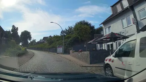
Hotel-Restaurant Jägerstuben
Restaurant · Breakfast, Burger, Chicken, Friture, German · 6.4 km
23 Struckbergstraße, Ritterhude
Mo-Fr 06:00-09:00, 18:00-22:00; Sa 07:00-10:00, 18:00-22:00
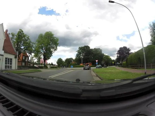
Lintel's
Restaurant · Burger · 1.5 km
66 Ritterhuder Straße, Osterholz-Scharmbeck
closed "Vorübergehend geschlossen"
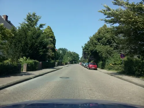
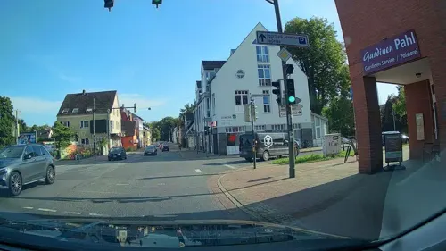


Bäckerei Rolf
Cafe
57b Bahnhofstraße, Osterholz-Scharmbeck
Mo-Fr 06:00-17:00; Sa 06:00-13:00; Su,PH 07:30-11:30
175 more on the map.
History
The town was first mentioned in 1043 as Scirnbeci. From 1180, the Scharmbeck belonged to the Prince-Archbishopric of Bremen. The monastery in Osterholz was founded in 1182 and persisted until 1650, when Lower Saxony became mostly Protestant. In 1648 the Prince-Archbishopric was transformed into the Duchy of Bremen, which was first ruled in personal union by the Swedish and from 1715 on by the Hanoverian Crown. In 1823 the Duchy was abolished and its territory became part of the Stade Region in the Kingdom of Hanover.
In 1927, the two communities of Osterholz and Scharmbeck were merged under the name of Osterholz-Scharmbeck and in 1929 town privileges were granted.
Between 1978 and 1992, 4,200 soldiers of the U.S. Army's 2nd Armored Division (Forward) were stationed, and another 4,000 family members resided in Osterholz-Scharmbeck.
From the History section of Osterholz-Scharmbeck on Wikipedia, under CC BY-SA 4.0.
Notable people from Osterholz-Scharmbeck
 Bodo RamelowGerman politicianPhoto: Steffen Prößdorf, CC BY-SA 4.0
 Herbert BehrensGerman politicianPhoto: Foto-AG Gymnasium Melle, CC BY 4.0
 Christian Georg Theodor RueteGerman ophthalmologist (1810–1867)Photo: Unknown author, CC BY 2.0
- Roland BaarGerman rower and university teacher (1965–2018)
- Eduard NeumannGerman university teacher (1903-1985)
- Olaf SchmidtGerman glider aerobatic pilot
Born in Osterholz-Scharmbeck, according to Wikidata (CC0). Each name links to its Wikipedia article.
Where to stay28
Übernachtung im kleinen philosophischen Salon
Motel and hotel · 9.3 km
10 Heinrich-Vogeler-Weg, Worpswede
Churches and places of worship34
Shopping57
Gas and EV charging21
CLASSIC Heilshorn
Gas station · 6.2 km
35 Bremer Heerstraße, Osterholz-Scharmbeck
Schools, colleges and libraries45
Arbeiter-Samariter-Bund Landesverband Bremen e.V. Bildungszentrum Ritterhude
School · 6.9 km
9 Ringstraße, Ritterhude
Healthcare18
Map of Osterholz-Scharmbeck
250 places. The map loads OpenStreetMap tiles when you open it.
Getting there and nearby towns
Bremen Airport (BRE) is the nearest airport with scheduled flights listed in OpenStreetMap, 20 km away.
- Ritterhude 6 km southwest, about 6 min by car
- Worpswede 9 km east, about 9 min by car
- Hambergen 9 km north, about 9 min by car
- Lilienthal 12 km southeast, about 12 min by car
- Schwanewede 13 km west, about 13 min by car
- Grasberg 14 km east, about 14 min by car
- Lemwerder 14 km southwest, about 14 min by car
- Bremen 17 km south, about 17 min by car
- Hagen im Bremischen 18 km northwest, about 18 min by car
- Delmenhorst 22 km southwest, about 22 min by car
Drive times are estimates from straight-line distance, not routes.
Towns near Osterholz-Scharmbeck


Keep exploring
Local news
Headlines from INDB.
Reviews, tips and questions
Loading what members have shared...
Sources and licences
- GeoNames (CC BY 4.0): population, coordinates, regions and time zone
- Mapillary (see each image): photos
- OpenStreetMap contributors (ODbL 1.0): places, airports, map data
- Wikidata (CC0 1.0): elevation, founding date, time zone, website, landmarks and historic places
- Wikimedia Commons (see each image): photos
- Wikipedia (CC BY-SA 4.0): overview and history text
Photo credits
- Schlauchkirche2 OHZ, CWitte at German Wikipedia, CC BY-SA 3.0
- Rathaus Osterholz-Scharmbeck, Till Westermayer, CC BY-SA 2.0
- Kriegerdenkmal Osterholz-Scharmbeck, Wernerad, CC BY-SA 3.0
- Osterholz-Scharmbeck, St. Willehadi, Orgel (14), Subbass1, CC BY-SA 4.0
- Kleinbahnhof Osterholz-Scharmbeck • Kulturzentrum, Geogast, CC BY-SA 4.0
- Kleinbahnhof Osterholz-Scharmbeck • Kulturzentrum • Bahnhofsschild, Geogast, CC BY-SA 4.0
- Osterholz-Scharmbeck, St. Willehadi, Chororgel (4), Subbass1, CC BY-SA 4.0
- Osterholz-Scharmbeck, St. Willehadi (04) (cropped), Subbass1, CC BY-SA 4.0
- Osterholz-Scharmbeck, St. Willehadi, Chororgel (5), Subbass1, CC BY-SA 4.0
- Osterholz-Scharmbeck, St. Willehadi, Chororgel (3), Subbass1, CC BY-SA 4.0
- Osterholz-Scharmbeck, St. Willehadi, Chororgel (1), Subbass1, CC BY-SA 4.0
- Osterholz-Scharmbeck, St. Willehadi, Chororgel (2), Subbass1, CC BY-SA 4.0
- Osterholz-Scharmbeck, St. Willehadi (04), Subbass1, CC BY-SA 4.0
- Osterholz-Scharmbeck, St. Willehadi, Chororgel (6), Subbass1, CC BY-SA 4.0
- Osterholz-Scharmbeck, St. Willehadi, Orgel (07), Subbass1, CC BY-SA 4.0
- Osterholz-Scharmbeck, St. Willehadi (05), Subbass1, CC BY-SA 4.0
- Osterholz-Scharmbeck, St. Willehadi, Orgel (06), Subbass1, CC BY-SA 4.0
- Osterholz-Scharmbeck, St. Willehadi, Orgel (04) (cropped), Subbass1, CC BY-SA 4.0
- Osterholz-Scharmbeck, St. Willehadi, Orgel (02), Subbass1, CC BY-SA 4.0
- Osterholz-Scharmbeck, St. Willehadi, Orgel (03) (cropped), Subbass1, CC BY-SA 4.0
- Osterholz-Scharmbeck, St. Willehadi, Orgel (08), Subbass1, CC BY-SA 4.0
- Osterholz-Scharmbeck, St. Willehadi, Orgel (03), Subbass1, CC BY-SA 4.0
- Osterholz-Scharmbeck, St. Willehadi, Orgel (04), Subbass1, CC BY-SA 4.0
- Osterholz-Scharmbeck, St. Willehadi, Orgel (15), Subbass1, CC BY-SA 4.0
- Osterholz-Scharmbeck, St. Willehadi, Orgel (17), Subbass1, CC BY-SA 4.0
- Osterholz-Scharmbeck, St. Willehadi, Orgel (01), Subbass1, CC BY-SA 4.0
- Osterholz-Scharmbeck, St. Willehadi, Orgel (07) (cropped), Subbass1, CC BY-SA 4.0
- Osterholz-Scharmbeck, St. Willehadi, Orgel (12), Subbass1, CC BY-SA 4.0
- Osterholz-Scharmbeck, St. Willehadi, Orgel (10), Subbass1, CC BY-SA 4.0
- Osterholz-Scharmbeck, St. Willehadi, Orgel (13), Subbass1, CC BY-SA 4.0
- Osterholz-Scharmbeck, St. Willehadi, Orgel (16), Subbass1, CC BY-SA 4.0
- Osterholz-Scharmbeck, St. Willehadi, Orgel (09), Subbass1, CC BY-SA 4.0
- Osterholz-Scharmbeck, St. Willehadi, Orgel (18), Subbass1, CC BY-SA 4.0
- Osterholz-Scharmbeck, St. Willehadi, Orgel (11), Subbass1, CC BY-SA 4.0
- Osterholz-Scharmbeck, St. Willehadi, Orgel (05), Subbass1, CC BY-SA 4.0
- Bahnhofsschild Osterholz-Scharmbeck, Geogast, CC BY-SA 3.0
- Osterholz-Scharmbeck, St. Willehadi (01), Subbass1, CC BY-SA 4.0
- Friedhorstpark 20160619, دوست خوب, CC BY-SA 4.0
- Campus, Jacobs University Bremen, 2006, IUB, CC BY-SA 3.0
- Zionskirche Worpswede South, picture: user:Concord, CC BY-SA 4.0
- Pfad in der Westlichen Hälfte des Langen Moores, AchtungBetreten, CC0
- Kaeseglocke, Unknown author, CC BY-SA 3.0
- Bremen-Lesum St-Martini 01, Joern M, CC BY-SA 3.0
- 90646 Wasserhorst Kirche v WSW, Ulamm ( talk ), CC BY-SA 4.0
- 2020-09-14 Worpswede kath Kirche Maria Frieden (2), Eduard47, CC BY-SA 4.0
- EmmaVonLesum, Quarz, CC BY-SA 3.0 de
- SchuleLandskronastr201908, HVL2.0 ( talk ), CC BY-SA 4.0
- Worpsweder Kunsthalle Friedrich Netzel Fassade, Axel Hindemith, CC BY-SA 4.0
- Worpswede Barkenhoff, Till F. Teenck, CC BY-SA 2.5
- Haus im Schluh, Alinea, Public domain
- Naturschutzgebiet Brundorfer Moor, Smarties, CC BY-SA 4.0
- Bremen-Burglesum St-Brigitta 01, Joern M, CC BY-SA 3.0
- Osterholz Familie 1, Kirchenfan, CC0
- Scharmbecker Muehle, CWitte, CC BY-SA 3.0
- Schonebecker Aue 01, MiracluixHB, Public domain
- Truper Blänken Naturschutz, Leecha4125, CC BY-SA 4.0
- Street-level photo, live, CC BY-SA 4.0
- Street-level photo, zoegglmeyr1, CC BY-SA 4.0
- Street-level photo, manfredi, CC BY-SA 4.0
- Street-level photo, geogast, CC BY-SA 4.0
- Street-level photo, manfredi, CC BY-SA 4.0
- Street-level photo, manfredi, CC BY-SA 4.0
- Street-level photo, zoegglmeyr1, CC BY-SA 4.0
- Street-level photo, zoegglmeyr1, CC BY-SA 4.0
- Street-level photo, manfredi, CC BY-SA 4.0
- Street-level photo, StefanS79, CC BY-SA 4.0
- Street-level photo, StefanS79, CC BY-SA 4.0
- Street-level photo, aceini, CC BY-SA 4.0
- Street-level photo, StefanS79, CC BY-SA 4.0
- Street-level photo, geogast, CC BY-SA 4.0
- Street-level photo, StefanS79, CC BY-SA 4.0
- Street-level photo, StefanS79, CC BY-SA 4.0
- Street-level photo, manfredi, CC BY-SA 4.0
- Street-level photo, StefanS79, CC BY-SA 4.0
- Street-level photo, live, CC BY-SA 4.0
- Street-level photo, manfredi, CC BY-SA 4.0
- Street-level photo, geogast, CC BY-SA 4.0
- Street-level photo, geogast, CC BY-SA 4.0
- Street-level photo, geogast, CC BY-SA 4.0
- Street-level photo, heetENkoel, CC BY-SA 4.0
- Street-level photo, heetENkoel, CC BY-SA 4.0
- Street-level photo, heetENkoel, CC BY-SA 4.0
- Street-level photo, heetENkoel, CC BY-SA 4.0
- Street-level photo, abmap, CC BY-SA 4.0
- Street-level photo, StefanS79, CC BY-SA 4.0
- Street-level photo, live, CC BY-SA 4.0


Page built November 9, 2026. Spotted a mistake? Tell us or suggest a place.