


Why visit Brand-Erbisdorf
Townapedia lists 131 museums and landmarks, 21 parks and trails, 146 places to eat, 29 places to stay and 20 attractions in and around town.
Highlights include Tierpark, Hofladen mit Räucherei, Huthaus Einigkeit and Dreibrüderschacht.
Weather in Brand-Erbisdorf
Forecast from MET Norway (CC BY 4.0). Full forecast
About Brand-Erbisdorf
Brand-Erbisdorf (German pronunciation: [ˌbʁantˈʔɛʁbɪsdɔʁf] ) is a small town in the district of Mittelsachsen, in Saxony, Germany. It is situated 5 km south of Freiberg. As of 2020, the town has a population of 9,145.
From the Wikipedia article Brand-Erbisdorf (this version), under CC BY-SA 4.0.
Things to do20

Tierpark
Zoo and aquarium · 5.3 km
8T Chemnitzer Straße, Freiberg
Apr 16-Oct 15: 09:00-17:00; Oct 16-Apr 15: 09:00-15:30; Mo off
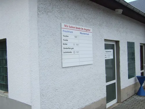
Hofladen mit Räucherei
Farm and orchard · 5.7 km
Verkaufsangebote lebender Süßwasserfisch, je nach Saison: Karpfen, Forelle, Saibling, Wels, Schlei, Hecht und Barsch | wöchentlich...
1 Talmühle, Lichtenberg/Erzgeb.
Fr 08:00-12:00,13:00-17:00; Sa 08:00-12:00






8 more on the map.
Museums and landmarks131

Huthaus Einigkeit
Museum · 0.6 km
14 Jahnstraße, Brand-Erbisdorf
Tu-Su 07:00-12:00,13:00-17:00


Freibergsdorfer Hammerwerk
Monument and historic site · 4.8 km
Technical_monument
4 Hammerweg, Freiberg


Königlich sächsischer Meilenstein
Monument and historic site · 5.1 km
Zur Wegweisersäule umgearbeiteter Stationsstein aus Freiberg


Schloss Weißenborn
Monument and historic site · 5.3 km
8 Frauensteiner Straße, Weißenborn/Erzgeb.

Klatschweiberbrunnen
Monument and historic site · 5.8 km
Wandrosette mit Fahrdrahtaufhänger der ehemaligen Straßenbahn Freiberg, welche im Zeitraum 1902-1919 die Verkehrsverbindungslinie...


119 more on the map.
Parks, trails and playgrounds21

Johannisbad
Sports field and stadium · 5.4 km
Tu,Th 10:00-22:00; We,Fr 07:00-22:00; Sa,Su,PH 09:00-22:00

Freibad Weißenborn
Sports field and stadium · 5.3 km
Mo-Su 10:00-19:00; Oct-Apr off
Johannisbad Freiberg
Sports field and stadium · 5.4 km
1A Johann-Sebastian-Bach-Straße, Freiberg
Tu,Th 11:00-21:45; We,Fr 07:00-21:45; Sa,Su 09:00-21:45


Saarplatz
Park · 4.4 km
Mit direktem Blick auf die Saarsäule laden zwei Bänke zum gemütlichen verweilen ein.

9 more on the map.
Restaurants and cafes146
Landhotel Kleinschirma
Restaurant · Regional · 5.0 km
65 Freiberger Straße, Oberschöna
Mo 11:30-22:00; Tu 16:00-22:00; We 11:30-22:00; Th 16:00-22:00; Fr...

Schankhaus 1863
Restaurant · Regional, Fast Food · 5.9 km
Eingang Kaufhausgasse
16 Obermarkt, Freiberg
Mo-Th 17:30-22:00; Fr-Sa 17:30-23:00
World Food
Restaurant · International, Greek · 5.5 km
8 Bahnhofstraße, Freiberg
Mo-Th 11:30-14:00,17:00-22:00; Fr 11:30-14:00,17:00-23:00;...
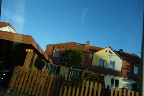
Bowling-Café am Stollnhaus
Cafe · Regional · 3.0 km
139 Hauptstraße, Freiberg
Oct-Apr: Mo 14:00-21:00; Tu 16:00-22:00; We-Th 14:00-21:00; Fr...

Gartengaststätte Waldfrieden
Restaurant · Regional, German · 5.2 km
15 Brückenstraße, Freiberg
Mo-Fr 15:00+; Sa 10:00-22:00; PH,Su 10:00-14:30; Tu off
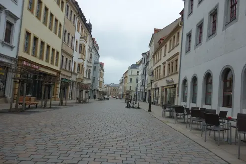
Oelmühle
Restaurant · Regional · 3.8 km
101 Dorfstraße, Oberschöna
Mo, Tu 17:00-20:30; Th-Sa 11:00-20:30; Su[1], We off; Su 11:00-14:30


134 more on the map.
History
The town is first mentioned in 1209 as Erlwinesberc, although it is suggested that it was founded earlier, in the middle of the 12th century.
The long tradition of silver mining around the town came to an end in the beginning of the 20th century. It was only after 1945 that the mining industry reappeared to a limited extent, before finally closing in 1968. From 1900 onwards, various other industries began to take hold in the town, slowly replacing mining as the primary industry. Of these were most notably the wood industry originating from the Ore Mountains and the "Elite-Werke".
From the History section of Brand-Erbisdorf on Wikipedia, under CC BY-SA 4.0.
Where to stay29
Churches and places of worship24
Evangelisch-Lutherische Kirchgemeinde Brand-Erbisdorf-St.Michaelis
Church · Lutheran · 0.7 km
3 Kirchweg, Brand-Erbisdorf
Kirchgemeinde "Jakobi-Christophorus"
Church · Lutheran · 2.5 km
74 Am Graben, Freiberg
Evangelisch-freikirchliche Gemeinde Freiberg
Church · Baptist · 5.2 km
41 Chemnitzer Straße, Freiberg
Shopping56
Gas and EV charging11
Schools, colleges and libraries18
Healthcare16
Map of Brand-Erbisdorf
250 places. The map loads OpenStreetMap tiles when you open it.
Getting there and nearby towns
Dresden Airport (DRS) is the nearest airport with scheduled flights listed in OpenStreetMap, 43 km away.
- Flöha 17 km west, about 17 min by car
- Zschopau 22 km southwest, about 22 min by car
- Olbernhau 23 km south, about 23 min by car
- Dippoldiswalde 25 km east, about 25 min by car
- Chemnitz 28 km west, about 28 min by car
- Dresden 36 km northeast, about 36 min by car
- Burgstädt 37 km west, about 37 min by car
- Weinböhla 37 km northeast, about 37 min by car
- Stollberg 42 km southwest, about 42 min by car
- Penig 44 km west, about 44 min by car
Drive times are estimates from straight-line distance, not routes.
Local news
Headlines from INDB.
Reviews, tips and questions
Loading what members have shared...
Sources and licences
- GeoNames (CC BY 4.0): population, coordinates, regions and time zone
- Mapillary (see each image): photos
- OpenStreetMap contributors (ODbL 1.0): places, airports, map data
- Wikidata (CC0 1.0): elevation, founding date, time zone, website, landmarks and historic places
- Wikimedia Commons (see each image): photos
- Wikipedia (CC BY-SA 4.0): overview and history text
Photo credits
- Branderbisdorfzentrum, Unukorno, CC BY-SA 3.0
- Brand-Erbisdorf Hauptstrasse 23, Unukorno, CC BY 4.0
- Brand-Erbisdorf Polizei 02, Unukorno, CC BY 4.0
- Brand-Erbisdorf Polizei 01, Unukorno, CC BY 4.0
- Brand-Erbisdorf Eisenbahnbruecke Brandsteig 02, Unukorno, CC BY 4.0
- Brand-Erbisdorf Eisenbahnbruecke Brandsteig 03, Unukorno, CC BY 4.0
- Brand-Erbisdorf Eisenbahnbruecke Brandsteig 01, Unukorno, CC BY 4.0
- Brand-Erbisdorf Stadthaus Detail, Unukorno, CC BY 4.0
- Brand-Erbisdorf Denkmal Opfer beider Weltkriege, Unukorno, CC BY 4.0
- Brand-Erbisdorf Stadthaus, Unukorno, CC BY-SA 3.0
- 14804-Brand-Erbisdorf-1912-Hotel Kronprinz-Brück & Sohn Kunstverlag, Brück & Sohn Kunstverlag Meißen, CC0
- 21728-Brand-Erbisdorf-1920-Gasthof zum Kronprinz-Brück & Sohn Kunstverlag, Brück & Sohn Kunstverlag Meißen, CC0
- 10667-Brand-Erbisdorf-1909-"Beschert Glück" - Altes Grubengebäude-Brück & Sohn Kunstverlag, Brück & Sohn Kunstverlag Meißen, CC0
- 21865-Brand-Erbisdorf-1921-Großhartmannsdorfer Straße-Brück & Sohn Kunstverlag, Brück & Sohn Kunstverlag Meißen, CC0
- 21864-Brand-Erbisdorf-1921-Erzgebirgische Holzindustrie-Fabrik-Brück & Sohn Kunstverlag, Brück & Sohn Kunstverlag Meißen, CC0
- 21867-Brand-Erbisdorf-1921-Berthahütte-Brück & Sohn Kunstverlag, Brück & Sohn Kunstverlag Meißen, CC0
- 21861-Brand-Erbisdorf-1921-Markt-Brück & Sohn Kunstverlag, Brück & Sohn Kunstverlag Meißen, CC0
- 21857-Brand-Erbisdorf-1921-Blick vom Kirchturm auf Brand-Erbisdorf-Brück & Sohn Kunstverlag, Brück & Sohn Kunstverlag Meißen, CC0
- 16854-Brand-Erbisdorf-1913-Kinderbewahranstalt-Brück & Sohn Kunstverlag, Brück & Sohn Kunstverlag Meißen, CC0
- 21862-Brand-Erbisdorf-1921-Drei-Bruder-Schacht-Brück & Sohn Kunstverlag, Brück & Sohn Kunstverlag Meißen, CC0
- 21856-Brand-Erbisdorf-1921-Blick auf Brand-Erbisdorf-Brück & Sohn Kunstverlag, Brück & Sohn Kunstverlag Meißen, CC0
- 21866-Brand-Erbisdorf-1921-Schacht Beschert Glück-Brück & Sohn Kunstverlag, Brück & Sohn Kunstverlag Meißen, CC0
- 21860-Brand-Erbisdorf-1921-Glashütte-Brück & Sohn Kunstverlag, Brück & Sohn Kunstverlag Meißen, CC0
- 23588-Brand-Erbisdorf-1926-Marktplatz-Brück & Sohn Kunstverlag, Brück & Sohn Kunstverlag Meißen, CC BY-SA 3.0
- 21858-Brand-Erbisdorf-1921-Markt-Brück & Sohn Kunstverlag, Brück & Sohn Kunstverlag Meißen, CC0
- 23587-Brand-Erbisdorf-1926-Erzenglerteich-Brück & Sohn Kunstverlag, Brück & Sohn Kunstverlag Meißen, CC BY-SA 3.0
- 16853-Brand-Erbisdorf-1913-Stadtwappen-Brück & Sohn Kunstverlag, Brück & Sohn Kunstverlag Meißen, CC0
- 21729-Brand-Erbisdorf-1920-Elite Werke-Brück & Sohn Kunstverlag, Brück & Sohn Kunstverlag Meißen, CC0
- 15662-Brand-Erbisdorf-1913-Kirche und Diakonat-Brück & Sohn Kunstverlag, Brück & Sohn Kunstverlag Meißen, CC0
- 21863-Brand-Erbisdorf-1921-Straße nach Freiberg-Brück & Sohn Kunstverlag, Brück & Sohn Kunstverlag Meißen, CC0
- 21859-Brand-Erbisdorf-1921-Blick auf Brand-Erbisdorf-Brück & Sohn Kunstverlag, Brück & Sohn Kunstverlag Meißen, CC0
- Fg080509 10dom, Unukorno, CC BY-SA 3.0
- Freiberg Tempel, No machine-readable author provided. Peter Wöllauer assumed (based on copyright claims)., Public domain
- Glueck, RobertPorter, Public domain
- 20181106320MDR Freiberg Freibergsdorfer Hammer, Jörg Blobelt, CC BY-SA 4.0
- Drei-Brüder-Schacht Hunt, SupapleX 13:59, 27. Dez. 2009 (CET), Public domain
- 10671-Freiberg-1909-Leipziger Straße mit Straßenbahn-Brück & Sohn Kunstverlag, Brück & Sohn Kunstverlag Meißen, CC0
- 20160718110DR Weißenborn Schloß, Jörg Blobelt, CC BY-SA 4.0
- Thelersberger Stolln Mundloch und Treppe, malenki, CC BY-SA 3.0
- Freibergjakobikirche, Unukorno, CC BY-SA 3.0
- Freiberg Beethovenstrasse 11, Unukorno, CC BY 4.0
- Freiberg Auberge Mistral, Unukorno, CC BY 3.0
- Freiberg Postmeilensaeule Petersstrasse, Unukorno, CC BY 4.0
- Brand-Erbisdorf Kirche, Unukorno, CC BY-SA 3.0
- 20170703260DR Oberschöna Kirche, Jörg Blobelt, CC BY-SA 4.0
- Berthelsdorf Kirche, Unukorno, CC BY-SA 3.0
- Kirche mit Einfriedungsmauer sowie vier Grabmäler aus dem 19. Jh. auf den ehem. Kirchhof Talstraße 64, Schwarzweisz, CC0
- Brand-Erbisdorf Museum Huthaus Einigkeit, Unukorno, CC BY 4.0
- Kapelle Zug, Schwarzweisz, CC0
- Drei-Brüder-Schacht Ansicht, Birgit Seidel, CC BY 3.0
- 0x-kglsaechs-klschirma-3, Oxensepp, CC BY-SA 3.0
- 20060803440DR Weißenborn Schloß, Jörg Blobelt, CC BY-SA 4.0
- Wandrosette Strab Freiberg, Thogo, CC BY-SA 3.0
- 0x-kursaechs-langenau-1, Oxensepp ( talk ), CC BY-SA 3.0
- Freiberg Brueckenstrasse 5, Unukorno, CC BY 4.0
- Freiberg Hotel Alekto, Unukorno, CC BY-SA 3.0
- KDFG 09200735 An der Nikolaikirche 3 LvT, Lord van Tasm, CC BY-SA 3.0
- Freiberg Theater 2004, Photo: Andreas Praefcke, CC BY 3.0
- Freiberg Petrikirche April 2020 (cropped), Unukorno, CC BY 4.0
- Tierpark Freiberg in 2019, Unukorno, CC BY 4.0
- Triangulationssäule 89, Tännicht, UlrichClassen, CC BY-SA 4.0
- Freiberg Johannisbad, Unukorno, CC BY 4.0
- Street-level photo, LuisaFMBE, CC BY-SA 4.0
- Street-level photo, ctm5000, CC BY-SA 4.0
- Street-level photo, malenki, CC BY-SA 4.0
- Street-level photo, nase101, CC BY-SA 4.0
- Street-level photo, ubahnverleih, CC BY-SA 4.0
- Street-level photo, nase101, CC BY-SA 4.0
- Street-level photo, yaron, CC BY-SA 4.0
- Street-level photo, malenki, CC BY-SA 4.0
- Street-level photo, LuisaFMBE, CC BY-SA 4.0
- Street-level photo, malenki, CC BY-SA 4.0
- Street-level photo, elbacho, CC BY-SA 4.0
- Street-level photo, malenki, CC BY-SA 4.0
- Street-level photo, malenki, CC BY-SA 4.0
- Street-level photo, malenki, CC BY-SA 4.0
- Street-level photo, malenki, CC BY-SA 4.0
- Street-level photo, canislupus, CC BY-SA 4.0
- Street-level photo, malenki, CC BY-SA 4.0
- Street-level photo, canislupus, CC BY-SA 4.0
- Street-level photo, nase101, CC BY-SA 4.0
- Street-level photo, malenki, CC BY-SA 4.0
- Street-level photo, malenki, CC BY-SA 4.0
- Street-level photo, malenki, CC BY-SA 4.0
- Street-level photo, canislupus, CC BY-SA 4.0
- Street-level photo, malenki, CC BY-SA 4.0
- Street-level photo, ubahnverleih, CC BY-SA 4.0
- Street-level photo, malenki, CC BY-SA 4.0
- Street-level photo, nase101, CC BY-SA 4.0
- Street-level photo, emploi, CC BY-SA 4.0
- Street-level photo, lea27784, CC BY-SA 4.0


Page built November 8, 2026. Spotted a mistake? Tell us or suggest a place.