


Why visit Wustermark
Townapedia lists 37 museums and landmarks, 17 parks and trails, 50 places to eat, 6 places to stay and 12 attractions in and around town.
Highlights include Hofladen Lienert, Eichberg, Wasserturm Wustermark and 1936 Olympic Village.
Weather in Wustermark
Forecast from MET Norway (CC BY 4.0). Full forecast
About Wustermark
Wustermark is a municipality of the Havelland district, in Brandenburg, Germany.
From the Wikipedia article Wustermark (this version), under CC BY-SA 4.0.
Photos of Wustermark


Things to do12
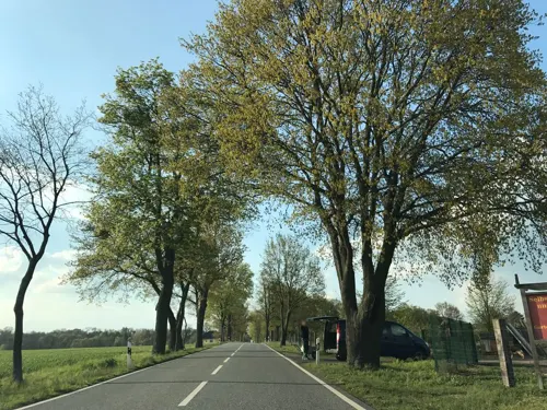




Museums and landmarks37

Wasserturm Wustermark
Monument and historic site · 3.5 km
Wasserturm auf dem Gelände des Rangierbahnhof Wustermark, Bahnhofstraße in Wustermarke OT Elstal



Sielmanns Natur-Erlebniszentrum Döberitzer Heide
Museum · 4.6 km
9 Zur Döberitzer Heide, Wustermark
Apr-Oct: We-Su,PH 10:00-17:00; Nov-Mar: We-Su,PH 11:00-16:00

Preußischer Meilenstein
Monument and historic site · 3.2 km
Preußischer Ganzmeilenstein
25 more on the map.
Parks, trails and playgrounds17
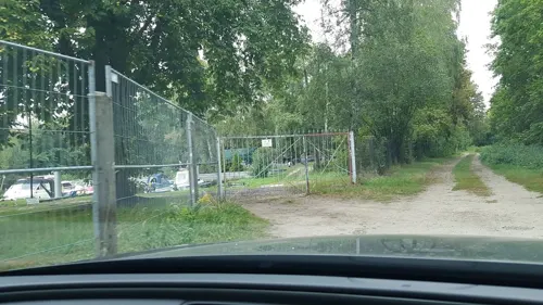


Karls Erlebnis-Dorf Elstal
Sports field and stadium · 3.8 km
Der Eintritt ist frei. Einige Attraktionen sind kostenpflichtig.
1 Zur Döberitzer Heide, Wustermark
08:00-19:00



Fichte-Sportplatz
Sports field and stadium · 6.0 km
146 Karl-Marx-Straße, Brieselang
5 more on the map.
Restaurants and cafes50
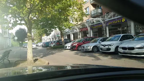
Capp U Gino
Restaurant · Italian · 5.5 km
4 Am Markt, Brieselang
Tu-Fr 09:00-20:30, Sa 10:00-21:00, Su 10:00-20:00
T&T - Sushi & Vietnamese Cuisine
Restaurant · Sushi, Vietnamese · 5.5 km
11 Am Markt, Brieselang
Mo-Fr 11:00-22:00; Sa-Su 12:00-22:00
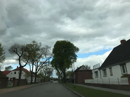
Pusteblume
Cafe · Ice Cream, Waffles, Cocktails · 0.9 km
Vintage-Lädchen und Café
19 Berliner Allee, Wustermark
Sa-Su 15:00-18:00
Restaurant "Zum ersten Siedler"
Restaurant · German · 6.1 km
Mo-Sa 16:00-24:00; Apr 01-Aug 30 Sa 11:30-24:00; PH 11:30-24:00
Pizzeria B5 Il Centro
Restaurant · Italian, Pizza · 2.2 km
1 Nauener Straße, Wustermark
Tu-Su 12:00-21:00

Gutshof Havelland
Restaurant · Regional · 5.2 km
30a Potsdamer Allee, Ketzin/Havel
Oct-Apr: Mo-Fr 17:00-22:00; Sa 12:00-22:00; Su 12:00-18:00;...

BioBackHaus. und Cafe
Bakery · 2.3 km
2 Leipziger Straße, Wustermark
Mo-Fr 06:00-16:30; Sa,Su 07:00-13:00

Asia Cocos
Restaurant · Asian · 2.5 km
1 Alter Spandauer Weg, Wustermark
Mo-Sa 10:00-20:00
38 more on the map.
History
It was established in 2002 through a merger of the five villages: Buchow-Karpzow, Elstal, Hoppenrade, Priort, and Wustermark. Elstal was the host of the Olympic Village at the 1936 Summer Olympics in Berlin.
From the History section of Wustermark on Wikipedia, under CC BY-SA 4.0.
Notable people from Wustermark
- Jutta LauEast German rower
- Johann Friedrich GräfeGerman composer
Born in Wustermark, according to Wikidata (CC0). Each name links to its Wikipedia article.
Where to stay6
Rüst- und Freizeitheim "Bei den Aposteln"
Motel and hotel · 3.0 km
16 Wustermarker Straße, Brieselang
Churches and places of worship10
Dorfkirche Falkenrehde
Church · Protestant · 5.7 km
37 a Potsdamer Allee, Ketzin/Havel
St. Nikolai
Church · Protestant · 5.7 km
8 Markauer Hauptstraße, Nauen
Dorfkirche Wernitz
Church · Protestant · 2.5 km
30 Dorfstraße, Wustermark
Kirche Buchow-Karpzow
Church · Protestant · 3.4 km
20a Priorter Straße, Wustermark
Shopping17
Gas and EV charging4
Schools, colleges and libraries10
Healthcare3
Map of Wustermark
166 places. The map loads OpenStreetMap tiles when you open it.
Getting there and nearby towns
Berlin Brandenburg Airport "Willy Brandt" (BER) is the nearest airport with scheduled flights listed in OpenStreetMap, 42 km away.
- Brieselang 6 km northeast, about 6 min by car
- Nauen 8 km northwest, about 8 min by car
- Falkensee 10 km east, about 10 min by car
- Potsdam 18 km southeast, about 18 min by car
- Hennigsdorf 20 km northeast, about 20 min by car
- Velten 22 km northeast, about 22 min by car
- Kleinmachnow 24 km southeast, about 24 min by car
- Stahnsdorf 26 km southeast, about 26 min by car
- Hohen Neuendorf 27 km northeast, about 27 min by car
- Berlin 32 km east, about 32 min by car
Drive times are estimates from straight-line distance, not routes.
Towns near Wustermark


Keep exploring
Local news
Headlines from INDB.
Reviews, tips and questions
Loading what members have shared...
Sources and licences
- GeoNames (CC BY 4.0): population, coordinates, regions and time zone
- Mapillary (see each image): photos
- OpenStreetMap contributors (ODbL 1.0): places, airports, map data
- Wikidata (CC0 1.0): elevation, founding date, time zone, website, landmarks and historic places
- Wikimedia Commons (see each image): photos
- Wikipedia (CC BY-SA 4.0): overview and history text
Photo credits
- Hoppenrade (Havelland) church 2016 NE, Hans G. Oberlack, CC BY-SA 4.0
- Wustermark - Friedrich-Rumpf-Strasse - geo.hlipp.de - 43242, Colin Smith on geo.hlipp.de, CC BY-SA 2.0
- Wustermark - Hamburger Strasse - geo.hlipp.de - 43240, Colin Smith on geo.hlipp.de, CC BY-SA 2.0
- Wustermark church 2009 ESE, Clemensfranz, CC BY-SA 3.0
- Wustermark - Havelkanalbruecke (Havel Canal Bridge) - geo.hlipp.de - 43239, Colin Smith on geo.hlipp.de, CC BY-SA 2.0
- Wustermark - Frachtkahn (Barge) - geo.hlipp.de - 43243, Colin Smith on geo.hlipp.de, CC BY-SA 2.0
- Wustermark - Graben (Drainage Ditch) - geo.hlipp.de - 43237, Colin Smith on geo.hlipp.de, CC BY-SA 2.0
- Wustermark - Havelkanal - geo.hlipp.de - 43244, Colin Smith on geo.hlipp.de, CC BY-SA 2.0
- Wustermark-Dyrotz Ortsansicht (1), Assenmacher, CC BY-SA 4.0
- Wustermark-Dyrotz Ortsansicht (2), Assenmacher, CC BY-SA 4.0
- Wustermark - Eisenbahn (Railway Line) - geo.hlipp.de - 43236, Colin Smith on geo.hlipp.de, CC BY-SA 2.0
- OlympDorf Berlin 08-2013 img04, A.Savin, CC BY-SA 3.0
- Zeestow church 2016 NE, Hans G. Oberlack, CC BY-SA 4.0
- NSG Falkenrehder Wublitz and Havelkanal 2024-05-11 04, Leonhard Lenz, CC0
- Dorfkirche Markau 2024 SSW, Hans G. Oberlack, CC BY-SA 4.0
- Dorfkirche Falkenrehde 2017 SSE, Hans G. Oberlack, CC BY-SA 4.0
- Wustermark Buchow-Karpzow Kirche, Clemensfranz, CC BY-SA 3.0
- PriortMontetonKopfFigur, Global Fish, CC BY-SA 4.0
- Wernitz (Havelland) church 2016 NE, Hans G. Oberlack, CC BY-SA 4.0
- Elstal church 2016 NW, Hans G. Oberlack, CC BY-SA 4.0
- Wustermark Elstal Wasserturm, Oberlausitzerin64, CC BY-SA 4.0
- ElstalOlyNationen2, Global Fish, CC BY-SA 3.0
- Stolperstein für Helmut Riedel (Brieselang), Christian Michelides, CC BY-SA 4.0
- Markau, Dorfkirche (20), Subbass1, CC BY-SA 4.0
- Karpzow church 2016 SW, Hans G. Oberlack, CC BY-SA 4.0
- Dorfkirche Dyrotz Südwestansicht, Assenmacher, CC BY-SA 4.0
- BfDallgow-DöberitzBstgAusgangS, Global Fish, CC BY-SA 4.0
- BfDallgow-DöberitzBstgTreppe, Global Fish, CC BY-SA 4.0
- BfDallgow-DöberitzBstgAusgangN, Global Fish, CC BY-SA 4.0
- Dyrotz - Havelkanalbruecke (Havel Canal Bridge) - geo.hlipp.de - 43335, Colin Smith on geo.hlipp.de, CC BY-SA 2.0
- Down by the River (39398660560), Rolf Dietrich Brecher from Germany, CC BY 2.0
- Dyrotz - Am Havelkanal - geo.hlipp.de - 43343, Colin Smith on geo.hlipp.de, CC BY-SA 2.0
- Dyrotz - Binnenhafen Am Havelkanal (Inland Harbour on the Havel Canal) - geo.hlipp.de - 43347, Colin Smith on geo.hlipp.de, CC BY-SA 2.0
- Dyrotz - Graben beim Havelkanal (Drain by Havel Canal) - geo.hlipp.de - 43333, Colin Smith on geo.hlipp.de, CC BY-SA 2.0
- Dyrotz - geo.hlipp.de - 43334, Colin Smith on geo.hlipp.de, CC BY-SA 2.0
- Dorfkirche Dyrotz Westturm Nordwestansicht Glockengeschoss, Assenmacher, CC BY-SA 4.0
- Dorfkirche Dyrotz Westturm Nordwestansicht Erdgeschoss, Assenmacher, CC BY-SA 4.0
- Dorfkirche Dyrotz Westturm Westansicht Glockengeschoss, Assenmacher, CC BY-SA 4.0
- Dorfkirche Dyrotz Westturm Westportal, Assenmacher, CC BY-SA 4.0
- Dorfkirche Dyrotz Nordansicht, Assenmacher, CC BY-SA 4.0
- Street-level photo, kartonage, CC BY-SA 4.0
- Street-level photo, atpl_pilot, CC BY-SA 4.0
- Street-level photo, tb4711, CC BY-SA 4.0
- Street-level photo, dsmm, CC BY-SA 4.0
- Street-level photo, kartonage, CC BY-SA 4.0
- Street-level photo, kartonage, CC BY-SA 4.0
- Street-level photo, mar_k83, CC BY-SA 4.0
- Street-level photo, atpl_pilot, CC BY-SA 4.0
- Street-level photo, atpl_pilot, CC BY-SA 4.0
- Street-level photo, jacobbraeutigam, CC BY-SA 4.0
- Street-level photo, thetornado76, CC BY-SA 4.0
- Street-level photo, kartonage, CC BY-SA 4.0
- Street-level photo, tb4711, CC BY-SA 4.0
- Street-level photo, atpl_pilot, CC BY-SA 4.0
- Street-level photo, atpl_pilot, CC BY-SA 4.0
- Street-level photo, atpl_pilot, CC BY-SA 4.0
- Street-level photo, mar_k83, CC BY-SA 4.0
- Street-level photo, kartonage, CC BY-SA 4.0
- Street-level photo, kartonage, CC BY-SA 4.0
- Street-level photo, dsmm, CC BY-SA 4.0
- Street-level photo, atpl_pilot, CC BY-SA 4.0


Page built November 9, 2026. Spotted a mistake? Tell us or suggest a place.