
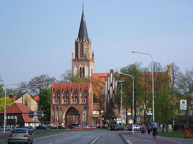


Neubrandenburg, Germany
Neubrandenburg is a town of 68,082 people in Mecklenburg-Vorpommern, Germany, founded in 1248.
Why visit Neubrandenburg
Townapedia lists 81 museums and landmarks, 30 parks and trails, 187 places to eat, 16 places to stay and 11 attractions in and around town.
Highlights include Schauspielhaus Neubrandenburg, Aussichtsturm Behmshöhe, Kunstsammlung Neubrandenburg and Marstall.
Weather in Neubrandenburg
Forecast from MET Norway (CC BY 4.0). Full forecast
About Neubrandenburg
Neubrandenburg (German: [nɔʏˈbʁandn̩bʊʁk] ; Low German: Niegenbramborg; lit. 'New Brandenburg') is a city in the southeast of Mecklenburg-Vorpommern, Germany. It is located on the shore of the lake Tollensesee and forms the urban centre of the Mecklenburg Lakeland.
From the Wikipedia article Neubrandenburg (this version), under CC BY-SA 4.0.
Travel tips from other travellers: Neubrandenburg on Wikivoyage (CC BY-SA 4.0).
Photos of Neubrandenburg


Things to do11



RS-Landveredlung
Farm and orchard · 6.8 km
Sie treffen in der Regel täglich von 08.00 bis 21.00 Uhr einen auf unserem Hof an. Sollten wir mal nicht gleich die Tür öffnen – wir...
45 Strelitzer Straße, Burg Stargard
08:00-21:00

Cinestar Neubrandenburg
Cinema and theater
55 Friedrich-Engels-Ring, Neubrandenburg
"Öffnet täglich 30 Minuten vor Start des ersten Filmes."

Tierhof
Zoo and aquarium · 0.8 km
Die Gehege dürfen erst im Beisein von einem Mitarbeiter des Regenbogen e.V. und nach dessen OK betreten werden!

Museums and landmarks81

Kunstsammlung Neubrandenburg
Museum
24 Große Wollweberstraße, Neubrandenburg
We-Su 10:00-17:00; Mo,Tu off

Marstall
Museum
Kann auch für Veranstaltungen gemietet werden - mehr Informationen dazu unter: https://im-marstall.de/veranstaltungsraum/
16 Behmenstraße, Neubrandenburg

Brigitte-Reimann-Literaturhaus
Museum
Tu 10:00-12:00,13:00-18:00, We 10:00-12:00,13:00-16:00; Sa[1] 10:00-16:00


Großsteingrab Neubrandenburg
Monument and historic site · 4.4 km
Zerstörtes Großsteingrab - Reste sind vorhanden, aber vor Ort schlecht erkennbar. Der Bereich ist dauerhaft abgesperrt - Zutritt verboten.

Ravensburg
Monument and historic site · 3.9 km
Reste von einem slawischen Burgwall (ein recht kleiner Ringwall)




Speicher
Museum · 6.0 km
Kann auch für Veranstaltungen gemietet werden - mehr Informationen dazu unter: http://www.speicher-woggersin.de/#about
3 Hofstraße, Woggersin
69 more on the map.
Parks, trails and playgrounds30



Forscherpark
Park · 1.0 km
Der Park beinhaltet mehrere Experimentierstationen und kann auch ganz oder teilweise für Veranstaltungen gemietet werden. Mehr...
38 Wilhelm-Külz-Straße, Neubrandenburg
Tu 10:00-12:00; Th 14:00-16:00; Mo,We,Fr,Sa,PH off

"Am Messeplatz"
Playground · 1.2 km
Mehrgenerationen-"Rethra"-Themenspielplatz, mit dazugehöriger Fitnessstrecke am Wegerand (welche zwar nicht zum "Rethra"-Thema gestaltet...
24/7

18 more on the map.
Restaurants and cafes187

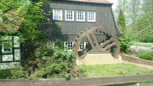
Zur Lohmühle
Restaurant · German, Regional
Bar hat noch bis 21:00 geöffnet, Küchenschluss aber um 20:00
4 Stargarder Tor, Neubrandenburg
Mo-Sa 12:00-14:00,17:00-20:00; Su off
25 Grad
Cafe · Coffee, Cake, Breakfast
5 Stargarder Straße, Neubrandenburg
Mo-Fr 08:00-19:00, Sa 09:00-18:00; PH off

Hellas
Restaurant · Greek · 0.7 km
Reservierungen nur telefonisch.
14 Lessingstraße, Neubrandenburg
Tu-Su 11:30-14:30, 17:30-22:00; Mo off

Kiek in
Cafe · Breakfast, Snack, Coffee, Softdrinks · 1.7 km
93 Neustrelitzer Straße, Neubrandenburg
Mo-Fr 07:00-10:00
Mudder-Schulten-Stuben
Restaurant · German
Reservierung nur per Telefon.
425 4.Ringstraße, Neubrandenburg
11:30-22:30
Schweinestall
Restaurant · German
"Tischreservierungen werden nur telefonisch entgegengenommen!"
55 Friedrich-Engels-Ring, Neubrandenburg
Mo-Fr 17:00-22:00; Sa,PH 11:30-14:00,17:00-22:00
Argentinisches Steakhouse
Restaurant · Steak House · 3.3 km
142 Ihlenfelder Straße, Neubrandenburg
Mo,We-Sa,PH 17:00-22:00; Fr-Sa,PH 11:00-14:00; Tu off
Café Broda
Cafe · Coffee, Cake, Ice Cream · 1.7 km
2 Oelmühlenstraße, Neubrandenburg
Mo-Fr 12:00-17:30; Sa,Su 11:00-17:30
Café Mühle
Cafe · Ice Cream, Cake, Coffee · 2.2 km
2 Hinterste Mühle, Neubrandenburg
easter-Oct 31 We-Su,PH 13:00-17:30; Mo,Tu off
Doki
Restaurant · Japanese, Vietnamese
28 Turmstraße, Neubrandenburg
Mo-Sa, PH 11:00-15:00, 16:30-22:00
175 more on the map.
History
The region had been left largely empty during the Migration Period and was re-settled by Slavs who then formed the Veleti, starting in the 7th century. Frankish and Saxon influence increased since the late 8th century but suffered several setbacks. After final subjugation by the Saxons in the mid-12th century, German colonisation greatly intensified after 1200. The first Christian monks in the area were Premonstratensians at Broda Abbey, a monastery by the lakeshore (about 1240). The foundation of the city known as of Neubrandenburg took place in 1248, when the Margrave of Brandenburg decided to build a settlement in the northern part of his fief, naming it after the older city of Brandenburg further south. In 1292, the city and the surrounding area became part of Mecklenburg.
Read more of the history
The city flourished as a trade centre until the Thirty Years' War (1618–48), when this position was lost due to incessant warfare. During the dramatic advance of the Swedish army of Gustavus Adolphus into Germany, the city was garrisoned by Swedes, but it was retaken by Imperial Catholic League forces in 1631. During this campaign, it was widely reported that the Catholic forces killed many of the Swedish and Scottish soldiers while they were surrendering. Later, according to the Scottish soldier of fortune Robert Munro, 18th Baron of Foulis, when the Swedes themselves adopted a "no prisoners" policy, they would cut short any pleas for mercy with the cry of "New Brandenburg!". The city, therefore, played an unconscious role in the escalation of brutality of one of history's most brutal wars.
Neubrandenburg was one of two Vorderstädte (lit. 'primary cities') of the duchy of Mecklenburg, i.e. it represented the interests of the cities and towns at the regional assembly (the Landtag or diet). From 1701 to 1934, it formed a part of Mecklenburg-Strelitz, a small, primarily rural, and socio-economically backward state of northeastern Germany, being its largest or second-largest city (closely tied with Neustrelitz, the capital). From 1856 to 1863, Fritz Reuter, the most successful author of Low German literature and one of the best-sold German authors of the 19th century, lived here. In 1864, Neubrandenburg was connected to Berlin by railway, and developed some modest industry, mostly connected with the needs of the predominant agricultural sector of the region.
Under Nazism, an airbase was built at nearby Trollenhagen and a facility for torpedo trials was established in Lake Tollense. The city's rural situation far from any borders shielded it from air attacks for some time. During the Second World War, two German prisoner-of-war camps for Allied POWs of various nationalities were located in Fünfeichen within the city limits: the large Stalag II-A and the adjacent Oflag II-E/67 for officers. The same site was operated from 1945 to 1948 as special NKVD-camp Nr. 9. The town was also the location of a forced labour camp for Sinti and Romani people. In 1945, a few days before the end of the Second World War, 80% of the old town was burned down by the Red Army in a great fire that destroyed, inter alia, City Hall (incl. most of the Municipal Archives), the Grand Ducal Palace (incl. the Municipal Arts Collections) and St. Mary's Church. About 600 people committed suicide in fear of or as a result of the Soviet advance.
After the war, within the newly-founded Socialist GDR (East Germany), the city centre was slowly rebuilt in the 1950s and 60s in a simplified neoclassicist and neo-Renaissance style. Large numbers of refugees from Germany's former eastern territories and from Czechoslovakia were resettled in the city. Neubrandenburg was designated the centre of a Bezirk, the highest tier of administrative divisions in East Germany, in 1952. As such, the city was supposed to embody the vision of a "Socialist city" and was to be greatly expanded and industrialised. Population increased from about 20,000 at war's end to about 90,000 in the late 1980s. Large panel-type housing estates were built in several parts of the city (among them the first example of WBS 70 which became the most common type of panel housing in East Germany). The demolished market square area was reshaped by the Haus der Kultur und Bildung (House of Culture and Education), a Socialist-style civic centre, complemented by a 56 m highrise. Brigitte Reimann, a prominent GDR writer whose works deal with the attempt at building a Socialist society, spent her last years (1968-1973) in the city.
As in all of East Germany, the reunification of Germany in 1990 brought an improvement of political and social freedoms but also a deep socio-economic crisis with large-scale unemployment and emigration. The population sharply dropped, stabilising at about 65,000 people (2023), with some of those losses, however, just going to surrounding bedroom communities. The economic situation finally slowly improved, many historical buildings were renovated, e.g. St. Mary's Church that was refurbished as a concert hall. The University of Applied Sciences was founded in 1991, focusing on social work, health, agriculture and food industry. After 1990, Neubrandenburg lost its position as a Bezirk centre and remained an autonomous district-level city (Kreisfreie Stadt) within the state of Mecklenburg-Vorpommern. In 2011, it emerged as the capital of a huge new district Mecklenburgische Seenplatte, the largest in Germany, with an area slightly more than half that of its former Bezirk.
From the History section of Neubrandenburg on Wikipedia, under CC BY-SA 4.0.
Notable people from Neubrandenburg
 Cornelia OschkenatGerman sprinter and hurdlerPhoto: Wolfgang Kluge, CC BY-SA 3.0 de
 Anja DittmertriathletePhoto: MartinPutz, CC BY-SA 3.0
 Luise MühlbachGerman author, editor (1814–1873)Photo: Unknown author Unknown author, Public domain
 Wenceslaus Johann Gustav Karstenmathematician (1732-1787)Photo: Unknown author, CC BY 4.0
 Ernst BollGerman scientist (1817–1868)Photo: Theodor Schloepke, Public domain
 Silvio SchirrmeisterGerman hurdlerPhoto: Ailura, CC BY-SA 3.0 at
 Franz BollGerman historian and theologian (1805-1875)Photo: Bernhard Reinhold (1824–1892), Public domain
 Stefan HoltzGerman sprint canoerPhoto: Oliver Strubel, CC BY-SA 3.0
- Tim BorowskiGerman footballer (born 1980)
- Otto Ernst RemerGerman Regiment/Division Army Officer in the Wehrmacht (1912-1997)
- Jana SorgersEast German rower
- Franz Christian BollGerman physiologist and histologist (1849–1879)
Born in Neubrandenburg, according to Wikidata (CC0). Each name links to its Wikipedia article.
Where to stay16
Churches and places of worship21
Sankt Joseph / Sankt Lukas
Church · Roman Catholic · 1.0 km
15 Heidmühlenstraße, Neubrandenburg
Shopping59
Gas and EV charging16
PROGAS-Boie GmbH & Co. K...
Gas station · 3.8 km
9 Werner-von-Siemens-Straße, Neubrandenburg
Schools, colleges and libraries29
Healthcare23
Map of Neubrandenburg
250 places. The map loads OpenStreetMap tiles when you open it.
Getting there and nearby towns
Flughafen Neubrandenburg-Trollenhagen (FNB) is the nearest airport with scheduled flights listed in OpenStreetMap, 6 km away.
- Neustrelitz 25 km southwest, about 25 min by car
- Waren 39 km west, about 39 min by car
- Demmin 42 km north, about 42 min by car
- Anklam 44 km northeast, about 44 min by car
- Prenzlau 48 km southeast, about 48 min by car
- Pasewalk 49 km east, about 49 min by car
- Torgelow 50 km east, about 50 min by car
- Templin 51 km south, about 51 min by car
- Ueckermünde 55 km east, about 55 min by car
- Universitäts- und Hansestadt Greifswald 60 km north, about 1 h by car
Drive times are estimates from straight-line distance, not routes.
Towns near Neubrandenburg


Keep exploring
Local news
Headlines from INDB.
Reviews, tips and questions
Loading what members have shared...
Sources and licences
- GeoNames (CC BY 4.0): population, coordinates, regions and time zone
- Mapillary (see each image): photos
- OpenStreetMap contributors (ODbL 1.0): places, airports, map data
- Wikidata (CC0 1.0): elevation, founding date, time zone, website, landmarks and historic places
- Wikimedia Commons (see each image): photos
- Wikipedia (CC BY-SA 4.0): overview and history text
Photo credits
- Neubrandenburg Stargarder Tor, Ch.Pagenkopf, CC BY-SA 3.0
- Neubrandenburg, Haus Stargarder Straße 19, Dguendel, CC BY 3.0
- Neubrandenburg Marktplatz Innenstadtmodell, LasseG, CC0
- Neubrandenburg, das Hotel Radisson blu und Haus Waagestraße 1, Dguendel, CC BY 3.0
- Neubrandenburg Kanaldeckel 2009, LasseG, CC0
- Neubrandenburg Stadtmittelpunkt Marktplatz, Oberlausitzerin64, CC BY-SA 4.0
- Neubrandenburg Marktplatz 01, LasseG, CC0
- Neubrandenburg HKB-Turm Sanierung 2012, LasseG, CC0
- Neubrandenburg Stargarder Straße Nord, LasseG, CC0
- Neubrandenburg Stadtmittelpunkt, LasseG, CC0
- Erwin Spindler Ansichtskarte Neubrandenburg, Erwin Spindler, Public domain
- Altes Rathaus Marktplatz Palais Neubrandenburg, Fr. Carow, Public domain
- Neubrandenburg, die Badstüberstraße, Dguendel, CC BY 3.0
- Neubrandenburg, Haus Stargarder Straße 13-15, Dguendel, CC BY 3.0
- Neubrandenburg Badstüberstraße 1, LasseG, CC0
- Neubrandenburg Stargarder Straße 10a-10b, LasseG, CC0
- Neubrandenburg Badstüberstraße 8, LasseG, CC0
- Neubrandenburg, Kirche St. Marien, Dguendel, CC BY 3.0
- Neubrandenburg Badstüberstraße 10, LasseG, CC0
- Neubrandenburg Pfaffenstraße 1912, Tekniska museet, CC BY 2.0
- Neubrandenburg Neues Tor 1912, Tekniska museet, CC BY 2.0
- Neubrandenburg Badstüberstraße 3-5-7, LasseG, CC0
- Neubrandenburg Stargarder Straße 7-9-11, LasseG, CC0
- Neubrandenburg Badstüberstraße 12, LasseG, CC0
- Neubrandenburg Waagestraße Wandbilder, LasseG, CC0
- Neubrandenburg Wartlaustraße 2-4-6-8, LasseG, CC0
- Neubrandenburg Wartlaustraße Harry-Gedenktafel, LasseG, CC0
- Neubrandenburg Badstüberstraße 14, LasseG, CC0
- Neubrandenburg Wartlaustraße 1-3-5-7, LasseG, CC0
- Neubrandenburg Herbordstraße 6, LasseG, CC0
- Neubrandenburg Turmstraße 14, LasseG, CC0
- Marienkirche in Neubrandenburg 2, Claus-Joachim Dickow, CC BY-SA 3.0
- Neubrandenburg-Aussichtsturm-Behmshöhe-02, LasseG, CC0
- Broda's Belvedere, Accessfalk, CC BY-SA 3.0
- Neubrandenburg Gartenstraße 6 Literaturhaus, LasseG, CC0
- Bargensdorf-Kirche, LasseG, Public domain
- NB-Kulturpark-im-Werderbruch-02-06-2008-104, Botaurus-stellaris, Public domain
- NB-Friedlaender-Tor-11-IV-2007-041, Botaurus, Public domain
- NB-Stargarder-Tor-11-IV-2007-116, Botaurus, Public domain
- NB-Schauspielhaus-26-VIII-2007-49, Botaurus stellaris, CC BY-SA 3.0
- MoerderbergWeitin1, RonnyKrüger, CC0
- BurgwallRavensburg5, RonnyKrüger, CC0
- Neubrandenburg-Kunstsammlung-01, LasseG, CC0
- Birkbuschwiese, Patrice77, CC BY-SA 3.0
- NB-Treptower-Tor-11-IV-2007-060, Botaurus, Public domain
- Neubrandenburg-AEG-01, LasseG, CC0
- Bundesarchiv Bild 183-1986-0607-008, Heike Drechsler, Silke Gladisch, Bernd Settnik, CC BY-SA 3.0 de
- Brückner Neubrandenburg, Dr. Brückner sen., Public domain
- Burg Stargard Kirche 2011-03-07 087, Niteshift ( talk ), CC BY-SA 3.0
- Neubrandenburg Gemeindezentrum St. Michael 2010-10-18 143, Niteshift ( talk ), CC BY-SA 3.0
- Pestalozzi Schule Neubrandenburg, Jörg Fuhrmann (Intermerker), CC BY-SA 4.0
- Neubrandenburg-Aussichtsturm-Behmshöhe-01, LasseG, CC0
- Neubrandenburg Behmenstraße 16, LasseG, CC0
- NB-Friedlaender-Tor-11-IV-2007-037, Botaurus, Public domain
- 19 Neubrandenburg 027, Tilman2007, CC BY-SA 3.0
- 19 Neubrandenburg 010, Tilman2007, CC BY-SA 3.0
- NB-St.-Georg-04-07-2008-164b, Botaurus stellaris, Public domain
- NB-Kath.-Kirche- St.-Josef - St.-Lukas-04-09-2009-034, Botaurus, Public domain
- Neubrandenburg-IGS-VierTore-Wandrelief, LasseG, CC0
- Street-level photo, jacobbraeutigam, CC BY-SA 4.0
- Street-level photo, wentus, CC BY-SA 4.0
- Street-level photo, jacobbraeutigam, CC BY-SA 4.0
- Street-level photo, jacobbraeutigam, CC BY-SA 4.0
- Street-level photo, soepzi, CC BY-SA 4.0
- Street-level photo, soepzi, CC BY-SA 4.0
- Street-level photo, jacobbraeutigam, CC BY-SA 4.0
- Street-level photo, soepzi, CC BY-SA 4.0
- Street-level photo, soepzi, CC BY-SA 4.0
- Street-level photo, soepzi, CC BY-SA 4.0


Page built November 9, 2026. Spotted a mistake? Tell us or suggest a place.