


Denzlingen, Germany
Denzlingen is a town of 13,511 people in Baden-Wurttemberg, Germany.
Why visit Denzlingen
Townapedia lists 69 museums and landmarks, 49 parks and trails, 88 places to eat, 6 places to stay and 15 attractions in and around town.
Highlights include Altdorfhittli, Franz Xaver Obsthof, Alamannen-Museum Vörstetten and Severinskapelle.
Weather in Denzlingen
Forecast from MET Norway (CC BY 4.0). Full forecast
About Denzlingen
Denzlingen (German pronunciation: [ˈdɛntslɪŋən]) is a municipality in the district of Emmendingen, in Baden-Württemberg, Germany. It is situated 8 kilometres (5.0 mi) north of Freiburg.
From the Wikipedia article Denzlingen (this version), under CC BY-SA 4.0.
Things to do15

Franz Xaver Obsthof
Farm and orchard · 3.9 km
3 Schwarzwaldstraße, Waldkirch
Mo-Fr 08:00-18:30; Sa 08:00-17:00; May-Oct: Su 10:00-18:00

Roßkopf Tower
Monument and historic site · 6.4 km
Observation tower on Roßkopf mountain in the Black Forest
Erdbeerstand Obsthof Schätzle Waldkirch
Farm and orchard · 2.5 km
Mobiler Erdbeerstand; nur während der Erdbeerzeit
May-Jul
Obst und Gemüse Hubert Blattmann
Farm and orchard · 2.5 km
Mo-Fr 10:00-12:00,15:00-18:30;Sa 09:00-12:00

3 more on the map.
Museums and landmarks69
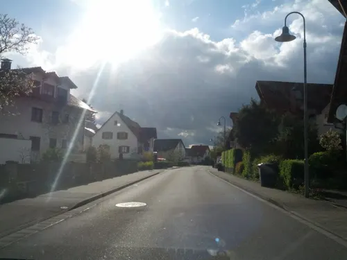
Alamannen-Museum Vörstetten
Museum · 2.3 km
24a Denzlinger Straße, Vörstetten
Th 10:00-17:00; Fr 10:00-15:00; Sa 14:00-18:00

Severinskapelle
Monument and historic site · 1.7 km
Former chapel
24/7

The German Diary Archive
Museum · 6.5 km
Archive in Emmendingen, Germany



57 more on the map.
Parks, trails and playgrounds49

Obermattenbad
Sports field and stadium · 3.7 km
Tu,Th,Fr 13:30-21:00; We 07:00-10:00,13:30-21:00; Sa,Su 10:00-18:00


37 more on the map.
Restaurants and cafes88

Da Carmelo
Restaurant · Italian · 3.9 km
Ehem. "Cafe Burgblick"
131 Talstraße, Gundelfingen
Tu-Sa 17:00-22:00; Su 11:30-22:00; Mo off
Belvedere
Restaurant · Italian · 0.6 km
36 Waldkircher Straße, Denzlingen
Th,Fr,Su,Mo 11:30-14:00,17:30-23:00; Sa 17:30-23:00; Tu,We off
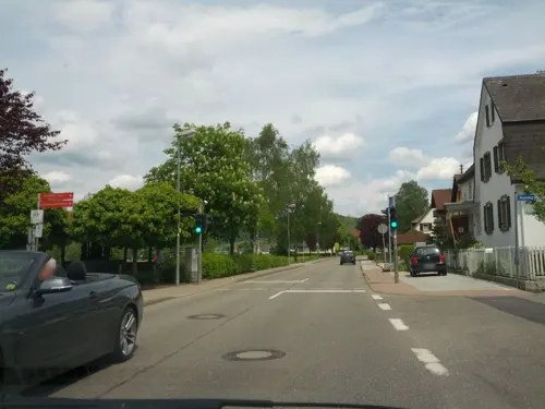
Bergmattenhof
Restaurant · Regional · 3.5 km
21 Lörchstraße, Sexau
Tu-Fr 11:30-23:00; Sa,Su 11:00-24:00, Mo closed

Einbollenstüble
Bar and pub · Pizza, Italian · 1.7 km
1 Zum Einbollen, Denzlingen
Mo-Fr 11:30-14:00, 17:00-23:00; Sa,Su 11:30-23:00
Gasthaus Kandelblick
Restaurant · Regional · 3.8 km
54 Talstraße, Gundelfingen
Mo off; Tu-Sa 17:00+; Su 11:00-14:00,17:00-21:00
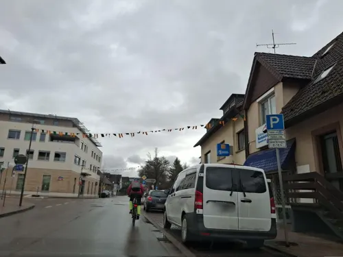


Restaurant Gasthof Suggenbad
Restaurant · Regional · 3.2 km
1 Talstraße, Waldkirch
We-Fr 17:00-22:00; Sa,Su 11:45-14:00,17:00-22:00
Restaurant Treffpunkt
Restaurant · International · 0.8 km
6 Gottlieb-Daimler-Straße, Denzlingen
Mo-Fr 11:30-14:00,17:30-22:30; Sa-Su 18:00-22:30
76 more on the map.
History
Denzlingen was already settled during the time of the Roman Empire. It was named after the Alemannic tribal chief Denzilo who lived here in the 5th century. The first explicit mention of the town dates back to the year 984. Medieval Denzlingen consisted of two separate settlements, Niederdorf and Oberdorf (Lower Village and Upper Village), both on the Glotter and alongside an old road from Riegel to the Glottertal. The two settlements eventually grew together into one stretched-out town, which led to the sobriquet of Langendenzlingen, meaning "Long Denzlingen".
The town was destroyed during the Thirty Years' War. The Thirty Years' War veteran Hans Jakob Christoffel von Grimmelshausen described the battle between Imperial and Swedish troops at Denzlingen in the novel Simplicius Simplicissimus.
The town has grown rapidly since the 19th century, especially after being connected to the Baden railroad system in 1845.
From the History section of Denzlingen on Wikipedia, under CC BY-SA 4.0.
Where to stay6
Churches and places of worship16
Evangelische Kirche
Church · Protestant · 2.5 km
1 Marchstraße, Vörstetten
Shopping28
Gas and EV charging8
Ladestation in der Tiefgarage unter "Kaisers Gute Backstube"
EV charging · 2.9 km
72;74 Alte Bundesstraße
Schools, colleges and libraries18
Allmend-Schule Wasser - Sonderpäd. Bildungs- und Beratungszentrum Förderschwerpunkt geistige Entwicklung
School · 3.4 km
7 In der Kohlgrube, Emmendingen
Esther-Weber-Schule - Sonderpädagogisches Bildungs- und Beratungszentrum mit Internat - Förderschwerpunkt körperliche und motorische Entwicklung
School · 3.4 km
5 In der Kohlgrube, Emmendingen
Healthcare8
Gelenkklinik , Dr. Peter Baum, Dr. Thomas Schneider
Clinic and pharmacy · 3.0 km
Map of Denzlingen
250 places. The map loads OpenStreetMap tiles when you open it.
Getting there and nearby towns
Lahr Airport (LHA) is the nearest airport with scheduled flights listed in OpenStreetMap, 34 km away.
- Gundelfingen 3 km southwest, about 3 min by car
- Emmendingen 6 km north, about 6 min by car
- Waldkirch 7 km northeast, about 7 min by car
- Teningen 9 km northwest, about 9 min by car
- Ettenheim 22 km north, about 22 min by car
- Titisee-Neustadt 28 km southeast, about 28 min by car
- St. Georgen im Schwarzwald 34 km east, about 34 min by car
- Neuenburg am Rhein 37 km southwest, about 37 min by car
- Gengenbach 39 km north, about 39 min by car
- Schramberg 41 km northeast, about 41 min by car
Drive times are estimates from straight-line distance, not routes.
Local news
Headlines from INDB.
Reviews, tips and questions
Loading what members have shared...
Sources and licences
- GeoNames (CC BY 4.0): population, coordinates, regions and time zone
- Mapillary (see each image): photos
- OpenStreetMap contributors (ODbL 1.0): places, airports, map data
- Wikidata (CC0 1.0): elevation, founding date, time zone, website, landmarks and historic places
- Wikimedia Commons (see each image): photos
- Wikipedia (CC BY-SA 4.0): overview and history text
Photo credits
- Inselhäuschen auf der Glotterinsel in Denzlingen, links im Hintergrund der Kohlerhof, Andreas Schwarzkopf, CC BY-SA 3.0
- Die Glotter in Denzlingen - panoramio, pictures Jettcom, CC BY 3.0
- Glotterinsel in Denzlingen, Andreas Schwarzkopf, CC BY-SA 3.0
- Ortskern Denzlingen - panoramio (5), pictures Jettcom, CC BY 3.0
- Ortskern Denzlingen - panoramio (6), pictures Jettcom, CC BY 3.0
- Hauptstraße Denzlingen - panoramio, pictures Jettcom, CC BY 3.0
- Hauptstraße (Denzlingen) jm2737, joergens.mi, CC BY-SA 3.0
- St. Georg (Denzlingen) jm2732, joergens.mi, CC BY-SA 3.0
- Stadtkern Denzlingen - panoramio, pictures Jettcom, CC BY 3.0
- St. Georg (Denzlingen) jm2729, joergens.mi, CC BY-SA 3.0
- May 2013 Denzlingen - panoramio, pictures Jettcom, CC BY 3.0
- Glotter in Denzlingen - panoramio (9), pictures Jettcom, CC BY 3.0
- Cafe in Denzlingen - panoramio, pictures Jettcom, CC BY 3.0
- St. Georg Denzlingen - panoramio, pictures Jettcom, CC BY 3.0
- Brunnen (Denzlingen) jm2707, joergens.mi, CC BY-SA 3.0
- Rosskopfturm, Andreas Schwarzkopf, CC BY-SA 3.0
- Deutsches Tagebucharchiv, Hans D. Schmitz, Public domain
- 20180425 09 Denzlingen (41661199762), Sjaak Kempe from Groningen, The Netherlands, CC BY 2.0
- Kapelle St. Severin Mauracher Berg Denzlingen, Andreas Schwarzkopf (cropped by Rabanus Flavus ), CC BY-SA 4.0
- St. Maximilian Kolbe in Vörstetten 2, Andreas Schwarzkopf, CC BY-SA 3.0
- Vörstetten, evangelische Kirche, Rauenstein, CC BY-SA 3.0
- St. Jakobus in Denzlingen 28, Andreas Schwarzkopf, CC BY-SA 3.0
- St. Pankratius, Buchholz, James Steakley, CC BY-SA 4.0
- Katholische Kirche Bruder Klaus in Gundelfingen, Andreas Schwarzkopf, CC BY-SA 3.0
- Gundelfingen (Breisgau), Bruder-Klaus-Kirche (21), Subbass1, CC BY-SA 4.0
- Total petrol station (51743034109), Mondo79, CC BY 2.0
- Silberbergwerk Suggental Josephistollen, Christian Rößler, Public domain
- Eiche - panoramio (6), pictures Jettcom, CC BY 3.0
- St. Georg - panoramio (14), pictures Jettcom, CC BY 3.0
- Street-level photo, fxesbg, CC BY-SA 4.0
- Street-level photo, fxesbg, CC BY-SA 4.0
- Street-level photo, fxesbg, CC BY-SA 4.0
- Street-level photo, qungo, CC BY-SA 4.0
- Street-level photo, fxesbg, CC BY-SA 4.0
- Street-level photo, fxesbg, CC BY-SA 4.0
- Street-level photo, tasmaniadevil, CC BY-SA 4.0
- Street-level photo, samara_widmer, CC BY-SA 4.0
- Street-level photo, qungo, CC BY-SA 4.0
- Street-level photo, fxesbg, CC BY-SA 4.0
- Street-level photo, qungo, CC BY-SA 4.0
- Street-level photo, qungo, CC BY-SA 4.0
- Street-level photo, tbkrtz, CC BY-SA 4.0
- Street-level photo, qungo, CC BY-SA 4.0
- Street-level photo, fxesbg, CC BY-SA 4.0
- Street-level photo, qungo, CC BY-SA 4.0
- Street-level photo, fxesbg, CC BY-SA 4.0
- Street-level photo, qungo, CC BY-SA 4.0
- Street-level photo, fxesbg, CC BY-SA 4.0
- Street-level photo, qungo, CC BY-SA 4.0
- Street-level photo, toebgen, CC BY-SA 4.0
- Street-level photo, tasmaniadevil, CC BY-SA 4.0
- Street-level photo, fxesbg, CC BY-SA 4.0
- Street-level photo, qungo, CC BY-SA 4.0
- Street-level photo, toebgen, CC BY-SA 4.0
- Street-level photo, karthoo, CC BY-SA 4.0
- Street-level photo, karthoo, CC BY-SA 4.0


Page built November 8, 2026. Spotted a mistake? Tell us or suggest a place.