


Dossenheim, Germany
Dossenheim is a town of 11,612 people in Baden-Wurttemberg, Germany.
Why visit Dossenheim
Townapedia lists 141 museums and landmarks, 32 parks and trails, 134 places to eat, 11 places to stay and 32 attractions in and around town.
Highlights include Bauernhof Linnenbach, Bioland-Gärtnerei Wiesenäcker, Besucherbergwerk Grube Anna-Elisabeth and Burgstall Mauersechseck (Wolfsgrund).
Weather in Dossenheim
Forecast from MET Norway (CC BY 4.0). Full forecast
About Dossenheim
Dossenheim (German pronunciation: [ˈdɔsn̩ˌhaɪ̯m] ; Palatine German: Dossene) is a municipality in the Rhein-Neckar-Kreis (district) in Baden-Württemberg, Germany.
From the Wikipedia article Dossenheim (this version), under CC BY-SA 4.0.
Things to do32

Bioland-Gärtnerei Wiesenäcker
Farm and orchard · 2.3 km
4, Heidelberg
Tu,Fr 10:00-12:00,15:00-18:30; PH off
Seitz-Mühle
Farm and orchard · 3.1 km
180 Talstraße, Schriesheim
Mo-Th 12:00-17:00, Fr 09:30-17:00, Sa 09:30-13:00
Verkaufsstand
Farm and orchard · 2.3 km
Verkaufsstand für Gemüse und Pflanzen uvm. Spielzeug zum tauschen im Schrank
70 Gewann Schläuchen, Heidelberg
24/7

Old Bridge
Bridge · 4.7 km
Bridge over the Neckar in Heidelberg, Germany

Teltschik Tower
Monument and historic site · 6.0 km
Observation tower in Baden-Württemberg, Germany

Theater & Orchester Heidelberg
Cinema and theater · 4.9 km
Theatre and opera house in Heidelberg, Germany


20 more on the map.
Museums and landmarks141

Besucherbergwerk Grube Anna-Elisabeth
Museum · 3.1 km
500 Jahre altes Silber- und Vitriolbergwerk mit Außenanlage aus dem 18. Jahrhundert
157 Talstraße, Schriesheim

Burgstall Mauersechseck (Wolfsgrund)
Monument and historic site · 1.1 km
Mauerreste

Füllhaltermuseum Handschuhsheim
Museum · 2.6 km
5 Dossenheimer Landstraße, Heidelberg
Su [2, 4] 15:00-17:00

Galerie Arabeske
Museum · 2.3 km
Sitz des Vereins Freunde Arabischer Kunst und Kultur e.V.
69 Dossenheimer Landstraße, Heidelberg


Museum Geowissenschaften
Museum · 3.5 km
235 Im Neuenheimer Feld, Heidelberg
Mo-Fr 08:00-17:00 || "Am Wochenende auf Anfrage"

President Friedrich Ebert Memorial
Monument and historic site · 4.8 km
Museum in Baden-Württemberg

129 more on the map.
Parks, trails and playgrounds32



Tertiärgarten
Park · 3.5 km
Einige Pflanzengesellschaften heute noch lebender Bäume und Sträucher in typischer Umgebung, die während des Tertiärs den Bildungsraum...
24/7

Unterer Neckar: Altneckar Heidelberg-Wieblingen
Hiking and trails · 3.2 km

Unterer Neckar: Altneckar Wörth-Weidenstücker
Hiking and trails · 3.3 km


20 more on the map.
Restaurants and cafes134
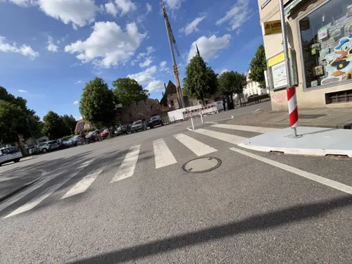
Café Tiefburg
Cafe · Regional, German · 2.7 km
Es gibt Kuchen und gebackenes aus eigener Herstellung. Rollstuhlzugang nur im Außenbereich möglich.
78 Steubenstraße, Heidelberg
We-Fr 09:30-18:00; Sa 08:30-18:00; Su,PH 09:30-18:00; Mo,Tu off

Cantina
Restaurant · Regional, International · 3.2 km
Kantine/Restaurant im Olympiastützpunkt Rhein-Neckar. Hier gibt es einen reichhaltigen Mittagstisch. Nach Wahl vegetarisch oder mit...
710 Im Neuenheimer Feld, Heidelberg
Mo-Fr 08:20-21:00
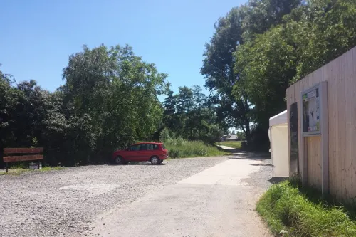
Forschner's im Schützenhaus
Restaurant · Regional, Mediterranean · 3.4 km
Restaurant und Biergarten, eigene Schlachtung
8 Neuweg, Ladenburg
Mo-Su 11:00-23:00
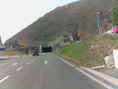
Peperoni
Restaurant · Regional, Pizza · 3.0 km
176 Talstraße, Schriesheim
Mo-Sa 17:00-24:00+; PH,Su 10:00-24:00+
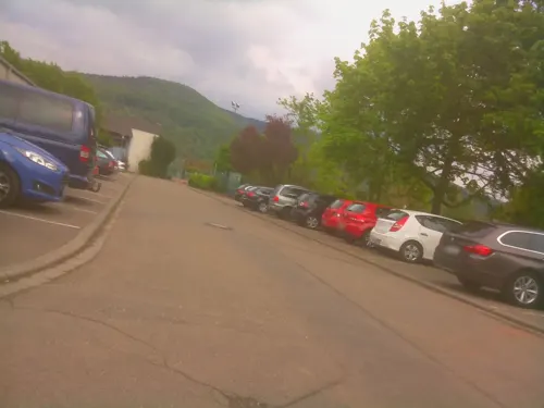
Ambiente
Restaurant · Mediterranean · 1.1 km
5 Am Sportplatz, Dossenheim
Tu-Fr 11:30-14:00, Tu-Sa 17:00-22:30, Su 11:00-14:00, Su 17:00-21:00
CANTINACCIA
Restaurant · Italian · 2.6 km
4 Dossenheimer Landstraße, Heidelberg
Tu-Fr 11:00-14:30,18:00-23:00; Sa 17:00-23:00; Su 11:00-23:00
Conditorei Cafe Meisel
Cafe · Cake
1 Am Kronenburger Hof, Dossenheim
Tu-Sa 07:00-16:00; Mo off; PH,Su 07:00-17:00
Franky`s
Restaurant · Coffee Shop · 2.7 km
16 Schillerplatz, Schriesheim
Mo,Th 07:30 - 18:00 , Fr 07:30 - 22:00 , Sa 09:00 - 22:00, Su 09:00 - 18:00


Kaffeerösterei Beans of Joy
Cafe · Coffee Shop
10 Am Neuberg, Dossenheim
PH,Su 12:00-18:00+; Fr 10:00-18:00; Sa 14:00-18:00; Mo 14:00-18:00
122 more on the map.
History
Dossenheim was first mentioned in the Lorsch codex in 766. 1130 is the first mention of the noble family Wolfsölden-Schauenburg, who ruled the area from the Schauenburg. After this family died out in 1280, the inheritors sold the lands to the electors of the Palatinate of the Rhine of Heidelberg in 1303. As early as 1319, the prince-elector archbishopric of Mainz had won all the rights that the fief of Schaenberg had pawned to the knights of Handschuhsheim. After a long period of rivalry between the Archbishop of Mainz and the Palatinate of the Rhine, until Frederick I conquered the area for the Palatinate and destroyed the Schauenburg.
In the Landshut War of Succession, the Hessian landgrave destroyed Dossenheim in 1504. During the Thirty Years' War Tilly's troops, more than others, destroyed and plundered Dossenheim in 1622. After seizing the capital Heidelberg, Dossenheim belonged to the Archbishop of Mainz for a short time. However, as part of the Bergstrasse Cease-fire of 1650, Dossenheim was returned to the Palatinate. In the Dutch War and in the War of the Grand Alliance French troops set fire to numerous buildings in 1674, 1689, and 1693.
In 1714, Lothar Franz von Schönborn, the archbishop of Mainz renounced all claims to Dossenheim forever. In 1803 the Palatinate was dissolved and Dossenheim became part of Baden. In 1925 Schwabenheim was annexed to Dossenheim.
From the History section of Dossenheim on Wikipedia, under CC BY-SA 4.0.
Where to stay11
Churches and places of worship24
Sankt Bartholomäus
Church · Roman Catholic · 3.7 km
29 Wallstraße, Heidelberg
Alte Kirche - St. Bartholomäus
Church · Roman Catholic · 3.5 km
235 Mannheimer Straße, Heidelberg
Kreuzkirche
Church · Protestant · 3.3 km
254 Mannheimer Straße, Heidelberg
Friedenskirche
Church · Protestant · 2.5 km
16 Kriegsstraße, Heidelberg
Johanneskirche
Church · Protestant · 3.8 km
7 Handschuhsheimer Landstraße, Heidelberg
Mariä Himmelfahrt
Church · Roman Catholic · 2.9 km
1 Pfarrer-Eberhard-Platz, Schriesheim
Shopping50
Gas and EV charging17
Schools, colleges and libraries29
Healthcare22
Map of Dossenheim
250 places. The map loads OpenStreetMap tiles when you open it.
Getting there and nearby towns
City-Airport Mannheim (MHG) is the nearest airport with scheduled flights listed in OpenStreetMap, 12 km away.
- Schriesheim 3 km north, about 3 min by car
- Heidelberg 5 km south, about 5 min by car
- Edingen-Neckarhausen 5 km west, about 5 min by car
- Ladenburg 5 km northwest, about 5 min by car
- Eppelheim 6 km southwest, about 6 min by car
- Heddesheim 8 km northwest, about 8 min by car
- Schwetzingen 10 km southwest, about 10 min by car
- Weinheim 11 km north, about 11 min by car
- Leimen 11 km south, about 11 min by car
- Neckargemünd 11 km southeast, about 11 min by car
Drive times are estimates from straight-line distance, not routes.
Local news
Headlines from INDB.
Reviews, tips and questions
Loading what members have shared...
Sources and licences
- GeoNames (CC BY 4.0): population, coordinates, regions and time zone
- Mapillary (see each image): photos
- OpenStreetMap contributors (ODbL 1.0): places, airports, map data
- Wikidata (CC0 1.0): elevation, founding date, time zone, website, landmarks and historic places
- Wikimedia Commons (see each image): photos
- Wikipedia (CC BY-SA 4.0): overview and history text
Photo credits
- Dossenheim Luftbild von Westen, Areuland, CC BY-SA 4.0
- Dossenheim Kirche, Ikar.us, CC BY 3.0 de
- Dossemer Kerwe 2023, Kirchweih in Dossenheim, Hauptstraße 02, Nemracc, CC BY-SA 4.0
- Dossemer Kerwe 2023, Kirchweih in Dossenheim, Hauptstraße 01, Nemracc, CC BY-SA 4.0
- St.-Pankratius-Kirche Dossenheim, SvenDK, CC BY-SA 4.0
- Dossenheim Blick über Friedhof auf Gemeinde, 4028mdk09, CC BY-SA 3.0
- Dossenheim - Strom Tanken, Photographs by Radosław Drożdżewski (User:Zwiadowca21), CC BY-SA 4.0
- Dossenheim - Strom Tanken-001, Photographs by Radosław Drożdżewski (User:Zwiadowca21), CC BY-SA 4.0
- Dossenheim Bf 2015, Photographs by Radosław Drożdżewski (User:Zwiadowca21), CC BY-SA 4.0
- Dossenheim Bf 2015 (2), Photographs by Radosław Drożdżewski (User:Zwiadowca21), CC BY-SA 4.0
- St. Pankratius Dossenheim (DSC01922), Polibil, CC BY-SA 4.0
- Dossenheim von Osten 2024-08-21, R. J. Mathar, CC0
- Dossenheim Vatter, Ikar.us, CC BY 3.0 de
- 2012.07.07.110509 Steinbruch Dossenheim, Hermann Luyken, CC0
- Amsel Nabu Dossenheim (DSC04595), Polibil, CC BY-SA 4.0
- Eichelhäher Dossenheim (DSC04990), Polibil, CC BY-SA 4.0
- Alte Brücke Heidelberg, BishkekRocks, CC BY-SA 3.0
- Teltschikturm-01, Muck, CC BY-SA 4.0
- Heidelberg - Altstadt 001, RAdoslav Droschdschewski (Zwiadowca21), CC BY-SA 3.0
- Heidelberg-Schloß, Pumuckel42 (Reinhard Wolf) at de:Wikipedia, CC BY-SA 3.0
- Kurpfälzisches Museum Haupteingang, 4028mdk09, CC BY-SA 3.0
- President Friedrich Ebert Memorial, Magnus Manske, CC BY-SA 3.0
- Sammlung Prinzhorn Ansicht von Westen, 4028mdk09, CC BY-SA 3.0
- Heidelberg Tiergarten Haupteingang, 4028mdk09, CC BY-SA 3.0
- Heidelberg 20060420 021, No machine-readable author provided. Hlohning assumed (based on copyright claims)., CC BY 2.5
- Heidelberg - Landfriedstraße 12, Radosław Drożdżewski (Zwiadowca21), CC BY-SA 4.0
- Alte Universitaet, Pumuckel42 at German Wikipedia, CC BY-SA 3.0
- Fachhochschule Heidelberg, Stephan Gerner at de.wikipedia, CC BY-SA 2.0 de
- Johanneskirche Ostseite, 3268zauber, CC BY-SA 3.0
- Schriesheim Anna-Elisabeth Grube 040, Jacquesverlaeken, CC BY-SA 4.0
- Pädagogische Hochschule HD, 4028mdk09, CC BY-SA 3.0
- Heidelberg Friedenskirche 20110111, Rudolf Stricker, Attribution
- St Vitus Westansicht, 3268zauber, CC BY-SA 3.0
- St.Raphael Schulen Heidelberg, P.Schmider, CC BY-SA 2.5
- Heidelberg Klinik Sankt Elisabeth 20120501, Rudolf Stricker, Attribution
- St Raffael Heidelberg, 3268zauber, CC BY-SA 3.0
- Heiligenberg Thingstätte, BishkekRocks, CC BY-SA 3.0
- Mauersechseck Dossenheim, Agricolax, CC BY-SA 4.0
- Heidelberg Wieblingen Elisabeth-von-Thadden-Schule, Rudolf Stricker, Public domain
- Aussichtsturm Weißer Stein (Odenwald), Muck, CC BY-SA 4.0
- Tiefburgschule Altbau, 3268zauber, CC BY-SA 3.0
- Rhyolite on Wendenkopf, LTWitkowski, CC BY-SA 3.0
- Naturschutzgebiet Altneckar Heidelberg-Wieblingen, 4028mdk09, CC BY-SA 3.0
- NSG Edingen Neckarhausen, Emmaus, Attribution
- Außenansicht KGS 2, 10bKGS, CC BY-SA 4.0
- Angelika-Lautenschläger-Klinik, 3268zauber, CC BY-SA 3.0
- Kopfklinik Universitätsklinikum Heidelberg rückwärtige Ansicht, 3268zauber, CC BY-SA 3.0
- Schriesheim Stadtkirche, MSeses, CC BY-SA 3.0
- Schriesheim Katholische Kirche von Osten, Areuland, CC BY-SA 4.0
- NSG Ölberg Panorama Abendsonne, Gliessecke, CC BY-SA 3.0
- Pfarrkirche St Bartholomaeus Wieblingen 2, Luftschiffhafen, CC BY-SA 3.0
- Heidelberg-Wieblingen St. Bartholomäus 20100623, Rudolf Stricker, Attribution
- Heidelberg Wieblingen Kreuzkirche 20100721, Rudolf Stricker, Attribution
- Auerstein, Pascamel, CC BY-SA 4.0
- Street-level photo, hdvalentin, CC BY-SA 4.0
- Street-level photo, wegavision, CC BY-SA 4.0
- Street-level photo, ramap, CC BY-SA 4.0
- Street-level photo, knistertoni, CC BY-SA 4.0
- Street-level photo, knistertoni, CC BY-SA 4.0
- Street-level photo, ramap, CC BY-SA 4.0
- Street-level photo, hdvalentin, CC BY-SA 4.0
- Street-level photo, hdvalentin, CC BY-SA 4.0
- Street-level photo, hdvalentin, CC BY-SA 4.0
- Street-level photo, hdvalentin, CC BY-SA 4.0
- Street-level photo, knistertoni, CC BY-SA 4.0
- Street-level photo, knistertoni, CC BY-SA 4.0
- Street-level photo, wegavision, CC BY-SA 4.0
- Street-level photo, ramap, CC BY-SA 4.0
- Street-level photo, wegavision, CC BY-SA 4.0
- Street-level photo, wegavision, CC BY-SA 4.0
- Street-level photo, knistertoni, CC BY-SA 4.0
- Street-level photo, steffenjohn, CC BY-SA 4.0
- Street-level photo, ramap, CC BY-SA 4.0
- Street-level photo, knistertoni, CC BY-SA 4.0
- Street-level photo, exacom, CC BY-SA 4.0
- Street-level photo, veloroute_hamburg, CC BY-SA 4.0
- Street-level photo, hdvalentin, CC BY-SA 4.0
- Street-level photo, wegavision, CC BY-SA 4.0
- Street-level photo, wegavision, CC BY-SA 4.0
- Street-level photo, changchun1, CC BY-SA 4.0
- Street-level photo, wegavision, CC BY-SA 4.0


Page built November 8, 2026. Spotted a mistake? Tell us or suggest a place.