


Elmschenhagen, Germany
Elmschenhagen is a town of 17,097 people in Schleswig-Holstein, Germany.
Why visit Elmschenhagen
Townapedia lists 6 museums and landmarks, 19 parks and trails, 48 places to eat, 3 places to stay and 5 attractions in and around town.
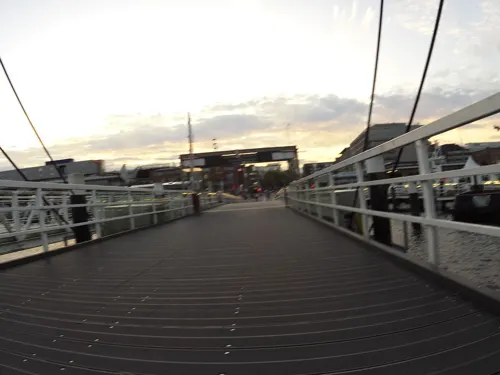
Highlights include Hörn Bridge, Kiel Opera House, Kiel Maritime Museum and Kunsthalle Kiel.
Weather in Elmschenhagen
Forecast from MET Norway (CC BY 4.0). Full forecast
Things to do5




Museums and landmarks6



Parks, trails and playgrounds19

Altarm der Schwentine
Park · 3.0 km
Nature reserve in Schleswig-Holstein, Germany






7 more on the map.
Restaurants and cafes48

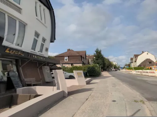
Bäckerei Lyck
Bakery · 1.8 km
109 Ellerbeker Weg, Kiel
Mo-Fr 04:30-18:00; Sa 04:30-12:30; Su 06:00-13:00

Klausdorfer Hof
Restaurant · 2.7 km
2 Schwentinestraße, Schwentinental
We-Sa 17:30-21:00; Su 11:30-14:00; Mo,Tu off
Junge Die Bäckerei
Bakery · 2.0 km
24 Mergenthalerstraße, Schwentinental
Mo-Sa 07:00-18:00; Su,PH 07:00-15:30
Phönix
Restaurant · Chinese · 2.3 km
2 Dieselstraße, Schwentinental
Mo-Su 11:00-23:00


36 more on the map.
Where to stay3
Churches and places of worship13
Tiger Temple Angel Plön
Place of worship · Thai · 2.6 km
23 Wasserwerksweg, Schwentinental
Evangeliums-Christen (Baptisten)
Church · Baptist · 1.3 km
18 Nelkenweg, Kiel
Shopping18
Gas and EV charging8
Schools, colleges and libraries17
Landesförderzentrum körperliche und motorische Entwicklung Schwentinental
School · 1.4 km
6-10 Henry-Dunant-Straße, Schwentinental
Healthcare9
Apotheke am Andreas-Hofer-Platz
Clinic and pharmacy · 1.1 km
10 Andreas-Hofer-Platz, Kiel
Map of Elmschenhagen
146 places. The map loads OpenStreetMap tiles when you open it.
Getting there and nearby towns
Kiel-Holtenau airport (KEL) is the nearest airport with scheduled flights listed in OpenStreetMap, 10 km away.
- Kiel 5 km northwest, about 5 min by car
- Preetz 8 km southeast, about 8 min by car
- Kronshagen 9 km northwest, about 9 min by car
- Plön 21 km southeast, about 21 min by car
- Neumünster 27 km southwest, about 27 min by car
- Malente 27 km southeast, about 27 min by car
- Eutin 32 km southeast, about 32 min by car
- Rendsburg 34 km west, about 34 min by car
- Neustadt in Holstein 45 km southeast, about 45 min by car
- Schleswig 48 km northwest, about 48 min by car
Drive times are estimates from straight-line distance, not routes.
Local news
Headlines from INDB.
Reviews, tips and questions
Loading what members have shared...
Sources and licences
- GeoNames (CC BY 4.0): population, coordinates, regions and time zone
- Mapillary (see each image): photos
- OpenStreetMap contributors (ODbL 1.0): places, airports, map data
- Wikidata (CC0 1.0): elevation, founding date, time zone, website, landmarks and historic places
- Wikimedia Commons (see each image): photos
Photo credits
- Kiel, Andreas-Hofer-Platz, Ticolino, CC BY-SA 3.0
- Innweg, Kiel-Elmschenhagen, Christian Alexander Otto, CC BY 4.0
- Schild Friedhof Elmschenhagen, Christian Alexander Otto, CC BY 4.0
- Friedhof Elmschenhagen Kapelle, Siegbert Brey, CC BY-SA 4.0
- Friedhof Elmschenhagen Grabsteine, Siegbert Brey, CC BY-SA 4.0
- Maria-Magdalenen-Kirche Kiel-Elmschenhagen 02, Frank Eschenmann, CC BY-SA 4.0
- Maria-Magdalenen-Kirche Kiel-Elmschenhagen, Frank Eschenmann, CC BY-SA 4.0
- Polizeistation Kiel-Elmschenhagen, Siegbert Brey, CC BY-SA 4.0
- Preetzer Straße, Elmschenhagen, Christian Alexander Tietgen, CC BY 4.0
- Opernhaus Kiel msu2017-9209, User:Matthias Süßen, CC BY-SA 4.0
- Schifffahrtsmuseum Kiel 2014, Holger.Ellgaard, CC BY-SA 3.0
- Kunsthalle Kiel msu2017-8814, User:Matthias Süßen, CC BY-SA 4.0
- Naturschutzgebiet Altarm der Schwentine, Simmmox, CC BY-SA 4.0
- Nikolaikirche, Kiel msu2017-9142, User:Matthias Süßen, CC BY-SA 4.0
- FH Kiel Campus Kiel Dietrichsdorf Schwentine 02, Lasse Hänert, CC BY-SA 4.0
- Legienstraße 35, Kiel, Michael Brandtner, CC BY 4.0
- Kiel-Elmschenhagen (Süd), Maria-Magdalenen-Kirche, Ticolino, CC BY-SA 3.0
- Baumgruppe beim Steggraben Kiel 4, Habitator terrae, CC BY-SA 4.0
- Tröndelsee, StephanErnst, CC BY-SA 3.0
- Gymnasium Kiel-Elmschenhagen, Ticolino, CC BY-SA 3.0
- De Duitse minister van verkeer Lauritzen spreekt tijdens de opening, Bestanddeelnr 926-8231, Hans Peters for Anefo, CC0
- Московская центральная церковь евангельских христиан-баптистов, Николай Аввакумов, CC BY 3.0
- Kleinbahn Kiel-Segeberg (Stammaktie), Manfred Kopka, CC BY-SA 4.0
- Panorama Russenberg (1), Frank Eschenmann, CC BY-SA 4.0
- Allgaeuer Strasse 5 Kiel, Siegbert Brey, CC BY-SA 4.0
- Villa Baujahr 1907 Kruppallee, Epotthasth, CC BY-SA 4.0
- Wellsee 03 2022, Frank Eschenmann, CC BY-SA 4.0
- Trinitatis Weinberg, Siegbert Brey, CC BY-SA 4.0
- Pötterweg 1, Kiel-Wellsee, Christian Alexander Otto, CC BY 4.0
- Pötterweg 5, Kiel-Wellsee, Christian Alexander Otto, CC BY 4.0
- Osteospermum ecklonis by A - 2020.06.19, A, CC BY-SA 4.0
- Pötterweg 10, Kiel-Wellsee, Christian Alexander Otto, CC BY 4.0
- Pötterweg, Kiel-Wellsee, Christian Alexander Otto, CC BY 4.0
- Staples Filiale Filiale, Schwentinental, DYVER, CC BY-SA 4.0
- Troendelsee Steg, Siegbert Brey, CC BY-SA 4.0
- AOK NordWest, Edisonstraße 70, Kiel-Wellsee, Christian Alexander Otto, CC BY 4.0
- Dänisches Bettenlager Filiale, Schwentinental, DYVER, CC BY-SA 4.0
- Parkplatz im Gewerbegebiet, DYVER, CC BY-SA 4.0
- Lidl Niederlassung, Schwentinental, DYVER, CC BY-SA 4.0
- Gewerbegebiet Raisdorf Leuchtreklame, DYVER, CC BY-SA 4.0
- Grebiner Weg (Kiel), Siegbert Brey, CC BY-SA 4.0
- Street-level photo, rasmustravemnd, CC BY-SA 4.0
- Street-level photo, rasmustravemnd, CC BY-SA 4.0
- Street-level photo, rasmustravemnd, CC BY-SA 4.0
- Street-level photo, rasmustravemnd, CC BY-SA 4.0
- Street-level photo, rasmustravemnd, CC BY-SA 4.0
- Street-level photo, rasmustravemnd, CC BY-SA 4.0
- Street-level photo, chuck, CC BY-SA 4.0
- Street-level photo, rasmustravemnd, CC BY-SA 4.0
- Street-level photo, rasmustravemnd, CC BY-SA 4.0
- Street-level photo, rasmustravemnd, CC BY-SA 4.0
- Street-level photo, swedishkiwi, CC BY-SA 4.0
- Street-level photo, rasmustravemnd, CC BY-SA 4.0
- Street-level photo, mjay, CC BY-SA 4.0
- Street-level photo, rasmustravemnd, CC BY-SA 4.0
- Street-level photo, rasmustravemnd, CC BY-SA 4.0
- Street-level photo, rasmustravemnd, CC BY-SA 4.0
- Street-level photo, rasmustravemnd, CC BY-SA 4.0


Page built November 8, 2026. Spotted a mistake? Tell us or suggest a place.